


You are here
Ala-Archa gorge.
Horse-riding tourism in Kyrgyzstan.
“At his best, man is the noblest of all animals; separated from law and justice he is the worst”
Aristotle.
Cultural tourism in Kyrgyzstan.
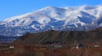
The Ala-Archa gorge is located on the northern slope of the Kyrgyz ridge in its most elevated part in the Alamudun district of the Chui region. Gorge Ala-Archa is on northern slope of the Kyrgyz ridge and has latitudinal a direction. It is located between gorges Sokuluk (Belogorka) which is in the West from gorge Ala-Atcha also gorge Alamedin in the east, in a valley of the river Ala-Archa.
One of the sights often quoted as a “must not miss” highlight of a visit to the Kyrgyz Republic is Ala Archa. Ala Archa is an alpine valley about an hours drive from the centre of Bishkek.
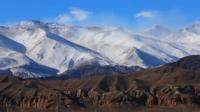
The spectacular scenery, with steep wood covered mountain slopes, makes a favourite spot for the local citizens for a “day out” or a picnic.
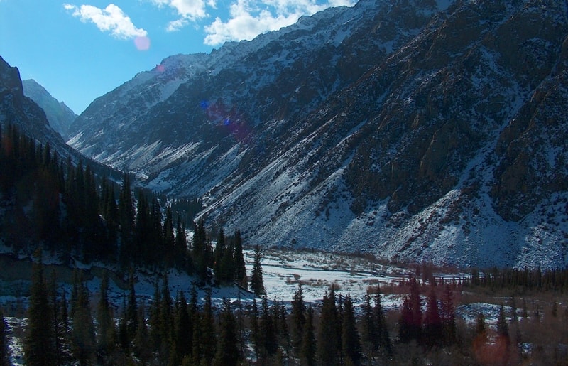
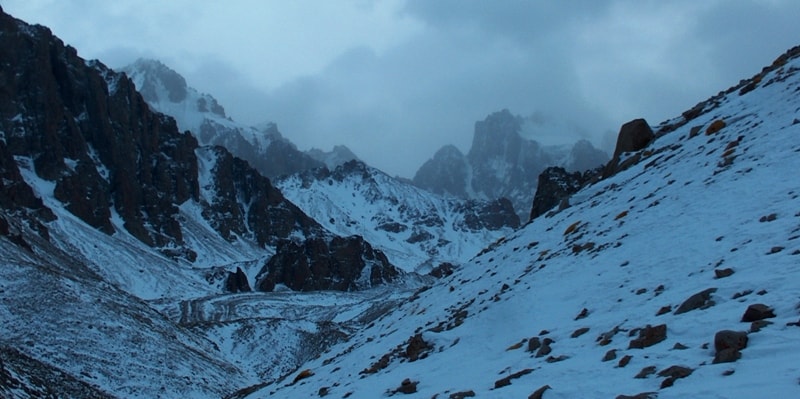
From hotel «Ala-Archa», the track which conducts in beautiful gorge Ak-Sai which northern slope Tien-Shan fur-trees begins. Ala-Archa gorge is a recreational area, favorite place for tourists. It is a grand, but accessible gorge to the south of Bishkek with huge glaciers, picturesque rocks, mountain rivers, crystal waterfalls Ak-Sai and Adyge, archa-forest, brushwoods of willow bed, wild rose, various animals: 26 species of mammals, more than 160 species of birds.
Most canyons are the part of state nature park. Offering dozens of walking and trekking possibilities, including hikes to glaciers and, for the serious mountaineer, treks to the region's highest peak.
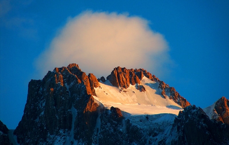
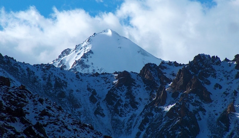
The region of Ak-Sai glacier, located in Ala-Archa gorge, is the most popular and most frequently visited area. Around 150 routes have taken place through this area from the most simplest routes to the complex ones with walls of up to 1100 m high.
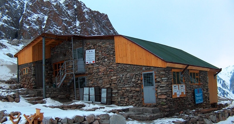
There are four mountain huts, three of them are small (approximately 4 x 4 m), one made of stone and is more comfortable, it holds up to 20 people. From the end of the road in Al-Archa gorge to the large hut in the parking lot of Ak-Sai, is a 3hrs walk on foot.
Other gorges of Ala-Archa include Adygene, Top-Karagai, Tuyuk and Golubina, and are visited less frequently than Ak-Sai itself, they do not hold such unique opportunities for climbing.
An excess height there is up to 600 meters and the tours are generally of easy and moderate difficulty, but there are far more opportunities for discovering and enjoying new routes. Ala-Archa river originates from the big glacier.
There is a number of major tributaries that flow into the river, from the top to the mouth, and they include Tuyuk-Suu, Top-Karagai, Teke-Top, Ak-Sai, Adygene, Karagai-Bulak, Kadyr-Berdy, Beru-Sai, Kashka-Suu and Oruu-Sai.
Unique landscapes of Ala-Archa gorge characterize the nature of both the arid western and the eastern, more damp and woodland-like, parts of the Northern Tien-Shan. The Ala-Archa gorge has more than 10 large glaciers, more than 50 mountain peaks (with 140 classified mountaineering routes of various levels of difficulty/complexity), and 30 mountain passes.
The national park is also rich in flora and fauna - with over 800 species of plants, 160 species of birds and about 170 specials of animals. It has Marco Polo sheep, wolves, bears, lynx, boar, eagles, and snow leopards.
The hills are lined with Spruce and Juniper woods. When you arrive at the park, you will have already risen oven a kilometre above the city. The base camp is several kilometres from the main gate and is at an altitude of 2100m above sea level. In the park you can find a small Nature museum and the Presidential Yurt.
Trekking to almost 5000 m is possible, although most people stay near the lower reaches that are often used for picnics. Although there are others, the three main routes which are used by trekkers are.
To the Ak-Sai Canyon – follow the signpost along the track to the left of the gate at base camp which leads to Karona Peak (4692m) and the Ak-Sai Glacier; to the Adygene Gorge - cross the footbridge over the river to the right of the gate at the base camp and climb the slope of the valley.
The trail leads past cemetery for “fallen” mountaineers, before continuing to the Adygene glacier; and following the course of the Ala Archa River up the main canyon, along a jeep track for 18 kilometres to a ski base.
It is possible to visit and simply relax or to organize light walking, 1 or 2 day's trekking – or horse-riding. The hills are lined with Spruce and Juniper woods. The base camp is several kilometres from the main gate and is at 2100 m.
Trekking to almost 5000 m is possible, although most people stay near the lower reaches that are often used for picnics. Ak-Sai canyon - to the left of the gate at base camp - track leads to Karona Peak (4692 m) - the Ak-Sai Glacier - trekking is possible, but equipment is really needed.
Adygene gorge - to the right of the gate at the base camp - walk leads past cemetery for "fallen" mountaineers, including one who is buried outside the boundaries because he committed suicide, cutting himself free to save his comrades rather than pull them down with him.
The path continues for 7 m under the Adygene glacier. Main Canyon - straight up from the gate at the base camp - following a jeep track for 18 km to a ski base with 2 drag lifts. It is possible to visit and simply relax, or to organize light walking, 1 or 2 day's trekking - or horse-riding.
Geographic coordinates of the Ala-Archa gorge: N42 ° 33'50.69 "E74 ° 28'48.58"
Authority:
“Discovery Travel” Magazine.
Photo by
Alexandr Petrov.