


You are here
Canyon Temirlik in Kazakhstan.


Excursion tourism in Almaty.
“The world is a book and those who do not travel read only one page”
Augustine of Hippo.
Shopping tourism in Kazakhstan.
The canyon of the Temirlik (Iron Turk.) River is located on the right bank of the Charyn River, 4.3 kilometers east of the Bestamak Canyon, west of the Donkara tract in the Uigur and Rayymbek districts of the Almaty region.
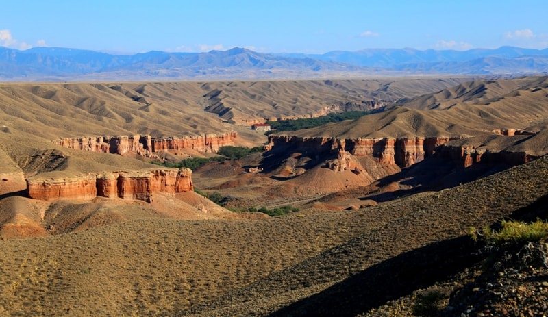
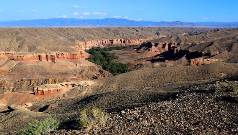
The Temirlik river and canyons are located 181 kilometers (in a straight line) from Almaty. The Temirlik canyon, 21.5 kilometers long, at a channel height of 865.8 meters above sea level, at the mouth of the channel, connects with the Charyn canyon.
The Temirlik River is the last major tributary of the Charyn. The foothill plain of the northern slopes of the Kuluk-Tau mountains, the Ketmen and Shoshanai ridges is composed of red clay deposits mixed with crushed stone and rock remains that were exposed by the Temirlik River. Temirlik canyon is divided into three significant parts.
First Temirlik canyon.
The first, narrowest part of the canyon, 3 kilometers long, starts from the mouth of the Temirlik River. At the mouth, the width of the canyon reaches 270 meters, in the middle part - 390 meters, at the end - 420 meters.
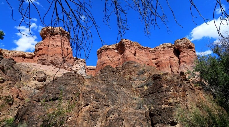
Water, over millions of years, has cut a deep and narrow canyon in the sedimentary rocks. Forms of the resulting relief resemble the Valley of Castles in the Toraygyr mountains on the left bank of the Charyn River. You can get into the canyon both from the left side of the canyon and from the right.
In order to get into the canyon from the left side, you need to turn off the road in the village of Aksai and move north along the dirt road, following the right branches of the roads. You can go down to the canyon on a bad dirt road.
The lowest part of the canyon can also be reached from the right bank. To do this, it is necessary to cross the Temirlik River to the right bank along the P-24 road and climb along the road to the exit from the canyon. After leaving the canyon, you should immediately turn left and move along the dirt road for 8 kilometers. From this place you can walk down into the canyon.
Second Temirlik canyon.
Starting from the ancient necropolis of Sharbakty located on the right side of the canyon, at an altitude of 1076.3 meters above sea level, the Temirlik canyon begins to expand and stretches for 10.5 kilometers. The end of the wide part of the canyon ends in the vicinity of the Akmola necropolis.
The necropolis is located on the left side of the canyon, at an altitude of 1350 meters above sea level, in close proximity to the triangular road fork Chundzha - Kegen - Almaty. At the beginning of the wide part, the width of the canyon reaches 320 meters, in the middle part in the Sarykamys tract, the width reaches 2 kilometers, at the end of the second part of the canyon, the width reaches 1600 meters.
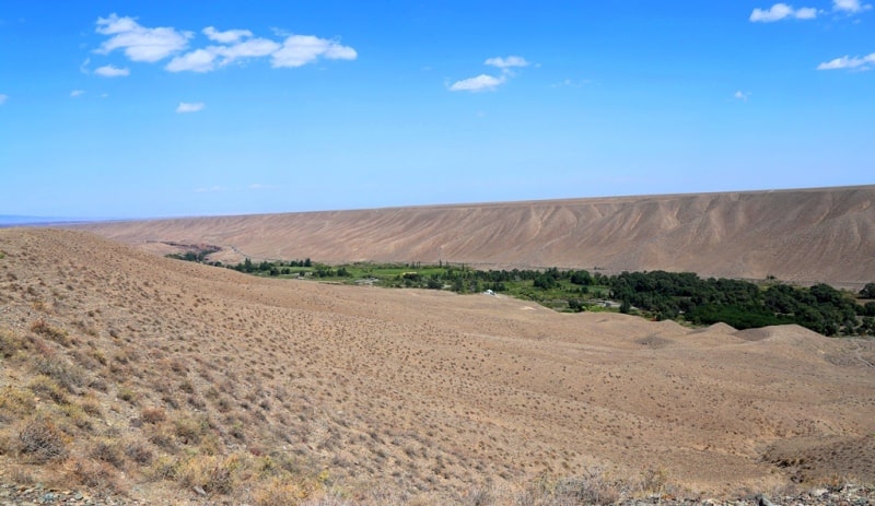
You can get to the Second Temirlik Canyon from the road bridge across the river, in the Sarykamys tract. The water of the river smoothly carries its waters under the canopy of numerous trees and bushes of red barberry along picturesque green glades. A real oasis in the hot semi-desert.
A huge advantage of this part of the canyon is the presence of a dense green thicket and thickets of turanga, which create a comfortable microclimate at the bottom of the canyon.
Third Temirlik canyon.
The third part starts from the Akmola necropolis and stretches for 8 kilometers to the left tributary of the Katuldruk. In the lower part, the width of the canyon reaches 370 meters, in the middle part up to 380 meters, in the upper part up to 130 meters.
The river in the shade of trees quickly carries water through a small rocky canyon and again goes out into the open spaces of a wide canyon.
Geographical coordinates of Temirlik canyon: N43°21'35.09" E79°09'53.38"

Authority:
Alexander Petrov.
http://almatyregion-tour.kz
Photos by
Alexander Petrov.