


You are here
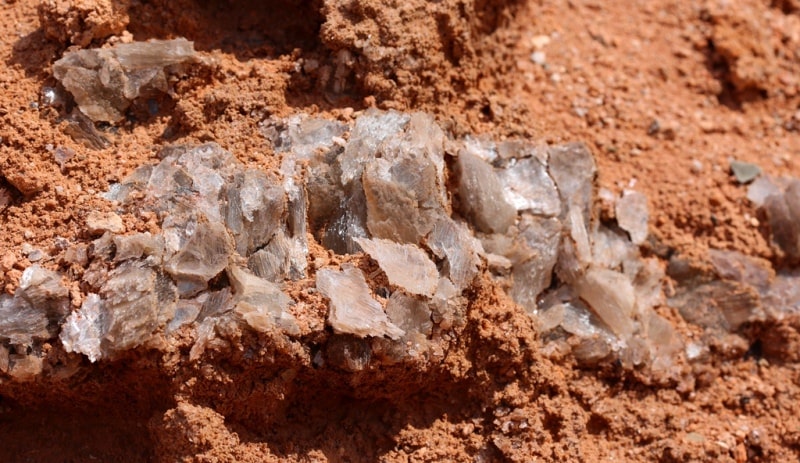
Geology of Central Asia.


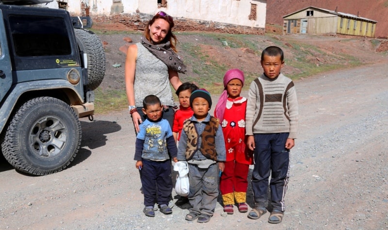
Kazakhstan Silk Road Travellers.
“Why do you go away? So that you can come back. So that you can see the place you came from with new eyes and extra colors. And the people there see you differently, too. Coming back to where you started is not the same as never leaving”
Terry Pratchett. “A Hat Full of Sky”.
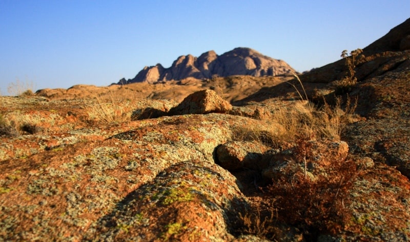
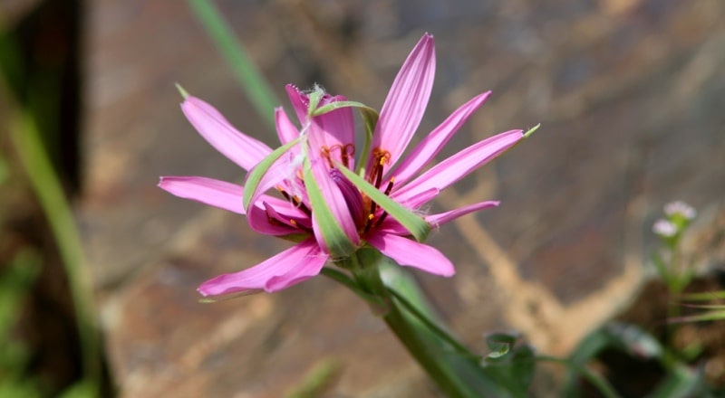
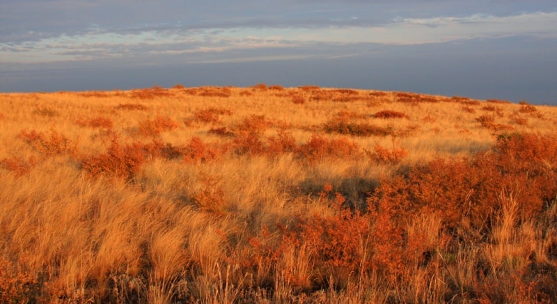
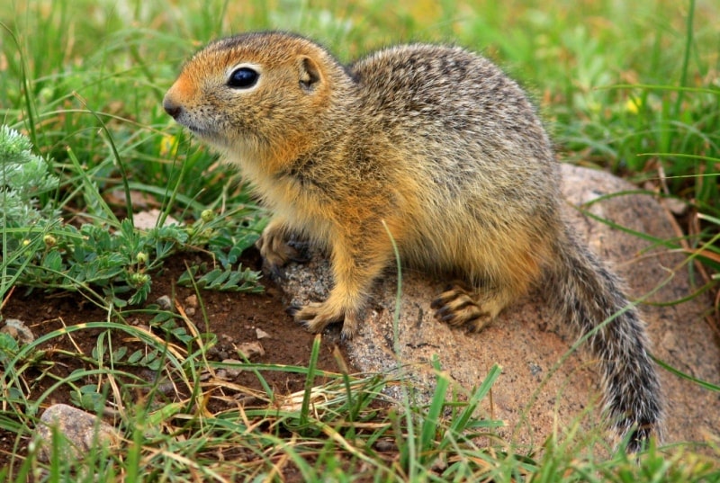
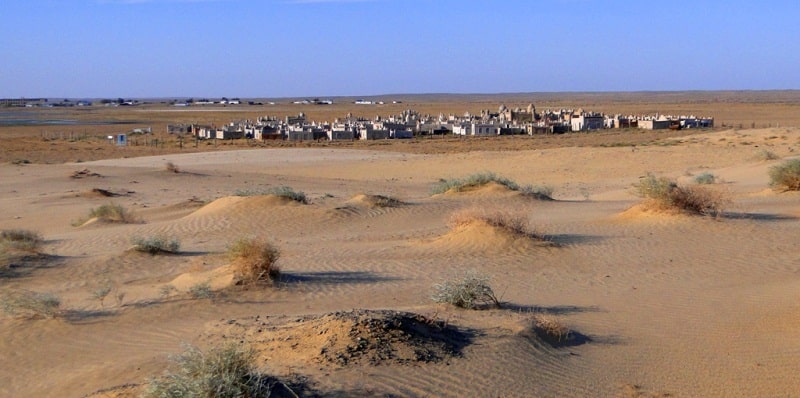
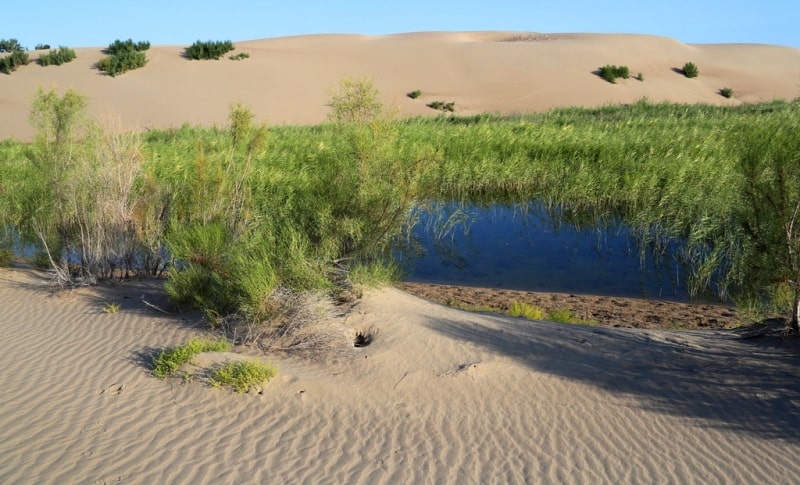
First Moments iin Kazakhstan.
A brief introduction to the tectonic structure showed that most of the territory under consideration has a Paleozoic folded basis. The most ancient sites, located in the west of the Kazakh Hills and in the northern half of Tien-Shan, experienced wrinkling educational movements in the Proterozoic, even in the Archean, and as a result of the Caledonian folding, these parts of the Ural-Tien Shan geosyncline turned into hard folded blocks.
In the remaining parts of the Ural-Tien-Shan geosyncline, the geosynclinal regime continued along the northern margin of Tethys, which ended mostly by the end of the Paleozoic. As a result of hercynian orogenesis, folded mountain chains and massifs were formed here, which were further exposed to peneplain, which exposed the roots of Paleozoic intrusions (associated with them in the areas of the Kazakh lowland, Tien Shan and northern chains of the Pamir-Alai).
The peneplain process began in the Paleozoic and already in the Permian period led to the formation of residual plains (for example, in the Tien-Shan). In the Mesozoic and Paleogene, most of the territory of Central Asia had a platform mode with a relatively small amplitude of oscillatory movements, while the Tetis geosyncline continued to develop in the south (the present Kopetdag and Pamir regions).
When lowering the platform, marginal parts of the Tien-Shan and Pamir-Alay from the west and south penetrated the seas (Upper Cretaceous and Paleogene transgressions) to the marginal parts of the Kazakh Hills, the Turan lowland, from the west and south, and left sea sediments.
However, in large areas of the Kazakh and Tien-Shan continental regime remained. This contributed to the continuity of the development of continental landscapes, which occurred against the background of changing climatic conditions.
The fossil flora found in a number of locations in Central Asia and Central Kazakhstan indicates a warm tropical and subtropical climate that prevailed in the Cretaceous, humid, but at times with seasonal aridity and, apparently, with seasonal cooling. In the southern parts of Central Asia, where the remnants of the Cretaceous flora are rare and sparse, a drier hot climate is suggested (E. P. Korovin, 1961).
The Paleocene flora of the northern half of the territory under consideration has not yet lost links with the upper Cretaceous and was of a humid subtropical character, but its xerophytes subsequently occurred. In the south, in the Eocene, tropical savannas were spread, the grass spaces of which were interspersed with thickets of xerophilus bushes and trees.
The warm climate was characterized by a pronounced dry season. At the end of the Paleogene, the entire space of the north of Central Asia and Central Kazakhstan was covered with shady forests consisting of beech, hornbeam, maple, walnut, alder and many other, mostly deciduous, partially coniferous trees; among them were giant sequoias.
The flora of these forests, formed in the Oligocene, is called Paleobotany Turgai. The climate was humid and warm, with a cold snap. The vegetation of the south of Central Asia was completely different. There were growing xeromorphic trees and shrubs, with small leathery leaves.
The climate here was mild, but considerably drier, with a very uneven distribution of precipitation over the seasons. In the Miocene, the current mountainous region of Tien Shan and, apparently, the plains of Central Kazakhstan covered deciduous forests of poplar, willow, alder, elm, maple.
The composition of vegetation shows an intermediate character between Turgai and modern flora. The climate remained fairly humid, but was characterized by more moderate temperatures and a cold winter. Mostly xerophytic formations were common. Xerophytic vegetation apparently continued to develop in the south.
In the process of development of the Cenozoic Tetis geosyncline to the south of present-day Central Asia, mountain ranges appeared in the Pamirs, the sea spaces decreased; All this contributed to the weakening of the influence of the southern seas and oceans on the climate and strengthening its continentality.
In the Neogene, the differentiation of oscillatory movements of the Earth's crust increased noticeably, and at the end of the Neogene and early Quaternary period, in the regions of the Dzungarian Alatau, Tien Shan and in the northern part of the Pamir-Alay, powerful mountain chains appeared on the site of residual plains and lowlands with Paleozoic folded structure subjected to folded deformations, which were accompanied by faults and movements along deep faults).
In the area of the Kazakh Upland, local block elevations complicated the relief, arrays of lowlands were formed. Differential shifts of the folded base occurred in measures also in the area of the Hercynian platform, causing the formation of folded structures in the Mesozoic-Cenozoic strata.
In the south, in the Tethys zone, the development of the Alpine geosynclinal region was completed. There were powerful uplifts of the Pamirs, the Khindu-Kush, the mountain barrier of Kopetdag was formed. The geosynclinal basin closed, the seas retreated, huge mountain barriers blocked Central Asia from the south from oceanic influences.
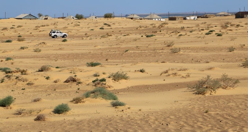
On the plains, the continental climate sharply increased and conditions were created for the formation of desert landscapes. Deserted flora formed on the low plains, while the slopes of the mountain ranges that emerged, favorably located with respect to humid air currents and receiving rather heavy precipitation, turned out to be occupied by deciduous forests.
Their elements - walnut, maple, exochord - are preserved in the modern vegetation cover of the mountains of Central Asia. In the Neogene, due to the powerful uplifts of the mountains, the process of transformation of the flat flora and fauna into the mountain one took place, the ancient alpine flora was formed.
The highlands formed in the Tethys area as a result of the alpine orogenesis - the Iranian and adjacent to it - became centers of plant speciation. New xerophytic forms were formed here, widely distributed in the lower parts of the mountains and in the deserts of Central Asia and largely displaced the ancient xerophytic flora.
The other important center of new speciation that influenced the development of the vegetation cover of Central Asia was the eastern Mediterranean. Central Asian elements of flora penetrated from east to north of Central Asia and Central Kazakhstan.
The rise of the Tien-Shan and Pamir-Alai led to the development of mountain glaciation. It is assumed that the first glaciation of the mountains of Central Asia (in the region of the Western Pamirs) occurred in the Neogene (Pliocene).
In the Pamir-Alai region (area of the Peter the Great Range), lower quaternary glaciation is observed. The last two Quaternary glaciations associated with the general changes in the climate of the northern hemisphere, have already developed at a time when the dismemberment of the mountain relief was close to modern.
The glaciations disturbed the structure of the high-altitude zoning of landscapes formed by the beginning of the glacial epoch, pushing the high-mountain vegetation down and promoting the mixing of plants of disjointed mountain systems.
Along with this, with the alternation of glacial and interglacial epochs, the steppe vegetation of the Eurasian plains penetrated into the mountains of Central Asia (which spread throughout Central Asia during the glaciation period with a general shift to the south of latitudinal vegetation zones), which later took its place in the structure of high-altitude zoning. In the aftermath of the glacial period, the vegetation belts shifted upwards and the modern structure of the high-altitude zoning of landscapes was formed.
Alternations of the Quaternary glacial and interglacial epochs were associated with changes in the climatic and hydrological geomorphological conditions of the desert plains. The ice age corresponded to pluvial periods, when the plains were flooded due to the increased flow of melt glacial waters from the mountains, alluvial plains developed, the desert climate softened slightly (in the north, in Central Kazakhstan, there was a noticeable wetting of the climate), evaporation decreased.
Between the glacial epochs corresponded to thermal periods - periods of increasing aridity of the climate, a sharp reduction in water flows from the mountains, waving of alluvial plains, and the development of aeolian forms of the relief of sandy deserts.
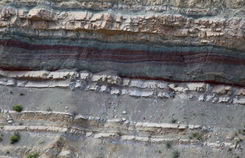
However, during the entire Quaternary period, the climate remained sharply continental and in the plains of Central Asia, the desert or desert steppe (during pluvial epochs) regime remained. The known stability of the climatic situation is confirmed, in particular, by the results of studying the loess strata, indicating the duration and continuity of the accumulation of loess-like material in a sharply continental climate and the presence of few humus buried soils of the gray earth type in the loess strata.
The last xero thermal epoch corresponded already after the ice age. At the end of the last century and at the beginning of this one, the hypothesis of Central Asia’s desiccation of a historical epoch was widespread. L. S. Berg, vigorously supported by A. I. Voeikov, entered into polemics with the supporters of this hypothesis.
The dispute was not only geographical, but also sociological. Proponents of the drying out hypothesis were in the position of geographical determinism and considered the “drying up” of the climate as the cause of the invasion of the Mongols and the death of the ancient cultures of Central Asia.
Berg also argued that these phenomena were social in nature and not related to climate change. L. S. Berg proved that the climate of Central Asia in the historical epoch “has not undergone a slight change in the direction of deterioration (desiccation)” and that the era of desiccation that has changed its ice age has long ended. In the modern era there is no progressive climate change, there are only short periods of change in the amount of precipitation.
As for Central Asia, some facts that at first glance indicate drying out, such as: the disappearance of surface water in the lower reaches of rivers that do not reach the main river arteries, the drying up of poplar thickets in the former river beds, can be explained by the anthropogenic impact ) or (in the second case) the wandering of the rivers (E.M. Murzaev).
However, not all researchers reject the drying hypothesis. Others (V.M. Sinitsyn, M.P. Petrov) continue to insist on the shrinkage of Central Asia, on the periphery of which there are Central Asian deserts. The solution of this issue is crucial for understanding the mode of modern physiographic processes in the desert plains of Central Asia (fluctuations in the levels of lake water, the dynamics of sand desert landscapes, etc.).
The dynamics of the Central Asian landscapes also depend on the continuing tectonic development of the territory. This dependence can be traced on a number of objects of the flat areas, but it is especially pronounced in the mountains of Central Asia.
The intensity of seismic phenomena indicates their continuing tectonic development. The strongest earthquakes are observed in Kopetdag, in the south of the Karakum, in the strip from Kopetdag to the southern part of the Krasnovodskiy Peninsula and the Cheleken Peninsula, in the Pamir-Alai (Gissar Range, the Surkhoba and its tributaries, the Pamir Highlands), in the Amur region, in the Amur region.

Authority:
N. A. Gvozdetsky, N. I. Mikhaylov. "Physical geography of the USSR. Asian part. The edition third corrected and added. Moscow "Thought" of 1978. http://tapemark.narod.ru/geograf/1_5_5.html
Photos by
Alexander Petrov.