Вы здесь
Bokty mount on Mangyshlak.

Tours, Travel, Holidays on Mangyshlak.
“All nature wears one universal grin”
Henry Fielding.
Tours to Bokty mount on Mangyshlak.
Mount Bokty, 165.8 meters high above sea level, is located at bottom of a dried salt marsh in northwestern part of Mangyshlak Peninsula, north of Baysary valley, northeast of Kulandy ledge, 23.4 kilometers (in a straight line) west of valley Bozzhyra, 36 kilometers southeast of the underground mosque Shopan ata in Karakiyansky district of Mangystau region.
From the south, Mount Bokty is closed by the Baysary valley; from the west, the Azhyrektyoi valley approaches Bokty. If you continue moving from Mount Bokty further to the east, country, well-worn roads will lead to the Bozzhyra valley.
Mount Bokty on the northern side is bounded by the Golbanshe hillock, through which the grader road to the Beket ata mosque and to the Bozzhyra valley passes.
The length of the surviving ridge of the mountain is elongated in the latitudinal direction by 452 meters, the width of the ridge in the central part is 92 meters. The base of the mountain is 965 meters from west to east, the width is 591 meters, the base of the mountain stretches 1.2 kilometers from southeast to northwest, the width of the base is 1.1 kilometers.
The foot of the mountain is located at an altitude of 19 meters above sea level. The path from the Shopan ata mosque to Mount Bokty lies along a steppe country road. Moving from the Bozzhyra valley to Bokty, you will have to climb a low mountain ridge, which stretches in the meridional direction, as if dividing the Bozzhyra valley from Mount Bokty.
The distance from the Bozzhyra valley to Mount Bokty is 39 kilometers; in rainy weather this path will not seem easy; the country road to the mountain range is made of clay. The path along the mountain ridge sometimes goes along exposed, smoothed monolithic rocks.
Traversing a small plateau, the road passes through, which leads to a sharp descent to the sor, on which Mount Bokty is located. The remnant chalk mountains have the amazing feature of changing their outlines beyond recognition from different viewing points.
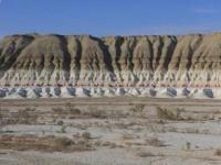
Mount Bokty is one of them. On the one hand, it is a giant boat with its keel turned upside down; when viewed from the south, the mountain looks like a majestic pyramid cut by horizontal, multi-colored stripes. On the other, there is a majestic miraculous pyramid, comparable to the legendary tomb of Cheops in Giza.
From the base to half of the mountain is colored with white-yellow-red stripes, the remaining part to the top has monochromatic colors ranging from gray-brown-greenish. The base of the mountain is carved with meridional gorges that look like paws and figures of fantastic animals.
The mountain is located on a clay surface as flat as a table - takyr.
Geographic coordinates of Mount Bokty: N43 ° 25'19 E53 ° 47'57
Authority and photos:
Alexander Petrov.


