


Вы здесь
Geography of Kazakhstan.
Travel by trains across Central Asia.
“Nature reacts not only to physical disease, but also to moral weakness; when the danger increases, she gives us greater courage”
Johann Wolfgang von Goethe.
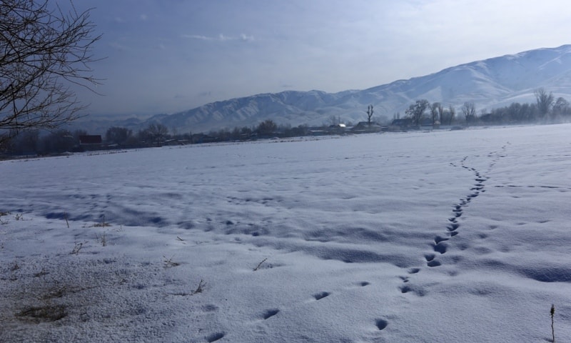
Flashpacker on Kazakhstan Altai.
Kazakhstan covers an area of 2,717,300 sq km (1,049,155 sq mi), making it by far the largest country in Central Asia. It was the second largest republic of the former Soviet Union, after Russia. Although high mountain ranges fringe the republic’s eastern and southeastern borders, the terrain of Kazakhstan consists mostly of deserts, steppes (vast, semiarid grassy plains), and hilly upland areas.
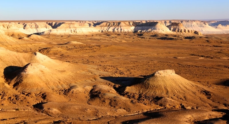
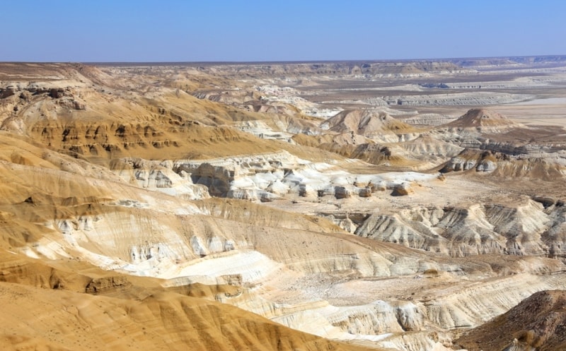
Deserts and semideserts (such as stone, salt, and sand wastelands) cover more than two-thirds of Kazakhstan’s surface area. The most expansive deserts in the republic are the sandy, barren Qyzylqum, which also occupies part of Uzbekistan, and the clay-crusted Betpak-Dala; both are located in the southern portion of the republic.
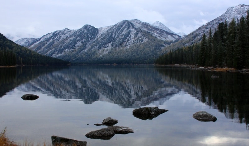
Kazakhstan contains extreme variations in elevation. The Tian Shan mountains contain the country’s highest point, Hantengri (6,398 m/20,991 ft), which lies in the extreme southeast where the borders of Kazakhstan, Kyrgyzstan, and China meet.
The Altay Mountains along the country’s eastern border also contain high peaks. Kazakhstan’s lowest elevation is found in the extreme southwest, just east of the Caspian Sea, where the Karagiye Depression lies 132 m (433 ft) below sea level.
The area north of the Caspian, in northwestern Kazakhstan, is occupied by the Caspian Depression, which also extends into Russia. The landscape of Kazakhstan varies dramatically. Lowlands and plains occupy the north, north-west and south-west of the country. The central part is occupied by the Kazakh low hills, also called the Sary-Arka.
The-Tien Shan, Zhungarskiy Alatau, Saura, Tarbagatai and Altai mountains occupy the largest area in the extreme South and south-east, where a lot of extremely high peaks. The Ustyurt desert Plateau is in the south-west of the country, and is surrounded by formative slopes; chunks from surrounding it plains.
A considerable part of the Republic is occupied by sandy deserts. The highest point in Kazakhstan - the Khan Tengri Peak in the Tien-Shan Mountains - reaches 7010 m. The lowest point - the Karagiye Cavity, located 132 m below sea level - is at the Mangystau Peninsula in West Kazakhstan.
The mountainous regions of Southern and Eastern Kazakhstan and some of the Kazakhstan low hills - are places of popular recreation. Opportunities for sports, active recreation and general tourism commend these regions. The largest land-locked country in the world, Kazakhstan is impressive because of the great physical contrasts within its boundaries.
Covering an area of more than 2.7 million square kilometres, it is the ninth-largest country in the world, and equivalent in size to the whole of Western Europe. It accounts for around 1.8% of the world's land, and also has the distinction of being the world's largest landlocked country. It is bordered in the north by Russia, with whom it shares a land border an astonishing 6,846km long, in the east by China, and in the south by the central Asian republics of Kyrgyzstan, Uzbekistan and Turkmenistan. In the west it abuts onto the Caspian.
The population of this huge country is around 16 million, giving Kazakhstan the low population density of fewer than six people per square kilometre. While most of Kazakhstan lies geographically in Asia, that part of the west of the country above the Caspian, lying west of the line of the Ural Mountains, is considered part of Europe, giving strength to Kazakhstani claims that it represents both continents (and hence its presence, for example, in the European football body UEFA).
Except for the strings of mountains along its southern and eastern borders, Kazakhstan is pretty flat. At 2.7 million sq km, it’s about the size of Western Europe. The most central of Central Asian countries, Kazakhstan has extensive land borders with Russia (6,467km), Uzbekistan (2,300km), China (1,460km), Kyrgyzstan (980km) and Turkmenistan (380km).
Add to this its maritime border on the Caspian shelf, which stretches over 600 kilometres, and Kazakhstan's total border length reaches around 12,187 kilometres. From the lowlands and plains in the west and north, to the high mountains in the southeast and south, Kazakhstan's territory has an altitude range of more than 7,000 metres.
The country features an exceptional variety of landscapes, the most visually impressive being the high mountain ranges. The Tien Shan, a northern branch of which-the Zailiyskiy Alatau-separates Kazakhstan from Kyrgyzstan over a distance of 300 kilometres, is a folded massif which was formed during the Neo-Palaeozoic and Tertiary eras and later rose again as an anticline fault line ridge.
This mighty mountain chain stretches 2,500 kilometres from Kazakhstan across Kyrgyzstan into China. The Chinese called it the Mountains of Heaven, and at a height of 7,010 metres on Khan Tengri, Kazakhstan's highest summit, one gets close to Heaven indeed-and each year, due to the high seismic activity of the mountain range, up to five millimetres closer.
The northern Tien Shan distinguishes itself by its ruggedness: within the relatively short period of time since the mountain range's formation, the strong erosive forces of ice and water have formed steep, deep valleys and filled them with rock debris, but failed to round off the peaks and ridges.
Towards the north, the Tien Shan massif extends to the Zhungar (Dzhungar) Alatau, which occupies a vast area along the border with China, and reaches heights of up to 4,622 metres. Further to the north rises the wild, rocky Tarbagatay mountain chain, the highest peak of which reaches 2,992 metres.
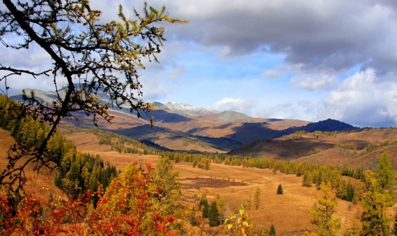
The second major mountain range of Kazakhstan, the Altai, is also young in geological terms. The Altai's main chain consists of schist rock, which was folded and pushed up from the surrounding steppe and large plateaus until the Quaternary Era.
The last Ice Age froze the Altai hard, and the snowline lay about 1,000 metres below its present-day level; as a result, today a rich variety of glacial formations are found: broad, bath-shaped valleys, coarse gravel fields and numerous lakes.
The Altai is rich in polymetallic resources, particularly on its western, Kazakh slopes. In contrast, in the west, close to the Caspian, lie some of the lowest points on the territory of the former Soviet Union. Kazakhstan's lowest land altitude is the Karagiye Depression in Mangistau Region, at -132m.
The north of the country is flat, mostly treeless steppe, with much of its original grassland now turned over to wheat or othe agriculture. Further south and west the steppe is increasingly arid, becoming desert or semidesert. A surprising number of lakes, especially in the north, and scattered ranges of hills, break up the steppe.
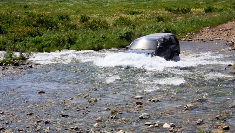
The most important rivers are the Syr-Darya, flowing across the south of Kazakhstan to the Little Aral Sea; the Ural, flowing from Russia into the Caspian Sea; the Ili, flowing out of China into Lake Balkhash; and the Irtysh, which flows across northeast Kazakhstan into Siberia.
Lake Balkhash in the central east is now (following the demise of the Aral Sea) the largest lake in Central Asia (17,000 sq km). Many of Kazakhstan's rivers flow northwards and westwards from its high ranges, and their continuations in China and central Asia.
Many rivers simply expire in the arid expanses which straddle much of the country. Kazakhstan also boasts some 48,000 lakes.


Authority:
"Zhetysu is the Land of tourism”. A Tourist Guide-book. Almaty. 2003. 68 p. and the material for this page is taken from the printed edition."Guide to Kazakhstan" Baur Publishing House. 2002
Photos
Alexander Petrov.