


Вы здесь
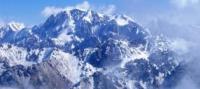
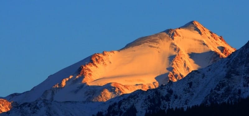
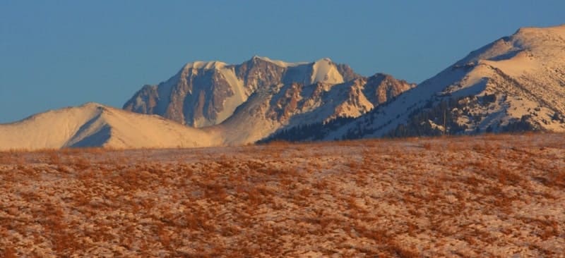
Northern Tien-Shan mountains.

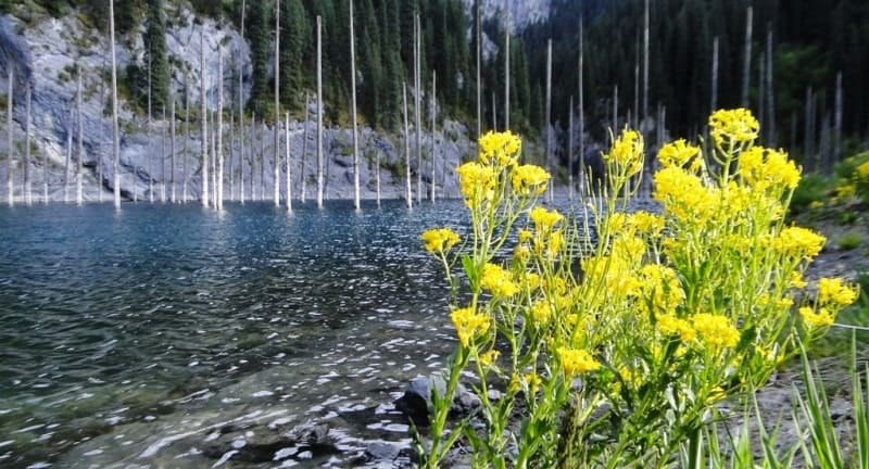
Popular destinations in Almaty.
«Every creature lives in a state of war by nature»
Jonathan Swift.
Popular vacation destination Kazakhstan.
Northern Tien Shan is located north of the basin of Lake Issyk-Kul. These include Tarbagatai and Saur, the Chu-Ili Mountains, the Dzungarian, Trans-Ili Alatau and Kungei-Alatau, the Kyrgyz Ala-Too, the Ketmen Range, the Chu-Ili Mountains.
The Tarbagatai and Saur ridges are located between the Alakol and Zaisan depressions. They occupy a border position between the mountains of Southern Siberia and Central Asia. The Tarbagatai ridge has an almost latitudinal extension, its maximum heights reach 2991 meters above sea level.
The slopes of the ridge are deeply dissected by gorges. The southern slope is steeper than the northern one. The watershed ridge is flattened and pressed against the southern slope. The Saur ridge is located within the extreme eastern part of Tarbagatai. It also has a latitudinal strike.
The average height is 3000 meters above sea level, most of it with maximum heights and the Muztau peak at 3816 meters above sea level is located in China. The ridge is sharply asymmetrical: its southern slope is steep (up to 10 kilometers wide), and its northern slope is flatter (up to 20 - 25 kilometers wide).
The watershed spaces of the ridge are flat surfaces of ancient denudation, while the slopes are strongly dissected. In the upper reaches of the valleys there are circuses and punishments.
Dzungarskiy Alatau is located in the southeast of Kazakhstan, along the border of Kazakhstan. It is separated from the Tarbagatai ridge by the Alakol and Sasykkol lakes, and from the Barlykh and Maili ridges, located in China, by the Dzungarian Gate.
The Dzungarian Alatau stretches from west-southwest to east-northeast for about 400 kilometers. It is represented mainly by two ridges: the North-Central, or Main, which is accompanied by low and short forward chains on the northern side, and the South-Central, consisting of the Toksanbay, Bezhintau and Tyshkantau ridges.
The ridges are separated by a deep intermountain depression, which in the western part is occupied by the river valley. Koksu, and in the eastern - by the valley of the Borotala River. The watershed of these rivers is a bridge connecting the ridges.
The heights of the ridges exceed 4000 meters above sea level, reaching 4464 meters above sea level in the northern chain and 4359 meters above sea level in the southern chain. The relief of the Dzhungar Alatau is characterized by ancient leveling surfaces, which are located at an altitude of 3000 - 4000 meters above sea level.
To the west, the Dzhungar Alatau gradually decreases and breaks up into a series of short ridges that diverge fan-shaped. The Dzungarian Alatau is separated from the southernmost ridges of the Trans-Ili Alatau by a wide intermountain depression occupied by the Ili River valley.
The depression is elongated in the latitudinal direction, and its total length is about 600 kilometers. The western part of the depression lies within Kazakhstan, and the eastern part lies within China. From the city of Ili it changes its direction to the north-west and cuts through the Karoi plateau, which is the connecting link between the Chu-Ili mountains and the western spurs of the Dzhungar Alatau.
Trans-Ili Alatau stretches from the Chilik River in the east to the Chu River in the west. In plan, it forms a wide arc with a convexity facing south. The eastern part of the ridge is dissected by longitudinal valleys into several parallel mountain ranges.
Beyond the Novokastek Pass, the strike of the ridge deviates from the latitudinal one and becomes west-northwest. Its continuation is the lower Zhetyzhol ridge, and then the slightly dissected Kendyktas mountains and the heavily denuded Chu-Ili mountains.
The central part of the ridge has the character of a narrow ridge with sharp peaks and peaks, its southern slope is strongly dissected. In the western part of the ridge, leveling surfaces are developed, gently descending to the south, to the flat bottom of the Chuya depression. The eastern continuation of the Trans-Ili Alatau are small mountain ranges.
In the central part of the ridge, individual peaks reach a height of 4500 meters above sea level (peaks Metallurg, Bogatyr, etc.). Among them, Talgar Peak stands out with a height of 4978.9 mountain node To the south of the Trans-Ili Alatau there is the Kungei-Alatau ridge, which forms an arc with its convex part facing north.
The ridges are connected in the central, highest part by a bridge - the Chiliko-Kemin mountain junction, which is the watershed of the Chon-Kemin and Chilik rivers, which separate the ridges in the western and eastern parts. The ridge frames Lake Issyk-Kul from the north, stretching from the Boom Gorge, formed by the Chu River, to the Santash Pass in the eastern part.
Kungey-Alatau reaches its greatest height at the peak of Choktal, 4771 meters above sea level, which is located in the central part of the ridge. The crest of the ridge is cut by carcasses and cirques. Leveling surfaces are observed to the north and south of it.
The western continuation of Kungei-Alatau is the Kyrgyz ridge, which stretches in an almost latitudinal direction from the Boom Gorge in the east to the town of Taraz in the west. The ridge is separated from the arc of the Trans-Ili Alatau by the vast Chui Valley.
The northern slope of the ridge, facing the Chui Valley, is longer and flatter than the southern one. Its maximum width is 40 - 50 kilometers. The slope is strongly dissected by transverse valleys, along which numerous tributaries of the river flow Chu. Due to strong dissection, no ancient alignment surfaces have been preserved on the ridge.
The maximum heights of the ridge are in the central part, where they reach 4857 meters above sea level at the Western Alamedin peak. To the west the levels drop significantly. The eastern continuation of Kungei-Alatau is the long Ketmen ridge, which extends east into China.
The geological basis of the Northern Tien-Shan ridges is made up of highly dislocated sedimentary rocks of the Paleozoic, represented by shales, limestones, sandstones, etc., intruded by intrusions of igneous rocks; intermountain depressions are composed of loose continental sediments.
Folding movements here occurred in the Proterozoic, as well as throughout the Paleozoic. As a result of the Caledonian orogeny, the Issyk-Kul ridges were created, and the Hercynian - Tarbagatai, Saur, and Dzungarskiy Alatau. Subsequently, starting from the Paleozoic and throughout the Mesozoic and Paleogene, the created ridges were subjected to denudation processes, as a result of which their original relief was severely destroyed, reduced and leveled. The relief was dominated by denudation plains with low mountain ranges.
At this time, the described territory had a platform continental regime with a small amplitude of oscillatory movements of an epeirogenic nature. As a result of the Alpine orogeny, which occurred during the Neogene and Lower Quaternary times, in place of the ancient leveled relief, a modern high-mountain relief was formed, with highly elevated deformed leveling surfaces.
The consequence of the high elevation of the ridges was glaciation, which, according to most researchers, was double. Ancient glaciation has not yet been sufficiently studied. The snow line on the ridges of the Northern Tien Shan rises from northwest to southeast.
On Kyrgyz ridge it is located at an altitude of 3600 - 3800 meters above sea level on the northern slopes and 3300 - 4200 meters above sea level on the southern ones. On Saur, the snow line is located at an altitude of 3320 - 3340 meters above sea level in the Dzhungar Alatau on the northern slope - at an altitude of 3300 - 3500 meters above sea level, on the southern slope - at an altitude of 3700 - 3900 meters above sea level.
Modern glaciation has developed on almost all ridges of the Northern Tien Shan. On Saur, according to Yu.P. Seliverstov, there are currently 18 glaciers with a total area of about 17 square kilometers. The glaciers are located in the upper sections of the valleys at an altitude of more than 3000 meters above sea level and belong to the sources of the border river Ulkun-Ulasty and the right-bank tributaries of the Kenderlyka River.
Muztau glaciation belongs to the type of flat top glaciers. In the Dzungarian Alatau (within Kazakhstan), the glaciated area is 956 square kilometers with 724 glaciers. Various types of glaciers are developed here: valley, cirque, trail, hanging valleys and flat tops.
Powerful glaciation centers are located at altitudes above 4000 meters above sea level (in the upper reaches of the Lepsy, Big and Small Baskans, Sarkand, Karatalskaya Kora and Koksu). The glaciers of the Dzhungar Alatau feed many rivers that flow into lakes Balkhash, Alakol and Sasykkol.
In the Trans-Ili Alatau, N.N. Palgov took into account 265 glaciers with a total area of 484 square kilometers. On the northern slope there are 194 glaciers covering an area of 297 square kilometers. They are located from the headwaters of the Uzunkargaly River in the west to the headwaters of the Asy River in the east.
On the southern slope there are 71 glaciers with an area of 187 square kilometers; their distribution area extends from the sources of the Tegirmentysu River, which flows into the Chon-Kemin River, to the sources of the Odensay River, which flows into the Chilik River.
A large center of glaciation in the Trans-Ili Alatau is the Talgar massif, the glaciers of which give rise to the rivers: Chilik, Talgar, Bolshaya and Malaya Almaatinki. The basin of the Bolshaya and Malaya Almaatinok rivers is known for its threatening glacial mudflows, which carry out a lot of moraine material, discharged by rapidly retreating glaciers.
Glaciers of cirques and hanging valleys are very common in the Trans-Ili Alatau. Valley glaciers account for more than 1/4 of the total glaciated area. Of the valley glaciers, the largest is the Korzhenevsky glacier, which is 12 kilometers long and has an area of 50 square kilometers.
The Zhangyryk glacier has a length of 7.8 kilometers, an area of 24.5 square kilometers, the Bogatyr glacier has a length of 8 kilometers, an area of 30.3 square kilometers, etc. Glaciers of flat peaks are rare, mainly in the eastern half of the ridge.
On Kungey-Alatau, the area of modern glaciation is 237 square kilometers, in the Kyrgyz ridge - 223 square kilometers. It is confined mainly to the central, highest parts of the ridges. Almost all glaciers of the Northern Tien Shan are retreating.
The rivers of the Northern Tien Shan belong mainly to the basins of the Ili and Chu rivers. Their diet is mixed - glacial and snow. They experience high water in the summer, that is, during the intensive melting of glaciers and snow in the highlands.
Small rivers, the sources of which are located below the snow line, are fed mainly by melted snow water. They experience high water in the spring. The rivers of the Northern Tien Shan are used for irrigation and hydroelectricity. The climate of the Northern Tien Shan is sharply continental. It is deposited under the influence of circulation processes developing over Kazakhstan and Western Siberia, as well as under the influence of altitudinal zonation, due to which climatic high-altitude zones are distinguished - from the desert climate at the foothills to the cold climate of the highlands.
The predominant air mass in Central Asia and Kazakhstan is the air of temperate latitudes, which borders on Arctic air in the north and tropical air in the south. In the area of dominance of air at temperate latitudes, intrusions of both cold air from the north and warm air from the south occur.
This occurs due to the mobility of the Arctic and polar fronts. In winter, the western spur of the Siberian anticyclone passes through Kazakhstan and the north of , during which cloudless, quiet weather sets in with night cooling, and during the day there is a gradual increase in temperature.
However, the anticyclonic situation is replaced by cyclone breakthroughs, followed by cold masses of Arctic air invading from the northeast, north or northwest. This is explained by the position of the Iranian branch of the polar front south of the borders of Central Asia.
Significant differences between the tropical Iranian air and the air of temperate latitudes cause cyclonic activity in the zone of this front. It is associated with winter precipitation, especially intense on the western and southwestern slopes of the ridges, which leads to the accumulation of snow in the highlands.
At this time of year, the mountain-valley circulation is most pronounced in the mountains, which occurs in the valleys open to the west. In cases where in the east of the latitudinal location and open valleys to the west, the pressure is significantly higher than in the west of them, then foehn winds arise.
When they occur, air descends along the mountain slopes. The garmsil wind is also associated with the peculiarities of orography. In summer, the air of temperate latitudes is energetically transformed into tropical air, due to which temperature differences between air masses on both sides of the front are smoothed out.
Due to this, the polar front becomes greatly blurred, as a result of which cyclonic activity is weakened. This leads to the establishment of dry, clear weather. The fall of summer precipitation in high mountain areas is associated with cyclonic activity, where, due to the topography, fronts become active.
The bulk of precipitation is brought by western and northwestern winds, due to which the western slopes receive more precipitation. To the east, the amount of precipitation decreases. On average, 700 - 800 mm falls, but due to the highly dissected relief, their distribution is unusually variegated.
The peaks of mountains with altitudes of more than 4000 meters above sea level serve as a barrier that traps precipitation, which in the high-mountainous part of the ridge falls on average from 900 to 1000 mm. Above the snow line they fall mainly in solid form.
The maximum amount of precipitation in the mountains occurs in the summer, but the western slopes receive a large amount of precipitation in the winter, which is due to the peculiarities of atmospheric circulation in winter. Average monthly air temperatures in July in low places reach +20, +25°, in the middle part of the mountains +15, +17°, and higher on the slopes it drops below 5°.
The absolute maximums are +30, +35°. Average January temperatures in the mountains are below - 20°, with minimum temperatures reaching - 30, - 50°.
Soils of Northern Tien-Shan.
The mountainous and high-mountain relief of the Tien Shan determines the altitudinal zonation in the distribution of soil cover. The alluvial plains bordering the mountains are occupied by large areas of takyr, takyr and meadow soils, salt marshes and sands.
Gray soils are developed on high ancient alluvial terraces, as well as in the zone of foothill semi-deserts. In the area of high foothills and low mountains, which occupy heights of 700-1700 meters above sea level, light and dark mountain chestnut soils are common.
At altitudes from 1700 to 2000 - 2200 meters above sea level, within the low parts of the middle mountains, mountain chernozems of meadow steppes are developed, and within the high parts, at 2000 - 2800 meters above sea level, there are subalpine mountain meadow chernozem-like soils.
Mountain-forest dark-colored soils are common here in separate tracts at altitudes of 1200 – 1400 – 2000 meters above sea level. On the plateau-like peaks and on the southern slopes of the ridges, significant areas are occupied by mountain-meadow-steppe soils.
In the alpine belt at altitudes of 2800 - 3400 - 3600 meters above sea level, mountain-meadow peaty and semi-peaty dark brown soils predominate. In some places there are mountain-meadow-steppe semi-peaty brown soils occupying small areas.
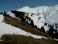
The vegetation of the Northern Tien Shan, like the soils, is subject to the pattern of altitudinal zonation. The flat spaces surrounding the mountain ranges are occupied by wormwood and solyanka deserts, which give way higher up to wormwood-turf-grass steppes.
Within the low mountains at altitudes from 700 - 900 to 1200 - 1700 meters above sea level, the vegetation cover is represented by mountain turf and grass steppes dominated by (Festuca sulcata) and (Stipa capillata, S. Lessingiana, etc.). These steppes are characterized by the presence of specific Central Asian elements (Eremurus olgac, E. robustus, etc.). Higher up they pass into mid-mountain meadow steppes and forests.
The steppes are used as pastures and hayfields. Low, more comfortable places swing open. Wheat, cotton, melons, etc. are grown here. There are many rodents in the steppes: gophers, jerboas, hamsters, mice, gerbils, etc. From an altitude of 1200 - 1700 m and up to 2000 meters above sea level, deciduous forests are distributed in separate tracts within the mountain forest, meadow and steppe zones.
Aspen forests are found here in small areas along the northern slopes. They include other wild fruit trees and shrubs. A large number of wild apple trees grow on the northern slopes of the Trans-Ili Alatau. Hawthorn, Tien Shan rowan, honeysuckle, etc. also grow in aspen forests.
The grass cover consists of large grasses with a predominance of large umbelliferous grasses. Areas of birch and poplar forests and woodlands are found mainly in river valleys and along the bottoms of gorges. Rarely do they climb mountain slopes.
Forests of Northern Tien-Shan.
Higher up are coniferous forests of Tien Shan spruce (Picea Schrenkiana). Spruce forests are divided into mid-mountain spruce forests and high-mountain ones. Mid-mountain spruce forests grow at altitudes from 1400 to 2500 - 2600 meters above sea level.
Among them, spruce forests include moss, grass-moss, shrub-tall grass and mixed ones. Moss spruce forests occupy steep mountain slopes with northern and northeastern exposures. Their undergrowth is sparse and their moss cover is thick.
Grass-moss spruce forests are located on gentler slopes. They are characterized by a dense tree stand, a fairly developed herbaceous layer and moss cover. Shrub-tall-grass spruce forests are represented by park open forests. They are characterized by a large number of shrubs, which are represented by honeysuckle, rose hips, currants, and sometimes rowan.
Along with spruce, mixed spruce forests include such tree species as aspen, birch, poplar, rowan, and apple. They grow mainly along the bottoms of gorges and river terraces, less often along gentle slopes. Alpine spruce forests grow at altitudes above 2500 meters above sea level and represent open forests.
Among them are: lichen spruce forests, juniper spruce forests, caragana spruce forests and meadow ones. Lichen spruce forests are common only in the Trans-Ili Alatau, in the upper reaches of deep gorges. Juniper spruce forests, which are close to caragana spruce forests, occupy the slopes of eastern and western exposures.
The plantings are sparse, the undergrowth is represented by dwarf juniper (Juniperus turkestanica, J. sibirica). Meadow small spruce forests grow at the upper limit of the distribution of Tien Shan spruce. These plantings are very rare. Along with spruce in the Dzungarian Alatau, fir (Abies sibirica) is found in some places.
On the drier slopes of this belt there are thickets of juniper. In coniferous forests live: lynx, Siberian roe deer, pine and stone martens, weasel, wolf, fox, birds - crossbill, nutcracker, juniper oakberry, etc. The upper zones are occupied by subalpine and alpine meadows.
Subalpine meadows begin in the upper part of the coniferous forest belt. Subalpine meadows include: cereals - sheep, foxtail, fescue; from forbs - mantles, geraniums, buttercups, etc. Thickets of creeping juniper are common among the meadows.
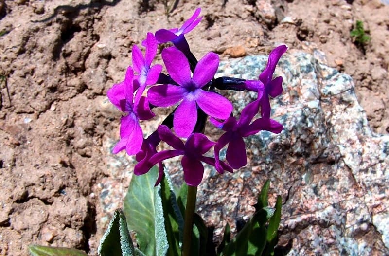
Subalpine meadows are the main and highly productive summer pastures (“jailau”). Alpine meadows are located above subalpine meadows and rise to the eternal snow. The vegetation cover here is torn, represented by sedge-grass vegetation and kobresias with an admixture of buttercups, primroses, anemones, poppies, etc., classified as colorful forbs, and meadow-steppe vegetation of fescue, thin-legged, sedge, etc.
Typical animals for this zone are: snow leopard, pika, teke mountain goat, Central Asian argali sheep, many marmots, and voles. Above the alpine meadows there are glaciers, snowfields, and rocks that belong to the glacial-nival zone. The plant cover here is found on rocks and stones in the form of algae and lithophilous lichens.


Authority:
http://big-archive.ru
Photos by:
Alexander Petrov.