


![]()
Вы здесь
Republic of Kazakhstan.
Kazakhstan is a country in Central Asia.
“In the international arena, Kazakhstan has taken a stable place as one of the models of the world, a multinational world order. We are like a world in a big world"
Olzhas Suleimenov.
Kazakhstan on world map.
A state located in the southwestern part of Central Asia, in the very center of Eurasia. The Republic of Kazakhstan is washed by the Caspian Sea in the west, and by the Aral Sea in the north. It borders in the north with the Russian Federation, in the south-west - with Turkmenistan, in the south - with the Republic of Uzbekistan, the Republic of Kyrgyzstan and in the south-east and east - with the People's Republic of China, in the north-west and west it is washed by the Caspian Sea.
Territory - 2,724.9 thousand square kilometers. The capital is Nur-Sultan. The Republic of Kazakhstan is the most urbanized of all the republics of Central Asia. The largest cities are Almaty. Almaty (1.13 million people), Karaganda (560 thousand people), Chimkent-Kazakh. Shymkent (409 thousand people), Dzhambul (320 thousand people), Pavlodar (300 thousand people), Semipalatinsk (270 thousand people).
Administratively, it is divided into 14 regions and 3 city akimats (Astana, Alma-Ata, Leninsk), 160 districts, 2150 aul (rural) districts. The largest regions are Aktobe, Almaty, East Kazakhstan, Karaganda, Kostanay.
Population - 18.28 million people (2018). Ethnic composition: Kazakhs (53%), Russians (30%; if in 1989 6.1 million Russians lived in the Republic of Kazakhstan, then in 2000 there were 4.5 million people), Ukrainians (3, 7%), Germans (2.4%), Uzbeks, Tatars, Uighurs, Belarusians, Koreans, etc.
The economically active population of the Republic of Kazakhstan is 7.2 million people, of which 6.3 million people are employed in the sectors of the economy. The official language is Kazakh. Most of the believers are Muslims who practice Sunni Islam.
Russians are adherents of the Orthodox Church. Most Germans adhere to Lutheran Protestantism. The monetary unit is tenge. Part of the CIS. The Constitution of the Republic of Kazakhstan, adopted as a result of a referendum on August 31, 1995, provides for a presidential form of government in combination with a permanent professional bicameral (senate and majilis) parliament.
The Republic of Kazakhstan is declared a democratic, secular, unitary state.
The head of state is the president, who heads the unified system of executive power of the republic. Nursultan Nazarbayev was elected President of the Republic of Kazakhstan in direct general elections on 01.12.1991 for a period of 5 years.
As a result of the elections on April 29, 1998, his term of office was extended. The highest body of state power is a bicameral parliament. Government - Cabinet of Ministers. More or less actively in the Republic of Kazakhstan there are about 30 parties and movements.
The surface of the Republic of Kazakhstan is extremely diverse. Low-lying plains are replaced by plateaus, hummocks, and in the east and southeast - by high ridges. In the west of Kazakhstan there is the lowest place in the country, the Karagiye depression (- 132 m. b. s. l.), and in the east there are mountains covered with eternal snow and glaciers, up to 5,000 meters high.
Most of the surface of the Republic of Kazakhstan is plain and lowland. A significant area is occupied by the Caspian lowland, near the shores of the Caspian Sea, the lowland lies 28 meters below sea level, further north it rises to 50-60 meters above sea level.
In the northeast, the Caspian lowland is bounded by the Ural Mountains and the Mugodzhars. To the east of Mugodzhary there is the Turgai plateau (250 - 300 m. a. s. l.), which turns into the Turan lowland in the south, occupied mainly by the sands - the Kyzylkum deserts and the Aral Karakum desert.
To the west of the Aral Sea rises the Ustyurt plateau (altitude up to 300 meters above sea level), which is cut off in all directions by steep ledges - "chinks". In the central part there is the Kazakh Upland, which is the remains of an ancient mountain system, with separate mountain ranges - Kyzylrai and Karkaraly.
The southern part of the Kazakh Upland turns into the vast desert plateau Betpak-Dala (altitude 300 - 400 meters above sea level), to the south of it a large area is occupied by the Muyunkum sands. In the east and southeast of the Republic of Kazakhstan along its southern borders stretch the southern chains of Altai, the Tarbagatai, Saur, Dzhungarsky Alatau ranges, the northern chains of the Tien-Shan, Zailiysky Alatau.
The climate is sharply continental and dry. In the south, the masses of continental tropical air invading from Iran and the Caspian Sea have a noticeable effect. The average January temperature is from - 18 ° С in the north to - 3 ° С in the south, in July, respectively, 19 and 28 - 30 ° С.
In the north, precipitation is up to 300 mm per year (falls in summer), in deserts less than 100 mm (falls in spring), in mountains up to 1600 mm. Over 2,700 glaciers (the total area of glaciation is about 2,000 square kilometers).
The rivers of the Republic of Kazakhstan, except for the Irtysh, belong to the basins of the Caspian and Aral seas and Lake Balkhash. Irtysh belongs to the basin of the Arctic Ocean. The main rivers are Irtysh, Ural, Syrdarya, Emba, Turgai, Nura, Sarysu. Many rivers dry up in summer.
Rivers flow into Lake Balkhash: Ili, Karatal, Aksu, Lepsy. 180 reservoirs have been built on the rivers, large ones - Chardarya, Bukhtarma, Kapchagayskoye and others, the Irtysh-Karaganda canal with a length of 478 kilometers.
There are over 48,000 lakes in the Republic of Kazakhstan, mostly deltaic and floodplain. The largest are Balkhash, Zaysan, Alakol and others. After the Aral Sea dried up and divided it into three reservoirs - the North, East and West Seas - the first remained completely within the republic.
Soils, black earth in the north of the Republic of Kazakhstan, are replaced to the south by dark chestnut, chestnut. Most of them were plowed up during the rise of virgin lands in the mid 50s of the XX century. Further to the south, brown and gray-brown soils are widespread. Within the extreme south - sierozem; in intermontane dry hollows - brown soils.
The vegetation of the herb-grass and fescue-feather grass steppes (mostly plowed) is replaced by the wormwood-cereal semi-desert and wormwood-saltwort desert. 
In the foothills there are dry steppes, in the middle mountains there are coniferous forests, above there are subalpine and alpine meadows. The fauna is represented by numerous rodents, reptiles and partially predatory (fox, wolf, badger, etc.).
In semi-deserts and deserts, the hump-nosed saiga and gazelle are found; from birds - bustard, kretchetka, curlew, from waterfowl - ducks, geese, swans, cormorants, pelicans, etc. In the mountains there are mountain sheep - argali, in the Tien-Shan - snow leopard (irbis).
In the Caspian Sea and the Ural River, they catch herring, roach, beluga, sharp, stellate sturgeon. On the Small Aral Sea - asp, bream, carp. The seal fishery is developed in the Caspian. There are 8 reserves in the Republic of Kazakhstan: Alma-Ata, Aksu-Dzhabagly, Barsakelmes, Naurzum and Kurgaldzhinsky, Markakolsky, West Altai, Ustyurt.
The Bayan-Aul Natural Park has existed since 1997. The Republic of Kazakhstan is distinguished by its exceptional diversity and large reserves of minerals. Of the 105 elements of the periodic table, 99 have been identified in its depths, 70 have been explored, more than 60 have been involved in production.
In terms of proven reserves of lead, zinc, bismuth, the Republic of Kazakhstan ranks first among the CIS member states, and second in reserves of copper, molybdenum, bauxite, oil, phosphates and cadmium. The bowels of Kazakhstan on the shelf of the Caspian Sea and the adjacent land have the richest hydrocarbon raw materials of all the CIS countries.
The Republic of Kazakhstan ranks 13th in the world in terms of proven oil and gas reserves and 26th in terms of production. Currently, more than 180 oil and gas fields have been explored in the territory of the Republic of Kazakhstan, and only 60 of them have been developed.
Explored hydrocarbon reserves amount to 2.2 billion tons of oil, 0.7 billion tons of gas condensate and 2.7 trillion tons of gas. Cubic meters of gas. The potential resources of the Republic of Kazakhstan onshore and offshore are estimated at 12 billion tons of oil, 1.6 billion tons of gas condensate and 5.9 trillion cubic meters of natural gas.
The identified oil reserves are classified as difficult to recover, since they contain high concentrations of asphalt-resinous-paraffinic components. Large deposits of oil and gas, significant deposits of phosphorites, chromium, uranium ores.
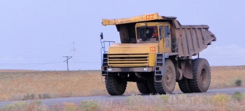
The north is rich in iron ores, gold, coal, bauxite and table salt are mined here. There are deposits of titanium ores and asbestos. In the eastern part, non-ferrous metal ores prevail, the main of which are polymetallic. In most cases, they are confined to the deposits of the Rudny Altai.
In the center of the country are concentrated deposits of iron and manganese ores, copper, as well as the largest coking coal deposit in Kazakhstan (Karaganda basin). In the south, there is the largest phosphorite deposit in the CIS - Karatau.
In addition, the country has enough raw materials to develop the construction materials industry. The first settlements of people on the territory of Kazakhstan, discovered by archaeologists, appeared in the 2nd-1st millennium BC. e. in the Karatau tract. Then the first settlements arose in the steppe.
According to scientists, in the north of it then the peoples of the eastern Chudi (Ugrians) prevailed, and in the south - the Scythian tribes (saki). They were replaced, other nomadic peoples assimilated with them: Usuns and Huns at the beginning of our era, Türks in the VI - VIII centuries, Arabs in the VIII - IX centuries, Oguzes in the X - XI centuries, Mongolian Tatars in the XIII - XIV centuries.
It is customary to calculate the history of Kazakh statehood since the XVIth century.
But its prototype can well be considered the Kangyui nomad union. It existed until the IV century, but power in it belonged first to the Hephthalites (the nomadic people of the White Huns), and then to the Mongolian Zhuzhan Kaganate.
In the middle of the 1st millennium, the Turks founded their Khaganates. The first was the Türkic Kaganate, which disintegrated by the end of the 6th century, and was replaced by the Western Türkic Kaganate. At the end of the XIIIth century, the Kazakh lands were transferred to the ulus (region) of Mogolistan Sheiban.
The concept of "Kazakh", as already written sources testify, arose at the end of the XVth century, when the khans Zhanibek and Kerey united under their rule the tribes of Semirechye and the valley of the Shu river.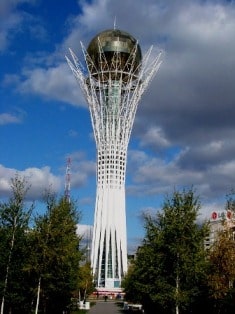
According to one of the linguistic versions, the name of the people comes from the Turkic "kas" - "to wander, to wander", and, therefore, a Kazakh is a "nomad". Khan Kasym, who ruled from 1511 to 1523, created the first real state of Kazakhs, the Kazakh Khanate.
It included the Syrdarya cities of Turkestan, Otrar, Sairam, Sauran, Sygnak, Suzak, Chimkent. At the same time, three territorial-tribal Kazakh associations began to form: Senior, Middle and Younger zhuzes. Historically, the territories of the Senior Zhuz are Semirechye and Southern Kazakhstan, the Middle - Central, Eastern and Northern Kazakhstan, the Younger - Western Kazakhstan.
In the 18th century, the Kazakh Khanate was constantly attacked by the Dzungars, the Mongol tribes living between the Tien-Shan and Altai, and the khans turned to Russia for help, which had border fortifications in the region.
In 1731, the Khan of the Younger Zhuz, Abulkhair, swore allegiance to Russia in exchange for military assistance and protection. Although the Middle Zhuz, led by Khan Ablay, was much less connected with Russia, and the Elder was subordinate to the Dzungars and the Kokand Khan, Abulkhair's oath played a fateful role in the history of Kazakhstan.
As a result, gradually all of Kazakhstan entered the Steppe Governorate of the Russian Empire. In 1815 - 1824 The khan's power in the zhuzes was liquidated, and the “Charter on the Siberian Kirghiz”, developed by M.M. Speransky (1772 - 1839), suggesting the transformation of Kazakhs into farmers.
The Kazakhs did not accept this innovation, an uprising broke out. After its suppression, the so-called steppe dwellers, deprived of the right to roam, began to quickly become impoverished. But Russia stood its ground.
The withdrawal of land from the indigenous population accelerated after the beginning of the reforms of P.A. Stolypin (1862 - 1911) in 1906 - 1911, along which the South Siberian and North Kazakhstan steppes were planned to be turned into granaries.
In 1906 - 1912 500,000 peasant households were relocated to Kazakhstan. Not only Russians arrived, but also Ukrainians and Volga Germans. As almost always in history, this resettlement cannot be assessed unequivocally: the Kazakhs were driven out of the best lands, but at the same time the development of agriculture began in the country.
The echo of the First World War came to Kazakhstan with confiscation of meat and grain, and then mass mobilization into the army. The events of 1917 in Russia gave rise to the party of the Kazakh intelligentsia "Alysh-Orda", which supported the White movement during the Civil War and was mercilessly destroyed for this.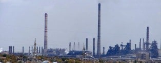
In 1918 the lands of the Senior Zhuz entered the Turkestan ASSR. In 1920, on the lands of the Middle and Junior Zhuzes, the Kyrgyz ASSR was formed with the capital in Orenburg. In 1924 - 1925 it was renamed into the Kazakh ASSR, the capital of which was already Kyzylorda, and from 1927 to 1997. it was Almaty.
During the period of collectivization 1929 - 1933. in Kazakhstan, up to 4 million people died from hunger and repression. In 1936 the Kazakh ASSR was transformed into the Kazakh SSR. And soon Kazakhstan entered the history of Soviet repression.
The abbreviations of such concentration camps of the GULAG system as ALZHIR (Akmola camp for the wives of traitors to the Motherland), Karlag (Karaganda forced labor camp), Steplag (Steppe camp) have become notorious throughout the world.
Innocent wives and children of "enemies of the people" were sent behind the barbed wire of Stalin's camps. Poles were deported from Western Ukraine and Western Belarus, Volga Germans, Chechens and Ingush, Karachais and Balkars, Crimean Tatars and Krasnodar Greeks.
These people have endured many hardships, but they all recall with gratitude the sympathetic attitude of ordinary Kazakhs towards them. In the 30s. active industrial construction is underway here. In the late 50s of the 20th century, the development of virgin and fallow lands.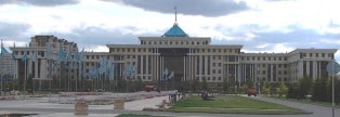
In 1960 - 1965 on the basis of 5 northern regions (Kokchetav, Kostanay, Pavlodar, North-Kazakh and Tselinograd), the Tselinny Territory was formed. Kazakhstan has become one of the leading industrial and agricultural regions of the USSR.
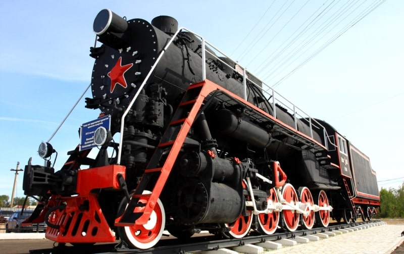
The development of the industry, primarily the mining industry, in Kazakhstan began in the 1930s. And during the Great Patriotic War, many industrial enterprises from Russia and Ukraine were transferred here, qualified specialists arrived.
The industry of Kazakhstan also developed intensively after the war, since the republic has huge resources of minerals. Enterprises of ferrous and non-ferrous metallurgy were built, new branches of mechanical engineering and chemical industry appeared.
Virgin land epic 1954 - 1960 - a special page in the history of Kazakhstan, which began with great victories and turned into disappointment from unfulfilled hopes.
On 10.25.1990, the Supreme Soviet of the Kazakh SSR adopted the Declaration on State Sovereignty.
On December 16, 1991, the Supreme Council adopted the Law “On State Independence of the Republic of Kazakhstan”.
1991 became for Kazakhstan, as well as for other former Soviet republics, the year of gaining independence. Kazakhstan emerged from the difficult, both politically and economically, post-Soviet period with honor.
It seems that its very land with its rich subsoil, deposits of ferrous, non-ferrous and rare metals, oil and gas supports all plans and undertakings for the modernization of the country.
On May 25, 1992, an Agreement on Friendship, Cooperation and Mutual Assistance was signed between the Russian Federation and the Republic of Kazakhstan.
Diplomatic relations with Russia were established on October 22, 1992.
Member of the CIS since 1991.
The Republic of Kazakhstan is a member of the UN since 02.03.1992, as well as a member of the ADB, EBRD, IDB, OIC, ECO, SCO, ESCAP and other international organizations. The Republic of Kazakhstan belongs to countries with economies in transition.
After the collapse of the USSR, due to interrupted ties and the economic crisis, many industries were stopped. At present, privatization has been completed in the country, progressive tax legislation has been adopted, a modern banking system has been established, reforms have been carried out in the countryside, in the housing and communal services and in the social sphere.
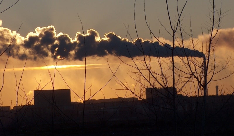
During the years of Soviet power, the republic has developed a diversified industrial production based on its own resources. Heavy industry dominated. In the structure of industry, the fuel and energy, metallurgy and food industries are distinguished.
The basis of the economy of Kazakhstan is the fuel and energy complex based on its own reserves of coal, oil, natural gas. For over 100 years, oil has been produced in the Republic of Kazakhstan. Until recently, all the explored oil fields in the country were located onshore - Tengiz-Korolevskoye, Kumkol and others, as well as the gas condensate Karachaganak.
After gaining independence, the Republic of Kazakhstan began to develop the shelf of the Caspian Sea. In 2000, the largest oil field, East Kashagan, was discovered with reserves of about 7 billion tons. According to forecasts, by 2015 Kazakhstan will become one of the ten largest suppliers of hydrocarbons in the world.
The country plays a significant role today in the political life of the Eurasian continent.
In 2010, Kazakhstan chaired the OSCE. And from January 30 to February 6, 2011, the VII Asian Winter Sports Games will be held in Astana and Almaty.
In accordance with the Agreement between Russia and the Republic of Kazakhstan on the delimitation of the bottom of the northern part of the Caspian Sea in order to exercise sovereign rights to subsoil use, the Khvalynskoye and Tsentralnoye fields will be developed jointly on a 50/50 basis.
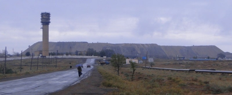
The Republic of Kazakhstan ranks 5th in terms of oil reserves. place in the world. The coal industry is concentrated in the Karaganda and Ekibastuz basins, but coal production has been sharply reduced. The country mines from the production volumes of the CIS: 40% of uranium, 97% of chromium, 70% of lead, 50% of zinc, significant volumes of extraction of other types of raw materials, as well as pure precious metals, including gold.
The power industry is based on the use of large state district power plants. Large hydroelectric power plants have also been built on the Irtysh (Bukhtarma, Ust-Kamenogorsk, Shulbinsk), powerful thermal power plants operate in Ekibastuz, Karaganda, Taraz, near Almaty and Pavlodar.
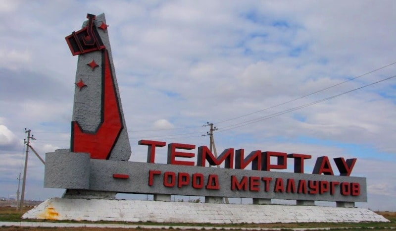
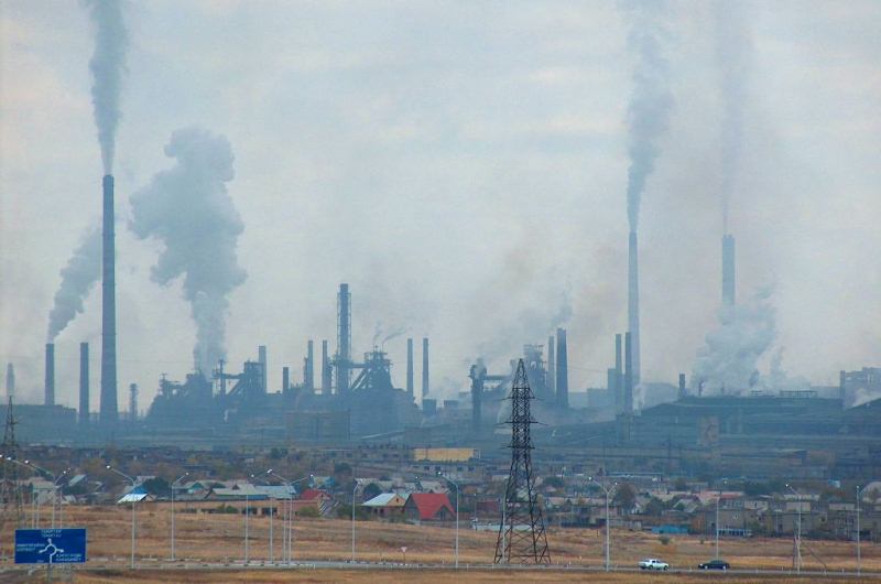
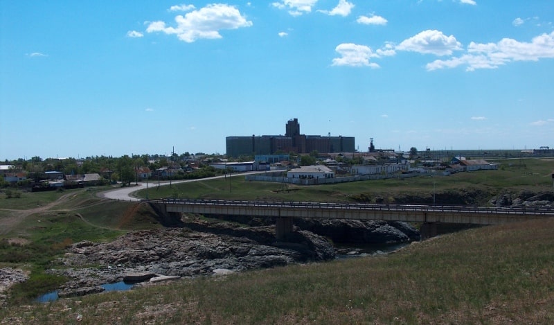
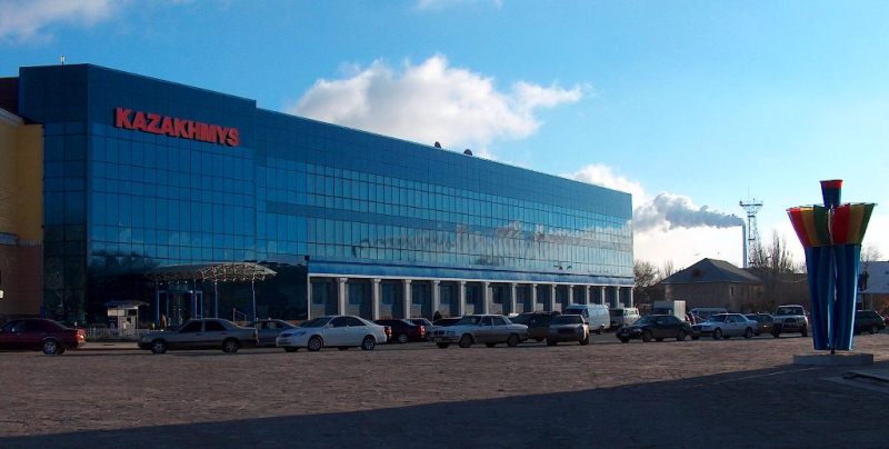
Metallurgy plays a special role in the national economy. Its share in industrial production is 14%, in exports - 30%. A large full-cycle metallurgical plant operates in Temirtau, ferroalloy plants - in Aktyubinsk and Aksu (Pavlodar region).
Non-ferrous metallurgy is one of the leading branches of industrial production in Kazakhstan. There are 2 large, territorially united regions of non-ferrous metallurgy: central (copper) and eastern (polymetallic - lead, zinc, aluminum, copper, gold, etc.).
The main centers of non-ferrous metallurgy are Ust-Kamenogorsk, Leninogorsk, Balkhash, Zhezkazgan, Shymkent, alumina production - Pavlodar, chromium compounds - Aktyubinsk. The Caspian Mining and Metallurgical Combine processes uranium ore into concentrate with simultaneous production of a range of rare and rare earth elements, ligatures and alloys based on them, as well as the associated production of phosphorus fertilizers.
One of the largest plants for the production of fuel for nuclear reactors is located in Ust-Kamenogorsk. Oil refineries are located in Atyrau, Pavlodar, Shymkent. Their total refining volume is 11 million tons of oil. The only gas processing plant has been built in the city of Zhanaozen.
The chemical industry is represented by the production of fertilizers (phosphoric flour, phosphoric salt, superphosphate), sulfuric acid, chemical fibers, plastics, etc. The main centers are Taraz, Kostanay, Aktau, and others.
Mechanical engineering was created during the Great Patriotic War on the basis of equipment evacuated from the European part of the USSR.
From the branches of mechanical engineering prevail: agricultural (Nur-Sultan, Aktyubinsk), tractor (Pavlodar), electrical (Almaty, Petropavlovsk, Uralsk), mining and transport (Karaganda, Almaty, Ust-Kamenogorsk), etc. mong the branches of light industry are developed: leather, fur, cotton, footwear.
The food industry is represented by large enterprises of meat (Semei, Almaty), sugar (Taraz, Taldykorgan), butter, cheese, flour-milling (mainly in the regional centers of the north of the republic) industry, etc. The share of agriculture in the structure of the agro-industrial complex reaches 50%.
In agriculture, the Republic of Kazakhstan combines 2 leading sectors: large-scale mechanized farming and distant pasture animal husbandry. Arable land, concentrated mainly in the north of the republic, occupies 18% of agricultural land. The development of most of the virgin fallow lands took place in the early 1950s of the XX century.
Smaller arable land areas are concentrated in the foothills of the Altai, Tien Shan, along the river valleys. The sown area is over 15 million hectares. The main branch of agriculture is grain farming. More than 11 million hectares are occupied by cereals. Sunflower, millet, corn, rice are also grown (in the Syrdarya valley).
Of industrial crops, cotton is cultivated on small areas in the south, and sugar beets and tobacco are cultivated in the southeastern regions. Orchards and vineyards are laid out in the foothills. Melon growing is developed. Rangelands occupy 57% of the country's territory.
The main branch of animal husbandry is sheep breeding (9.8 million heads), primarily fine-fleece, semi-fine-fleece and karakul. In the steppes, beef cattle are bred. The dairy business is developing in the suburban economy. The number of cattle is 4 million heads. Horse breeding, camel breeding and pig breeding are also developed.
The main types of transport are rail (95% of the country's freight turnover) and road. The operational length of railways is about 15,000 kilometers, of roads - about 100,000 kilometers. The largest oil pipelines: Omsk - Pavlodar - Shymkent, Aktau - Atyrau - Samara; gas pipelines: Zhanaozen - Makat - Saratov, Bukhara - Ural, Tashkent - Almaty. Large ports on the Caspian Sea - reconstructed Aktau, Atyrau.
Navigable rivers: Irtysh, Ural, Ili. Airports - Nur-Sultan, Almaty and all regional cities. In the Kyzylorda region, near the city of Baikonur, there is the Baikonur cosmodrome, which Russia leases for launching spacecraft. The telecommunication system of the Republic of Kazakhstan is represented by the national joint stock company “Kaztelecom”. In the country's economy, a preferential orientation towards accelerated development at the expense of foreign, mainly Western, investments in the extractive and processing industries is becoming more and more clear.
Export proceeds from the sale of mineral raw materials and products of their processing are considered as the main lever for bringing the republic out of the crisis. This finds expression in projects for the development of Tengiz and other oil and gas fields, in the active development of foreign economic cooperation with the United States, European and Asian states.
The Republic of Kazakhstan signed agreements with foreign oil companies worth more than $ 40 billion, which will be invested in the oil-extracting sector of the economy in over the next 40 years. The largest investors are the American company Chevron, the French company Elf-Akiten, and others.
The main types of exported products are oil and oil products (40% of exports), ferrous and non-ferrous metals, mineral products, including ore raw materials, fuel. In the structure of imports, a significant share is occupied by machines, equipment, vehicles, fuel and energy resources, as well as sugar, tea, etc.
The main import suppliers are Germany, Austria, Morocco, Mongolia, Turkey. Of the CIS countries, 82% are delivered from Russia. The tourism sector is developing. On the territory of the republic there are such famous resort areas as Medeo, Borovoe, Kokchetav, etc.
There are several dozen higher educational institutions in the republic, including large ones like the Kazakh State University in Almaty, the L. Gumilyov Eurasian University in Nur-Sultan, Turkestan International University, Karaganda University, etc.
The Academy of Sciences of Kazakhstan was founded in 1946. There are about 40 theaters in operation. The Kazakhstan Television and Radio Broadcasting Company (in Kazakh and Russian) was established. Radio broadcasting is conducted in Kazakh, Russian, German, Korean, Uyghur languages.
List of major dates of the Republic of Kazakhstan.
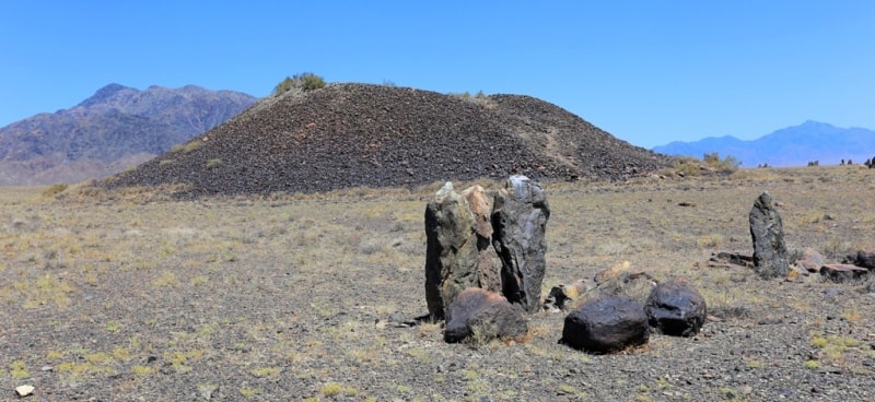
1949 - the first nuclear tests at the Semipalatinsk nuclear test site.
1950 - commissioning of the Baikonur space complex.
1964 - the termination of ground tests of nuclear weapons at the Semipalatinsk test site (in connection with the 1963 international treaty of nuclear countries)
1986 December 17 - mass disturbances in Almaty, December 18 violent suppression of disturbances
1989 - N. Nazarbayev - First Secretary of the Central Committee of the Communist Party of Kazakhstan.
1990 April - election by the Supreme Council of Kaz. SSR N. Nazarbayev for the post of president of Kaz. SSR.
1991 - the closure of the Semipalatinsk nuclear test site.
1991 September - at an extraordinary and extraordinary congress of the Communist Party of Kazakhstan, a decision was made to dissolve the Communist Party of Kazakhstan
1991 December 1 national election of the President of Kazakhstan, December 10 inauguration of N. Nazarbayev
1993 - introduction of the national currency in the Republic of Kazakhstan.
1994 - an agreement between Kazakhstan on the Russian Federation on the transfer of the Baikonur cosmodrome to Russia for a period of 20 years with the right to subsequently extend this period.
7 of July 1994 - the flight of the Kazakh cosmonaut T. Musabayev as part of the international crew on the Soyuz TM-19 spacecraft
1998 - the capital of the Republic of Kazakhstan was moved to Astana.
1862 - completion of the construction of the Verny - Pishpek telegraph line.

Authority:
Encyclopedia of Kazakhstan.
http://geosfera.org/aziya/kazaxstan/465-respublika-kazahstan-gosudarstvo-v-centre-azii.html
Photos by:
Alexander Petrov.