


![]()
Вы здесь
Cheleken Peninsula (Yarymada).

Caspian Sea in Turkmenistan.
“There are ridges in the Caspian Sea
Their layers are saturated with thick oil,
There is a sea of oil - oily and black,
We bring him out of the dark into the light "
Ilyas Dzhansugurov. "Caucasus".
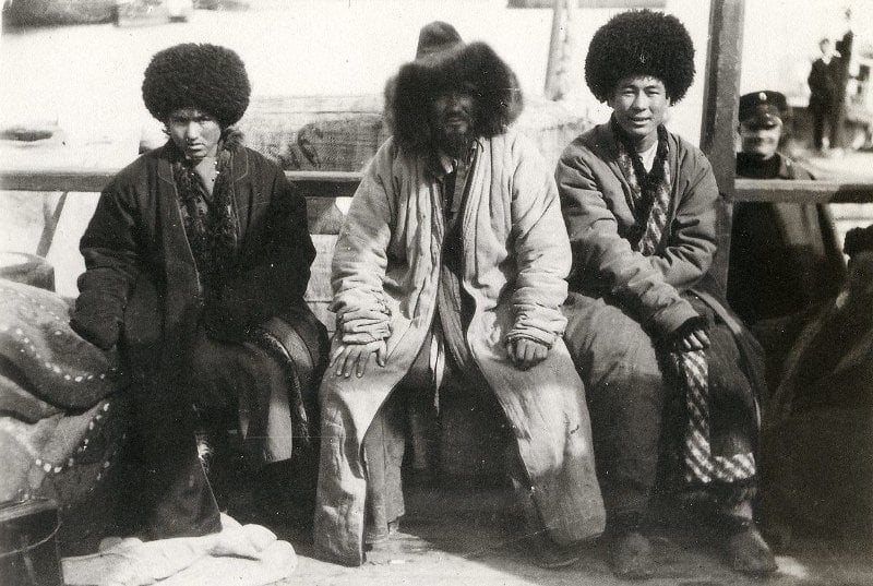
Eastern coast of Caspian Sea in Turkmenistan.
Cheleken Peninsula (Yarymada) - (from Turkic people - “desert”), currently Khazar, a former island, now - a peninsula on the eastern coast of the Caspian Sea, north of the Dervish peninsula, west of the Kelkor depression and its two branches connecting with By the Caspian Sea, and from the Nebitdag oil field in the Balkan velayat (formerly Krasnovodsk region), Turkmenistan.
The Persian name is Chearkan, which means “the island of the four riches”. G.S. Karelin noted here 4 types of oil produced: naphthagyl - a hardened sticky black resin used for tarring ships and used for torches; common oil, black; pyr-dum - the purest, colorless oil; yangi-tufya - lower in quality than ordinary oil.
Analysis of ancient information allows us to assert that Herodotus meant Cheleken when he mentioned the island on the Arak (Uzboy) River. It was first mapped by Alexander Bekovich-Cherkassky in 1715 as Chereken Island. On a number of maps of the XVIIIth - XIXth centuries it is designated as Oil.
It was formed from the island of the same name, which joined due to the fall in the level of the Caspian Sea and the drainage of shallow water between the island and the mainland after 1937. If you look at the peninsula from above, it resembles a bird in flight, directed towards the Caucasian ridge, towards the Absheron Peninsula.
Its right wing is directed from south to north in the meridional direction, this is the North Cheleken Spit or the Kafaldzh Peninsula. The left wing has a direction from north to south and corresponds to the South Cheleken Spit, this is the Dervish Peninsula.
The area is about 500 square kilometers, the length is about 40 kilometers, and the width is 22 kilometers. The surface is mostly flat. The western bank of Cheleken is steep in the central part (height up to 25 meters). To the north and south it decreases and turns into long sandy spits, slightly hilly.
The eastern coast is low-lying, sandy. In the central part of Cheleken, there are hills (up to 100 meters) of faulted origin with the common name Chokrak, composed of limestones and sandstones. Vast areas are occupied by hilly sands, semilunar dunes and salt marshes - takyrs.
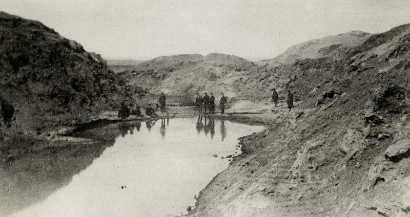
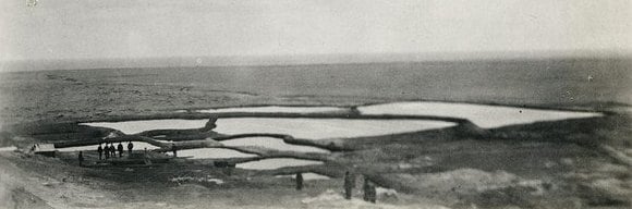
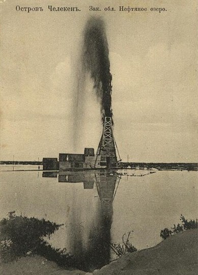
In the southwestern part of the peninsula, there are small lakes, some of which have pink water due to the presence of a large number of purple bacteria. Precipitation up to 150 mm per year. There are many (up to 370) mineral springs on Cheleken (ferruginous, salt). Oil fields, rock salt and mica deposits, natural gas.
Fishing is developed on the coast. Cheleken ozokerite became known from the 2nd half of the 19th century, paraffin and ceresin (mineral wax) were obtained from it. Periodically, the Cheleken peninsula becomes an island as a result of the rise in the level of the Caspian.
Active surge wave activity in July 1995 turned the Cheleken Peninsula into an island.
Geographic coordinates of the Cheleken Peninsula: N39 ° 28'37.91 "E53 ° 19'36.90"
Authority:
http://www.caspianmonitoring.ru/