


![]()
Вы здесь
Stone arrows of Ustyurt.
Kazakhstan geoglyphs.
“You must allow yourself to see, not judge, what is happening around. Respect the facts, even if they do not match your expectations"
Jack Trout.
Stone arrows of Ustyurt in Kazakhstan.
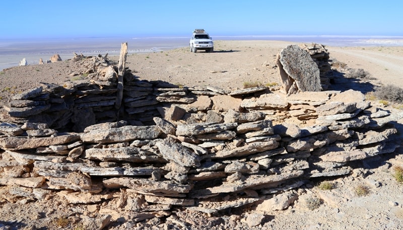
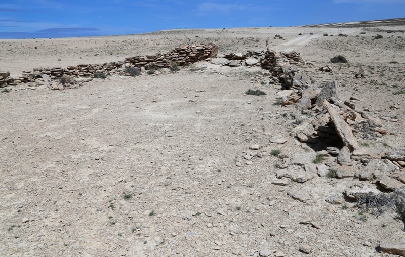
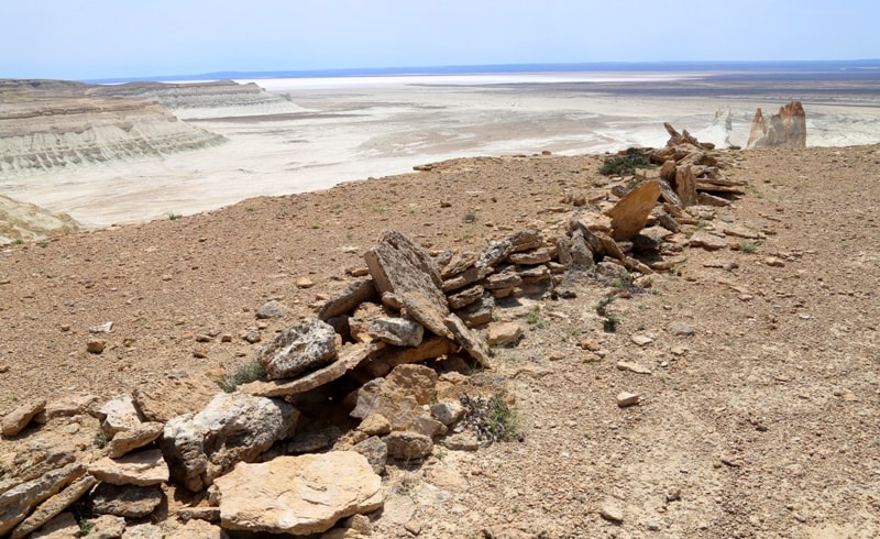
The so-called stone arrows of Ustyurt are found everywhere on the Ustyurt plateau: on the Western cliff of the Ustyurt plateau, the Northern cliff of the Ustyurt plateau, on the Donyztau cliff, in the vicinity of the Shomishkol salt marsh and other places.
For the first time, strange arrow-shaped signs, never previously encountered in archaeological practice, were noticed in the early 1980s when analyzing and deciphering aerial photography materials. With the usual methods of archaeological survey of the area, these signs are quite difficult to notice, if only by accident, the gigantic dimensions make them completely unperceivable from the height of human growth.
Their relief is smoothed out, and you can ride along the arrows hundreds of times without knowing that you have a unique monument under your feet.
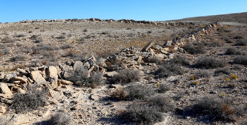
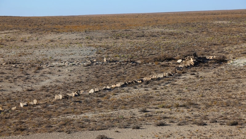
It was possible to identify dozens of such arrow-shaped layouts, almost in a continuous chain stretching in a latitudinal direction from Cape Duan on the Aral Sea into the interior of the Ustyurt plateau. All of them are turned by arrows to the north and differ little from each other in shape and size.
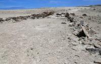
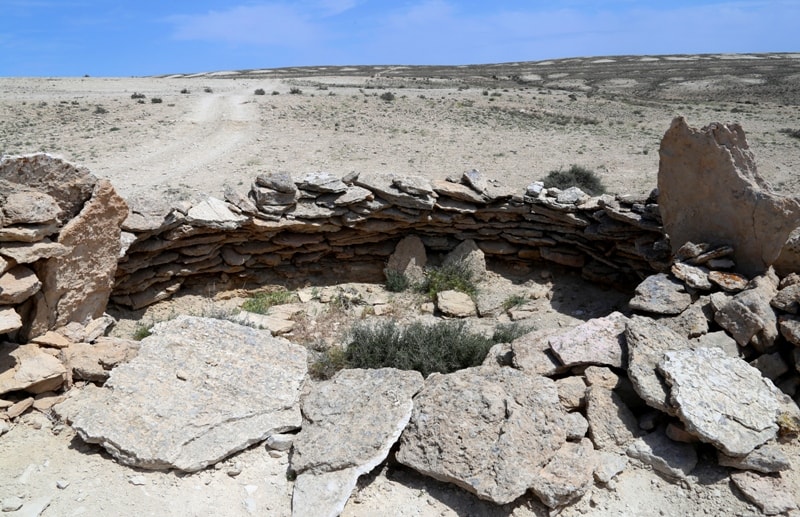
Each layout is an arrow-shaped figure with the upper part retracted inward, broken by a wide passage, to which a guide shaft leads in some of the layouts. The height of the ramparts is now a little less than a meter, but judging by the debris around, it used to be much greater.
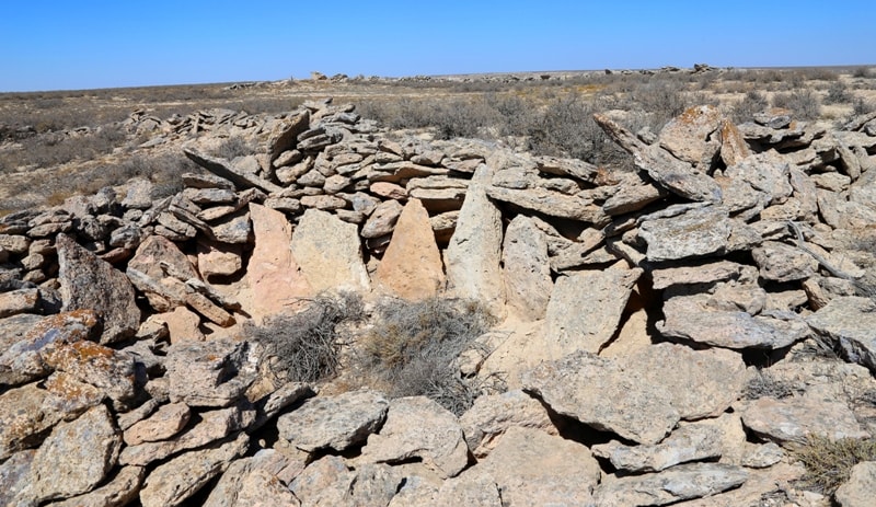
The upper sharp edges of the arrows form, thus, two splayed arrows with tips in the form of elongated triangles - a narrow passage leads into them from the body of the arrow. At the tops of the triangles there are rings of ten meters in diameter, which once served as pits.
The schematic drawing of the system resembles a military map, on which the direction of a massive strike is indicated with bold arrows. The length of each of the layouts is 800 - 900 meters, and together with the guide shaft it reaches one and a half kilometers, the width is 400 - 600 meters, the height of the fence in its current state does not exceed 80 centimeters.
The Cyclopean system has been traced so far at a hundred kilometers, but scientists are sure that it stretches further, across the territory of Kazakhstan, exceeding the length of the world famous system of mysterious lines and drawings in the Peruvian Nazca desert.
During a trial excavation of one of the arrow fences, pottery and other items related to the 7th - 8th centuries AD were found. However, if we consider that these objects are located slightly above the cultural layer, which dates back to the time when the arrow walls were created, then the above centuries refer exclusively to the “upper border” of the period of arrow construction.
These arrows, which are often found along the chinks of the Ustyurt plateau, are known to the local population as “arans”. According to the head of the archaeological expedition from Nukus V. Yagodin, who investigated these formations, they served as excellent enclosures for ancient hunters while hunting large ungulates...
Geographic coordinates of the arrows of Ustyurt in the vicinity of the First panoramic platform in the Boszhira valley: N43 ° 27'55.97 "E54 ° 02'16.83"
Geographic coordinates of the arrows of Ustyurt in the vicinity of the Fifth panoramic platform in the Boszhira valley: N43 ° 24'31.80 "E54 ° 06'22.50"
Geographic coordinates of the arrows of Ustyurt in the environs of the Shomishkol salt land: N45 ° 44'55.03 "E56 ° 02'28.98"
The geographic coordinates of the arrows of Ustyurt in the environs of the Manaysor salt land (Donyztau cliff): N46 ° 13'22.66 "E56 ° 09'39.74"
Geographic coordinates of the arrows of Ustyurt on the northern side of the Asmantai-Matai salt land in the Aktobe region: N45 ° 43'00.64 "E57 ° 20'03.55"


Authority:
Andrey Astafyev, Aktau town. Alexander Petrov.
Photos by
Alexander Petrov.