


![]()
Вы здесь
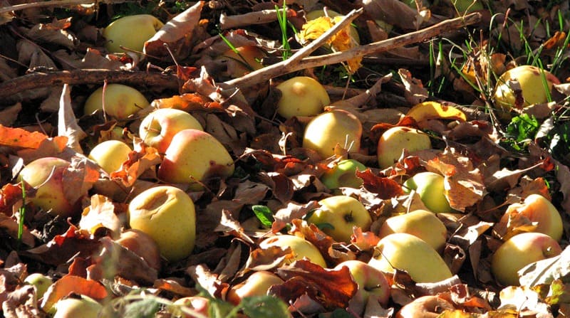
Tour of wild Sievers apple trees in autumn.

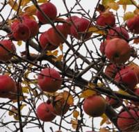
Siversii apple tree in Kazakhstan.
“The day is fading in rebellious colors.
The sunset flows like a trembling rainbow.
ehind her is the insinuating shadow of the night
secretly strives to reach the firmament.
I wait for the night, not letting go of the day.
I need light and shadow to continue
The contrasts of me living
In the presumption of autumn confusion."
Victor Storopov.
Siversii apple-tree excursion in Zhongar-Alatau nature park.
Short description of route of tour of wild apple trees of Sieversii:
Almaty - town Taldykorgan - Sarkand settlement - Topolevka village - Lepsi village - Almaty.
Distance of tour: 1054 km.
Season: September 1 to October 20.
Duration of tour: 3 days, 2 nights.
Best time for tour: flowering apple orchards.
Distance active part of tour: 10 km.
No. in party: from 1 to 10 people.
Zhongar-Alatau natural park pursues the main goal - the preservation and study of the phenomenon of wild fruit plantations - apple trees of Siversii, Nedzvetsky and other species listed in the Red Book of Kazakhstan. The unique gene pool of the Siversii wild apple tree is a national treasure and wealth of Kazakhstan, since the only place on the planet where it grows naturally, starting from the Cretaceous period, is the spurs of the Dzhungar Alatau.
The Siversii apple tree is an indigenous Kazakh species that has existed since the time of the dinosaurs, which survived all the cataclysms of nature. Botanist Johann Sivers, made the first description of the Sivers apple tree in 1793, when he met apple forests in the vicinity of the village of Urdjar.
In Kazakhstan, the Sivers apple tree is included in the Red Book of Kazakhstan. The largest number of Sievers apple trees is located in the northern foothills of the Dzhungar Alatau - 50%), in the Zailiyskiy Alatau mountains - 25.4%, in South Kazakhstan in the Karatau mountains - 12.1%, in the Turkestan and Zhambyl regions in the Talas Alatau mountains - 11.7% , in the East Kazakhstan region in the Tarbagatai mountains - 2%.
Since the beginning of the 80s of the last century, the Sievers apple tree in Kazakhstan has been under the threat of extinction. The current area of apple forests is shrinking compared to the last century. This was due to a number of factors.
First, apple cultivars were planted at an altitude of 1000 meters above sea level.
Secondly, the tinting of wild-fruited apple trees with cultivated varieties was carried out in 1973 - 1980 of the last century. Thirdly, there is a change of species, the territory that was previously occupied by the Sievers apple tree is intensively overgrown with birch, aspen, and poplar.
The wild apple tree is valuable in that it has existed for several tens of thousands of years under the influence of a changing natural environment, it has naturally adapted to temperature extremes, pests and diseases, and has a unique genetic resource.
For scientists, it is still a big mystery, since it has a unique combination of genetic traits for breeding varieties with predetermined qualities. The most abundant populations of wild apple trees in the mountains of the Dzhungar Alatau are located on the northern slopes from 1200 to 1600 meters above sea level and along river terraces.
In the Zailisky Alatau mountains, apple populations are found from 900 to 1800 meters above sea level. In this regard, the Sievers apple tree has genes that are responsible for adapting to frost and harsh climatic conditions.
This is what makes the apple tree unique as a genetic resource.
It is here that you can find the necessary combination of genetic traits for breeding varieties with predetermined qualities. In this case, we are talking about the traditional way of creating varieties, and not created by genetic engineering methods.
Detailed tour program day by day to relict apple trees in Kazakhstan:
Day 1. Almaty – Sarkand village (413 km).
Transfer: Almaty – Konaev town - Taldykorgan town - Zhansugurovo settlement - Sarkand settlement.
Departure from Almaty at 7.00. The path from Almaty leads to the northeast, past the town of Konaev (formerly Kapshagai), which is the administrative center of the Zhetysu region. The country's largest gambling zone with casinos and hotels is located in the roadside part of the town.
The Kapshagai reservoir, 100 kilometers long, with beaches, boarding houses, hotels and holiday homes, is adjacent to the town. Soon, along the bypass road we pass the town of Taldykorgan and then our path lies along the northern slopes of the Dzhungarskiy Alatau.
Arrival in the settlement of Sarkand, late lunch at a local cafe. Transfer to the hotel, accommodation. Walk in the vicinity of Sarkand.
Transfer: Sarkand - Ekiasha village - Amanbokter village (43 km).
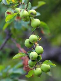
A walk in the vicinity of the Maly Baksan River. In the gorge of the Maly Baksan River there are single and small groups of Sivers apple trees. Apple fruits are characterized by a pleasant sour-sweet taste, beautiful appearance of the fruit,
They have a low tannin content and can be consumed fresh. T
he Sievers apple tree has high adaptability to winter conditions, drought, compatibility and productivity of grafted varieties.
Transfer: Malyi Baskan river – Bayanbay village – Avdia river gorge (Aulie-Tas valley) (17 km).
After the Malyi Baksan River, we drive along the western slope of the Akbulak massif to the south to a small peasant farm, after which our path lies along the right (eastern) bank of the small Avdiya River in the Aulie Tas valley.
Arrival at the stone valley Aulie-Tas, a walk in the surrounding area among the Sivers apple trees.
Around you exude the aromas of herbs of this natural zone: oregano, sage, chamomile, etc. Here the air rings with the chirping of various insects and cicadas, echoing the voices of birds.
Transfer: Avdia gorge – Ekiasha village – Sarkand settlement (30 km).
Arrival in Sarkand, dinner, overnight at a hotel.
Day 2. Sarkand settlement – Lepsi village (Lepsinsk) (94 km).
Breakfast. Transfer: Sarkand village – Ekiasha (Pokatilovka) village – Topolevka village (39 km).
From Sarkand our path lies to the southeast, along the northern slopes of the Markatau mountains. We pass the village of Ekiasha, which until 1993 was called Pokatilovka. The 11-time champion of Kazakhstan in freestyle wrestling Abilseit Aykhanov, actor Kuman Tastanbekov, who played one of the main roles in the film “Kyz-Zhibek” (1970), was born and raised in the village; the hero of the Soviet Union Vasily Belenko, a participant in Great Patriotic War.
We head to the village of Ekiasha, pass the bridge over the Bolshoy Baskan River and turn northeast to the next village - Topolevka, which is located in the northern part of the Zhamankotyrta Mountains. If desired, in the village you can visit the apiary of Pitenko beekeepers
Transfer: Topolevka village – Terekty river – Kokzhota valley (7 km).
The Kokzhota valley is located on the northern slope of the Dzungarskiy Alatau Mountain in the upper reaches of the Vasilyev Klyuch River, in the northern part of the Gorely Log valley and in the northwest of the Mynbulak valley.
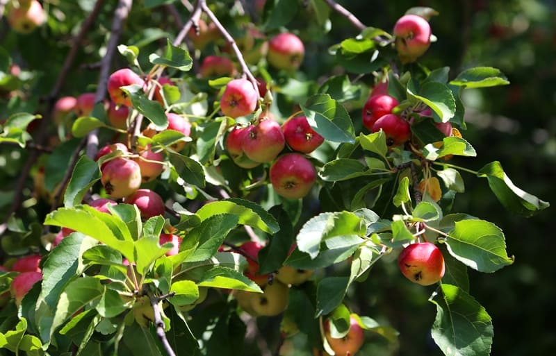
In the Kokzhota valley we will meet individual Sivers apple trees and small groups.
Constant companions of the Sievers apple tree are two types of trees: Songara hawthorn (Crataegus songarica) and common apricot (Armeniaca vulgaris). Walk along the left bank of the Terekty River.
Further transfer: Kokzhota valley - Terekty river - Mynbulak valley - Maket Kol lake (14 km).
We pass the Terekty River, here is a picturesque place - granite slabs slope down into the river. Water flows among the thickets of aspen forest, apple trees, and bushes. From the Kokzhota valley our path lies northwest to the southern slopes of the Shatyrbai ridge.
From here we turn northwest and drive along the picturesque Mynbulak valley. The Mynbulak valley is located in a small intermountain depression in the northern part in a natural depression where Lake Maket kol is located, this is one of the picturesque places in the northern foothills of the Dzhungarskiy Alatau.
ake Maket kol is located at an altitude of 1093 meters above sea level; in its northern part there is a bulk dam that blocked the sources of the Maly Zhalanash River. In the southwestern part of the lake grows the rare Lychnis, a flowering plant with red flowers, which gives the lake a unique color against the backdrop of the snowy peaks of the Dzungarskiy Alatau. Walk around the lake.
Transfer: Lake Maket kol – Aganakty River – Bolshoi Zhalanash River – Karbushka River Gorge (11 km).
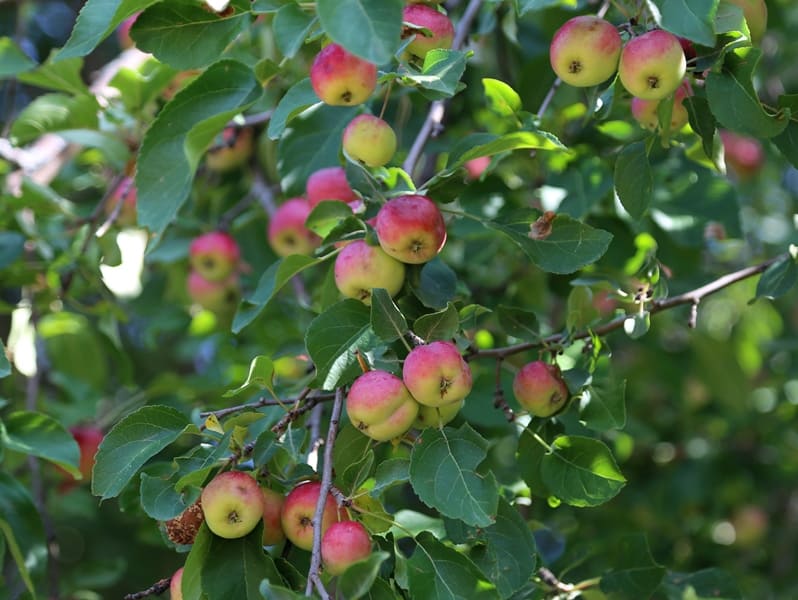
From Maket Kol our path lies to the east, we cross the Aganakty River bridge and head to the Karbushka River gorge. On the left bank of the river there are thickets of Sievers apple trees; just above on the right bank of the river there is a forest nursery.
Sievers apple tree (Malus sieversii) from the Rosaceae family, listed in the Red Book of the Kazakh SSR in 1981. In the Dzungarian Alatau, the Sievers apple tree occupies 48.8%. On the territory of Kazakhstan there are about 75% of Sivers apple groves, which are concentrated mainly in the Trans-Ili and Dzungarskiy Alatau.
On the territory of the Zhongar-Alatau Park it is found in the Kokzhar Topolevka, Zhalanash, Chernovsk areas at an altitude of 1100 - 1850 meters above sea level. Walk in the surrounding area.
Transfer: Karbushka river – Zhalanash valley – Aganakty river – Lepsi village (Lepsinsk) (15 km).
We ford the Karbushka River and move along the right side of the river valleys of Aganakty and Bolshoy Zhalanash to the village of Lepsi. The village received its name from the Lepsy River, whose sources are located on the northern slope of the Dzungarskiy Alatau.
During the reign of the Dzungars, there was a headquarters of one of the Kalmyk khans here. With the defeat of the Khanate in 1758 by the Manchus and Chinese, the empty lands of Semirechye began to be populated by the Kyrgyz and Kaisaks of the Middle and Great Hordes.
The first settlers settled here in 1855 - 1856; they were two hundred Siberian Cossacks from the VIth, VIIth, VIIIth and IX9th regiments of the Siberian Linear Cossack Army and 200 peasant families. The first batch of Cossack migrants arrived on June 18, 1855.
The valley of the Lepsy River was chosen as the place for settlement. Arrival in the village of Lepsi, accommodation in a guest house, lunch.
Transfer: Lepsi – Lepsi forest nursery (2.3 km).
After lunch, visit the forest nursery of the Lepsinsky branch of the Zhongar-Alatau Park. The forest nursery is located in the southern part of the village at an altitude of 1019 m. a. s. l. More than 18 species of tree species are grown in the nursery.
Here you can get acquainted with the technology of growing Sievers apple trees and the main measures for sowing and caring for young plants. Here they are trying to preserve the Sivers apple tree, which has existed since the time of the dinosaurs and has survived all natural disasters, and to increase its number.
At the Sarkand, Lepsi and Alakol branches of the Zhongar-Alatau Park there are several nurseries where Sivers apple trees are grown. End of the excursion.
Transfer: Lepsinsky forest nursery – Chernaya Rechka cordon (12 km).
From the village we drive first along the left bank of the Piketny stream and gradually the country road turns to the southeast. Along the way we pass two small lakes overgrown with reeds; in the fall these lakes almost dry up.
oon the road leads us to the Chernaya Rechka cordon, which is located at an altitude of 1221 m. a. s. l. on the left bank of the Chernaya Rechka River.
The cordon and its buildings are located among apple trees, one of them, an old Sievers apple tree, grows in the cordon fence.
On the eastern side, the cordon is surrounded by an acacia hedge. Formalities for passing through access control.
Further transfer: Cordon Chernaya Rechka – Chernovsk valley (Rodmir Vishnyakov’s apiary) (4 km).
The road from the cordon leads us to a ford across the Chernaya Rechka River. The road is narrow and rarely visited by cars, replete with steep ascents and descents, the sides of the road are overgrown with raspberries and other bushes that completely blocked the road. Soon we are at the apiary, which is located in a picturesque, open place.
Hiking: apiary - long-lived Sievers apple tree (1.5 + 1.5 = 3 km).
From the apiary begins the ascent to the southeast along the old path, which passes among tall grass, bushes: Semenov's euonymus (Euonymus semenovii), Tatarian honeysuckle (Lonicera tatarica), spherical barberry, Bykova, heteropod (Berberis sphaerocarpa), laxative jockstrap, kushina laxative (Rhamnus cathartica), gray blackberry, common blackberry (Rubus caesius, R. idaeus).
The companions of the Sievers apple tree are two types of trees: Songara hawthorn (Crataegus songarica) and common apricot (Armeniaca vulgaris). Soon we reach the place where the long-lived Sievers apple tree grows.
The apple tree is located at an altitude of 1458 meters above sea level.
From here you can observe a beautiful panorama of the Lepsy River, thickets of apple trees, picturesque views of the mountains According to DNA studies, it has been proven that the Sieversii apple tree is the ancestor of most cultivated varieties of apple trees.
This long-lived Sievers apple tree grows alone in the region on the northern slope of the Dzungarian Alatau ridge, between the Vankova Griva ridge in the west and the Zhunzhuru mountains in the east. The apple tree reaches a height of 18 meters, the trunk diameter at the base is 1.8 meters, and the crown diameter is 15 meters.
Using a special technique developed by specialists from the Lepsinsky branch of the Zhongar-Alatau Park, the age of the Siver apple tree was determined (as an exception); it was 300 years. Walk in the surrounding area, visiting the ancient Sievers apple tree.
End of the excursion, return to Lepsi (17.5 km).
Arrival in Lepsi, accommodation in a guest house, dinner, overnight.
Day 3. Lepsi – Almaty (547 km).
Breakfast. Transfer: Lepsi – Kabanbai village – Koilyk settlement – Sarkand settlement – Zhansugurov settlement – Taldykorgan town (284 km). Lunch at a local cafe.
Further transfer: Taldykorgan - town Konaev - Almaty (263 km).
Arrival in Almaty, end of the tour.
Details of program “Tour for Sivers apple trees in autumn” in Zhongar-Alatau Park:
1. In the village of Lepsi, accommodation is in a private, rural house, which does not have a bathroom - toilet and shower. The village toilet is located in the courtyard of the house. If desired, you can prepare a Russian bath with hot and cold water.
2. There are no cafes or restaurants in the village. Meals (lunch and dinner on the first day, and breakfast on the second day) will be in a private home, prepared by the family. During your stay, you can get to know better the family customs and everyday traditions of a modern Kazakh family; it can also be a family of a different nationality.
3. Part of the route passes along the Sarkand – Topolevka highway. Along the way you can see stone and granite slabs on the Terekty River - a place for rest and bathing of the local population, rock paintings of Bayanbay, the Aulie Tas valley with picturesque and relief granite remains.
Additional trips and walks from Lepsi:
Walk to Lake Zhasylkol.
Distance of route: 50 km.
Tour duration: 1 day.
Distance of active part of tour: 8 - 10 km.
Lepsi village - Zhasylkol lake (25 km).
Transfer: Lepsi village – Zhalanash cordon – Martynov apiary – Zhasylkol cordon (25 km).
Arrival at the Zhasylkol cordon, start of the walk to Lake Zhasylkol.
Hiking: Zhasylkol cordon – Zhasylkol lake (4 km).
First, from the cordon we climb along the Aganakty River, then, gradually, the trail moves away from the river and begins the ascent to an ancient moraine, which blocked the river bed and formed a lake. The flowing, fresh lake Zhasylkol is located at an altitude of 1630.5 m. a. s. l., located on the northern slope of the Dzungarskiy Alatau ridge in the valley of the Aganakty River.
The greatest length of Lake Zhasylkol from the northern to the southern shore is 1.9 kilometers, the greatest width of the lake in the southern part of the lake is 525 meters. In the northern part, the greatest width of the lake reaches 632 meters.
The area of the lake is 0.95 square kilometers, the length of the coastline reaches 5.2 kilometers. The delta of the Aganakta River in the southern part of the lake is 312 meters. Flowing through the lake, in the southwestern part the river overcomes huge rocks in the riverbed and forms a cascade of waterfalls outside the lake. Walk around the lake.
Lunch on the shore of the lake.
Return to Zhasylkol cordon (4 km). Transfer: Zhasylkol cordon – Zhalanash cordon – Lepsi village (25 km).
Arrival in Lepsi, end of the walk.
Trip to Uygen-Tas mound.
Distance of route: 74 km.
Tour duration: 1 day.
Lepsi village – Uygentas mound (37 km).
Transfer: Lepsi village – Koktobe pass (9 km).
We leave the village of Lepsy to the north, cross the bridge over the Lepsy River and immediately turn east, passing the rural hippodrome, which remains on our left side. We drive 7 kilometers from the bridge over the Lepsy River and gradually begin to climb the mountains.
Our path lies to the Koktobe pass, 1797.5 meters above sea level, which divides the Zhanzhurek mountains into western and eastern parts. The Zhanzhurek Mountains are the northern spur of the Dzungarian Alatau ridge, which stretch 13 kilometers in the latitudinal direction.
The eastern border of the mountains is the Tentek River, in the south the mountains border the right bank of the Lepsy River, in the west the mountains gently descend into the valley of the Lepsy River. The highest point of the mountains is the peak of Koktobe, 1814.4 m. a. s. l., which rises 500 meters in the southeast of the Koktobe pass.
At the pass there is a radio broadcaster that provides communications and television to the villages of Lepsinsk and Zhanzhurek. Stop at the pass. From the pass a picturesque panorama of the northern slope of the Dzungarskiy Alatau ridge and the surrounding area opens up.
A short walk in the environs of the pass.
Transfer: Koktobe pass – Tentek river – Uygentas mound (28 km).
Our path lies to the east, we move among the hills, cross the sources of the Krutaya River, which is the left tributary of the Lepsy, and gradually begin our descent into the valley of the Tentek River. Before descending to the Tentek River, Mount Zhunzhuru rises in the south, 1733 m. a. s. l.
The road takes us to the left bank of the Tentek, from here we turn at an acute angle and head south, passing a ford across the small river Rybny Klyuch, which flows into the Tentek on the left. After 1.5 kilometers we cross the bridge over the Tentek River to the right side and after 600 meters we reach the Uygentas mound.
The mound of oval stones Uygen-Tas is located at an altitude of 1374 meters above sea level, located between the Tentek and Ipili rivers. Here, 250 meters south of the Uygen-Tas mound, there are L-shaped ruins with slumped earthen walls, which consisted of five rooms with separate entrances measuring 20 x 10 meters.
140 meters northwest of the mound there is another completely identical L-shaped structure. Dimensions of the Uygen-Tas mound: height 6 meters, length of the mound from south to north 65 meters, width from west to east is 74 meters, area of the mound is 3778.78 square meters, perimeter of the mound reaches 221 meters.
Apparently, the mound is a funerary burial. On the right bank terrace of the Tentek River, in the vicinity of the mound, there are about ten small burials. In the southern part of the mound there is a reinforced concrete structure without inscriptions.
Judging by the sunken, collapsed central part, the mound was plundered in ancient times. No modern excavations or surveys have been carried out by archaeologists. The well-known legend about Tamerlane, who passed here with his army, is associated with the mound.
The terrible ruler ordered each of his warriors to put a stone in a pile. Returning, each warrior also took one boulder from the pile. The remaining and counted stones gave the number of those killed in the battles. A very similar San-Tash mound, somewhat smaller in size, made of the same oval stones, is located in the Tyup district of the Issyk-Kul region in the southeastern part of the Kungey Alatau ridge.
The Kazakh explorer and traveler Chokan Valikhanov visited the San-Tash mound in May 1856. Walk in the vicinity of the mound. Lunch on the banks of the Tentek River.
Return to village of Lepsi (37 km).
Arrival in the village of Lepsi, end of the trip.


Note:
Authors program by Alexander Petrov. Copying and use of material - with permission of author.
Photos by:
Alexander Petrov.