


![]()
Вы здесь
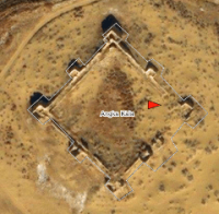
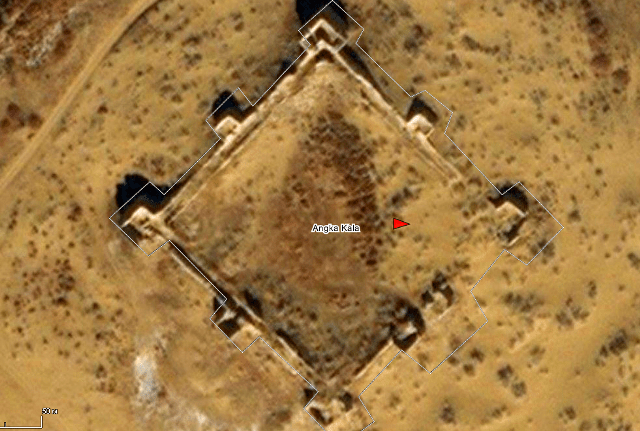
Fortress Angka Kala.
Visit to Karakalpakstan.
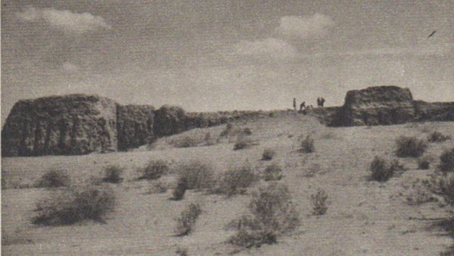
“Anga-kala was not at all similar to the ruins we had just examined - only brick and arrow-shaped loopholes spoke of the unity of the era.
A regular square in plan, with square towers at the corners and in the middle of the wall spans, with square pylons of gates leading to the courtyard - this was one of the best preserved ancient fortresses.
From its wall, where I ascended at sunset, behind, against the purple background of the western sky, behind the endless ridges of sand, stretched along the horizon the black silhouette of countless towers of the dead oasis Berkut kala, stretching 17 kilometers from north to south, and which seemed from afar as the silhouette of a huge city ".
Tolstov S.P. “In the footsteps of the ancient Khorezm civilization. Part 1". 1948.
Walking along architectural monuments of Karakalpakstan.
The Angka Kala settlement is located on a natural hill 105.1 meters above sea level, located in the southern part of the Bilkum sand, 24.8 kilometers northeast of the Turtkul village, 16 kilometers east and slightly north of the Bustan village, 4 , 3 kilometers northeast of the village of Bezirgen in the Turkul region of the Republic of Karkalpakstan.
The fortress, which in the plan has an almost square shape, is well preserved, in the plan it is square, with an area of 0.81 hectares, surrounded by double walls and proteikhism made of large square raw brick (40 - 50 x 40 - 50 x 10 -15 cm) rectangular in facades and towers square at the corners.
Here you can still see a corridor formed by the outer and inner walls, 8 rectangular towers, arrow-shaped loopholes that cut through the outer wall. It is noteworthy that almost all the bricks covering the loopholes are marked with "tamga" - the sign of the master.
One of the bricks has an ancient Khorezm inscription of five characters in one line. The monument belongs to the late antique culture of Khorezm in the 1st - 3rd centuries. n. e., it is these centuries that the ceramics that were found in the fortress are dated. However, well-preserved fortifications were probably used as early as the Middle Ages (X - XII centuries).
Geographic coordinates of the settlement of Angka Kala: N41 ° 45'31.55 "E61 ° 09'03.93"
Authority:
Fortification of ancient Khorezm (VI century BC - IV century AD). 1996. Khozhaniyazov, Gayratdin.
Photos
Tolstov S.P. “In the footsteps of the ancient Khorezm civilization. Part 1". 1948.