Вы здесь
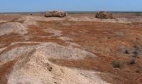
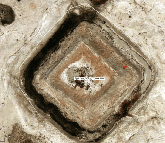
Ancient settlement Rustem kala.

Excursions to monuments of Balkan velayat.
"History is written today, but rewritten tomorrow"
Unknown author.
Monuments of Balkan velayat.
The settlement Rustem kala is located at an altitude of 177 meters above sea level, located in the northeastern part of the Masrian plain and in the southwestern part of the Choganly plain, in the northwestern part of the Khurmen sands, 9.6 kilometers west of the village of Madau, 34 , 4 kilometers northeast of the small village of Indyrlan, 12.8 kilometers south and slightly east of the Dehistan settlement in the Etrek etrap of the Balkan velayat.
The Rustem Kala fortress dates back to the XIIth century, surrounded by three walls and a wide moat (up to 24 meters wide), which used to be filled with water. The inner part of the fortress (112 x 112 meters), which now rises to 10 meters, is reinforced with eight semicircular towers.
It was a serious fortification, on which many ceramic cores for catapults with imprints of Arabic letters were found. V.M. Masson suggested that the settlement of Rustem Kala is identified with the medieval fortress of Buheira.
A town probably existed in its place in Parthian times, as evidenced by the finds of Parthian ceramics.
Geographic coordinates of the settlement Rustem Kala: N38 ° 08'17.11 "E54 ° 37'55.87"

Authority:
"Ancient and new roads of Turkmenistan". V.S. Zaletaev. 2009.
http://etnolingvistika.ru


