Вы здесь
Yylanli medieval settlement.

Go for a ride in Turkmenistan.
"The fact that people do not learn from the mistakes of history is the most important lesson of history."
O. Huxley.
Sacred monuments of Turkmenistan.
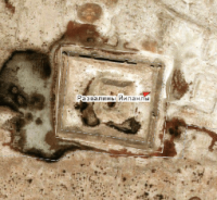
The medieval settlement of Yylanli is located at an altitude of 153 meters above sea level, located in the northwestern part of the Masrian plain and in the southwestern part of the Choganly plain, in the northwestern part of the Khurmen sands, 17.4 kilometers northwest of the village of Madau, 34.3 kilometers north-east of the small village of Indyrlan, 7.2 kilometers south-west of the Dehistan settlement in the Etrek etrap of the Balkan velayat.
Among other medieval cities of Dakhistan, Yylanly stands out (translated as "Serpentine", dates back to the 9th-14th centuries. Yylanli, according to V.M. Masson, was mentioned in the works of famous medieval scholars Samani and Yakut under the names of Khibrasana, Habratan, Habrata, Harratir or Fargul ) and his contemporary Guyly-Karaguz.
In Yylanli there was a pakhsa fortress and a palace, and in Guyly-Karaguz there was a large mosque and many remains of ceramics kilns. More archaic settlements of the late 2nd and early 1st millennia BC. e., belonging to the Bronze and Iron eras, are also clearly visible on the plain of Dakhistan, forming ruins, sometimes rising above the ground by 0.5 - 1 meters, then reaching twelve meters in height.
Geographic coordinates of the Yylanly settlement: N38 ° 00'49.95 "E54 ° 43'38.84"
Authority:
"Ancient and new roads of Turkmenistan". V.S. Zaletaev. 2009.
http://etnolingvistika.ru


