


![]()
Вы здесь
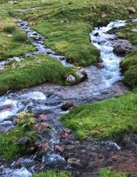
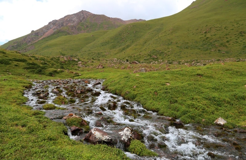
Buzunbai river in Terskey Alatau mountains.
Natural Wonders Almaty region.
"Camels and sheep lambing - noise in the paddocks,
From the wings of the birds in the ravines there is a buzz and a rumble.
When trees and flowers admire the water,
The river, like pava, bends, murmurs"
Abaya Kunanbaev. “On the Eve of Summer”.
Photo Terskey Alatau mountains.
The Buzunbai River belongs to the Tekes River basin, is the right tributary of the Ulken-Kokpak River, located on the northern slope of the Terskey Alatau ridge between the Kopyl mountains in the west and the northern spurs of the Meridional ridge in the Narynkol region of the Almaty region.
At an altitude of 2270 meters above sea level, another, large right tributary, Buzunbay, flows into Ulken-Kokpak, which originates from the moraine lake Akkoldekkol surrounded by glaciers from the south at an altitude of 3395 meters above sea level, located on the northern slope of the Terskey Alatau ridge.
The Akkoldekkol moraine lake has a perimeter of 718 meters, an area of 37965 square meters. The length of the lake from the south-east to the north-west is 247 meters, the maximum width is 282 meters from the bay on the eastern side of the lake.
The Buzunbai River flows 1.7 kilometers through Lake Karakol, which is located at an altitude of 3102 meters above sea level; the lake has the greatest width in the northern part of the lake, 444 meters. The length of the Buzunbai River is 22 kilometers, it is the second longest tributary of the Ulken-Kokpak River.
At an altitude of 2454 meters above sea level, a small left unnamed tributary with a length of 4.5 kilometers rushes into the Buzunbai River, it originates from the northwestern side of an unnamed peak 3527 meters above sea level.
600 meters below the Karakol Lake, a small stream 1 kilometer long flows into Buzunbai. Even lower, after 750 meters to the right, a stormy stream of an unnamed river 2.5 kilometers long flows into the Buzunbai River.
The height difference on the Buzunbai river is 1725 meters from the river mouth to Akkoldekol lake. In the forest zone, the banks of the river are overgrown with the Tien Shan spruce and mountain ash, higher on the left bank there are thickets of juniper.
Geographic coordinates of the Buzunbai River: N42 ° 32'13.95 "E79 ° 56'09.87"


Authority and photos by
Alexander Petrov.