Вы здесь
Lake Narynkol Lower.

Walking routes along Semirechye.
“One avalanche will come down there,
A new dawn will break out
And on sunny peaks
Our disasters will burn.
The mountains are wise and foggy
Will rise above the clouds
And lick our wounds
Glacier tongues."
Yuri Vizbor. 1962.
Walk along Narynkol gorge.
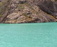
The flowing, moraine lake Narynkol Nizhnee is located at an altitude of 3412 meters above sea level, located in the upper reaches of the left sources of the Narynkol River, on the northern slope of the Meridional ridge, in the Narynkol region, Almaty region.
The lake is located 400 meters east of the Narynkol Upper Lake. On the western side of the lake is the mouth of a stream that flows out of the Upper Lake. A stream overflows from the southwestern part of the lake and after 1 kilometer flows from the left into the left source of the Narynkol River.
Two small moraine lakes are located 240 meters northeast of the lake. The highest point of the ridge is located at an altitude of 4227 meters above sea level. In the depths of the moraine, there is a glacier that feeds the lower lakes, including the Upper Lake Narynkol.
The length of the lake from southwest to northeast is 266 meters, the greatest width in the central part is 190 meters. The area of the lake is 39005 square meters, the perimeter of the lake is 835 meters. A stream flows out of the eastern part of the lake, which after 400 meters flows into the Lower Lake Narynkol located at an altitude of 3412 meters above sea level.
In 3.7 kilometers to the south and a little to the east there is Alaaygyr Lake 3709 meters above sea level. In 4.3 kilometers to the south and a little to the east in the crest of the ridge, along which the state border between the Republic of China and the Republic of Kazakhstan passes, there is the Alaaygyr pass with a height of 3870 meters above sea level.
Geographic coordinates of the Upper Narynkol lake: N42 ° 30'58.73 "E80 ° 12'11.81"
Authority andphotos by
Alexander Petrov.


