


![]()
Вы здесь
Mountains Adyrtor.

Mountain tourism in Kyrgyzstan.
"Travel is necessary for those who are studying"
Mark Twain.
Jeep tourism in Kyrgyzstan.
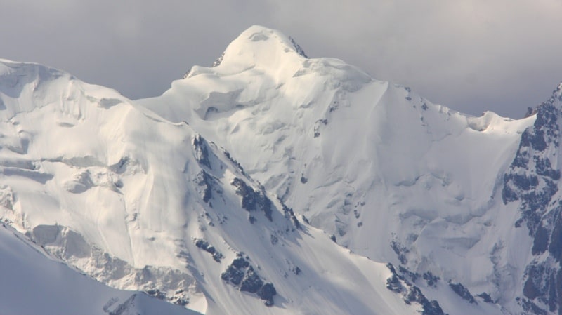
The Adyrtor ridge is located in the northeastern part of the Central Tien Shan mountains in the Ak-Suu district of the Issyk-Kul region. The length of the ridge from north-west to south-east is 33 kilometers, the maximum width is 12 kilometers in the western part.
Natural boundaries of the Adyrtor ridge are:
- in the east - the sources of the Semenov glacier flowing down from the western slopes of the Katta-Ashutor ridge with a length of 19.2 kilometers and the greatest width in the upper part up to 1.5 km,
- in the north - the Sarydzhaz river with a length of 28 kilometers from the source to the confluence of the Adyrtor river at an altitude of 3082 meters above sea level and the southern slopes of the Terskey Ala-Too ridge,
- in the south, the Mushketov glacier from the sources, which start from the northern slopes of Ignatiev Peak 5488 meters above sea level and ends at an altitude of 3424 meters above sea level and then the Adyrtor River 23 kilometers long to the mouth with the Saryjaz River and the northern slopes of the Saryjaz ridge,
- in the east, the confluence of the Adyrtor and Sarydzhaz rivers at an altitude of 3109 meters above sea level,
- in the west, the sources of the Semenov and Mushketov glaciers in the Sarydzhaz ridge.
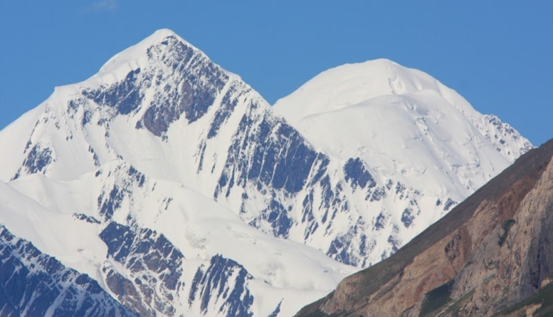
The highest heights are concentrated in the eastern part of the ridge. The dominant, unnamed peak is located in the easternmost part with a height of 4654 meters above sea level. A 2.3 km long glacier flows down from the northern slope of the summit and is the left tributary of the Semenov glacier.
In the southwestern part of the ridge, there is a rocky-ice peak Adyrtor with a height of 4304 meters above sea level. A 1.2 km long glacier slides down from its eastern slope and merges with the glacier, which originates from the northern slopes of the peak 4442 meters above sea level. The length of this glacier is 3.3 kilometers.
Small glaciers are located in its northern spurs, the slope of the southern exposure has a talus character and is not dissected at all. Small glaciers in the Adyrtor ridge are located in its northern spurs; the slope of the southern exposure has a talus character and is not dissected at all.
The western part of the northern slope of the Adyrtor ridge is characterized by large valley and tar glaciers, as well as glaciers of hanging valleys (No. 61 - 81). They occur in well-developed spacious valleys and, unlike the glaciers in the eastern part of the ridge, do not form large ice falls and steep falls.
They are characterized by a gradual transition from a bowl-shaped firn basin to a calm surface of the glacier body. lacier surfaces are relatively clean or slightly contaminated with fine earth. Only lateral moraines are well developed, often containing cores of dead buried ice.
There are usually no terminal moraine banks, and vast fields extend below the ends of the glaciers. Almost all glaciers of the Adyrtor ridge have exposure of northern points.
Geographic coordinates of the Adyrtor ridge: N42 ° 20'56.68 "E79 ° 49'40.74"

Authority:
Alexander Petrov.
http://www.mountain.ru/article/article_display1.php?article_id=1164
Photos by
Alexander Petrov.