


![]()
Вы здесь
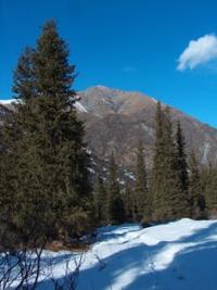
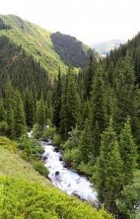
Ala-Archa river.
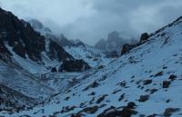

Rivers of Kyrgyz Ala-Too.
“It is difficult to say why the mountains made such an indelible impression on me, but I constantly remembered them, without losing hope to breathe once again that mountain air that so sweetly in early April cools the larynx, while the hot high-mountain sun burns my lips."
V.A. Soloukhin.
Rivers in Ala-Archa park.
The Ala-Archa River is located between the valleys of the Dzhelamysh rivers in the west and Alamedin in the east, on the northern slope of the Kyrgyz ridge in the Alamudun district of Chui oblast. The length of the Ala-Archi from its sources at an altitude of 3558 meters above sea level to the confluence of the river into the At-Bashinsky channel bypassing the Nizhne Ala-Archinskoye reservoir is 78 kilometers.
The catchment area of the river is 234 square kilometers. The Ala-Acha river is formed from the confluence of streams flowing from the Ala-Archinsky glaciers. The river has a typically mountainous character with an average slope of 6 meters by 100 meters in length.
The river bed is moderately meandering. The channel width is not very changeable, the river abounds in numerous drops up to 1.2 - 2.0 meters high. The Ala-Archa flows mainly in one channel and only in the places where the valley expands it splits into several branches.
Average river velocities in low-water periods range from 0.5 meters per second in the upper reaches to 2.5 meters per second in the lower reaches. In high water - from 3 meters per second to 4 meters per second.
The average depth in the upper reaches is 0.4 meters, in the lower reaches 0.6 meters. The tributaries flowing into the Ala-Archa above Aksai flow in the hanging gorges. The water regime of Ala-Archi is determined by the peculiarities of its nutrition.
The rivers of the basin belong to rivers with a mixed type of feeding and receive water from melting glaciers and eternal snows, on the one hand, and seasonal snows, on the other. Rainwater supply can be of significant importance only during summer rains, when short floods can form with a large rise in the water level and strong turbidity.
The runoff is distributed very unevenly over the seasons of the year: in spring - 9.8%, in summer - 62%, in autumn - 19%, in winter - 9.2% of the annual runoff. The sources of the main channel of the Ala-Archa river are located in the upper reaches of the gorge of the same name at an altitude of 3558 meters above sea level on the open part of the glaciers: Western and Eastern Small Ala-Archinsky, Western and Eastern Big Ala-Archinsky and Manas.
In addition to all, tributaries flowing into Ala-Archa originating from several glaciers of the northern slope of the Kyrgyz Ala-Too: Golubin, Tuyuk (New), Topkaragai, Teketor, Aksai, Korona, Uchitel, Adygene South. At 16 km after the source of the river on the right bank there is the hotel complex "Ala-Archa", at 28 km dachas begin, at 31 km there is a small reservoir. At 32 km, the village of Kashka-Su (formerly Malinovka), at 46 km is the southern border of the city of Bishkek. At 50 km there is the Victory City Park, at 53 km the river crosses the canal.
At 56 km the river passes the Osh bazaar, at 63 km the river crosses the canal, the Mayevskoe cemetery and a pond. At 66 km on the left there is a pond, at 73 km the 3rd Lower Ala-Archinskoye reservoir, at 78 km the river, bypassing the reservoir, flows into the At-Bashi canal.
Geographic coordinates of the Ala-Archa River: N42 ° 39'59.36 "E74 ° 30'24.13"
Right tributaries of the Ala-Archa river.
Dzheldy-Su river.
6.5 kilometers after the headwaters on the right, a tributary of Dzheldy-Su with a length of 1.9 kilometers flows into Ala-Archa. The source of the river begins from the Golubin glacier at an altitude of 3273 meters above sea level. The mouth of the river is located at an altitude of 2775 meters above sea level.
Geographic coordinates of the Dzheldy-Su River: N42 ° 29'02.90 "E74 ° 28'46.81"
Tuyuk stream.
After 530 meters on the right, a small tributary Tuyuk (New) with a length of 1.1 kilometers flows into Ala-Archa. The sources of the stream begin from the tongue of the closed, moraine part of the Tuyuk (Novy) glacier at an altitude of 3050 meters above sea level. The mouth of the river is located at an altitude of 2,718 meters above sea level.
Geographic coordinates of the Dzheldy-Su River: N42 ° 29'26.09 "E74 ° 29'04.73"
Top-Karagai river.
3.4 kilometers after the confluence of the Top-Karagai tributary, on the right, the Teketor River, 2.4 kilometers long, flows into the Ala-Archa. The river's sources begin from the tongue of the closed, moraine part of the Top-Karagai glacier at an altitude of 3372 meters above sea level.
The mouth of the river is located at an altitude of 2542 meters above sea level. The river also receives tributaries from the western slope of the ridge, which is a watershed with the Teketor River and from the western slopes of Teketor Peak, 4479.6 meters above sea level.
Geographic coordinates of the Top-Karagai River: N42 ° 30'55.41 "E74 ° 29'20.11"
River Teketor.
3 kilometers after the confluence of the Tuyuk tributary, on the right, the Teketor River, 2.9 kilometers long, flows into the Ala-Archa. The sources of the river begin from the tongue of the closed, moraine part of the Teketor glacier at an altitude of 3359 meters above sea level.
The mouth of the river is located at an altitude of 2295 meters above sea level. The river receives tributaries from the north-western slope of the Boks peak massif 4240 meters above sea level.
Geographic coordinates of the Teketor River: N42 ° 32'27.13 "E74 ° 29'31.30"
Aksai river.
700 meters after the confluence of the Teketor tributary, on the right, the full-flowing Aksai River, 4.8 kilometers long, flows into the Ala-Archa. The sources of the river begin from the tongue of the closed, moraine part of the Aksai glacier at an altitude of 3263 meters above sea level.
In the upper reaches of the Aksai glacier, there is the Korona glacier, the beginning of which is located on the western slopes of the peak of the same name, 4860 meters above sea level. The mouth of the river is located at an altitude of 2250 meters above sea level.
The river receives tributaries from the Uchitel South and North glaciers located in the eastern part of the gorge. 1.5 kilometers after the source, 150 meters from the right bank of the Aksai River, at an altitude of
863 meters above sea level, there is the Aksai waterfall.
Sharkyratma river.
After 2.7 kilometers on the right, a tributary of the Sharkyratma with a length of 1.7 kilometers flows into the Aksai River. Sharkyrtma has two gorges - central and western. The sources of the river are in the central gorge at an altitude of 4160 meters above sea level and in the side (western) gorge at an altitude of 4166 meters above sea level. The mouth of the Sharkyratma tributary is located at an altitude of 2549 meters above sea level.
Geographic coordinates of the Sharkyratma river: N42 ° 33'33.62 "E74 ° 31'22.40"
Geographic coordinates of the Aksai River: N42 ° 32'54.85 "E74 ° 30'50.64"
Murat river.
After 3.7 kilometers on the right, the 5.6 kilometers long Murat tributary flows into Ala-Archa. The sources of the river are in the Murat gorge at an altitude of 3928 meters above sea level. In the western part, the upper reaches of the gorge, there is the Murat glacier with a length of 230 meters.
In the ridge of the southern ridge, there is the Komsomolets peak 4204.1 meters above sea level. In the upper, western part of the gorge, there is the Violet Pass, 3760 meters above sea level, which is a watershed with the Sharkyratma River. The mouth of the river is located at an altitude of 2029 meters above sea level.
Geographic coordinates of the Murat River: N42 ° 34'36.25 "E74 ° 30'26.43"
Kuntybek river.
4 kilometers after the confluence of the Murat River, on the right, the Kuntybek tributary with a length of 1.7 kilometers flows into the Ala-Archa River. The main channel of the river is formed at an altitude of 2491 meters above sea level.
The main source of the river is in the central, northern gorge at an altitude of 3330 meters above sea level. In the lateral (southern) gorge at an altitude of 3010 meters above sea level, the next source is formed. In the upper part of the gorge there is the Pioneer peak 4021 meters above sea level. The mouth of the river is located at an altitude of 1813 meters above sea level.
Geographic coordinates of the Kuntybek River: N42 ° 35'48.83 "E74 ° 30'18.59"
Beyrek Stream.
2.6 kilometers after the confluence of the Kuntybek River, on the right, the Kuntybek tributary with a length of 3.2 kilometers flows into the Ala-Archa River. The sources of the river are located on the watershed ridge with the Kuntybek River at an altitude of 3076 meters above sea level. The mouth of the river is located at an altitude of 1684 meters above sea level.
Geographic coordinates of Beyrek Creek: N42 ° 37'31.35 "E74 ° 30'29.07"
Kashka-Su river.
The main channel of the Kashka-Su river is formed at an altitude of 1951 meters above sea level. The right, main tributary, in turn, consists of two tributaries, and one of them originates at an altitude of 3808 meters above sea level.
There are two waterfalls on the western (left) tributary. The western (left) tributary originates from the moraine lake Kashka-Su at an altitude of 3531 meters above sea level. The mouth of the river is located at an altitude of 1548 meters above sea level.
700 meters before the confluence of the tributaries, there is a waterfall on the river, which bears different names - Edelweiss, Golubiny, etc. The mouth of the Kashka-Su river is located at an altitude of 1548 meters above sea level.
Geographic coordinates of the Kashka-Su River: N42 ° 38'31.31 "E74 ° 31'44.56"
Left tributaries of the Ala-Archa river.
Adygene river.
The Adygene River is located on the northern slope of the Kyrgyz ridge in the left side gorge. Through 17 kilometers after the headwaters, a 9.1 kilometers long tributary Adygen flows into the Ala-Archa river on the left.
The sources of the Adygene River are located in the lake of the same name at an altitude of 3604 meters located on a moraine below the open part of the glacier. Above the lake is the Adygene South glacier with a length of 4.7 kilometers.
Adygene receives its sources from the left side of the gorge from the Panfilov glacier with a length of 1.4 kilometers. The mouth of the Adygene River is located at an altitude of 2059 meters above sea level. At an altitude of 2405 meters above sea level, 1.2 kilometers from the mouth, 110 meters from the right bank of the river, there is a memorial complex "Northern Star".
Geographic coordinates of the Adygene River: N42 ° 32'51.91 "E74 ° 27'10.74"
River Testor.
5.9 kilometers after the source of Adygene, the Testor tributary with a length of 3.6 kilometers is received on the left. The sources of the Testor River are located on the Adygeneter glacier with a length of 1.3 kilometers. In the upper reaches of the glacier, there is a peak of Adygene with a height of 4393.4 meters above sea level. The Testora estuary is located at an altitude of 2653 meters above sea level.
The geographical coordinates of the Testor River: N42 ° 33'16.40 "E74 ° 26'33.87"
Uraganjar river.
6.5 kilometers after the source of Adygene, the Uraganjar tributary with a length of 3.5 kilometers receives on the left. The sources of the river are located at an altitude of 3726 meters above sea level in a small gorge in the upper reaches of which there is a glacier under a moraine cover. The mouth of the river is located at an altitude of 2533 meters above sea level.
Geographic coordinates of the Uraganjar River: N42 ° 33'44.14 "E74 ° 26'46.66"
Kashka-Su river (left tributary of the Adygene river).
6.5 kilometers after the source, Adygene receives a tributary of the Kashka-Su with a length of 4.3 kilometers on the left. The sources of the river are located at an altitude of 3676 meters above sea level, in a small ridge that is a watershed with the Dzhelamysh River. The mouth of the Kashka-Su rivers is located at an altitude of 2163 meters above sea level.
Geographic coordinates of the Kashka-Su River (left tributary of the Adygen): N42 ° 34'15.20 "E74 ° 27'59.11"
Balkhaman stream.
2.7 kilometers after the confluence of the Adygene river, on the left, a small stream Balkhaman, 3 kilometers long, flows into Ala-Archa. The source of the stream is located at an altitude of 3292 meters above sea level. The mouth of the stream is located at an altitude of 1887 meters above sea level.
Geographic coordinates of the Balkhaman stream: N42 ° 35'46.54 "E74 ° 28'12.86"
Kadyrberdy river.
4 kilometers after the confluence of the Balkhaman stream, the river Kadyrberdy with a length of 8.3 kilometers flows into the river on the left. The sources of the river are located at an altitude of 3670.2 meters above sea level.
The mouth of the river is located at an altitude of 1684 meters above sea level. At an altitude of 2592, the right tributary of the Chenyter, 1.9 kilometers long, flows into the river on the left.
Geographic coordinates of the Kadyrberdy River: N42 ° 37'32.08 "E74 ° 27'23.90"
Chibyk-Tybek river.
3.5 kilometers after the confluence of the Kadyrberdy tributary into the Ala-Archu, a small stream Chibyk-Tybek with a length of 4.7 kilometers flows into the left. The sources of the stream are located on the eastern slope of the Ala-Archa gorge at an altitude of 2502 meters above sea level.
The mouth of the stream is located at an altitude of 1560 meters above sea level near the entrance to the Ala-Archa park.
Geographic coordinates of the Chibyk-Tybek River: N42 ° 39'08.22 "E74 ° 28'36.81"
Authority:
Alexander Petrov.
A. Kuznetsov "Alaarcha". “Defeated peaks. 1973 - 1974 ". “Mysl”. Publishing House, 1976.
Photos by
Alexander Petrov.