


![]()
Вы здесь
Markakol lake.
Trip to Markakol lake.
“With just one memory of the wondrous beauty of this lake in the mountains of southern Altai, I am involuntarily drawn again and again to this wondrous corner of the world, to this earthly paradise. And I would have given dearly, I would have sacrificed a lot in order to be able to go there again and settle there for the rest of my life. I have never seen a more picturesque place, a more beautiful mountain lake anywhere, although I have traveled and traveled a lot in my life..."
Naturalist, hunter N.I. Yablonsky. Journal "Nature and hunting", the beginning of the XX century.
Hiking in Kazakhstan Altai.
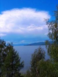
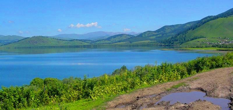
Fresh lake Markakol is located at an altitude of 1447 m. a. s. l., is located in the southern part of the Kurchum ridge to the north of the Asutau and Matabay ridges on the territory of the Markakol nature reserve in the Kurchum district in the east of the East Kazakhstan region.
The largest body of water in the Kazakh Altai is 38 kilometers long and 19.3 kilometers wide in the central part. The width in the eastern part, in the vicinity of the village of Urunkhaika, is 5.5 kilometers. The depth of Lake Markakol is 10 meters, the maximum is 27 meters, the average depth is 14.3 meters.
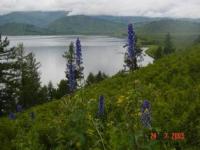
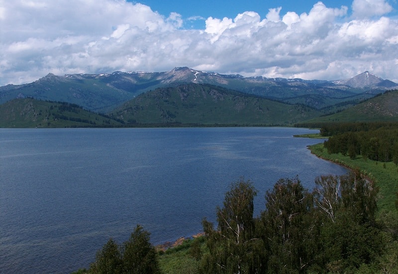
14 kilometers from the northern shore of Lake Markakol, in the main ridge of the Kurchum Range, there is the majestic Mount Aksubas, 3305.6 meters high above sea level. Guba Bay is located in the northeastern part of the lake on the western side of the mouth of the Topolevka River.
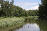
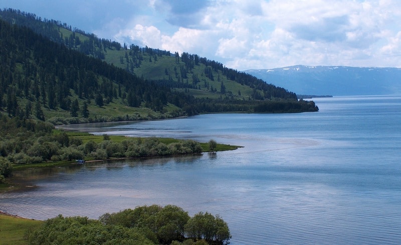
The water area of Guba Bay is 10.72 square kilometers. Lake Markakol in translation from Kazakh "One-year-old lamb". The lake belongs to the alpine type. The area of the lake reaches 455 square kilometers. 27 small rivers and streams flow into the lake, the largest of them are the Topolevka, Urunkhaika, Tikhushka rivers.
In the west, the Kaldzhir River flows out of the lake. The water is greenish-blue in color, transparency is 4 - 7 meters. The volume of water is 6,567,000,000 cubic meters. The basin is oval in shape. The coastline is indented, the southern shores are steep, the northern ones are slightly dissected, low-lying. In the estuaries of rivers.
Tikhushki, Multykbay, Tastybulak, there are wetlands with which groundwater outlets are connected. Almost the entire coast is overgrown with forest (larch, spruce, fir, birch, aspen, etc.). The catchment area of the lake is mountainous. The climate is sharply continental.
The minimum temperature in winter is 55'C. The first ice formations are observed at the end of October, the ice thickness is 1.16 meters, the average is 0.7 meters. The water temperature in July - August is 16-17 C. It feeds on surface, groundwater, atmospheric precipitation on the water area.
The highest water level is in June - July, the lowest - in October - November. The mineralization of water is 0.07 g/kg, the content of iodine, fluorine, bromine and other elements in it is low. There are fish in the lake: grayling, char, gudgeon, etc.; have no commercial value.
There are many waterfowl and marsh birds: duck, gull, sandpiper, etc. The muskrat lives at the mouth of the Tikhushka River and at the headwaters of the Kaldzhir River. More than 80% of the lake's water area is part of the Markakol State Reserve.
The origin of Lake Markakol is associated with one of the glacial phases of the Quaternary period of the Alpine tectonic cycle, when, as a result of uplifts and faults, a peculiar system of modern ridges and intermountain depressions was formed, which were then exposed to glaciation, traces of which are well expressed on the watershed parts of the Kurchum ridge.
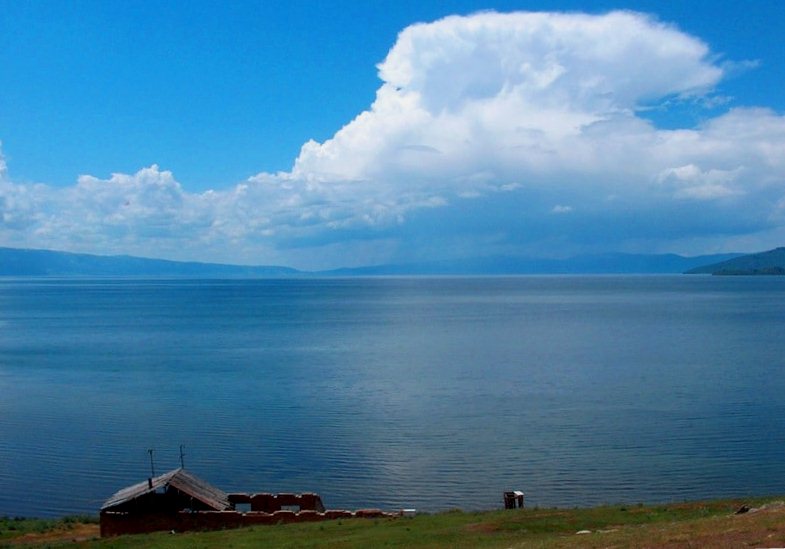
The basin of Lake Markakol is characterized by a peaked, steeply sloping, intensely dissected relief of a mid-mountain appearance. The slopes of the ridges are crossed by deeply flowing river valleys. On the eastern shore of the lake at the mouth of the Urunkhaika River, at an altitude of 1463 m. a. s. l., the village of Urunkhaika stretches from south to north for 1400 meters.
The village is part of the Tuskainsky rural district. The village was founded at the beginning of the XXth century. Currently, about 500 people live here. There is a feldsher station, a meteorological station, a pre-school educational center, a school in which about 80 schoolchildren study, and a post office in the village.
On the territory of the village is the directorate of the Markakol Biosphere Reserve, which was established in 1976. A road passes through the village through the Alataysky passes 1792 meters above sea level and Burkhat 2149.9 meters above sea level, which leads to the valley of the Bukhtarma River in the Katon-Karagay region.
On the eastern shore of the lake, three kilometers from the village of Urunkhaika, there is a house adapted for a turret. On the eastern shore, 37 kilometers from Urunkhaika, there is the village of Verkhnyaya Yelovka, followed by the village of Nizhnyaya Yelovka, there are about 10 houses of local residents.
Behind the village of Nizhnyaya Elovka is the village of Glukhovoe, then there is the village of Chumek, 70 kilometers from Urunkhaika. It is 10-11 kilometers from the village of Chumek to the gamekeeper post Matabay, 12-15 families live in Matabay.
Geographic coordinates of Lake Markakol: N48°44'17 E85°44'55
Authority:
Alexander Petrov.
"Reserves of Central Asia and Kazakhstan". Publishing house "Thought". Moscow, 1990.
Photos by:
Alexander Petrov.