


![]()
Вы здесь
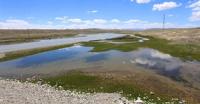
Taragai river.
Trip to Tien-Shan.
“Meeting further with Taragay, the drain of the huge Petrov glacier in the Dzha-ak-tash highlands, Dzha-ak-tash-su takes the name Taragay and bends to the southwest, and at the confluence with Karasai, flowing from the southwestern part of the same mountain masses, Taragai turns directly to the west and at its outlet from the syrt into the first narrow gorge is called the Big Naryn, into which even further, at the lower end of the gorge, the Small Naryn flows.
"Journey through Turkestan region and study of mountainous country of Tien-Shan.". N. Severtsov. 1873
Rivers of Inner Tien-Shan.
Taragay basin consists of following rivers: Kashka-Su, Arabel-Su, Ittysh, Kichi-Maytor, Maitor, Koturtor, Jetimbel, Choloktor, Sook.
Taragai river.
Taragai River originates from the southern and southeastern slopes of the Terskey Ala-Too. The length of the river is 40 kilometers from the beginning of the confluence of the Kashka-Su and Maytor to the confluence of the right tributary of the Jamanechka.
From the beginning of its sources, the river receives 9 right tributaries, left - 4 tributaries, one of them is the largest - Kumtor. The speed of the river flow is from 2 to 2.5 meters per second. The height difference on the river for 40 kilometers is 255 meters.
Geographic coordinates of Taragay River: N41°41'45 E77°50'44
Kashka-Su river.
Kashka-Su River originates on the southern slope of the Terskey Ala-Too ridge at an altitude of 3881 meters above sea level from a cascade of lakes. The lakes are located south of the Kashka-Su pass, which is located in the main ridge of the Terskey Ala-Too ridge at an altitude of 3891 m. a. s. l. In the upper reaches, the river flows through a cascade of lakes.
The length of the river Kashka-Su is 30 kilometers. At 8 km after the sources, the river on the left receives a small tributary, which starts from two low-water lakes. At 16 km, the river on the left receives a tributary that flows from a large lake located at an altitude of 3782 m. a. s. l.
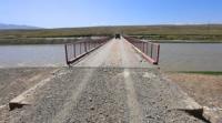
At the 20th kilometer, Kashka-Su receives a tributary on the left, which starts from a lake located at an altitude of 3627 meters above sea level. At 21 kilometers, the river crosses a road bridge, the road through which leads to the Kumtor mine. The long tributary Arabel-Su flows into the left for 24 kilometers.
Geographical coordinates of Kashka-Su River: N41°51'58 E78°04'54
Arabel-Su river.
The Arabel-Su River, 41 kilometers long, originates at an altitude of 3,779 m. a. s. l. from a group of lakes called Dzhashyl-Kel, which are located in the Arabel valley. In turn, the Arabel valley is located between the southern slopes of the Terskey Ala-Too ridge and the northern slopes of the Sook and Jetim-Bel ridges on syrt formations.
The Arabel-Su river basin consists of three main tributaries - Koturtor, Ittysh and Kichi-Maytor. The sources of the river start from the south-east side of the Barskoon pass located at an altitude of 3754 m. a. s. l. Just below the pass is Lake Barskoon at an altitude of 3750 m. a. s. l.
The river passes Lake Barskoon and after 1.8 kilometers flows into Lake Dzhashyl-Kel West, located at an altitude of 3779.1 m. a. s. l. Just 200 meters to the south is the Central Lake Dzhashyl-Kel, located at an altitude of 3779.1 m. a. s. l. After 5.5 kilometers, the river flows into the Jashyl-Kel South Lake, located at an altitude of 3752 m. a. s. l.
The river bends around the Jetym-Bel ridge from the north, turns south and flows between the western slopes of the Akshiyrak ridge and the southeastern slopes of the Jetym-Bel ridge until it flows into.
Geographic coordinates of Arabel-Su River: N41°52'51 E77°53'20
Taragai River.
At the 28th kilometer in Arabel-Su on the left, the Katurtor River flows into the river at an altitude of 3647 m. a. s. l. At 35 km after the sources, the Ittysh River flows to the left and a little higher, the Kichi-Maitor River flows to the right.
Throughout its length, Kashka-Su receives 8 tributaries on the left, 15 tributaries on the right.
The speed of the river flow is 1.1 - 1.2 meters per second.
Geographic coordinates of Taragay River: N41°41'45 E77°50'44
Ittysh river.
Ittysh River, 17 kilometers long, originates from the southern slope of the Ittysh Pass, located at an altitude of 3880.2 meters above sea level, which in turn is located in the main ridge of the Terskey Ala-Too ridge. 4 kilometers after the sources, the river receives a tributary on the left, which originates from the glaciers of the southern slope of the Terskey Ala-Too ridge.
At 7 km after the sources, a tributary flows from the left, originating from the watershed spur between the Kumtor and Arabel-Su rivers. At 14.5 km, the river receives a tributary on the left, which flows from a small lake located at an altitude of 3645 m. a. s. l.
At the 17th kilometer of the Ittysh River, it flows from the left into the Arabel-Su River.
Geographic coordinates of Ittysh River: N41°57'13 E78°01'46
River Koturtor.
Koturtor River is the left tributary of Arabel-Su, 8.5 kilometers long, originates from the Koturtor glacier, 5.3 kilometers long, which is located on the southern slope of the Terskey Ala-Too ridge. The beginning of the glacier is located in the main ridge of the ridge at an altitude of 4368 m. a. s. l., the tongue of the glacier lies at an altitude of 3882 m. a. s. l.
The mouth of the Koturtor River is located at an altitude of 3647 m. a. s. l. The coturtor has 4 small tributaries on the right.
Geographical coordinates of river Koturtor: N41°55'24 E77°57'48
River Kichi-Maytor.
Kichi-Maitor River, 8 kilometers long, is the right tributary of the Arabel Su River. The sources of the river are located on the northeastern slope of the Sook Range. The main channel of the river is formed from three tributaries: northern, central and southern at an altitude of 3894 m. a. s. l.
The southern tributary flows from the moraine lake Kichi-Maytor located at an altitude of 4081 meters above sea level. The length of the lake is 288 meters, the largest width in the central part reaches 190 meters. The mouth of the Kichi-Maytor River is located at an altitude of 3625 m. a. s. l.
Geographical coordinates of Kichi-Maytor River: N41°52'15 E78°00'33
Maitor river.
Maitor River, 14.7 kilometers long, is the right tributary of the Taragay River. The sources of the river are located on the eastern slope of the Sook Range. The main channel of the river is formed from two small tributaries: northern and southern.
The southern tributary flows from the northern branch of the Maitor Yuzhny glacier. The length of the main glacier, which mostly lies on the southern slopes of the ridge, is 3.5 kilometers. The area of the glacier reaches 4.77 square kilometers, the perimeter of the glacier is 10.6 kilometers.
The length of the side branch of the glacier, from where the southern source of the Maytor River originates, is 1.9 kilometers, its area is 1.07 square kilometers, and its perimeter is 4.78 kilometers. There is a small moraine lake 600 meters below the glacier.
The upper part of the glacier is located at an altitude of 4573.2 m. a. s. l., the tongue of the glacier is located at an altitude of 3999 m. a. s. l.. The main channel of the river flows out of the large Maitor Zapadny glacier, 2.9 kilometers long.
The area of the glacier is 5.57 square kilometers, the perimeter is 10.06 kilometers.
The upper part of the glacier is located at an altitude of 4573.2 m. a. s. l., the tongue of the glacier is located at an altitude of 3965 m. a. s. l.
The mouth of the Maitor River is located at an altitude of 3458 m. a. s. l.
Geographical coordinates of Maytor River: N41°50'39 E78°03'10
Jetimbel river.
Jetimbel River, 6.9 kilometers long, is the right tributary of the Taragay River. The main sources of the Jetimbel River are located on the southern slope of the Jetimbel pass, 3993.8 m. a. s. l. 180 meters below the pass there is a moraine lake with a length from south to north of 280 meters and a width of 125 meters.
The river is located on the southern exposition of the area - there are no glaciers in the sources of the river. The mouth of the Jetimbel River is located at an altitude of 3374 m. a. s. l.
Geographic coordinates of Jetimbel River: N41°47'04 E77°56'16
Choloktor river.
Choloktor River, 14 kilometers long, is the left tributary of the Taragay River, located on the southern slope of the Akshiyrak ridge. The main channel of the river is formed at an altitude of 3478 m. a. s. l. There are no glaciers at the head of the river. To the west of the river is a swampy plateau with numerous small lakes.
The mouth of the river is located at an altitude of 3318 m. a. s. l.
Geographic coordinates of Choloktor River: N41°41'30 E77°56'22
Sook river.
The Sook River, 15.7 kilometers long, is the right tributary of the Taragay River, located on the southern slope of the Sook Range. The main channel of the river is formed at an altitude of 3563 m. a. s. l. from three tributaries. The westernmost of them flows down from the southern slope of the Sook Pass, 4021 m. a. s. l.
There are no glaciers at the head of the river. The upper part of the sources is located at an altitude of 4573 m. a. s. l. The mouth of the river is located at an altitude of 3307 meters above sea level. Along the river, there is an automobile road connecting the syrts of the Inner Tien-Shan with the Issyk-Kul valley, and a high-voltage power line.
On the road A 364 you can get to the frontier outpost Karasai, the Uchkoshkon deposit and through the Ashu-Suu pass you can get to the Uzenge-Gush river valley.
Geographic coordinates of Sook River: N41°44'34 E77°47'34
Kyzylchesme River.
Kyzylcheshme River, 26 kilometers long, is the left tributary of the Taragai River, located on the southern slope of the Akshiyrak ridge. The upper part of the sources is located at an altitude of 4281 m. a. s. l. The mouth of the river is located at an altitude of 3299 m. a. s. l.
Geographical coordinates of Kyzylchesme River: N41°39'16 E77°56'19
Jamanechki river.
Jamanechki River, 28 kilometers long, is the right and last tributary of the Taragay River after which it receives the name Naryn. The sources of the river are located between the northern slopes of the Jetim ridge and the southern slopes of the Jetim-Bel ridge.
On the left side, the river has 8 tributaries of the northern exposure Jetim-Bel. On the right side, the river receives 7 tributaries, one of which - Shorgosu - is a large southern exposition of Jetim. The northern main tributary originates from the Jamanechki glacier, 1.8 kilometers long, located in the side spur of a closed, deep circus.
The area of the glacier is 1.5 square kilometers, the perimeter is 4.94 kilometers. The upper part of the glacier is located at an altitude of 4425 m. a. s. l., the tongue of the glacier is at an altitude of 4055 m. a. s. l. On the western side in the spur there is a breakthrough through which water enters the upper reaches of the northern source.
The southern source of the river originates from the northern slope of the Jamanechki pass, 3863.5 m. a. s. l. The second right tributary originates from the Jamanechki South glacier, 2.8 kilometers long, consisting of two branches, located on the southern slope of the Jetim ridge.
The area of the glacier is 3.63 square kilometers, the perimeter is 12.31 kilometers. The upper part of the glacier is located at an altitude of 4469 m. a. s. l., the tongue of the glacier is at an altitude of 3831 m. a. s. l. 3.7 kilometers to the mouth, on the right, the Dzhalgyzbulak tributary, 4.3 kilometers long, adjoins the Jamanechki, which also forms an extended ravine.
The mouth of Jlgyzbulak is located at an altitude of 3297 m. a. s. l. 2.4 kilometers to the mouth, on the right, the Koturchap tributary, 3.4 kilometers long, adjoins Jamanechki, which forms an extended ravine. The mouth of the river is located at an altitude of 3231 m. a. s. l.
Geographic coordinates of Jamanechka River: N41°38'45 E77°42'28
Shorgosu river.
Shorgosu River, 12.2 kilometers long, is the right tributary of the Jamanechka River. The river originates from the Shorgosu glacier, 1 km long, located in a side gorge on the northern slope of the Jetim ridge. The area of the glacier is 0.91 square kilometers, the perimeter is 4.9 kilometers.
The upper part of the glacier is at an altitude of 4384 m. a. s. l., the tongue of the glacier is at an altitude of 3957 m. a. s. l.
Geographical coordinates of Shorgosu River: N41°39'18 E77°39'09
Ekurgen river.
Ekurgen River, 19.7 kilometers long, is the right tributary of the Taragay River, located on the southern slope of the Sook Range. The river mostly flows along the northern side of the Taragay valley. The source of the river is located on the southern slope of the Sarytor pass located at an altitude of 4050 m. a. s. l. in the main ridge of the Sook ridge.
For 4 kilometers from the pass to the confluence with Lake Ekurgen-Kel, located at an altitude of 3628.5 m. a. s. l., the river is called Sarytor. The remaining distance to the mouth of the river flows under the name of Ekurgen. 3.5 kilometers after Lake Ekurgen-Kel, on the left, the tributary Sarytor Zapadny flows into Ekurgen, 11.4 kilometers long.
Before the formation of the main channel, the river has 7 tributaries. The sources of the tributary originate from the Sarytor North and Sarytor West glaciers located on the southern slope of the Jetim-Bel ridge. The Sarytor Severny glacier is 1.5 kilometers long.
The area of the glacier is 0.73 square kilometers, the perimeter is 4.09 kilometers. The upper part of the glacier is at an altitude of 4341 meters above sea level, the tongue of the glacier is at an altitude of 4193 m. a. s. l. Glacier Sarytor West with a length of 2.28 kilometers.
The area of the glacier is 1.78 square kilometers, the perimeter is 5.91 kilometers. The upper part of the glacier is located at an altitude of 4498 m. a. s. l., the tongue of the glacier is at an altitude of 4040 m. a. s. l. The mouth of the Ekurgen River is located at an altitude of 3249 m. a. s. l.
Geographic coordinates of Ekurgen River: N41°39'51 E77°43'57


Authority and photos by:
Alexander Petrov.