


![]()
Вы здесь
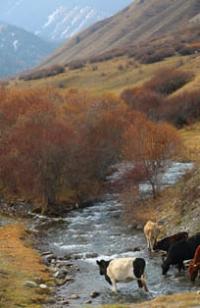
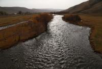
At-Bashi river.
Holidays tour in Kyrgyzstan.
“It’s hard for me to sit at home in the evening.
Seeing the sunset in a smoldering window,
I hasten to throw a bag on my shoulder
And I run into the forest, where the shadow flows,
Overflowing containers glades;
Where weeds seem to be weeds,
Where the sunset glows until dawn
And its expanse is embraced by the echoing silence.»
Victor Storopov.
Natural Wonders Adventure in Kyrgyzstan.
At-Bashi River, 122 kilometers long, is formed from confluence of Western Ulan and Dzhaldzhir rivers, is left tributary of Naryn River, flows through territory of At-Bashi district, Naryn region.
The catchment area is 5540 square kilometers. There are more than 200 tributaries in the At-Bashi river system, large ones: Kolmo, Ulan, Boroondu, Kek-Dzhar, Bash-Acha, Acha, Ichke-Suu, Dzhany-Dzher, Balyk-Suu, Besh-Belchir, Tuyuk-Bogoshtu, Acha- Kaiyndy, Terek-Suu, Kara-Koyun and others.
There are more than 280 glaciers in the river basin with a total area of 113.7 square kilometers and lakes Kel-Tor, Kosh-Kel, Dzhashyl-Kol, Kokuy-Kel. The main source of food is snow and glacial waters. The flood begins in May and ends in November.
The average annual water flow is 33.2 meters per second. The waters are used for irrigation. In the vicinity of the village of Dostuk, 4.7 kilometers before the confluence of the At-Bashi River with the Naryn, there is the At-Bashi hydroelectric power station.
At-Bashi hydroelectric power station is distinguished by a non-standard dam design with an impervious element in the form of a diaphragm made of polyethylene film. At-Bashi HPP is a high-pressure dam hydroelectric power plant with a hydroelectric power plant diversion building.
It is located in a narrow mountain gorge at an altitude of 1925 meters above sea level. The installed capacity of the power plant is 40 MW, the design average annual electricity generation is 165 million kWh. The facilities of the hydroelectric complex include: an earth filled (made of local gravel-pebble soils and stone) dam with an impervious element in the form of a diaphragm made of polyethylene film embedded in the injection core.
The dam is 55 meters long and 79 meters high. Four vertical hydraulic units with a capacity of 10 MW each are installed in the HPP building. The pressure structures of the HPP form a small reservoir with an area of 1 square kilometer, its design total capacity is 9.6 million cubic meters.
The At-Bashi HPP was designed by the Central Asian branch of the Hydroproject Institute. The construction of the hydroelectric power plant was started in 1963 by the Narynhydroenergostroy construction department.
The At-Bashi River was blocked in November 1965. All hydroelectric units of the station were put into operation in December 1970. The station is the only source of electricity in the Naryn region, providing about 25% of the region's needs.
The following villages are located on the At-Bashi River: Ak-Muz, Ak-Moyun, Birdik, At-Bashi, Ak-Jar, Acha-Kaiyndy, Bash-Kaiyndy, Kara-Tal, Bogoshtu, Taldy-Suu, Ozgyoryush, Dostuk and others. The mouth of the At-Bashy River is located in the vicinity of the village of Dostyk at an altitude of 1802 meters above sea level.
Geographical coordinates of At-Bashy River: N41°12'32 E76°09'13
Hydrography of At-Bashi river basin.
Sources of river At-Bashi.
River Ulan West.
Basin of the Western Ulan River consists of the following rivers and streams: Telshi, Dzhargalach, Baibiche, Ubulak, Kekbulak, Ayulutor Northern. The Ulan West River, 30 kilometers long, originates on the western slope of the Naryn-Too ridge.
The sources are located on the western slope of the Ulan pass, located at an altitude of 3791.4 meters above sea level. Western Ulan receives 10 tributaries on the right, among which the main ones - Kekbulak, Baibiche, Dzhargalach and Telshi are full-flowing, the river receives 12 tributaries on the left.
The river gets its sources from five small glaciers located on the northern slope of the Ulan Zapadny gorge. The area of glaciers is 1.25 square kilometers, the perimeter of the glacier reaches 7.79 kilometers. The upper limit of glacier feeding is at an altitude of 4525 meters above sea level. Glacier tongues are located at an altitude of 3852 meters above sea level. Mouth Ulan West River is located at an altitude of 2839 meters above sea level.
Geographic coordinates of Western Ulan River: N41°21'47 E76°46'55
Telshi stream.
At the 16.1th kilometer, Western Ulan receives the Telshi stream on the right, 7.8 kilometers long. The Telshi stream originates on the southern slope of the Naryn-Too ridge at an altitude of 3976.5 and 4065 meters above sea level. The mouth of the Telshi stream is located at an altitude of 3122 meters above sea level.
Geographical coordinates of Telshi stream: N41°23'13 E76°48'52
Stream Ayulutor North.
At the 12.9th kilometer, the Western Ulan River receives on the right the Ayulutor Northern tributary with a length of 7.5 kilometers. The sources of the stream are located at an altitude of 3932 meters above sea level in the Naryn-Too ridge. The mouth of the Ayulutor stream is located at an altitude of 3136 meters above sea level.
Geographic coordinates of Ayulutor stream: N41°22'27 E76°51'02
Jargalach stream.
At the 15.5th kilometer, the Telshi stream receives the tributary Dzhargalach on the left, 7.6 kilometers long. The sources of the stream are located on the eastern slope of the Baibiche pass, located at an altitude of 3784.4 meters above sea level.
Other sources of the stream are located on the southern and western slopes of the Dzhargalach gorge at an altitude of 4012 and 4065 meters above sea level.
Geographic coordinates of Dzhargalach stream: N41°22'36 E76°46'19
Baibiche stream.
At the 23.8th kilometer, Western Ulan receives the Baibiche stream on the right, 8.7 kilometers long. The sources of the stream are located on the southern slope of the Naryn-Too ridge, on the southern slope of the Baibiche Pass, located at an altitude of 3784.4 meters above sea level. The mouth of the stream is located at an altitude of 2920 meters above sea level.
Geographical coordinates of Baibiche stream: N41°21'00 E76°43'32
Ubulak stream.
At the 25.9th kilometer, Western Ulan receives the Ubulak stream on the right, 3.9 kilometers long. The sources of the river are located on the southern slope of the Ubulak gorge at an altitude of 3912 and 4130 meters above sea level. The mouth of the Ubulak River is located at an altitude of 2999.3 meters above sea level.
Geographic coordinates of Ubulak stream: N41°20'53 E76°41'46
Kekbulak stream.
At the 29.3th kilometer, Western Ulan receives the tributary Kekbulak on the right, 6.4 kilometers long. The sources of the river are located on the southern slope of the Kekbulak gorge at an altitude of 4130 meters above sea level. The mouth of the Kekbulak River is located at an altitude of 2846 meters above sea level.
Geographical coordinates of Kekbulak stream: N41°20'25 E76°40'09
Jaljir River.
At the 30th kilometer, a tributary of Dzhaldzhir, 54 kilometers long, flows into the Western Ulan River on the left. Basin of the Dzhaldzhir River consists of right tributaries: Ayulutor, Dungurame, Susarlytor, Archaly. Left tributaries of the Western Ulan River: Archaly, Jilanach, Tashayryk, Charatash, Akbaital, Kensu, Chontor, Sarytor, Muzbulak.
The source of the river is located on the northern slopes of the Naryn-Too ridge. In the upper reaches of the Dzhaldzhir gorge there are three glaciers of the same name: East, West, Central and the Kalyntaygak glacier. At an altitude of 3489 meters above sea level, the main channel of the river is formed from two main tributaries.
Jaljir East glacier is 3.7 kilometers long, the total area of the glacier is 4.44 square kilometers, the perimeter of the glaciers reaches 14.18 kilometers. The upper boundaries of the glacier feeding are located at an altitude of 4620 to 4767 meters above sea level. The tongue of the glacier is located at an altitude of 3899 meters above sea level.
Central Jaljir Glacier is 2.7 kilometers long, the total area of the glacier is 1.56 square kilometers, the perimeter reaches 6.69 kilometers. The upper boundary of the glacier feeding is located at an altitude of 4540 meters above sea level. The tongue of the glacier is located at an altitude of 3984 meters above sea level.
Dzhaldzhir West glacier, 2.5 kilometers long, consists of three branches, the total area of the glacier is 2.89 square kilometers, the perimeter of the glacier reaches 12.58 kilometers. The upper boundary of the glacier feeding is located at an altitude of 4726.8 meters above sea level. The tongue of the glacier is located at an altitude of 3941 meters above sea level.
Kalyntaygak glacier is 3.5 kilometers long, the total area of the glacier is 3.6 square kilometers, the perimeter reaches 9.8 kilometers. The upper boundary of the glacier feeding is located at an altitude of 4651 meters above sea level.
The tongue of the glacier is located at an altitude of 3981 meters above sea level. The mouth of the Jaljir River is located at an altitude of 2839 meters above sea level.
Geographic coordinates of Jaljir River: N41°18'23 E76°47'06
Right tributaries of Dzhaldzhir River.
Stream Ayulutor South.
At the 38.9th kilometer, Dzhaldzhir receives on the right the Ayulutor South tributary with a length of 7.7 kilometers. The source of the stream is located at an altitude of 3932 meters above sea level in the Naryn-Too ridge. The mouth of the Ayulutor South stream is located at an altitude of 3136 meters above sea level.
Geographical coordinates of Ayulutor South stream: N41°20'10 E76°53'24
Dungurame stream.
At the 36.7th kilometer, a tributary of the Dungurame with a length of 13.7 kilometers flows into the Dzhaldzhir River on the right. The river receives its sources from the western side of the Dungurame pass located at an altitude of 3954.9 meters above sea level and from the glacier of the same name with a length of 1.58 kilometers, an area of 1.52 square kilometers, a perimeter of 4.72 kilometers.
The upper boundary of the glacier's feeding is located at an altitude of 3954.9 meters above sea level. The tongue of the glacier is located at an altitude of 3934 meters above sea level. The mouth of the Dungurame stream is located at an altitude of 3162 meters above sea level.
Geographical coordinates of Dungurame stream: N41°21'30 E76°58'20
Stream Susarly-Tor.
At 26.8 km, a tributary of the Susarly-Tor with a length of 5.2 km flows into the Dzhaldzhir River on the right. The sources of the stream are located in the Naryn-Too ridge, on the western side of the Susarly-Tor peak located at an altitude of 4522.6 meters above sea level and at an altitude of 4394.5 meters above sea level. The mouth of the river is located at an altitude of 3273 meters above sea level.
Geographic coordinates of Susarlytor stream: N41°19'38 E77°02'33
Left tributaries of the Jaljir River.
Archaly river.
At the 53.5th kilometer, the tributary Archaly, 11.6 kilometers long, flows into the Jaljir River on the left. The sources of the river are located in the Naryn-Too ridge. The main channel of the river is formed at an altitude of 3167 meters above sea level from 5 tributaries.
The main tributary originates from the northern slope of the Kashkasu pass located at an altitude of 3970.3 meters above sea level. The next tributary begins from the northern slope of the Archaly Pass, 3926.9 meters above sea level.
These two passes are located on the watershed of the East Aksai and At-Bashi rivers. The westernmost tributary originates at an altitude of 4006.7 meters above sea level. The mouth of the river is located at an altitude of 2925 meters above sea level.
Geographical coordinates of Archaly River: N41°16'24 E76°44'16
Jilanach river.
At 47.7 km, a 12.7 km long tributary Jilanach flows into the Jaljir River from the left. The main channel of the river is formed near the confluence with the Jaljir at an altitude of 3072 meters above sea level. The river basin consists of two right tributaries: Kelayryk and Tashayryk.
The sources of the river are located on the northern slope of the Jilanach peak, 4451.2 meters above sea level. There is a small glacier on the northern slope of the pass. The right tributary of the Jilanach River originates from the northern slope of the Jilanach pass located at an altitude of 4008 meters above sea level. The mouth of the river is located at an altitude of 3015 meters above sea level.
Geographic coordinates of Jilanach River: N41°16'34 E76°48'24
River Kelayrik.
3.7 kilometers before the confluence of the Jilanash River into the Jaljir, the Kelairik tributary, 8.8 kilometers long, flows from the right. The sources of the river are located on the northern slope of the Orto-Kashkasu pass, located at an altitude of 4042.1 meters above sea level.
There is a small glacier on the northern slope of the pass. At an altitude of 3376 meters above sea level, the river forms the main channel, in the upper reaches there are 4 tributaries. Lake Kel-Kudu is located 60 meters from the right bank of the river at an altitude of 3431 meters above sea level.
The length of the lake from south to north is 134 meters, the largest width in the central part reaches 60 meters, the lake area is 0.01 square kilometers, the perimeter of the lake is 0.36 kilometers. The lake is located on an ancient moraine, has underground filtration. The mouth of the river is located at an altitude of 3147 meters above sea level.
Geographical coordinates of river Kelairik: N41°15'33 E76°49'53
Tashayrik river.
1.4 kilometers before the confluence of the Jilanash River with the Dzhaldzhir, a tributary of the Tashayrik, 9.5 kilometers long, adjoins on the right. The beginning of the main source of the river is located on the northern slope of the Kensu Pass, located at an altitude of 4025 meters above sea level.
On the left, the Tashayryk has two tributaries, and on the right, there are also two tributaries originating at altitudes of 4118.3 and 4022.8 meters above sea level. The mouth of the river is located at an altitude of 3076 meters above sea level.
Geographical coordinates of Tashayryk River: N41°16'22 E76°51'21
Charatash river.
At 40.8 km, the Charatash tributary, 11.5 km long, flows into the Jaljir River on the left. The sources of the river are located on the northern slope of the Charatash Pass, located at an altitude of 3875.5 meters above sea level.
There is a small glacier on the northern slope of the pass. At an altitude of 3361 meters above sea level, the river forms the main channel, in the upper reaches there are 2 tributaries. The mouth of the river is located at an altitude of 3112 meters above sea level.
Geographical coordinates of Charatash River: N41°17'35 E76°53'54
Akbaital river.
At the 30.7th kilometer, the Akbaital tributary, 14 kilometers long, flows into the Jaljir River from the left. The sources of the river originate from a small Akbaital glacier located on the eastern slope of the Akbaital gorge in the Naryn-Too ridge.
The length of the glacier is 650 meters, the area is 0.21 square kilometers, the perimeter reaches 1.83 kilometers. To the north of the glacier is the Charatash pass with a height of 3875.5 meters above sea level. One of the northern tributaries originates from the northern slope of the Akbaital Pass, located at an altitude of 3668 meters above sea level.
The Akbaital pass is a watershed between the East Aksai and At-Bashi rivers. Akbaital has 6 tributaries on the right and left. The mouth of the river is located at an altitude of 3231 meters above sea level.
Geographic coordinates of Akbaital River: N41°18'07 E77°00'06
Kensu River.
At 22.8 km, the Kensu tributary, 6.1 km long, flows into the Jaldzhir River on the left. The main channel of the river is formed at an altitude of 3440 meters above sea level and consists of two tributaries that originate from two small glaciers Kensu - East and Kensu West located on the northern slope of the gorge of the same name. The mouth of the river is located at an altitude of 3356 meters above sea level.
Kensu East Glacier is 1.3 kilometers long, the area of the glacier is 0.35 square kilometers, the perimeter of the glacier reaches 2.42 kilometers. The upper limit of glacier feeding is located at an altitude of 4469.3 meters above sea level. Glacier tongues are located from 3843 meters above sea level.
Kensu West Glacier is 803 meters long, the total area of the glacier is 0.49 square kilometers, the perimeter reaches 2.7 kilometers. The upper boundary of the glacier feeding is located at an altitude of 4469.3 meters above sea level. The tongue of the glacier is located at an altitude of 3937 meters above sea level.
Geographic coordinates of Kensu River: N41°16'32 E77°02'41
Chontor river.
1.7 kilometers before the confluence of the Kensu River into the Dzhaldzhir, a tributary of the Chontor with a length of 5.9 kilometers flows from the right. The main channel of the river is formed at an altitude of 3490 meters above sea level from three tributaries that originate from three small glaciers located on the northern slope of the Chontor gorge.
The upper limit of glacier feeding is located on the northern slope of Chontor peak 4690 meters above sea level and Chontor Western peak 4662 meters above sea level. Glacier tongues are located at an altitude of 3995 to 3918 meters above sea level. The mouth of the Chontor River is located at an altitude of 3311 meters above sea level.
Geographic coordinates of Chontor River: N41°17'13 E77°04'11
Sarytor river.
At 17.9 km, a 2.3 km long tributary Sarytor flows into the Jaljir River from the left. The sources of the river are located on the northern slope of the gorge from a small glacier in the Naryn-Too ridge. The upper boundary of the glacier's feeding is located at an altitude of 4356 meters above sea level. The tongue of the glacier is located at an altitude of 4105. The mouth of the Chontor River is at an altitude of 3360 meters above sea level.
Geographical coordinates of Sarytor River: N41°17'27 E77°07'31
Muzbulak river.
At 16.8 km, the Muzbulak tributary, 6.4 km long, flows into the Jaljir River from the left. The sources of the river are located on the northern slope of the gorge from a small glacier in the Naryn-Too ridge. The main channel of the river is formed at an altitude of 3471 meters above sea level from two tributaries that originate from the small glaciers Muzbulak West and Muzbulak East.
The mouth of the Muzbulak River is located at an altitude of 3386 meters above sea level.
Muzbulak Western glacier is 1.3 kilometers long, the area of the glacier is 1.02 square kilometers, the perimeter of the glacier reaches 6.02 kilometers. The upper limit of glacier feeding is located at an altitude of 4561 meters above sea level. The tongue of the glacier is located at an altitude of 3929 meters above sea level.
Kensu East Glacier is 2.6 kilometers long, the total area of the glacier is 1.48 square kilometers, the perimeter reaches 8.8 kilometers. The upper boundary of the glacier's feeding is located at an altitude of 4561 meters above sea level. The tongue of the glacier is located on altitude 3898 meters above sea level.
Geographic coordinates of Muzbulak River: N41°17'15 E77°09'03
Tributaries of At-Bashi River.
River Kultor.
At 3.9 km from the beginning of the sources, the Kultor tributary, 12 km long, flows into the At-Bashi River on the right. The main channel of the river is formed at an altitude of 3112 meters above sea level from three tributaries originating from the southern slope of the Naryn-Too ridge.
In the riverbed at an altitude of 3077.2 there is a moraine, flowing, fresh lake Kultor. The length of Lake Kultor from southeast to north is 1.3 kilometers, the area of the lake is 0.38 square kilometers, the perimeter of the lake reaches 3.21 kilometers. The mouth of the Kultor River is located at an altitude of 2806 meters above sea level.
Geographic coordinates of Kultor River: N41°20'54 E76°37'42
Stream Archaly Southern.
At 6.2 km, a tributary of the Archaly South, 4.5 km long, flows into the At-Bashi River on the right. The sources of the river are located at an altitude of 4058.1 meters above sea level. The mouth of the Archaly South River is located at an altitude of 2785 meters above sea level.
Geographical coordinates of river Archaly South: N41°20'05 E76°36'00
River Uzunbulak South.
At 8.7 km, the Uzunbulak South tributary flows into the At-Bashi River on the right, 5 km long. The main channel of the river is formed at an altitude of 2868 meters above sea level from two tributaries. The sources of the river are located on the southern slope of the Naryn-Too ridge at an altitude of 4102 meters above sea level. The mouth of the river Uzunbulak South is located at an altitude of 2773 meters above sea level.
Geographical coordinates of river Uzunbulak South: N41°19'33 E76°34'16
Chet-Kamandy river.
At 25.7 kilometers, a tributary of the Chet-Kamanda, 3 kilometers long, flows into the At-Bashy River on the right. The Chet-Kamanda river basin consists of the following tributaries: Acha-Kamanda and Chong-Acha-Kamanda.
The main channel of the Chet-Kamanda River is formed at an altitude of 2721 meters above sea level from two tributaries - the eastern Acha-Kamanda and the western Chong-Acha-Kamanda. The sources of the river are located on the southern slopes of the Naryn-Too ridge. The mouth of the Chet-Kamandy River is located in the Bosogo tract and is located at an altitude of 2665 meters above sea level.
Geographical coordinates of Chet-Kamanda River: N41°15'14 E76°27'22
Acha-Kamanda river.
At the 3rd kilometer, a tributary of the Acha-Kamanda, 12.1 kilometers long, flows into the Chet-Kamandy River from the left. The river receives its sources from the Acha-Kamandy glacier, which consists of two parts, located on the northern slope of Mount Beshmoinok, 4216.1 meters high above sea level.
Mount Beshmoinok is located in the main ridge of the Naryn-Too ridge. The length of the glacier is 1.08 kilometers, the area of the glacier is 0.69 square kilometers, the perimeter of the glacier reaches 4.56 kilometers.
The upper limit of the glacier's feeding is at an altitude of 4216.1 meters above sea level. The tongue of the glacier is located at an altitude of 3912 meters above sea level. At an altitude of 3474.2 meters above sea level, the river receives small tributaries from springs located on the right and left sides of the river. The mouth of the Acha-Kamanda River is located at an altitude of 2721 meters above sea level.
Geographical coordinates of Acha-Kamanda River: N41°16'54 E76°28'51
Chong-Acha-Kamanda river.
At the 3rd kilometer, a tributary of the Chong-Acha-Kamandy, 13.1 kilometers long, flows into the Chet-Kamandy River on the right. The river receives its sources from a small glacier Chong-Acha-Kamanda located on the eastern slope of the peak of Ichke-Kamanda with a height of 4499.8 meters above sea level.
The top of Ichke-Kamanda is located in the main ridge of the Naryn-Too ridge. The length of the glacier is 2.15 kilometers, the area of the glacier is 1 square kilometer, the perimeter of the glacier reaches 6.08 kilometers.
The upper limit of the glacier's feeding is at an altitude of 4499.8 meters above sea level. The tongue of the glacier is located at an altitude of 4072 meters above sea level. At an altitude of 3474.2 meters above sea level, the river receives small tributaries from springs located on the right and left sides of the river. The mouth of the Chong-Acha-Kamanda River is located at an altitude of 2721 meters above sea level.
Geographic coordinates of Chong-Acha-Kamanda River: N41°17'26 E76°25'52
Balykty river.
At 18.3 km, a tributary of the Balykta with a length of 20.7 km flows into the At-Bashi River from the left. The Balykta river basin consists of the following tributaries: Chon-Kargadzhailo, Kichi-Kargadzhailo, Western Balykty. The sources of the river are at an altitude of 3602 meters above sea level. The mouth of the Balykta River is located at an altitude of 2691 meters above sea level.
Geographic coordinates of Balykta River: N41°16'27 E76°36'00
Chon-Kargadzhailo river.
6.8 kilometers after the beginning of the Balykta River, a tributary of the Chon-Kargadzhailo with a length of 5.1 kilometers flows from the left. The sources of the river are located on the northern slope of the Kargadzhailo Vostochny pass located at an altitude of 3671.6 meters above sea level. The mouth of the Chon-Kargadzhailo River is located at an altitude of 3115 meters above sea level.
Geographical coordinates of Chon-Kargadzhailo River: N41°15'58 E76°39'40
River Kichi-Kargadzhailo.
At 7.7 km, a tributary of the Kichi-Kargadzhailo, 7.5 km long, flows into the Balykty River from the left. The main channel is formed at an altitude of 3173 meters above sea level of their three tributaries. The source of the river is located on the southern slope of the Naryn-Too ridge, on the northern slope of the Kargadzhailo pass, 3681.3 meters above sea level, located in the Balykty gorge. The mouth of the Kichi-Kargaydzhailo River is located at an altitude of 3088 meters above sea level.
Geographical coordinates of Kichi-Kargadzhailo River: N41°16'16 E76°38'14
Stream Balykty Western.
At the 15.6th kilometer, the Balakty Zapadny Stream, 10 kilometers long, flows into the Balykty River from the left. The sources of the stream are located on the western side of the Balykty pass, located at an altitude of 3661 meters above sea level and being the watershed of the basin of the At-Bashi and East Aksai rivers.
From the southern slope of the Balykty pass, the sources of the Balykta Yuzhnaya river flow down. The main channel of the river is formed at an altitude of 3156 meters above sea level from three tributaries. The mouth of the Balykty Western stream is located at an altitude of 2837 meters above sea level.
Geographical coordinates of stream Balykty West: N41°15'09 E76°34'07
River Kaynar.
At the 20.9th kilometer, the Kainar tributary, 21.6 kilometers long, flows into the At-Bashi River from the left. The main channel of the river is formed at an altitude of 2800 meters above sea level from two main tributaries.
The main tributary of the Kainar is located 3.4 kilometers southwest of the Balykty Pass, 3661 meters above sea level, which lies at the head of the Balykta Zapadnaya River. Another tributary is located on the northern slope of the Kainar pass at an altitude of 3293.7 meters above sea level, northeast of the Arasan mountains.
The middle tributary, which flows into the Kainar on the right, originates from the northwestern slope of the Opoyadoy Pass, located at an altitude of 3396.6 meters above sea level. The mouth of the Kainar River is located at an altitude of 2671 meters above sea level.
Geographical coordinates of river Kainar: N41°14'22 E76°31'08
River Koendu-Kolot.
At 22.6 km, the Koendu-Kolot tributary, 8.3 km long, flows into the At-Bashi River from the left. The sources of the river are located on the northern slope of the At-Bashi gorge at an altitude of 3641.9 meters above sea level. The mouth of the Koendu-Kolot River is located at an altitude of 2664 meters above sea level.
Geographic coordinates of Koendu-Kolot River: N41°14'08 E76°28'56
River Tyuz-Ashuu Northern.
At the 24th kilometer, a tributary of the Tyuz-Ashuu, 26 kilometers long, flows into the At-Bashy River from the left. The Tuz-Ashuu river basin consists of the following tributaries: left tributaries - Kuldzhany-Ter, Uyurme, Suuk-Ter, right tributaries: Kyndy and Arashan.
The Tuz-Ashuu North receives its sources from three of its tributaries. The mouth of the Tyuz-Ashuu North River is located at an altitude of 2660 meters above sea level.
Geographical coordinates of Tyuz-Ashuu River: N41°09'32 E76°23'56
River Kuldzhany-Ter.
At 8.5 km, the Kuldzhany-Ter tributary, 8.5 km long, flows into the Tyuz-Ashuu River from the left. The sources of the river are located on the southern slope of the At-Bashi ridge, on the southwestern slopes of the Tyuz-Ashuu North gorge. The mouth of the Kuljan-Ter River is located at an altitude of 3108 meters above sea level.
Geographic coordinates of Kuldzhany-Ter River: N41°07'51 E76°21'44
River Uyurme South.
At the 6th kilometer from the beginning of the sources, the Uyurme South tributary, 6.6 kilometers long, flows into the Suuk-Ter River from the left. The sources of Uyurme South are located on the southern slope of the At-Bashi ridge, flow down from the southern and eastern slopes of the Uyurme pass located at an altitude of 3851.4 meters above sea level.
After 2.6 kilometers after the sources, the Uyurme South River flows into the Uyurme-Kel Lake, located at an altitude of 3746.4 meters above sea level. The length of the lake is 660 meters from southwest to east, the area of the lake is 0.28 square kilometers, the perimeter is 2.28 kilometers. The mouth of the Uryume South River is located at an altitude of 3104 meters above sea level.
Geographical coordinates of river Uyurme South: N41°06'58 E76°17'56
Suuk-Ter river.
At 1.4 km from the beginning of the sources, a tributary of the Suuk-Ter with a length of 7 km flows into the Tuz-Ashuu River from the left. The sources of the Suuk-Tur River are located on the southern slope of the At-Bashi Range. at an altitude of 4162 meters above sea level. The mouth of the Suuk-Ter River is located at an altitude of 3490 meters above sea level.
Geographical coordinates of Suuk-Ter River: N41°06'05 E76°17'49
River Kyndy.
At the 24th kilometer, a tributary of the Kynda, 7.7 kilometers long, flows into the Tez-Ashuu Severny River on the right. The Kyndy River originates on the northern slopes of the Besh-Bel-Chir mountains, from the northern slope of the Kyndy pass, located at an altitude of 3400 meters above sea level. The mouth of the Kynda River is located at an altitude of 2687 meters above sea level.
Geographical coordinates of river Kynda: N41°10'39 E76°27'05
Arashan river.
At the 24th kilometer, the Arashan tributary, 8 kilometers long, flows into the Tez-Ashuu Northern River on the right. The Arashan River originates on the northern slopes of the Besh-Bel-Chir mountains, on the northern slope of the Arashan Pass, located at an altitude of 3413 meters above sea level. In the Suluu-Kongoy tract, the river dries up. The mouth of the Arashan River is located at an altitude of 2687 meters above sea level.
Geographical coordinates of Arashan River: N41°10'58 E76°28'07
Ichke-Kamanda river.
At 31.9 km, a tributary of the Ichke-Kamanda, 13.2 km long, flows into the At-Bashi River on the right. The river gets its sources from a small Ichke-Kamanda glacier located on the eastern slope of the Ichke-Kamanda gorge.
The length of the glacier is 1.54 kilometers, the area of the glacier is 1.09 square kilometers, the perimeter of the glacier reaches 4.29 kilometers. The upper limit of the glacier's feeding is at an altitude of 4153.6 meters above sea level.
The tongue of the glacier is located at an altitude of 3850 meters above sea level. At an altitude of 3474.2 meters above sea level, the river receives small tributaries from springs located on the right and left sides of the river. The mouth of the Ichke-Kamanda River is located at an altitude of 2597 meters above sea level.
Geographical coordinates of river Ichke-Kamanda: N41°17'15 E76°24'13
River Kek-Kumbez.
At 36.7 km, the Kek-Kumbez tributary, 11 km long, flows into the At-Bashi River from the left. The sources of the river are located on the southern slope in the upper reaches of the Kek-Kumbez gorge at an altitude of 3665.6 meters above sea level. There are no glaciers in the gorge. The mouth of the Ichke-Kamanda River is located at an altitude of 2548 meters above sea level.
Geographical coordinates of Kek-Kumbez River: N41°16'21 E76°20'04
Ak-Bulak river.
At 33.9 kilometers, the Ak-Bulak tributary, 5.7 kilometers long, flows into the At-Bashy River from the left. The sources of the river are located on the northern slope of the At-Bashi ridge at an altitude of 3353.4 meters above sea level. The mouth of the river is located at an altitude of 2554.6 meters above sea level.
Geographical coordinates of Ak-Bulak River: N41°14'09 N41°14'09
Karaidy-Bulak river.
At 39.2 kilometers, a tributary of the Karaida-Bulak, 8.4 kilometers long, flows into the At-Bashy River from the left. The sources of the river are located on the northern slope of the At-Bashi ridge at an altitude of 4331.4 meters above sea level.
1 kilometer before the river flows into the At-Bashi on the left into Karaidy-Bulak, the tributary Sary-Gal flows 8.9 kilometers long. The mouth of the river is located at an altitude of 2517 meters above sea level.
Geographic coordinates of Karaida-Bulak River: N41°13'07 E76°19'01
Sary-Gal river.
1 km before the confluence of the Karaida-Bulak River, the tributary Sary-Gal, 8.9 kilometers long, flows into the At-Bashi River from the left. The sources of the river are located on the northern slope of the At-Bashi ridge at an altitude of 4159.2 meters above sea level. The mouth of the Sary-Gal River is located at an altitude of 2554 meters above sea level.
Geographical coordinates of Sary-Gal River: N41°12'54 E76°18'11
Bash-Acha river.
At 42.2 km, a tributary of Bash-Acha, 18 km long, flows into the At-Bashi River on the right. The river receives its sources from a small glacier Bash-Acha located on the northwestern slope of the Bash-Acha gorge.
The length of the glacier is 1.64 kilometers, the area of the glacier is 0.59 square kilometers, the perimeter of the glacier reaches 3.83 kilometers. The upper limit of the glacier's feeding is at an altitude of 4153.6 meters above sea level. The tongue of the glacier is located at an altitude of 3742 meters above sea level. The mouth of the Bash-Acha River is located at an altitude of 2490 meters above sea level.
Geographic coordinates of Bash-Acha River: N41°15'24 E76°16'29
Acha river.
At 44.5 km, the 15.3 km long tributary Acha flows into the At-Bashi River on the right. The sources of the river are located in the upper reaches of the Acha gorge at an altitude of 4091.8 and 4262.8 meters above sea level. At an altitude of 3239 meters above sea level, the main channel of the river is formed, here it receives two tributaries - eastern and western. The mouth of the Acha River is located at an altitude of 2467 meters above sea level.
Geographic coordinates of Acha River: N41°15'38 E76°15'22
After the confluence of the Acha tributary on the right, the At-Bashi does not receive further tributaries, since parallel canals and ditches are laid along the right bank of the river, which fill the tributaries. Water is used for agricultural needs and irrigation.
These are tributaries that flow from the southern slopes of the Naryn-Too ridge: Ichke, Chong-Bulak, Dzhakash-Bulak, Borondy, Unkur-Ayryk, Termetash-Ayryk, Airyk, Chaar-Unkur, Chaar, Kyzy-Bel. Many tributaries receive their filling from numerous springs.
Zhol-Koo river.
After 98 kilometers from the beginning of At-Bashi, a tributary of the Zhol-Koo with a length of 5 kilometers flows from the right. The river originates from springs. The mouth of the Zhol-Koo River is located at an altitude of 1966 meters above sea level.
Geographical coordinates of Zhol-Koo River: N41°15'03 E75°46'37
River Uyurme North.
At 52 km, the Uyurme Severnaya tributary, 14.4 km long, flows into the At-Bashi River from the left. The sources of the river are located on the northern slope of the Uyurme pass, located at an altitude of 3851.4 meters above sea level. The mouth of the river Uyurme Severnaya is located at an altitude of 2434 meters above sea level.
Geographical coordinates of river Uyurme Severnaya: N41°12'31 E76°14'23
Taldy-Suu river.
At 62 kilometers from the beginning of the sources, the Taldy-Suu tributary, 18.7 kilometers long, flows into the At-Bashi River from the left. The basin of the Taldy-Suu river consists of the following tributaries: Orto-Ter, Kan-Dzhylga, Choton-Ter, Zhol-Bogoshty.
The sources of the Taldy-Suu River are located northeast of the Taldy-Suu Pass, located at an altitude of 4025.4 meters above sea level. In the middle course, at an altitude of 2939 meters above sea level, the river is replenished with springs. The mouth of the Taldy-Suu River is located at an altitude of 2305 meters above sea level.
Geographical coordinates of Taldy-Suu River: N41°09'41 E76°09'06
Orto-Ter river.
At the 14.6th kilometer on the left, the Orto-Ter tributary, 12.8 kilometers long, flows into the Taldy-Suu River. The sources of the river are located on the northern slope of the At-Bashi ridge at an altitude of 3945.3 meters above sea level and start from two small glaciers. The mouth of the Orto-Ter river is located at an altitude of 2364 meters above sea level.
Geographical coordinates of Orto-Ter River: N41°09'56 E76°10'52
Kan-Dzhylga river.
At 10.6 kilometers to the left, the Kan-Dzhylga tributary, 10.8 kilometers long, flows into the Orto-Ter River. At an altitude of 2411.4, the Kan-Dzhylga river forms the main channel. The right tributary is branched, originates from numerous springs located in the side gorge of Kan-Dzhylga.
The main tributary in the upper part is called Chon-Ter and originates at 4360.6 and 4045 meters above sea level. The sources of the river are located on the northern slope of the At-Bashi ridge. The mouth of the Kan-Dzhylga River is located at an altitude of 2305 meters above sea level.
Geographical coordinates of Kan-Dzhylga River: N41°10'21 E76°11'10
River Chauton-Ter.
At the 16th kilometer from the beginning of the headwaters, the tributary Choton-Ter with a length of 10.3 kilometers flows into the Taldy-Suu River on the left. The sources of the river are located on the northern slope of the At-Bashi ridge.
In the upper reaches of the river, at an altitude of 3638 meters above sea level, there is a Bugu-Ashty waterfall. The mouth of the Choton-Tur River is located at an altitude of 2321 meters above sea level.
Geographical coordinates of river Chauton-Ter: N41°09'43 E76°07'23
Zhol-Bogoshty river.
At 16.7 kilometers from the beginning of the headwaters, a tributary of the Zhol-Bogoshty with a length of 15.5 kilometers flows into the Taldy-Suu River from the left. One of the right tributaries originates from the flowing, fresh, moraine lake Bogoshty, located at an altitude of 3809 meters above sea level.
The lake is located 25 kilometers southeast of the village of At-Bashii, 13 kilometers southwest of the village of Taldy-Suu on the northern slope of the At-Bashi ridge. The length of the moraine lake is 380 meters, the lake stretches from the southwest to the northeast, the lake area is 0.07 square kilometers, the perimeter is 1.02 kilometers.
The southern and southwestern parts of the lake are closely adjacent to the Tuyuk-Bogushty Zapadny glacier with a length of 807 meters. The area of the glacier is 0.27 square kilometers, the perimeter of the glacier reaches 2.4 kilometers.
Zhol-Bogoshty River flows out of the eastern part of the lake. 15.5 kilometers long. The sources of the Zhol-Bogoshty River are located on the northern slope of the Bogoshty Pass, located at an altitude of 3928.4 meters above sea level. The mouth of the Zhol-Bogoshty River is located at an altitude of 2303 meters above sea level.
Geographic coordinates of Zhol-Bogoshty River: N41°09'33 E76°04'37
Tuyuk-Bogoshty river.
At 74 kilometers from the beginning of the sources, a tributary of the Tuyuk-Bogoshty with a length of 24.7 kilometers flows into the At-Bashi River on the left. The main source of the river is located on the northern slope of the At-Bashi ridge and starts from the Tuyuk-Bogoshty glacier, 1.5 kilometers long, the area of the glacier is 1.59 square kilometers, the perimeter reaches 8.48 kilometers.
The upper limit of the glacier's feeding is 4350.8 meters above sea level. The tongue of the Tuyuk-Bogoshty glacier is located at an altitude of 3894 meters above sea level. In the northwestern part of the tongue of the glacier there is an elongated moraine lake 230 meters long, the largest width of the lake in the southern part reaches 80 meters.
The area of the lake is 0.01 square kilometers, the perimeter reaches 0.46 kilometers. The western source of the river originates from the Tuyuk-Bogoshty Vostochny glacier, 1 kilometer long, the area of the glacier is 0.56 square kilometers, the perimeter reaches 3.17 kilometers.
The upper limit of the glacier's feeding is 4350.8 meters above sea level. The tongue of the Tuyuk-Bogoshty East glacier is located at an altitude of 3903 meters above sea level. The mouth of the Tuyuk-Bogoshty River is located at an altitude of 2263 meters above sea level.
Geographical coordinates of river Tuyuk-Bogoshty: N41°09'34 E76°02'39
Bash-Kaindy river.
At 79.4 kilometers from the beginning of the sources, a 20-kilometer-long tributary of the Bash-Kaindy flows into the At-Bashi River on the left. The right tributary of the Bash-Kaindy originates from the glacier of the same name, 1.6 kilometers long, the area of the glacier is 0.94 square kilometers, the perimeter reaches 5.41 kilometers.
The upper limit of the glacier's feeding is at an altitude of 4156.6 meters above sea level. The tongue of the Bash-Kaindy glacier is located at an altitude of 3764 meters above sea level. Below the moraine at a distance of 1.75 kilometers at an altitude of 3516 meters above sea level is one of the largest waterfalls in the mountains of Kyrgyzstan - Shar.
There are several small glaciers in the western gorge. The westernmost glacier is 850 meters long. The total area of glaciers is 0.90, the perimeter of glaciers reaches 9.68. In the lower part of the moraine there
s a small moraine lake 40 meters long. The mouth of the Bash-Kaindy River is located at an altitude of 2096 meters above sea level.
Geographic coordinates of Bash-Kaindy River: N41°07'03 E75°57'46
River Kich-Kairyk.
At 14.3 kilometers from the beginning of the sources of the Bash-Kaindy River, a 10.6-kilometer-long tributary Kich-Kairyk flows from the left. The sources of the river are located on the northern slope of the At-Bashi ridge at an altitude of 4147 meters above sea level. The mouth of the Kich-Kairyk River is located at an altitude of 2199 meters above sea level.
Geographical coordinates of Kich-Kairyk River: N41°08'10 E75°55'40
Orto-Kaindy river.
At the 79th kilometer from the beginning of the sources, a tributary of the Orto-Kaindy with a length of 15.8 kilometers flows into the At-Bashi River on the left. The sources of the river are located on the northern slope of the At-Bashi ridge at an altitude of 4147 meters above sea level. In the upper reaches of the river there are 4 sources, which originate from small glaciers.
The length of glaciers reaches from 1.1 to 1.7 kilometers. The total area of glaciers is 2.70 square kilometers, the perimeter of the glaciers reaches 14.12 kilometers. Glacier tongues are located at an altitude of 3532 to 3889 meters above sea level. The upper limit of glacier feeding is at an altitude of 4054.7 meters above sea level. The mouth of the Orto-Kaindy River is located at an altitude of 2084 meters above sea level.
Geographic coordinates of Orto-Kaindy River: N41°06'46 E75°53'19
Acha-Kaindy river.
At 85 km from the beginning of the sources, the 18.1 km long tributary of the Acha-Kaindy flows into the At-Bashi River on left. In the upper reaches of the Acha-Kaindy River, on the northern slope of the gorge of the same name, there are two glaciers that feed the river - Acha-Kaindy and Acha-Kaindy Western.
Acha-Kaindy glacier is 4.1 kilometers long, the area of the glacier is 3.16 square kilometers, the perimeter of the glacier reaches 9.43 kilometers. The tongue of the Acha-Kaindy glacier is located at an altitude of 3525 meters above sea level.
Acha-Kaindy Western glacier is 2.5 kilometers long, the area of the glacier is 1.63 square kilometers, the perimeter of the glacier reaches 6.29 kilometers. The tongue of the Acha-Kaindy Western glacier is located at an altitude of 3700 meters above sea level. The mouth of the Acha-Kaindy River is located at an altitude of 2048 meters above sea level.
Geographic coordinates of Acha-Kaindy River: N41°06'16 E75°49'14
Boskurbu river.
At 11.6 kilometers on the right, a tributary of Boskurbu with a length of 10.6 kilometers flows into the Acha-Kaindy River at an altitude of 2211 meters above sea level. The mouth of the Boscorbu River is located at an altitude of 2382 meters above sea level. In the upper reaches of the Boskurbu River, on the northern slope of the gorge of the same name, there are two glaciers that feed the river - Boskorbu and Boskorbu East.
Boscorbu Glacier is 3.5 kilometers long, the area of the glacier is 3.54 square kilometers, the perimeter of the glacier reaches 9.27 kilometers. The tongue of the Boscorbu Glacier is located at an altitude of 3738 meters above sea level.
Boscorbu East glacier is 2.7 kilometers, the area of the glacier is 1.5 square kilometers, the perimeter of the glacier reaches 6.83 kilometers. The tongue of the Boscorbu glacier is located at an altitude of 3655 meters above sea level.
Geographical coordinates of river Boskurbu: N41°04'46 E75°51'01
Terek-Suu river.
At 89.3 kilometers from the beginning of the sources, the tributary Terek-Suu, 23.4 kilometers long, flows into the At-Bashi River from the left. The sources of the river are located on the northern slope of the Terek-Suu gorge, in the upper reaches of which the glacier of the same name is located, 2.9 kilometers long, the area of the glacier is 2.46 square kilometers, the perimeter of the glacier reaches 9.12 kilometers. The mouth of the Terek-Suu River is located at an altitude of 2052 meters above sea level.
Geographical coordinates of Terek-Suu River: N41°03'48 E75°44'55
Taldy-Bulak river.
At 14.8 km from the beginning of the headwaters, a tributary of Taldy-Bulak, 12 km long, flows into the Terek-Suu River on the right. The sources of the river are located on the northern slope of the At-Bashi ridge at an altitude of 4147.4 meters above sea level. The mouth of the Taldy-Bulak River is located at an altitude of 2195 meters above sea level.
Geographical coordinates of Taldy-Bulak River: N41°05'09 E75°45'33
Kara-Koen river.
At 89.3 kilometers from the beginning of the sources, the Kara-Koen tributary, 35 kilometers long, flows into the At-Bashi River from the left. The Kara-Koen River is formed from the confluence of the main tributaries: Shirikty, Karasu, Tash-Rabat, Kenesh-Ayryk.
The river gets its name from the confluence of the rivers - Shirikty and Kenesh-Ayryk. The mouth of the Kara-Koen River is located at an altitude of 2008 meters above sea level in the northeast of the village of Daikyn.
Geographic coordinates of Kara-Koen River: N41°05'31 E75°37'42
Orto-Keltubek river.
At 3 km from the beginning of the Kara-Koen River, a tributary of the Orto-Keltubek with a length of 16.5 km flows into the right. The mouth of the Orto-Keltubek River is located at an altitude of 2411 meters above sea level.
The river originates from the Orto-Keltubek Vostochny glacier and the Orto-Keltubek glacier.
Orto-Keltubek glacier, 2.1 kilometers long, is located on the northwestern slope of the At-Bashi ridge in the upper reaches of the gorge of the same name. The area of the glacier is 1.93 square kilometers, the perimeter reaches 6.96 kilometers. The upper limit of glacier feeding is located at an altitude of 4404.5 meters above sea level. The tongue of the glacier is located at an altitude of 3685 meters above sea level.
Orto-Keltubek Vostochny glacier is 2.5 kilometers long, the area of the glacier is 2 square kilometers, the perimeter reaches 5.68 kilometers. The upper limit of glacier feeding is located at an altitude of 4549.8 meters above sea level. The tongue of the glacier is located at an altitude of 3819 meters above sea level.
Geographic coordinates of Orto-Keltubek River: N40°58'32 E75°32'20
River Chet-Keltubek.
At 8 km from the beginning of the source, the Chet-Keltubek tributary, 20 km long, flows into the Kara-Koen River on the right. It should be noted that the river bed in the southern part of the village of Kazybek (Border Guard) is divided into two, the left channel flows into the Kara-Koen River, the right one flows to the village of Ak-Talaa and is lost there in the swampy area.
At an altitude of 2614.3 meters above sea level, the main channel of the river is formed. From the southeast flows the tributary Osharijk with a length of 8 kilometers, from the south a small river Kapka with a length of 8.7 kilometers.
The mouth of the Chet-Keltubek River is located at an altitude of 2335 meters above sea level (on the right bank of the Kara-Koen River, in the vicinity of the village of Kazybek).
Geographical coordinates of Chet-Keltubek River: N40°59'15 E75°35'30
River Kapka.
At 8.1 kilometers after the sources of the Oshayryk River, a tributary of the Kapka, 8.7 kilometers long, flows in from the left. The sources of the river start from the Kapka glacier located on the northern slope of the At-Bashi ridge.
The length of the glacier is 2.1 kilometers, the area of the glacier is 3.57 square kilometers, the perimeter of the glacier reaches 9.76 kilometers. The upper feeding area of the glacier is located at an altitude of 4484 meters above sea level. The tongue of the glacier is located at an altitude of 3683 meters above sea level. The mouth of the river is located at an altitude of 2614.3 meters above sea level.
Geographical coordinates of Kapka River: N40°57'12 E75°36'54
Oshayryk river.
The Oshayryk River, 8 kilometers long, merges with the Kapka River and gives rise to the Chet-Keltubek River. The sources of the river start from the Oshayryk glacier located on the northern slope of the At-Bashi ridge.
The length of the glacier is 2.2 kilometers, the area of the glacier is 1.23 square kilometers, the perimeter of the glacier reaches 4.67 kilometers. The upper feeding area of the glacier is located at an altitude of 4496 meters above sea level. The tongue of the glacier is located at an altitude of 3911 meters above sea level. The mouth of the river is located at an altitude of 2614.3 meters above sea level.
Geographical coordinates of Oshayryk River: N40°58'16 E75°38'01
Shirikty river.
The Shirikty River, 33 kilometers long, merges with the Kenesh-Ayryk River and gives rise to the Kara-Koen River, which is the left tributary of the At-Bashi River. At an altitude of 2951 meters above sea level, the main channel of the Shirikta is formed.
On the left, the river has 5 tributaries, one of the western tributaries, 5.4 kilometers long, originates from the northeastern slope of the Beldzhal Vostochny pass, 3530.8 meters above sea level. The main source of the river starts from the north-eastern slope of the Shirikty pass located at an altitude of 4127.7 meters above sea level in the main ridge of the At-Bashi ridge.
On the right, the river receives 3 tributaries, one of them originates from the northern slope of the Kichi-Kurumdu peak, 4516 meters above sea level. In the middle reaches, the Shirikty river cuts through the Muztu-Bulak mountains, which are located on the northern slope of the At-Bashi ridge. The mouth of the river is located at an altitude of 2469 meters above sea level.
Geographic coordinates of Shirikty River: N40°54'56 E75°20'52
Saty-Bulak river.
At 29.2 kilometers from the beginning of the sources of the Shirikty River, the Saty-Bulak tributary, 8.3 kilometers long, flows in from the right. The sources of the river are located at an altitude of 3788 meters above sea level, starting from the northern slopes of the Chak-Tash mountains located on the northern slope of the At-Bashi ridge.
At an altitude of 2874 meters above sea level, two tributaries merge, which form the main channel of the river. The mouth of the river is located at an altitude of 2536 meters above sea level.
Geographical coordinates of Saty-Bulak River: N40°56'52 E75°25'59
Tash-Rabat river.
The Tash-Rabat River, 26.7 kilometers long, is the right tributary of the Karasu River. The sources of the main channel of the river originate at an altitude of 4182.8 meters above sea level and from the western slope of the Tash-Rabat pass located at an altitude of 3964.8 meters above sea level.
After 5.3 kilometers from the beginning of the sources, the eastern tributary flows into Tash-Rabat on the right, originating from the western slope of the Jamart pass, located in the main ridge of the At-Bashi ridge at an altitude of 3624.5 meters above sea level.
1.3 kilometers below the Tash-Rabat caravanserai at an altitude of 3063 meters above sea level, on the right, the Jamart tributary, 10.6 kilometers long, flows into the Tash-Rabat River. At 10.8 kilometers of the river, 1.3 kilometers before the confluence of the right tributary of the Ak-Jol, on the left bank is the Tash-Rabat caravanserai located at an altitude of 3112 meters above sea level.
From the caravanserai along the left bank of the river, a road was laid for 15 kilometers to the Naryn highway - the Torugart pass. The mouth of the river is located at an altitude of 2783.2 meters above sea level.
Geographical coordinates of Tash-Rabat River: N40°50'30 E75°17'25
Jamart river.
At 12.1 kilometers after the sources of the Tash-Rabta River, at an altitude of 3063 meters above sea level, the Jamart tributary, 10.6 kilometers long, flows to the right. The sources of the main channel of the river originate at an altitude of 4204.2 meters above sea level and from the northwestern slope of the Chunkoy Pass located at an altitude of 4002.8 meters above sea level.
The left tributary originates from the northeastern slope of the Jamart pass, located at an altitude of 3624.5 meters above sea level. The right, western tributary originates from the northwestern slope of the Shirikty pass located at an altitude of 4127.7 meters above sea level.
On the right the river has 6 tributaries, on the left 4 tributaries. The last tributary on the right, in front of the Ak-Jol River, originates from the Beldzhal Vostochny pass located on the northern slope of the At-Bashi ridge at an altitude of 3530.8 meters above sea level. The mouth of the Jamart River is located at an altitude of 3063 meters above sea level.
Geographic coordinates of Jamart River: N40°48'44 E75°20'32
Ak-Jol River.
At 11.9 kilometers from the beginning of the sources of the Tash-Rabat River, a tributary of the Ak-Jol with a length of 4.5 kilometers flows from the right. The sources of the river are located on the western slope of the Muztu-Bulak mountains at an altitude of 3980.1 meters above sea level.
In the upper reaches there are three sources, which at an altitude of 3391 meters above sea level form the main channel of the river. The mouth of the Ak-Jol River is located at an altitude of 3063 meters above sea level.
Geographical coordinates of Ak-Jol River: N40°50'25 E75°19'20
Ichke river.
At 14.1 km from the beginning of the headwaters of the Karasu River, a 10.4 km long tributary, the Ichke, flows in from the right. The Ichke River is formed at an altitude of 3024.4 meters above sea level from the confluence of two rivers - Chon-Airyk and Uch-Kara.
At 3.8 kilometers from the confluence of the Ichke rivers, it cuts through the eastern part of the Sukysh-Tau mountains and the western part of the Muztu-Bulak mountain. The mouth of the river is located at an altitude of 2854 meters above sea level.
Geographical coordinates of Ichke River: N40°52'49 E75°13'57
River Uch-Kara.
The Uch-Kara River is 13.2 kilometers long. In the upper reaches of the river, the eastern source originates on the western slope of the Janishke Pass, located at an altitude of 4062.8 meters above sea level. The western source originates from a moraine lake located at an altitude of 3798 meters above sea level.
On the right, the river has 6 tributaries, which are fed from springs, on the left, the river receives 4 tributaries. At an altitude of 3024.4 meters above sea level, from the confluence of the Uch-Kara and Chon-Airyk rivers, the Ichke River, 10.4 kilometers long, is formed, which is the right tributary of the Karasu River. The mouth of the Uch-Kara River is located at an altitude of 3024.4 meters above sea level.
Geographic coordinates of Uch-Kara River: N40°48'06 E75°13'51
Chon-Ayryk river.
The Chon-Airyk River, 9.4 kilometers long, originates on the northern slope of the Karasu peak, located at an altitude of 4432.8 meters above sea level. One of the left tributaries in the middle reaches originates from the eastern slope of the Karasu pass with a height of 3332.3 meters above sea level.
At an altitude of 3024.4 meters above sea level, from the confluence of the Chon-Airyk and Uch-Kara rivers, the Ichke River, 10.4 kilometers long, is formed, which is the right tributary of the Karasu River. The mouth of the Chon-Airyk River is located at an altitude of 3024.4 meters above sea level.
Geographical coordinates of Chon-Airyk River: N40°48'26 E75°11'34
Karasu river.
The Karasu River is formed from the confluence of two rivers: the Bel-Karasu and the Commission. The length of the river from the confluence of Bel-Karasu and the Commission is 26.4 kilometers. The sources of the river Commission are located on the northeastern slopes of the Orta-Too mountains.
The sources of the Bel-Karasu River originate at an altitude of 3614.1 meters above sea level. The Bel-Karasu River begins in the northwestern part of the At-Bashi Range at an altitude of 3442.4 meters above sea level in the Duishe-Bulak tract from numerous springs.
Part of the sources is located on the western slope of the Karasu pass with a height of 3332.3 meters above sea level, located on the western slope of the At-Bashi ridge. Passing the area Sarynyn-Bulak and the tract of Bessary, the river flows through the valley, where the road Naryn - Torugart Pass is laid. The mouth of the Karasu River is located at an altitude of 2469 meters above sea level.
eographic coordinates of Karasu River: N40°54'49 E75°13'36
Bel-Karasu river.
The Bel-Karasu River, 9.4 kilometers long, originates at an altitude of 3442.4 meters above sea level in the northwestern part of the At-Bashi ridge in the Duishe-Bulak tract from numerous springs. Part of the sources is located on the western slope of the Karasu pass with a height of 3332.3 meters above sea level, located on the western slope of the At-Bashi ridge. In the middle reaches, the river passes the eastern slopes of the Bel-Karasu mountains and the western slopes of the Aktash mountains. The mouth of the Karasu River is located at an altitude of 3082 meters above sea level.
Geographical coordinates of Bel-Karasu River: N40°48'32 E75°07'58
Burgan-Su river.
At 6.8 km from the beginning of the headwaters of the Karasu River, a tributary of Burgan-Su with a length of 28.1 km flows from the left. The sources of the river begin at an altitude of 43,830 meters above sea level and are located in the western spurs of the Jaman-Too mountains.
One of the sources is located on the eastern slope of the highest peak, Jaman-Tau, located at an altitude of 4737 meters above sea level. The mouth of the Burgan-Su River is located at an altitude of 2967 meters above sea level.
Geographic coordinates of Burgan-Su River: N40°53'29 E74°59'47
River Burgan-Su Northern.
At 6.8 km from the beginning of the headwaters of the Karasu River, a tributary of the Burgan-Su Severnaya, 17 km long, flows in from the left. The sources of the river begin from the northern slopes of the Kara-Tologai mountain, 3886.9 meters high above sea level.
One of the northern tributaries of the river originates from the southern slopes of the Beltelshi pass located at an altitude of 3573.4 meters above sea level located in the western spurs of the Jaman-Too mountains.
In the middle reaches, the Burgan-Su River is called Choychap. It should be noted that the mouths of the Burgan-Su and Burgan-Su Severnaya rivers have one mouth. The mouth of the Burgan-Su Severnaya River is located at an altitude of 2967 meters above sea level.
Geographical coordinates of river Burgan-Su Northern: N40°53'36 E75°04'05
Ichke-Sai river.
At 13.3 km from the beginning of the sources of the Karasu River, a tributary of the Ichke-Sai, 8.9 km long, flows in from the left. The source of the Ichke-Say River is located on the western slope of the Dzhaldy-Kolot pass, located at an altitude of 3394.9 meters above sea level. A road was laid along the river leading to the district center of Baetovo in the Naryn region. The mouth of the Ichke-Sai River is located at an altitude of 2585 meters above sea level.
Geographic coordinates of Ichke-Sai River: N40°56'34 E75°12'45
Kulak-Asu river.
At 14.6 km from the beginning of the sources of the Karasu River, a tributary of the Kulak-Asu with a length of 13.6 km flows from the left. The sources of the river are located on the eastern slope of the Kulak-Ashu pass, located at an altitude of 3399 meters above sea level.
The Kulak-Ashu pass is located in the southern part of the Oinak-Jar ridge. At an altitude of 3326 meters above sea level, a tributary Tekelyui-Tor with a length of 5.2 kilometers flows into the Kulak-Asu from the left. The sources of the river are located on the western slope of the Oynak-Jar ridge at an altitude of 3361 meters above sea level. The mouth of the Kulak-Asu River is located at an altitude of 2545 meters above sea level.
Geographic coordinates of Kulak-Asu River: N40°57'00 E75°13'43
Kara-Bulak river.
At 17.2 km from the beginning of the headwaters of the Karasu River, a tributary of the Kara-Bulak with a length of 12.8 km flows from the left. The sources of the river are located on the southern slope of the Oynak-Jar ridge at an altitude of 3361 meters above sea level. The mouth of the Kara-Bulak River is located at an altitude of 2819 meters above sea level.
Geographic coordinates of Kara-Bulak River: N40°57'37 E75°14'42
River Sai-Bulak Western.
t 19.6 kilometers from the beginning of the headwaters of the Karasu River, a tributary of the Sai-Bulak Western flows into the left, a length of kilometers. The sources of the river are located on the southern slope of the Oynak-Jar ridge at an altitude of 3072.4 meters above sea level. The mouth of the Sai-Bulak Western River is located at an altitude of 2785 meters above sea level.
Geographical coordinates of Western Sai-Bulak River: N40°57'26 E75°17'01
Sai-Bulak river.
At 20.1 kilometers from the beginning of the headwaters of the Karasu River, the Sai-Bulak tributary, 13 kilometers long, flows in from the left. The sources of the river are located in the central part of the southern slope of the Oynak-Jar ridge at an altitude of 3804.3 meters above sea level. The mouth of the Sai-Bulak River is located at an altitude of 2776 meters above sea level.
Geographical coordinates of Sai-Bulak River: N40°58'42 E75°17'02
Oinak-Jar River.
At the 26.6th kilometer from the beginning of the headwaters of the Karasu River, the Oynak-Dzhar tributary, 13 kilometers long, flows in from the left. The sources of the river are located in the central part of the southern slope of the Oynak-Jar ridge at an altitude of 3804.3 meters above sea level.
After 6.6 kilometers from the beginning of the sources of the Oynak-Jar River, a tributary of the Kumbel with a length of 7.4 kilometers flows from the left. The sources of Oynak-Jar begin from the western slope of the pass of the same name located at an altitude of 3590.2 meters above sea level.
The Oinak-Jar Pass is located in the western part of the Kumbel Range. The mouth of the Oynak-Jar River is located at an altitude of 2624 meters above sea level.
Geographic coordinates of Oynak-Jar River: N41°00'52 E75°18'44
River Kulmey.
24 kilometers before the mouth of the At-Bashi, the Kulmei tributary, 22.8 kilometers long, flows in from the left. Kulmey is formed from the confluence of two rivers: Tash-Bulak and Kyzyl-Eshme. The Tash-Bulak River, 14.3 kilometers long, originates from the southern slope of the Ulan Pass, located at an altitude of 2985.5 meters above sea level.
The Tash-Bulak River, 14.3 kilometers long, originates from the southern slope of the Ulan Pass, located at an altitude of 2985.5 meters above sea level. After 8.8 kilometers from the beginning of the sources of the Kulmey River, the Ak-Tal tributary with a length of 18.6 kilometers flows from the left. The mouth of the Kulmey River is located at an altitude of 1966 meters above sea level.
Geographic coordinates of Kulmey River: N41°10'21 E75°40'53
Tash-Bulak river.
he Tash-Bulak River, 14.3 kilometers long, originates from the southern slope of the Ulan Pass, located at an altitude of 2985.5 meters above sea level. The Ulan pass is located on the southern slope of the Kara-Too ridge. In the upper reaches, starting from the Ulan pass and up to a height of 2437.6 meters above sea level, the river is called Batkhan. The mouth of the Tash-Bulak River is located at an altitude of 2265 meters above sea level.
Geographic coordinates of Tash-Bulak River: N41°10'19.98" E75°32'23.73"
Kyzyl-Eshme River.
The Kyzyl-Eshme River, 24.7 kilometers long, originates from the western slope of the Kuturgan Mountains at an altitude of 2851 meters above sea level. Of the two tributaries at an altitude of 2424 meters above sea level, the main channel of the Kyzyl-Eshme River is formed.
At 23 km from the beginning of the sources in Kyzyl-Eshma, the Tatybek tributary, 9.7 km long, flows in from the left. The sources of the river are located on the western slope of the Kuturgan mountains at an altitude of 2673 meters above sea level. The mouth of the Kyzyl-Eshme River is located at an altitude of 2265 meters above sea level.
Geographical coordinates of Kyzyl-Eshme River: N41°08'22 E75°31'47
Botoshtunsay river.
After 18.1 kilometers from the beginning of the sources, the Botoshtunsay River, 20 kilometers long, flows into Kyzyl-Eshma from the right. The sources of the river are located on the northwestern slope of the Kumbel pass, located at an altitude of 2247.5 meters above sea level.
The Kumbel pass is located on the western slope of the ridge of the same name. The mouth of the Botoshtunsay River is located in the Mang-Bulak tract at an altitude of 2375 meters above sea level.
Geographic coordinates of Botoshtunsai River: N41°06'46 E75°27'51
Ak-Tal river.
After 8.8 kilometers from the beginning of the sources, the Ak-Tal tributary, 18.6 kilometers long, flows into the Kulmei River on the left. The spring sources of the river are located on the southern slope of the Kara-Too ridge in the Sary-Jon tract. The mouth of the Ak-Tal River is located at an altitude of 2147 meters above sea level.
Geographical coordinates of Ak-Tal River: N41°09'59 E75°38'49
Bash-Keltubek river.
At the 14.5th kilometer after the beginning of the Kara-Koen River, the Bash-Keltubek tributary, 21 kilometers long, flows in from the right. The Bash-Keltubek river basin consists of the following rivers: Zhol-Bel, Tuyuk-Teke, Ashutor.
The sources of the river of the Bash-Keltubek basin are located on the northern slope of the At-Bashi ridge. After 10 kilometers from the beginning of the sources, a tributary of the Zhol-Bel with a length of 6.2 kilometers flows into the Bash-Keltubek River on the left.
After 9.1 kilometers from the beginning of the sources, a tributary of the Tuyuk-Teke, 2.6 kilometers long, flows into the Bash-Keltubek River on the right. At the 8th kilometer on the right, the Ashutor tributary, 7 kilometers long, flows into the Bash-Keltubek River on the right.
After 19.3 kilometers from the beginning of the sources of the river Bash-Keltubek, a tributary of the Kenesh-Airyk, 14.7 kilometers long, flows in from the right. The sources of the river are located on the northwestern slope and originate from a small glacier located on the northern slope of the Bash-Keltubek pass at an altitude of 4185.7 meters above sea level. The mouth of the Bash-Keltubek River is located at an altitude of 2464 meters above sea level.
Geographical coordinates of river Bash-Keltubek: N40°54'48 E75°29'22
Zhol-Bel river.
After 10 kilometers from the beginning of the sources, a tributary of the Zhol-Bel with a length of 6.2 kilometers flows into the Bash-Keltubek River on the left. The sources of the river begin from the northern slope of the Besmoinok pass located at an altitude of 3579 meters above sea level. The Besmoinok pass is located on the northern slope of the At-Bashi ridge. The mouth of the Zhol-Bel River is located at an altitude of 2800 meters above sea level.
Geographic coordinates of Zhol-Bel River: N40°53'54 E75°28'48
Tuyuk-Teke river.
After 9.1 kilometers from the beginning of the sources, a tributary of the Tuyuk-Teke, 2.6 kilometers long, flows into the Bash-Keltubek River on the right. The sources of the river are located at an altitude of 3290.5 meters above sea level on the northern slope of the At-Bashi ridge. The mouth of the Tuyuk-Teke River is located at an altitude of 2837 meters above sea level.
Geographic coordinates of Tuyuk-Teke River: N40°53'52 E75°30'12
Ashutor river.
At the 8th kilometer on the right, the Ashutor tributary, 7 kilometers long, flows into the Bash-Keltubek River on the right. The sources of the river are located on the northern slope of the At-Bashi ridge at an altitude of 4327.3 meters above sea level. The mouth of the Ashutor River is located at an altitude of 2918 meters above sea level.
Geographical coordinates of Ashutor River: N40°52'42 E75°31'08
River Kenesh-Ayryk.
After 19.3 kilometers from the beginning of the sources of the river Bash-Keltubek, a tributary of the Kenesh-Airyk, 14.7 kilometers long, flows in from the right. The sources of the river begin from the Kenesh-Ayryk glacier, 1.2 kilometers long, located on the northern slope of the At-Bashi ridge.
The area of the glacier is 0.34 square kilometers, the perimeter of the glacier is 2.56 kilometers. The upper feeding area of the glacier is located at an altitude of 4418 meters above sea level. The tongue of the glacier is located at an altitude of 3894 meters above sea level.
At the end of the glacier there is a moraine lake at an altitude of 3890 meters above sea level. The length of the lake is 218 meters, the maximum width reaches 166 meters. The area of the lake is 0.03 square kilometers, the perimeter is 0.68 kilometers. The mouth of the Kenesh-Ayryk River is located at an altitude of 2505 meters above sea level.
Geographical coordinates of river Kenesh-Ayryk: N40°57'23 E75°29'17
Authority and photos by:
Alexander Petrov.