


![]()
Вы здесь
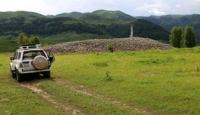
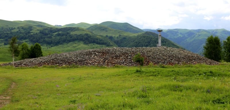
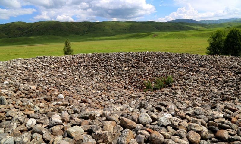
Burial mound of Uygen-Tas stones.
Traveling around Zhetysu region.
"There, in the tops of Lepsy, there is a high earthen mound, lined with stones. On this elevation, the Dzungar khan allegedly administered justice and punishment to the assembled Dzungars, and around this mound there were various public meetings, celebrations and national amusements."
August 24, 1865. N. A. Abramov. "Verkhlepsinskaya stanitsa, with its environs, in 1864".
Monuments of Zhetysu region.
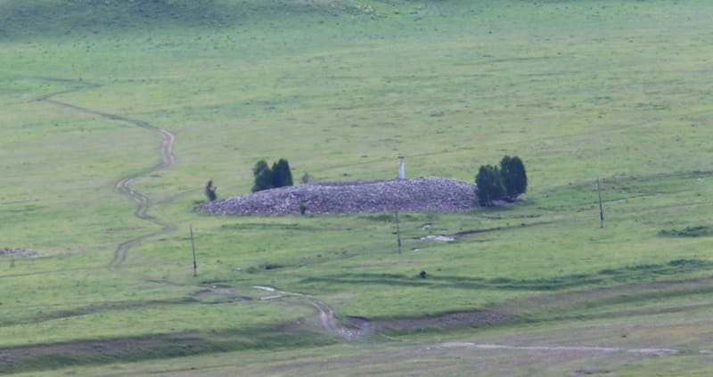
Burial mound of oval stones Uygen-Tas is located at an altitude of 1374 meters above sea level, located between Tentek and Ipili rivers, 437 meters east of right bank of Tentek River, 1 km north and slightly west of Uygentas border outpost of Usharalsky district , 37 kilometers by road to east and a little south of village of Lepsinsk, in southeastern part of Zhuzhuru mountains, on northern slope of Dzhungarsky (Zhetysu) Alatau ridge, in Alakolsky district of Zhetysu region.
250 meters to the south of the Uigen-Tas mound, there are G-shaped ruins with sagging earthen walls, which consisted of five rooms with separate entrances measuring 20 x 10 meters. 140 meters northwest of the mound is another completely identical G-shaped structure.
The dimensions of the Uygen-Tas barrow are: height 6 meters, the length of the barrow from south to north is 65 meters, the width from west to east is 74 meters, the area of the barrow is 3778.78 square meters, the perimeter of the barrow reaches 221 meters.
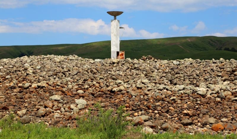
Apparently, the barrow is a burial place. On the right-bank terrace of the Tentek River, in the vicinity of the mound, there are about ten small burials. In the center of the mound there is a reinforced concrete structure without inscriptions.
Judging by the hollow, collapsed central part, the mound was plundered in antiquity. Modern excavations and surveys by archaeologists have not been carried out. A well-known legend about Tamerlane, who passed here with the army, is connected with the mound.
The terrible ruler ordered each of his soldiers to put a stone in a pile. Returning, each warrior also took one boulder from the pile. The remaining and counted stones gave the number of those killed in battles. A very similar burial mound San-Tash, somewhat smaller, made of the same oval stones, is located in the Tyup district of the Issyk-Kul region in the southeastern part of the Kungei Alatau ridge.
The Kazakh explorer and traveler Chokan Valikhanov visited the San-Tash mound in May 1856.
Geographic coordinates of Uygen-Tas burial mounds: N45°30'21 E80°55'14
Authority and photos by:
Alexander Petrov.