


![]()
Вы здесь
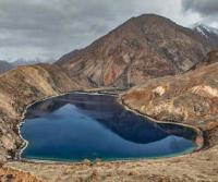
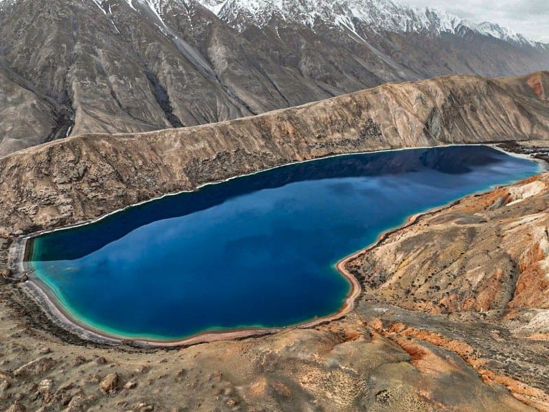
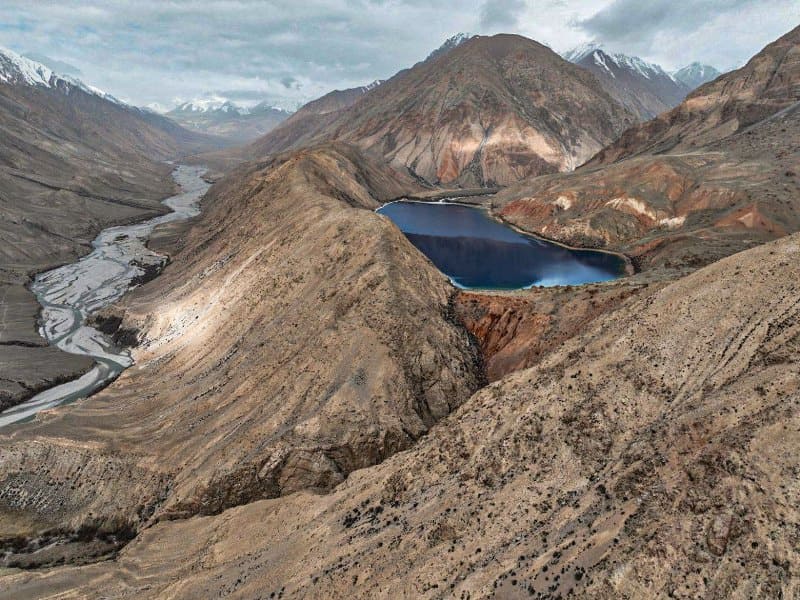
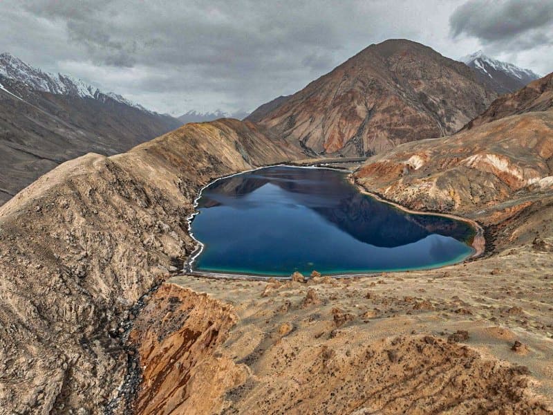
Lake Bash-Kel.
Lakes in mountains Kuyly-Too.
"At the foot of the great mountains
The grass stems sway slightly.
I look up into the blue -
Clouds rush into space
White manes spread out.
...I'm walking along a mountain path,
Meeting the sunrise at the peaks.”
Kalyk Akiev (translated by T. Streshneva).
Trip from village of Enylchek to village of Uchkoshkon.
Fresh, flowing lake Bash-Kel is located at an altitude of 2918 meters above sea level, located on southern slope of Kuylyu-Too ridge, 580 meters from left bank of Uchkel River, between Choktogai valley in east and Dzhilubulak, in Jety-Oguz region in south east of Issyk-Kul region.
On the western side, the Bash-Kel River, 6.7 kilometers long, flows into the lake, which originates from six glaciers in the upper reaches of the river, located on the southern slope of the Kuylyu-Too ridge. The length of the lake from east to west is 1.4 kilometers, the average width in the central part of the lake reaches 440 meters.
The area of the lake is 0.59 square kilometers, the length of the coastline is 3.59 kilometers. A 1.3-kilometer-long stream flows from the southeastern part of the lake, which is a left tributary of the Uchkel River. Due to abundant moisture, the river delta and lake shores are overgrown with low-growing bushes in some places.
The soils of the northern side of the lake are composed of pink and red clays, which gives the lake a picturesque and shining appearance.
Geographic coordinates of Lake Bash-Kel: N41°54'52 E78°45'28

Authority:
Alexander Petrov.
Photos by:
Alexey Ognev.