Вы здесь
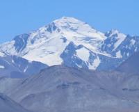
Glacier and river Darkharvak.

Rivers of Obimazor River basin.
"The world is boundless delight
Given to the singing heart"
Alexander Alexandrovich Blok.
Glaciers of Obihingou River basin.
Glacier and Darkharvak river are located between western slopes of Darkvarvak ridge and eastern slopes of Darvaz and Zotkin ridges, in North-Western Pamirs, in Sangvor region of Republic of Tajikistan.
River Darkharvak.
At 17.8 kilometers from the beginning of the sources of the Obimazor River, a tributary, Darkharvak, flows in on the left, 24 kilometers long.
Darkharvak glacier.
The river receives its sources from the Darkhvarvak glacier, at an altitude of 3727 meters above sea level, located at the junction of the ridges: Darvazsky with a length of 203 kilometers, Kuhiruzak with a length of 30 kilometers and Kuhibunay with a length of 12 kilometers.
The complex valley glacier Darkharvak consists of 5 branches and belongs to the basin of the Darkharvak and Obimazor rivers. The length of the Darkharvak glacier, located on the northern slope of the Darvaz ridge, is 7 kilometers. The area of the glacier reaches 32.04 square kilometers, the perimeter of the glacier is 57.11 kilometers.
The upper boundary of the glacier is located at an altitude of 5387 and 5131 meters above sea level. In the upper reaches of the Darkharvak glacier, the Bunai pass is located at a height of 4598 meters above sea level.
Geographic coordinates of Darkharvak glacier: N38°30'15 E71°25'52
The mouth of the river is located at an altitude of 2504 meters above sea level. Darkhvarvak has: 18 left and 14 right tributaries.
Geographic coordinates of Darkharvak River: N38°36'20 E71°18'54
Authority and photos by
Alexander Petrov.


