Вы здесь
Tour to Karynzharyk depression and Bulyoyyk cave.


ours on caves of Mangyshlak.
«The tourist goes for one thousand miles to be photographed at the machine»
Emil Geinst.
Short description of tour route on Mangyshlak:
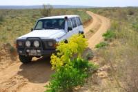
Aktau town – depression Karagie – Zhanaozen town – sand Tuiesu – mountain Bokty - cretaceous columns Baisary – valley Bozzhyra – Karynzharyk depression – cave Balayuk – cave Utebay – Aktau town.
Distance of route: 863 km.
Season: April - middle of October.
Best time for travel: April, May, June, September.
Duration of tour: 6 days, 5nights.
Detailed the program day by day across Mangistau of province:
Tourist destination on Mangyshlak.
1 day. Town of Aktau - valley Bozzhyra - (295 km).
Transfer: Актау - hollow Карагие (30 km).
After Актау, during 31 kilometers, asphalt road crosses one of deep hollows of Kazakhstan - Karagie, which on 132 meters below a level of Baltic sea. The lowest place where there passes a motorway - 119 meters. Walk in vicinities, a stop for photographing.
Transfer: hollow Karagie - town of Zhanaozen - settlement Senek - sand Tuiesu (170 km).
Walk on sand among barchans, photographing.
Transfer: sand Tuiesu - farewell mountain Bokty (37 km).
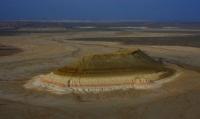
Lunch in a way. From the southern party this mountain is very similar to a pyramid, photographing.
Transfer: mountain Bokty - cretaceous columns Baisary (25 km).
Walk in vicinities around columns Baisary, photographing.
Transfer: mountain Bokty - valleyy Bozzhyra (33 km). A
rrival in valleyBoszhira. Placing of camp on Oinak Bozzhyra. Dinner and overnight.
2 day. Valley Bozzhyra.
Breakfast. Walk in vicinities, photographing of Azu ticteri Bozzhyra and other places of interest of valley. Transfer to cretaceous bottom of mount Ulken keme. Rise on a cretaceous slope on a plateau which is located between a rock the mount Borly tau and Ulken keme on plateau we leave to the Deep canyon.
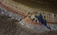
Photographing of a canyon from nearby rocks and vicinities. From here in northwest the dome-shaped cretaceous mountain which is represented on 1000 tenge to a banknote of Kazakhstan is well visible. Lunch in a way.
Ascention on mountain Ulken keme, we pass on east cretaceous a slope to ancient walls constructed of a stone. It is possible to assume, what is it the hunting shelters - arans or time shelter of people. Gradually we rise on a flat surface of mountain and it is gone to a southern extremity of mountain.
From here from edge of breakage of mountain the tremendous kind on Azu tisteri Bozzhyra opens, all southern part of valley Bozzhyra from here is well looked through. Returning in camp on a way rise. Dinner and overnight in tents in valley Bozzhyra.
3 day. Vaalley Bozzhyra - hollow Karyn-Zharyk (130 km).
Breakfast. Transfer: natural boundary Bozzhyra - settlement Ak-Kuduk - plateau Ak-Kuduk - sand Karyn-Zharyk - reserve Ustjurtsky - hollow Karyn-Zharyk (130 km).
We leave one of the most beautiful places of Mangyshlak and road conducts us on the south to new and novel beauty Mangyshlak. On a way the small settlement Ak-Kuduk which has got lost in sand of Mangyshlak is passed, here it is possible to fill up stocks of water.
On a way visiting of small plateau Ak-Kuduk with which wonderful and unforgettable kinds on surrounding steppes open. Further we cross sand Karyn-Zharyk with beautiful panoramas of cretaceous adjournment in the western part of sand. We pass sand and our way proceeds on an equal surface of plain which borders on hollow Karyn-Zharyk which is on 75 meters below a sea level. Lunch in a way.
Visiting of a cordon of reserve Ustyrt, transfer to a southeast extremity of a hollow. Placing of camp on the western slope of a hollow. Directly before us kinds on unique islands Three Brothers in saline land, located in a southern part saline land. Dinner and overnight in the tents.
4 day. Hollow Karyn-Zharyk - cave Bulyoyyk (58 km).
Breakfast. Transfer: hollow Karyn-Zharyk - hollow Utebai (58 km).
Arrival on hollow Utebai, descent, walk on friable ground and a deep dust in the main branch of a hollow, extent more than 70 meters, photographing. Visiting of a jack of an owl. Rise on a surface.
Transfer: hollow Utebai - cave Bulyoyyk (11 km).
A lunch. This one of deserted places of our way, on this way is only roads leaders in the different parties. From cave Bulyoyyk of 25 kilometers up to border with Republic Uzbekistan. Arrival on cave Bulyoyyk, preparation for descent in a cave.
Descent in a cave, overcoming of rocky ledges with use of the insurance. Length of a cave about 200 meters, an average and sometimes a steep bias. At the bottom of a cave there is a crystal-clear blue lake, water in lake salty and cold. Returning from a cave on a surface. Dinner and overnight in tents at a cave.
5 day. Cave Bulyoyyk - Zhanaozen city (230 km).
Breakfast. Transfer: cave Bulyoyyk - reserve Ustyurt - settlement Ak-Kuduk - settlement Senek - sand Tuiesu (180 km).
In northern part of settlement Senek the most beautiful sand of Mangyshlak - Tuiesu are located. Walk on sand Tuiesu, photographing. Lunch in vicinities.
Further transfer: sand Tuiesu - settlement Kyzylsai - the city of Zhanaozen (50 km).
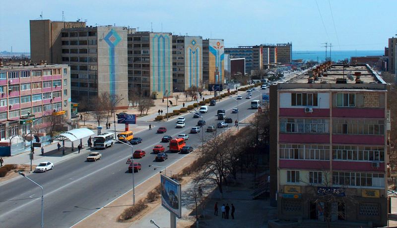
Arrival in Zhanaozen, transfer to hotel, accommodation. Evening walk by the central part of city. Dinner and overnight.
6 day. Zhanaozen - Aktau (150 km).
Breakfast. Transfer: Zhanaozen - Aktau.
For 60 kilometers before the city of Aktau descent in the deepest hollow in Kazakhstan - Karagie begins, its depth makes 132 meters below a level of Baltic sea. Sightseeing of vicinities of a hollow from a viewing platform near to Aktau. Arrival in Aktau, a farewell lunch local restaurant. The end of the program.

Note:
Author program is Alexander Petrov. Copying and use only from the sanction of the - petrovsra@mail.ru
Alexander Petrov
photos.


