Вы здесь
Barskoon site of ancient town.

Medieval town of Barskan (Barsgan, Barskhai).
"We arrived at the mouth of the Barskoon already at dusk; here were the deepest ravines, with small streams from the foothills, and the deepest of all was the ravine of Barskoon itself, where we stopped in the long-abandoned Kokand burial mound (i.e. between its half-ruined clay walls; there is nothing else; 3 miles higher - more ancient, also clay; both are mentioned by Protsenko.)"
"Travel through Turkestan region and exploration of the mountainous country of Tien-Shan." N. A. Severtsov. 1873.
Visit to Barskoon hillfort.
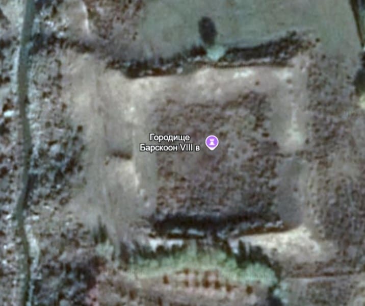
Barskoon settlement is located at an altitude of 1961 meters above sea level, 158 meters from right bank of Barskoon River, 5.3 kilometers south of village of same name, on northern slope of Terskey Ala-Too ridge, in Jety-Oguz district of Issyk-Kul region.
The first information about the nomadic peoples of Semirechye and the Tien Shan valleys can be found in ancient Persian cuneiform texts of the 6th century BC, carved by order of the Persian king Darius I on the Behistun rock.
The Behistun inscription tells of Darius's campaign in Central Asia and lists the conquered peoples, including the Saka-Sarmatians:
"Darius the king says: then I went with an army to the country of the Sakas. The Sakas, wearing pointed hats, came out to meet them, ready for battle. When we approached the water barrier (probably the Syr Darya), I crossed it with the entire army. After this, part of the Sakas was completely defeated, and the rest were taken prisoner.
Their leader, named Skunkha, was captured and brought to me. Then I appointed another leader at my discretion, and the country came under my power. " The Sakas are also mentioned in the Nakshirustam inscription of Darius and in other texts.
There is a version that the word "saka" is a simplified transcription of the term meaning "valiant man".
Medieval town of Barskan (Barsgan, Barskhai), with an eponymous fiefdom on the southeastern coast of Issyk-Kul (VIII - XIII centuries). By the XI century, the semi-nomadic population of Barskan was distinguished by a special dialect among the Karakhanid Turks.
The town was famous for its key position on the northern branch of the Great Silk Road and is recorded in Muslim sources of the 9th-13th centuries as "Barskan", "Upper Barskhan" (in some Arabic sources it was read as "Nushjan"), "Upper Nushjan".
The great Turkic scholar Mahmud ibn Hussein, who was from Barskhan, marks it on a round map of the world, included in his work "Divan lugat at-turk" ("Dictionary of Turkic languages"), in the form of "Barskan" and gives a folk etymology (Turkic anthroponym).
The name of medieval Barskan is reflected in the modern toponyms Barskaun (Barskoy) - the names of a river and a village in the Jety-Oguz region. According to Arab-Persian sources from the 9th century, this place is surrounded by a legend that during his campaign in China, Alexander the Great placed Persian warriors here, promising to return for them on the way back.
However, his return passed through India, and the promise was never kept...
Barskoon site of ancient settlement consists of the central ruins (citadel and shakhristan) and the territory surrounded by a long wall. The total area of the settlement is 3970.86 square meters, the perimeter reaches 252.3 meters. The settlement is square in plan, the length of the northern and southern walls is 61 meters, the western and eastern - 63 meters.
Identified with the city of Barskan, mentioned in written sources of the 9th - 13th centuries. The settlement was discovered by D. F. Vinnik in 1959. During excavations at the settlement, remains of rooms, utility pits were uncovered, and clay and stone items were collected.
The material obtained is typical for the VIIIth – XIIth centuries. Around 20 small settlements from the Vth – XIIth centuries have been preserved in the area of the settlement. In the XIXth century, it was used as the Kokand fortress, the fortress garrison was destroyed during Kyrgyz rebellion against the Kokand people in 1842.
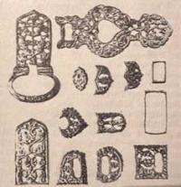
Barskoon of artifacts. A hoard of handicrafts from the Saka period. It was found in 1968 by local schoolchildren in a burial mound southeast of the village of Barskoon (southern shore of Lake Issyk-Kul). The hoard contained about 120 copper stamped plaques of 12 types, scraps of sheet metal, bowls, etc.
The plaques depict zoomorphic images and various forms of geometric and plant ornaments (including the “tree of life” theme). Stylistically, the plaques of the Barskoon hoard are closest to those from the Issyk burial mound, which served as clothing decoration.
There are also holes for sewing on the plaques of the Barskoon hoard. The motifs of the Barskoon treasure images are also associated with carved wooden art objects of the early nomads of Altai. The Barskoon treasure suggests local production of these objects.
Dated to the Vth – IIIrd centuries BC. Stored in the collections of the Institute of History of the Academy of Sciences of Kyrgyzstan.
Geographical coordinates of Barskoon settlement: N42°05'33 E77°35'40

Authority:
Encyclopedia "Issyk-Kol. Naryn". Academy of Sciences of Kyrgyz SSR. Frunze. 1991.
Alexander Petrov.


