







Вы здесь
Dzhukuchak Pass.
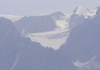
High mountain passes in Terskey Ala-Too range.
"Zaukshak from the south is easy to climb. The road goes along the glacier along moraines. The descent is very unpleasant; first along the moraine, then along the ice covered with cracks, then along the giant terminal moraine, between huge boulders, along slippery, narrow paths. This is the most unpleasant of all the passes I have visited. We pass Kyulyu only for horsemen; Bedel and for camels (although it’s hard for the latter); Zaukshak is also hard for horses.”
"An Essay on Historical Development of Flora of Southern Part of Eastern Tien-Shan. Discourses for Degree of Master of Botany by A.N. Krasnov." 1888.
Hiking from Dzhukuchak Gorge to Arabel high plateau.
Dzhukuchak Pass is route from Issyk-Kul Basin to high-mountain szyrts of Central Tien-Shan.
High on the main ridge of the Terskey Ala-Too Range, where the dense Tien Shan spruce forests end and a world of harsh, rocky wastelands begins, lies the Dzhukuchak Pass, one of the most famous high-altitude crossings to the high mountains of the Central Tien Shan. For centuries, shepherds, hunters, trade caravans, geologists, and the first explorers of Kyrgyzstan's mountains passed through it.
Today, the pass remains an important sport tourism destination and one of the most interesting routes, allowing you to traverse virtually all of the Terskey Ala-Too's natural zones in a single day - from the forest zone to the high-altitude nival landscapes.
Geographical location of Dzhukuchak Pass.
Dzhukuchak Pass is located at an altitude of 4,042 m. a. s. l.. m. in the main ridge of the Terskey Ala-Too Range, in the upper reaches of the Dzhukuchak River of the same name, in the Jety-Oguz District of the Issyk-Kul Region of Kyrgyzstan.
The pass connects the northern slopes of the Terskey Ala-Too Range with the high-mountain Arabel Plateau, serving as a natural transition between the Lake Issyk-Kul basin and the Naryn River valley. An ancient route passes through its saddle, long used for seasonal cattle migrations and communication between the northern and interior regions of the Tien-Shan.
According to the tourist classification, the pass is classified as category 1A, making it accessible to well-prepared hikers and horseback riders in favorable weather conditions.
Physical and geographical characteristics of Dzhukuchak Pass.
The pass is located in one of the highest sections of the Terskey Ala-Too, where the modern topography was shaped by the combined action of tectonic processes and ancient glaciation. The main ridge is composed primarily of granite, granodiorite, and other igneous rocks that are resistant to erosion.
However, the harsh highland climate has intensively reworked these massifs over millennia. Frost weathering has fractured the rocks, forming extensive kurums, scree, and scattered large boulders that cover the slopes of the pass today. During the Quaternary glaciation, the Dzhukuchak area was completely covered by powerful glaciers.
They formed the characteristic trough valleys, glacial cirques, moraine ridges, and polished rock surfaces that remain well preserved to this day. Despite the gradual reduction in the area of modern glaciers, small glacial patches and perennial snowfields still remain in the vicinity of the pass.
These present virtually no technical difficulties for crossing in the summer, yet they continue to play an important role in feeding the rivers of the Central Tien-Shan. A particularly interesting feature of the pass is its location on one of the largest watersheds in Asia.
From here, surface waters flow in several directions. The northern slopes feed the Issyk-Kul basin. The southern waters flow to the Naryn River, the main component of the Syr Darya. The eastern highlands, through the Sarydzhaz and Aksu river systems, belong to the basin of the great Tarim River.
Thus, the Dzhukuchak Pass is located near one of the most important hydrographic junctions of the Central Tien-Shan.
Altitude zonation of Dzhukuchak Pass.
The route through the pass is a unique excursion through the natural zones of the Northern Tien-Shan. The lower part of the Dzhukuchak Valley is covered with dense forests of Tien Shan Schrenk spruce. Along with the spruce, birch, rowan, honeysuckle, barberry, currant, and numerous shrub species grow.
As the altitude increases, the forest gradually thins, giving way to juniper thickets, subalpine meadows, and forbs. Above 3,300-3,400 m. a. s. l., the kingdom of alpine meadows begins. In summer, they are painted in vibrant hues by the blooming gentians, primroses, edelweiss, poppies, forget-me-nots, and other alpine plants.
Even higher up, vegetation virtually disappears. Here, rock scree, nival areas, snowfields, and glacial landforms predominate. Fauna includes marmots, pikas, argali, and Siberian ibex. Golden eagles, bearded vultures, and Himalayan vultures are often seen above the pass. Snow leopards can be found in the most inaccessible areas of the Terskey Ala-Too.
History of Dzhukuchak Pass.
The history of the Dzhukuchak Pass is closely linked to the development of the Central Tien-Shan. Long before the advent of modern roads, seasonal routes of nomads crossed it, driving huge herds between the high-altitude summer pastures of Arabel and the northern valleys of Issyk-Kul.
Later, trade caravans began to travel along this same road. In the second half of the XIXth and early XXth centuries, one of the routes connecting the Chinese cities of Aksu, Turpan, and Kashgar with Przhevalsk, the eastern Issyk-Kul region, and Semirechye passed through the pass.
Caravans brought silk and cotton fabrics, tea, and other oriental goods from East Turkestan, and returned with calico, metal goods, salt, samovars, and products from Russian factories. In the early XXth century, a project to build a road here was even considered.
"Sovsintorg" depots were established to develop trade with China. However, a more convenient automobile route was later built through the Barskoon Pass, and the ancient caravan route once again became a road used only by shepherds and travelers.
The renowned botanist Andrei Nikolaevich Krasnov left a particularly interesting description of the northern descent. During his explorations of the Tien Shan, he noted that the descent along the Dzhukuchak rock scree is one of the most difficult sections for horses due to the enormous number of boulders, scree, and slippery sections of ancient moraines.
Legends of Dzhukuchak Pass.
For Kyrgyz nomads, each high pass held special significance. They were perceived as a boundary between different worlds - green valleys teeming with life and harsh highlands subject only to snow, wind, and mountain spirits.
There is an ancient belief that the Dzhukuchak Pass is guarded by the Lord of the Highlands - an invisible spirit who favors only those who treat the mountains with respect. Old shepherds used to say that a traveler entering the mountains with good intentions will always find a safe path, while carelessness and arrogance can result in sudden bad weather or the loss of the trail.
To this day, the custom of briefly stopping at the saddle of a pass to thank the mountains for a safe ascent and ask for good luck before continuing onward has survived. Similar traditions are known at virtually all ancient passes of the Tien Shan and are part of the centuries-old culture of mountain nomads.
Tourism via Dzhukuchak Pass.
Today, the Dzhukuchak Pass remains one of the most popular high-altitude routes in the Issyk-Kul region. The journey usually begins in the Dzhukuchak Gorge, famous for its hot mineral springs, Dzhyluu-Suu. These radon-rich thermal waters have long been a popular resort where tourists can recuperate before the long climb.
The road then gradually ascends through a majestic spruce forest, passes alpine pastures, and emerges into a world of high-mountain moraines and glaciers. From the summit of the pass, sweeping panoramas of the Terskey Ala-Too, the Arabel high plateau, and numerous glaciers of the Central Tien-Shan open up.
The best time to hike this route is from July to early September. Even during this period, snowfalls, strong winds, and sudden drops in temperature are possible at altitudes above four thousand meters. Therefore, the ascent requires good physical fitness, warm clothing, reliable footwear, and experience in high-altitude travel.
Dzhukuchak Pass of Three Worlds.
Dzhukuchak is more than just a convenient passage through the Terskey Ala-Too. It is a place where the scale of the Terskey Ala-Too Mountains and the Central Tien Shan is especially vividly felt. Three worlds meet here: the green forests of the Issyk-Kul Basin, the rugged high-mountain syrts of Arabel, and the endless highlands and syrts of the Asian interior.
For centuries, caravans, nomads, explorers, and travelers have traveled this trail. Today, they have been replaced by tourists, but the road itself remains virtually unchanged. It still leads through rock moraines, alpine meadows, and snowfields, allowing you to experience the Tien-Shan that was once revealed to the first explorers of these great mountains.
This is how V.I. Lipsky describes crossing of Dzhukuchak Pass in 1903.
“It turned out that locating the pass wasn’t easy. We were moving through solid snow, which at its very top formed a spherical surface, almost equally sloping to both north and south. And somewhere here lies the pass point. But there was no pass in the true sense, as is usually understood.
Once past the highest pass point and descending somewhat to the other side, you notice that the pass was right there. Due to this circumstance, I also missed the pass, and so I had to measure it slightly lower. On the left side of the pass lies a long, completely snow-covered wall, which produces snow on both sides of the pass: i.e.
Snow falls from the same wall on both sides of the pass. What was quite interesting was that, standing at the highest snow point near the pass, I could clearly hear the murmur of a small river beneath the snow—a rather strange and difficult to explain phenomenon.
As I have already noted, I had to measure the pass's elevation not at the pass point itself, which I had overlooked and missed, but a little lower. The descent to the southern side was rather unpleasant. After loose, uncomfortable snow, where the horse kept sinking, came a very awkward, rocky descent.
So I descended about 300 feet below the pass before I found a spot where I could set up a hypsothermometer for boiling. The elevation of this spot is 13,540 feet, which means the pass's elevation is no less than 13,540 feet. The scene on the other side of the Zaukuchak Pass was unexpected.
Descending from the pass, you immediately find yourself in a rocky area: the entire area south of the pass consists of rock debris from the left (eastern) side, which appears to be a ruin. Descending from the pass, you immediately find yourself in a rocky area: the entire area south of the pass consists of rock debris from the left (eastern) side, which appears to be a ruin.
And this entire rocky area is full of water: streams, lakes, and melting snow. Such is the valley below, which, despite its altitude, thanks to its southern exposure, is almost snow-free. Only to the right (i.e., to the west), at a certain height, is a significant snow slope with firnak visible. In general, the heights on both sides of the valley have little snow.
If you drive a little further back and descend, then to the left, behind you, that is, closer to the pass, you see a snowfield falling in two ridges, and perhaps there is also ice there.
V.I. Lipsky. "Flora of Central Asia, i.e., Russian Turkestan and Khanates of Bukhara and Khiva." 1902-1903.
B.I. Rukavishnikov on Dzhukuchak Gorge and pass of same name in 1970.
"A little above the Dzhukinsky Forestry office, a large right tributary of the Dzhukuchak flows into the Dzhuku, over which a bridge is built at its mouth. Beyond the bridge, the trail runs 20 km along the left bank of the Dzhukuchak River to a glacier descending on both sides of the Dzhukuchak Pass.
You'll need to spend the night here. The pass is reached from the terminal moraine, about an hour's walk along the left side of the glacier. A huge icefall lies on the glacier to the east. The descent from the pass to the south is first along the glacier, then along the left slope of the valley, which is cluttered with scree.
After 30-40 minutes, the scree gives way to a green meadow. 0.5 km south of the end of the glacier lies a large lake, and 1 km beyond that is a second lake, from which flows the Arabel River, the left source of the Taragay River.
B.I. Rukavishnikov. "Lake Issyk-Kul and the Terskey Alatau Range." Moscow, Physical Culture and Sport, 1970.
Geographical coordinates of Dzhukuchak Pass: N42°01'21 E78°06'41
Authority and photos by:
Alexander Petrov.