







Вы здесь
Pickets from Semipalatinsk to Verny.
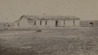
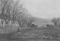
Pickets in Semirechye.
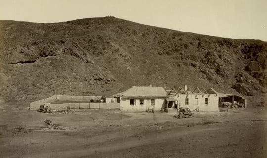
"A picket is a small house built near a river, or - in the absence of one - near a lake or well. The house contains a barracks for seven or twelve - or sometimes, depending on the strategic importance of the location, fifteen or more - Cossacks. A small vestibule separates the barracks from a room for travelers. If an officer is stationed at the picket, he occupies this room. The picket also includes stables, carriage sheds, barns, cellars, and other outbuildings. Most of the structures are enclosed by a ditch and an earthen rampart. The pickets are spaced 20, 25, or even 30 versts apart. Each picket maintains post horses and Cossack drivers. The purpose of these pickets is to secure communications between the steppe districts."
Archpriest Mikhail Putintsev. "From Semipalatinsk to Kopal," 1865.
Military fortifications on route from Semipalatinsk to Verny.
Until the end of the XIXth century, the term "picket" in Russian and European armies referred to an outpost, a field guard, or a small group of people guarding a specific location. To facilitate communication with the detachment at Kopal, a postal route between Ayaguz and Kopal was established by Imperial decree on May 22, 1848.
This required the construction of 12 pickets between the Ayaguzskaya stanitsa and Kopal, including the Juz-Agach picket. Today, Zhuzagash is a settlement in the Ayagoz District of the East Kazakhstan Region. Between 1847 and 1854 - following the uprising of Kenesary Kasymov and the submission of most Kazakh clans to Russian rule - Siberian Cossacks sought to protect the territory and its population from the expansionist ambitions of neighboring states (the Kokand Khanate and the Qing Empire).
They re-established Ayaguz in the Zailiysky region (Semirechye) and founded a series of military outposts - such as Chubar-Agach - as well as permanent urban settlements like Kapal and Verny (Almaty), which together formed the New Siberian Border Line.
A chain of 40 pickets was constructed over a distance of 1,100 kilometers, stretching from Semipalatinsk to the Vernoye fortification via the Sergiopol outpost. "Taking advantage of the weakness of our Orenburg and Siberian border lines - separated by an unoccupied stretch of 800 versts - the Khivans and Kokandians incessantly invaded our territory to plunder the Kyrgyz peoples under our rule.
To halt these incursions, we launched our own expeditions, destroying the fortifications closest to our borders that served as staging grounds for Kokandian raiding parties. Consequently, we successively captured Ak-Mechet, Zhulek, Yany, and Din-Kurgan on the Syr Darya River, as well as Tokmak and Pishpek beyond the Chu River.
However, despite the enormous costs involved, such temporary expeditions proved insufficient to ensure the region's lasting security; it was therefore deemed necessary to close the gap between the Siberian and Orenburg lines by constructing several intermediate fortifications in the unoccupied territory."
"This undertaking has now not only been carried out, but the brilliant successes of the current year have made it possible to complete in a single summer a plan originally intended for a later date - contingent upon particularly favorable circumstances - namely, to move beyond the temporary boundary along the northern slopes of the Alexandrovsky and Karatau ranges and immediately occupy the entire Turkestan region, establishing a forward line from Verny to Aulie-Ata along the mountain foothills, and continuing south of the mountains via Chimkent to Turkestan."
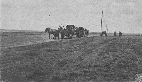
Memorandum from Minister of Foreign Affairs A. Gorchakov and Minister of War D. Milyutin to Emperor Alexander II regarding policy in Central Asia and Kazakhstan. November 20, 1864.
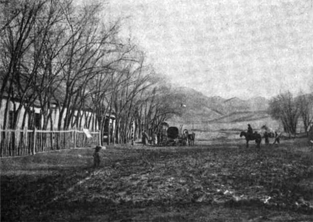
Cossack outposts or pickets are established along the entire steppe postal route at intervals of 20 to 40 versts. They consist of a small building made of stone (or sun-dried brick) divided into two sections: one houses the Cossacks and postal drivers, while the other is reserved for travelers.
Adjoining the rear of the building is a courtyard containing stables and outbuildings. Some outposts were surrounded by a small ditch and rampart; this was because - especially in the early days of our settlement in the steppe - the Kyrgyz, while out on raids to rustle livestock, were not averse to attacking an outpost and would readily make off with Cossack or postal horses.
We stopped near these outposts solely because one could usually find good water and forage for horses and livestock there. The posts offered no other amenities.
A. Shipilov. "Crossing the Yugontas: First Encounter and Clash with the Chinese." 1863.
"All the outposts are laid out according to the same plan, consisting of a long building divided in the middle by a passageway; on either side of this, within the courtyard, two staircases have been constructed. One leads to the barracks where the Cossacks sleep, while the other leads to a reasonably clean and spacious room intended for travelers.
A stable and a shed stand at the rear of the courtyard. The building walls are made of clay; in addition to small windows facing the courtyard, they feature loopholes. The entire complex is enclosed by an earthen rampart and a shallow ditch." This is how Vlangali describes these outposts, which in 1851 were likely still deemed necessary and maintained in their original state.
However, the ones we encountered were in a truly wretched condition: hardly any traces of the rampart or ditch remained, and instead of soldiers, there was only a horse-keeper. Kazakh yurts usually stand near the clay building; the occupants tend the horses and serve the outpost keeper.
As in many Cossack settlements, the Kazakhs here lead a sedentary life - out of necessity. Known as "dzhetaks," they are people who often work for years to pay off debts incurred out of desperation while trying to secure food during the winter».
"Journey to Western Siberia by Dr. O. Finsch and A. Brehm," 1882.
"From Semipalatinsk to the town of Sergiopol, the road stretched for 27.25 versts, passing through outposts spaced between 22 and 37 versts apart." These outposts were manned by Siberian Line Cossacks and maintained both contract postal horses and *zemstvo* horses for the use of traveling officials.
Communication between the district headquarters and the frontier line was conducted safely and without interruption along these military roads, although travelers were sometimes provided with a Cossack escort as a precaution. From Semipalatinsk to Kopal and onward to Almaty (the fortification of Verny), the military road ran through the outer districts of Ayaguz, Kopal, and Alatau.
Initially, the terrain beyond the frontier line was flat steppe, but further on - before reaching Sergiopol - the road encountered the spurs of the Kolbinsky and Chingiz-Tau ranges. Later, the route followed the Ayaguz River and the edge of Lake Balkhash; after passing Kopal, the terrain became mountainous again all the way to Almaty.
The journey was a unique experience! Cossack and Kazakh horses - true steppe breeds - would gallop at full speed, pulling the *tarantas* carriage (wherever the terrain permitted wheeled travel) amidst the wild whooping of the drivers, the prancing of the escort, and all the trappings of an Asian journey.
Amenities were scarce, save for a few well-populated settlements like Kopal and Almaty. Yet, during the pleasant summer season - or, more precisely, in late May, before the onset of the scorching heat - life in this part of the steppe, and the journey across it, offered not merely comfort but a certain poetic charm.
Many areas bore no resemblance to the steppe at all».
Captain of General Staff Alexander Fyodorovich Golubev. Monograph «Ala-Kul» («Notes on General Geography: Physical and Mathematical». 1867, Vol. I. «Notes of Imperial Russian Geographical Society»).
The initial transport routes connecting Siberia with Semirechye were the postal roads running from Semipalatinsk to Ayaguz, and from Ayaguz to Kapal and Verny. Ayaguz was linked to Kapal by a postal route in 1848-1849, and Verny to Kapal in 1855.
The postal stations - or "pickets," as they were known at the time - were built by the Cossacks themselves under official orders; they were designed so that each picket served as a defensive outpost. Such an arrangement was essential during those turbulent times, as any other configuration would have inevitably led to their being looted by the Kyrgyz.
These pickets were manned by active-duty and reserve Cossacks; for this purpose, entire field companies of one hundred - and earlier, "detachments" - were deployed across the region. Active-duty Cossacks formed the garrisons of the pickets and provided escorts armed escort for travelers and the mail between outposts, while reserve Cossacks served as post-drivers.
A station overseer - drawn from the ranks of the junior Cossack officers - was appointed at each outpost; his duties included supervising the military postal horses, wagons, and harness, as well as managing all other postal operations. The first post office - or, more accurately, a branch of the Semipalatinsk post office - was established in 1852 in Ayaguz, attached to the district administration; in 1856, following the designation of the Kopalskaya stanitsa as a district town, a post office was opened there as well.
This post office served not only the Kopal military district but also the Alatau district, handling ordinary and registered mail (including money remittances) arriving from Siberia and Ayaguz was delivered to this department, where it was received by an officer specially detailed for this purpose from Verny twice a month.
The officer in charge of deliveries also transported official correspondence from Verny to Kapal. All postal routes in Semirechye came under direct government administration only at the beginning of 1867; only then were the Cossacks relieved of duties - such as serving as post-drivers and station masters - that were ill-suited to their calling.
Cossack historian N.V. Ledenyov. “History of Semirechye Cossack Host”. 1909.
1. Semipalatinsk picket.
The road from Semipalatinsk to the town of Sergiopol (formerly the Ayaguz District Administration center) spans a distance of 271¼ versts, passing through a series of outposts spaced between 22 and 37 versts apart (at most). These outposts are garrisoned by Siberian Line Cossacks and maintain both contract postal horses and zemstvo horses for the use of traveling officials.
Communication between the district administrative centers and the frontier line now proceeds safely and without interruption along these military roads - though, naturally, travelers are provided with a Cossack escort as a prudent precaution. From Semipalatinsk, the military road to Kopal and onward to Almaty (the Vernoye fortification) runs through the outer districts - Ayaguz, Kopal, and Alatau - leaving the Kokpekty district to the left.
Upon leaving the frontier line, the terrain is initially flat steppe, but further along - before reaching Sergiopol - one encounters the spurs of the Kolbinsky and Chingiz-Tau mountain ranges. The road then follows the course of the Ayaguz River and skirts the edge of Lake Balkhash; after passing Kopal, the route becomes mountainous again all the way to Almaty.
The journey is a truly unique experience! Cossack and Kyrgyz horses - true children of the steppe - race the carriage (wherever the terrain permits wheeled travel) at a magnificent pace, accompanied by the drivers' wild whooping, the prancing of the escort, and all the trappings of a quintessentially Asian journey.
Amenities are, of course, scarce, save for a few well-populated settlements that have since grown into respectable towns - such as Kopal and Almaty. However, during the pleasant summer season - or, more precisely, in late May, before the onset of intense heat - living in this part of the steppe and traveling across it offer not only enjoyment but also a certain poetic charm”.
*Description of Western Siberia: Siberian-Kirghiz Steppe*. Vol. 3. Moscow, 1867.
Geographic coordinates of Semipalatinsk: N50°25'33 E80°15'07
2. Uluguz picket.
"The expanse between the Irtysh and the Uluguz Outpost - the first such station on my route (a distance of 26 versts) - had the character of a semi-desert. The soil here was sandy and pebbly; the extremely sparse vegetation consisted of feather grass (*Stipa capillata") and wormwood (several species of "Artemisia"), though certain characteristic, distinctly Asian plants had already begun to appear - specifically halophytes (saltworts)."
P. P. Semenov-Tyan-Shansky. “Journey to the Tian-Shan”. 1856-1857.
Geographic coordinates of Uluguz picket: N50°10'25 E80°19'35
3. Arkalyk picket.
"Just four versts or so before reaching the Arkalyk Outpost, I entered a mountain gorge composed of siliceous shale uplifted by green porphyry (greenstone), or diabase."
P. P. Semenov-Tyan-Shansky. “Journey to Tian-Shan”. 1856-1857.
Geographic coordinates of Arkalyk picket: N49°58'33 E80°19'25
4. Achikul picket.
In recent years, there have been relatively few places left where people travel "by post," and very many have no idea what these "post stations" actually were. Every 20-25 kilometers - sometimes more - there stood a post station where coachmen lived and several teams of three horses were kept; presiding over it all with absolute authority was the station master - the supreme arbiter of travelers fates.
Horses were harnessed to special carriages known locally as “trashpankas” - essentially a bare wagon box without seats, whether open-topped or covered. You arranged your belongings inside however you pleased - fashioning a seat or a bed out of them - and could travel sitting or lying down as you wished.
However, at the next station, the “trashpanka” would return to its point of origin, forcing you to transfer your belongings to a new “trashpanka” - a routine repeated throughout the journey. Alternatively, if no horses were available upon your arrival, you had to carry your things into the travelers' waiting room and bide your time until horses could be secured for the next leg of the trip.
If the prospect of constantly transferring your luggage - a task that, incidentally, had to be performed exactly 33 times on the route from the railway to Verny - did not appeal to you, you could acquire your own a long-distance carriage for the journey; in that case, only the horses were changed at the stations.
Anyone could obtain horses, but priority in the queue was given to those traveling "on official business" - that is, on duty - who held special “open warrants.” Otherwise, a strict first-come, first-served policy was observed - based on the moment of each traveler’s arrival at the station should several of them happen to congregate there.
The only ones granted special priority were and diplomatic couriers. Yet such individuals were exceedingly rare on this route; in all my years, I encountered only one of them. Even as he was merely approaching the station, horses were already being led out and harnessed for him.
All matters regarding the provision of horses and the like were decided peremptorily by the station overseer. Travelers were entirely at his mercy. It must be said, however, that the overseer’s position was hardly a tranquil one. There was not a single moment, day or night, when a carrying a traveler might not pull up - with every arrival immediately calling for the overseer and demanding horses.
If no horses were available, the logbook recording horse assignments would be demanded; since most travelers understood nothing of its contents, they would merely leaf through it for the sake of appearances, after which shouting and a scene over the delay would usually ensue. Invariably, every traveler claimed to be on the most urgent business, unable to wait even a minute.
Often, the overseer was entirely in the right - he truly had no horses - yet this did not spare him from the scenes. True, he cared little about them, for the upper hand was always his, and a traveler could shout and curse to his heart’s content. Yet the chronic lack of sleep, the need to leap out of bed at any hour of the night, and the shouting and abuse from hot-headed travelers would eventually embitter the overseers; they came to loathe the travelers, viewing them as their sworn enemies.
Every station had a complaint book; notably, it wasn't kept by the stationmaster but lay right on the table, making it very easy to use. However, your complaint wouldn't be reviewed for another two or three months, and you derived little benefit from the fact that the stationmaster might eventually receive a reprimand.
Even that rarely happened, as the drivers invariably backed up the stationmaster’s version of events, whereas the travelers' complaints usually lacked any corroboration. A complaint only led to consequences if the stationmaster’s actions were truly outrageous and the document bore multiple signatures.
Even then, it didn't mean you would get your horses any faster that day. How long did the journey from the railway to Verny take? It depended on the number of travelers, the volume of mail, and - above all - the weather, or rather the condition of the road.
Under good conditions, the trip took five days, or even four; during the mud season, however, there was no telling how long it might take. I never spent more than sixteen days on the road, but an acquaintance of mine once - in an ill-fated moment - set out from the railway on March 1st and didn't reach Verny until the 31st!
He told me that on the very first leg of the journey, he overtook a soldier returning home to Verny from the army and offered him a ride. The soldier refused with scorn, saying he would get there faster on foot. And he turned out to be almost right; my acquaintance only managed to pull decisively ahead of him just before reaching Verny.
To many people today, traveling by post-coach likely seems like an exhausting ordeal. In reality, this was far from the case: in good weather and on a good road - for instance, in the spring, when the mud has dried but the dust has not yet risen - traveling on horseback held a charm all its own, and a considerable one at that.
You ride alone, out in the open, exactly as you please: fast or slow, sitting or lying down; you stop whenever the fancy strikes, wherever you like, and for as long as you wish. All of nature is at your disposal, and you can enjoy it to the fullest - even making observations or collecting specimens if you desire - rather than having to content yourself with views through a train window, where shapes and people flash by before you can even make them out properly Moreover, the mere fact of spending several days in the fresh air is a source of immense pleasure - not to mention that it is, of course, far healthier than sitting in a train carriage.
I know of cases where sick people made a dramatic recovery during a six- or seven-day horseback journey - something that hardly ever happens on a train. And then there is the thrill of racing behind fine horses down a pass like the Kurdai or the Dolon, admiring the skill and confidence with which the driver handles his team along the countless as the Semirechye Cossacks call the sharp, winding turns typical of mountain paths and roads!
There was a time when I, too, failed to understand the rapture with which Gogol writes of the "bird-troika." Now, having traveled extensively on that very "bird-troika," I fully grasp the meaning of that evocative image of his! But for many of my readers, it may remain incomprehensible - or perhaps even strange - since nowadays, even in the most remote backwaters, mail-coach troikas have been replaced by mail trucks.
One might well trade a horse-drawn carriage for a train, but certainly not for a mail coach! Admittedly, the acquaintance of mine who took thirty days to cover 800 kilometers likely found the experience anything but fun, and I wouldn't wish the ordeal of mail-coach travel during the mud season on anyone.
Yet, attempting that same journey by car during the mud season is arguably even worse than by horse: horses, however slowly, do keep moving, whereas a car on a dirt road spins its wheels and gets hopelessly stuck - something I learned from firsthand experience.
V. N. Shnitnikov. "From a Naturalist's Memoirs: Traveling by Post-Horse." Moscow: Geografgiz, 1958. From chapter "Semirechye: Verny." Alma-Ata, 1943.
https://rus-turk.livejournal.com/544967.html
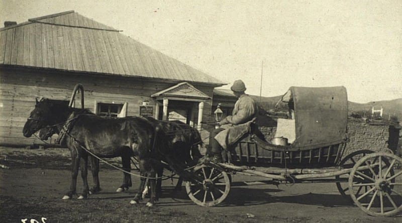
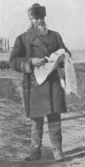
Geographic coordinates of Achikulsky picket: N49°43'24 E80°18'38
5. Jartashsky picket.
Geographic coordinates of Jartashsky picket: N49°30'58 E80°20'55
6. Kyzyl-Mulsky picket.
"The road to the Kyzyl-Mulsky outpost - a distance of 120 versts - is superb; your carriage rolls along as if on a perfectly constructed highway, and a boundless plain, devoid of even a single bush, stretches out before your eyes. Beyond the Kyzyl-Mulsky outpost, the Arkadsky Mountains begin to appear - low, bare crags of every conceivable shape, weathered by time.
There is no vegetation around - only *karagaynik* [scrub brush], about one and a half arshins high, which serves the Kyrgyz people as fuel, alongside *kizyak* (dried livestock dung). *Karagaynik* burns excellently even when freshly cut and produces intense heat; indeed, after heating their stoves with twisted into bundles, our soldiers at the outposts bake bread."
P. Galitsky. "From Semipalatinsk to Verny Fortification." “Sankt-Peterburgskie Vedomosti”. 1868, Nos. 150, 151.
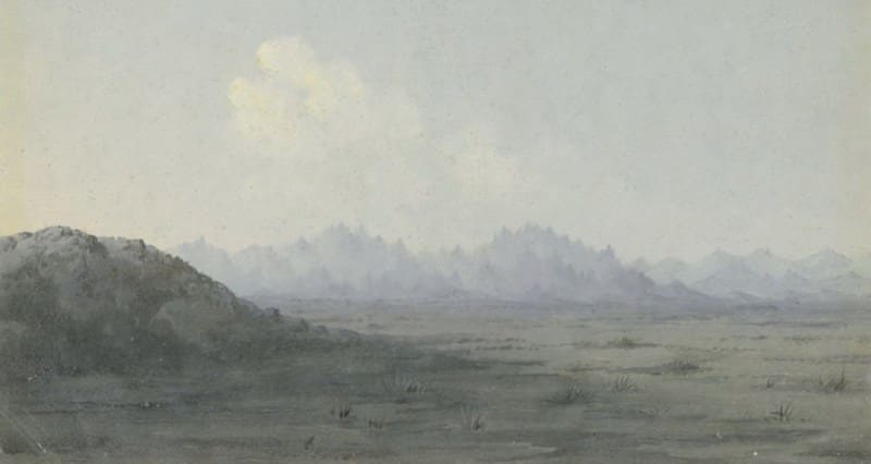
Geographic coordinates of Kyzyl-Mul picket: N49°17'43, E80°23'09.
7. Arkat picket.
“After traveling some thirty versts past Arkalyk, I reached the fifth outpost on my route - the Arkat outpost - only late in the evening on August 6. I spent the night there in my carriage, intending to explore the mountains neighboring the outpost the following morning, August 7.
The night was cool; by morning, the temperature was only +7.5°C. The Arkat outpost was situated to the right of the road, at the foot of a small hill, and was partially encircled by granite mountains - not particularly high, yet sharply defined - arranged in two groups.
One group, lying to the west of the outpost, was called Arkat, while the other, to the southwest, was called Burkat; the latter consisted of an elongated ridge of granite peaks remarkable for their shape, bearing a resemblance to pointed hoods or caps.
I ascended the Arkat mountains on horseback, but climbed the highest crags on foot, clinging to the scrubby vegetation. Their elevation, determined hypsometrically, did not exceed 800 meters. The mountains on the left side of the Kopal road (southeast of the picket station) had a completely different geological structure.
I found their summits to be composed of talc schist, uplifted on the northeastern side by purple porphyry. At the foot of these mountains lay a salt lake that dried up in summer; and Potamogeton perfoliatus as well as certain salt-tolerant plants (such as Statice caspia and St. suffruticosa") grew along its muddy margins, yet it contained no fish.
However, some thirty versts east of Arkat lay a lake teeming with fish - hence its name, Balyk-kul. The granite Arkat and Burkat mountains, with their sharp profiles, were an exception along my route to the Semirechye region.
P. P. Semyonov-Tyan-Shansky. “Journey to the Tian-Shan”. 1856-1857.
“All the way to the Arkat station, a hailstorm chased us; it would catch up and pelt the tarantass and the horses' backs, causing the animals to shudder and break into a faster run. The Arkat station is situated at the foot of a rocky ridge of the same name.
We wanted to rest there but decided it was better to press on so we could reach Semipalatinsk sooner. With nothing else to do, I walked over to the travel schedule hanging on the wall of the station building. They say there’s a bridge across the river, yet the crossing is made by fording!"
The horses have become so accustomed to fording that they take fright at the sight of the bridge ahead; they rear up and struggle wildly in all directions, refusing to set foot on it! And truly, I do not know which is better - to cross a dilapidated bridge that looks ready to collapse at any moment, or to ford the stream!
Boris Smirnov. “In Steppes of Turkestan”. 1914.
Geographic coordinates of Arkat picket: N49°01'57 E80°18'17
8. Aldzhanadrovsky picket.
Geographic coordinates of Adzhanadyrsky picket: N48°49'40 E80°19'08
9. Uzun-Bulaksky picket.
Over the next five stages leading to the town of Ayaguz (a distance of 118 versts), the mountains displayed the dome-like forms and rounded contours characteristic of porphyry uplifts. Such dome-shaped mountains were particularly noticeable between the Usunbulaksky and Ingrekeevsky pickets.
Here, the entire stage traversed hilly terrain. These mountains bore the name Ingrekey and were uplifted by green porphyries (diabases). Beyond the Ingrekeevsky picket, on the way to the Altynkalatsky picket, the steppe becomes flatter. About six versts past the Altynkalatsky picket, our road crossed the dry bed of a dried-up river, which the Cossacks called Gorkaya.
P. P. Semenov-Tyan-Shansky. “Journey to Tian-Shan”. 1856-1857.
Geographic coordinates of Uzun-Bulaksky picket: N48°35'42 E80°19'22
10. Inrekeysky picket.
Here, the entire stage traversed hilly terrain. These mountains were known as the Ingrekey; they were uplifted by green porphyries (diabases). Beyond the Ingrekey outpost, the steppe levels out as one approaches Altyn-Kalat. About six versts past the Altyn-Kalat outpost, our road crossed the dry bed of a river - which the Cossacks called Gorkaya.
This waterless river - the first I had encountered since leaving the Irtysh, a distance of 220 versts - was the Ashchi-su (or Chaganka), a left tributary of the Irtysh. The headwaters of the Ashchi-su lie in the Chingistau Range, whose jagged crest loomed blue in the distance from the Altyn-Kalat outpost.
I covered the final leg from Altyn-Kalat to Ayaguz (30 versts) late on the evening of August 7th; the sun had already set by the time I departed Altyn-Kalat. The evening glow had faded; the night was warm and magnificent. The stars shone with great clarity against the cloudless horizon, yet with a steady, even, and seemingly brilliance - lacking the multicolored scintillation one sees in the cloudless Italian sky.
For this reason, they appeared very small. In the east, following a faint glow, the moon was rising. It looked as small on the horizon as it would at the zenith; its disk was sharply defined and its light brilliant - all of which betrayed the extraordinary dryness of the air; there was not a trace of dew.
P. P. Semenov-Tyan-Shansky. “Journey to Tian-Shan”. 1856-1857.
Geographic coordinates of Inrekey picket: N48°21'18 E80°27'40
12. Sergiopol (Mamyrsu picket).
On September 2, 1848, Atkinson and his young wife left Semipalatinsk on the Irtysh River to undertake an autumn journey to Kopal - then the southernmost Cossack settlement near the Ala-Tau mountains. The journey as far as Ayaguz went quite smoothly.
The travelers sat atop their luggage in a light carriage. Fresh horses were harnessed at each settlement - roughly every 15 versts. One Cossack drove the team, while two others rode alongside the carriage to guard the travelers against potential attacks by Kyrgyz bandits who roamed near the travel routes.
Ayaguz was a fairly large Cossack a small fortress with ramparts, though it lacked cannons. However, there is a battery of field guns, 900 capable mounted Cossacks, and a small contingent of infantry stationed there; in addition to the troop commander, an official - an assessor - is present, charged with ensuring friendly relations with the nomadic tribes in the vicinity.
All the officials find life in this isolated settlement terribly dull. To stave off boredom, they consume large quantities of strong spirits. On the road, Atkinson encountered a wine merchant traveling to Ayaguz with a substantial stock of wine and champagne - though the latter had, of course, never seen France.
A bottle of this champagne sells for five rubles in Ayaguz. The assessor hosts an annual gathering summoning all the local chieftains annually for a ceremonial assembly. From Ayaguz, one had to travel on horseback, while baggage was carried by two camels.
The escort consisted of three Cossacks and five Kyrgyz; the latter are usually quite willing to accompany travelers.
English traveler and artist T.W. Atkinson. “Travels in the Regions of Upper and Lower Amoor and Russian Acquisitions on Confines of India and China” (published in Russian as “Travels in Siberia and Adjacent Countries of Central Asia”), 1865.
Around nine o'clock, we caught sight of the tall green bell tower of Sergiopol, and - not far from the town, on a hill - a horseman who, upon spotting us, galloped headlong toward the town. This surprised us somewhat, as previously a horseman would usually meet us at the station and escort us into town.
But Lieutenant Colonel Frederiks - for that was the name of our new patron - was not content to assign us merely a single Cossack escort; to our utter astonishment, eight Cossacks awaited us at the town gates in full dress uniform, complete with a trumpeter and a standard-bearer.
As we approached, they saluted and then accompanied us at a gallop - acting as a guard of honor - all the way to our lodgings. Here we were met by Lieutenant Colonel Frederiks - the head of the Sergiopol District (Lepsa) - a very amiable and welcoming gentleman who had traveled from Lepsa specifically to meet us.
It was under his experienced guidance that we were to continue our journey toward the Ala-Tau. Sergiopol - renamed in 1860 - was formerly known as Ayagus, after the river of the same name, and was founded in 1831. It is a small town with a population of around 1,000 (1,044 according to Schwanenbach, and 1,540 according to Stumm); the fortress, with its crumbling ramparts, has lost its original strategic importance and now serves only as a reminder of its initial role as a refuge against the Kazakhs.
Nevertheless, the fortress still houses government buildings, including the residence of the commandant, Major Palitsky. We were also warmly received by the local priest, whose church was located within the fortress. We inspected the building, though I found nothing remarkable inside - save for an altarpiece depicting Jesus praying on the Mount of Olives, the work of the artist Barulin (an artist unknown to me and, in all likelihood, to the majority of my readers).
I mention this detail about the church only to illustrate how, even in such remote locations, the Orthodox faithful strive to adorn their places of worship. The meticulous I. Gmelin would certainly not have been content with such a brief remark, for he kept - almost as if following a set program - a precise record of all the churches, their side-chapels, and the saints, martyrs, great-martyrs, and wonderworkers venerated and celebrated within them.
The inhabitants of Sergiopol are Tatars and Cossacks; among the latter, there are also the so-called chola-Cossacks. Strictly speaking, the term refers to the offspring of unions between people from Tashkent and Kazakhs; more generally, however, it denotes anyone who - whether by choice or compulsion - has lived for a long time in Central Asia (Kokand, Eastern Turkestan, etc.) and whose dress and language are indistinguishable from those of the local populations.
Many of these were deserters who, upon returning, presented themselves to the district authorities as individuals of unknown origin - employing the same ruse often used by fugitive exiles who surrender voluntarily and are classified as persons "with no memory of kinship."
Of the two hundred houses, only a few are made of wood; the majority are constructed from sun-dried brick and rammed earth with flat roofs, in the style common to Semirechye and Turkestan. The town has a bazaar where we were able to obtain not only tea, salt, and other essential supplies but even wrapping paper for drying plant specimens.
Life in Sergiopol, however, could hardly be considered pleasant; situated in the midst of a scorched steppe and devoid of vegetation or shade in summer, the settlement suffered as much from the blistering heat as it did from the bitter cold of winter.
There were few means of protection against the latter, moreover, due to a severe shortage of firewood. The only fuel available consisted of meager bundles of meadowsweetbrought to the market by the Kazakhs. While these bundles were inexpensive - costing a mere kopeck each - during periods of intense frost, one might easily require 200 to 300 of them a day just to warm a room even slightly, making the cost of heating quite steep.
We also had the pleasure of meeting a German speaker - the telegraph chief, Adolf Paul - whose presence at the dinner hosted for us by Lieutenant Colonel Frideriks made the occasion particularly enjoyable. Among the dishes served was fried fish from Lake Balkhash.
Refreshed by the meal, we set out once more; at three o'clock, our two *tarantass* carriages and the baggage cart departed hospitable Sergiopol, with a Cossack escort accompanying us as far as the outpost.
"Journey to Western Siberia by Dr. O. Finsch and A. Brehm," 1882.
Having stocked up in Omsk and Semipalatinsk on everything that could not be obtained further along the route, I arrived on March 18 at the Cossack settlement of Sergiopol, where I was to make final preparations for the journey. Ahead lay a wilderness containing - aside from the postal stations along the route - not a single Russian settlement; consequently, it was necessary to lay in provisions for several months.
Thanks to the courtesy of the military commander, a supply of hardtack was quickly secured, and I was able to set off again on March 23. The road runs alongside the Ayaguz River, which here consists of a series of deep pools. In places, towards the end of summer, one can ford the river without getting one's feet wet by hopping from stone to stone. In the spring, Cossacks catch marinka and osman fish in its waters.
Near Sergiopol, the river valley is covered with low, heavily thinned-out willow scrub; groves of large poplar and aspen trees appear only after the third station. It is on this third leg of the journey that the road descends from the mountains into the steppe.
A. M. Nikolsky, Curator of Zoological Museum of St. Petersburg University. "Journey to Lake Balkhash and Semirechye Region." “Notes of West Siberian Branch of Imperial Russian Geographical Society”. Book VII, Issue I. 1885.
The Sergiopol settlement is notable for its abundance of ancient stone statues, which were brought there at various times from the surrounding localities. Most of these figures are positioned at gateways: they are planted in the ground like posts and firmly brace the gates, keeping them from being shaken loose by the winds that blow here with great force.
These figures are usually attached to the wooden gateposts by iron bands. Apart from the ones we located at the gateways of various households in the *stanitsa*, many such figures were used by the Cossacks for other domestic purposes - as posts, in the construction of fences, and so forth.
I saw many such figures - some with heads, some without - embedded in walls, used as posts, and the like. Some are planted in the ground like posts along fences or at the corners of homesteads. I photographed the stone figures located at the following sites:
1) by the stanitsa administration building,
2) by the house of Lepsinsk townsman Kagirman Chiradzhiev,
3) by the house of Alexander Sokolov,
4) by the house of Leberfarb,
5) by the house of merchant Pervukhin,
6) by the house of Mikhail Chernov,
7) by the house of Sergey Chernov,
8) at the Sergiopol bazaar, on the corner of a shop.
The Sergiopol Cossacks call these figures "Chud gods." Many of these "gods" are scattered across the surrounding tracts of land, from where the Cossacks retrieve them for their own purposes.
Orientalist N.N. Pantusov. "Stone Figures in Semirechye Region." 1898.
But now the mosque and the drab buildings of Ayaguz come into view. In the distance, the river gleams like a silvery serpent, winding through the poplar groves that fringe its meandering banks. This sight is immensely soothing to the weary eye after it has traversed a vast expanse of barren, sun-scorched wilderness.
I hope to rest at Ayaguz, which stands in the steppe like a welcome oasis. The Ayaguz outpost - and fortress - is situated on the right bank of the mountain river of the same name; this river marks the threshold of the Semirechye region, named for the seven rivers that flow down from the Djan, or Alatau, range.
After a course that is at times turbulent in the mountains and at others tranquil amidst the sands, the Ayaguz empties into Lake Balkhash some two hundred versts from its source. An infantry detachment is stationed in the fortress, while several hundred Cossacks live in the Cossack settlement under the command of an officer who also serves as the fortress commandant.
The settlement is laid out with orderly streets along the riverbank; nearby stand the yurts of the Kyrgyz people, who always live in the vicinity of Cossack settlements. A verst upstream lies a Tatar settlement featuring the neat homes of prosperous merchants; these men travel to Chuguchak and Kulja to trade their cattle and sheep for tea and other goods that are profitably sold across the steppe, as well as in Semipalatinsk and Petropavlovsk.
F. S. "Memoirs of Kyrgyz Steppe," 1854.
The Sergiopol the first settlement in Semirechye - left an unpleasant impression on me due to its wretchedness. The buildings there are wretched mud-walled huts - not even whitewashed - surrounded by sand. There are no gardens, even though a mountain stream flows right by the settlement.
The residents of Sergiopol choke in the dust and bake in the sun - without gardens - solely because of their own laziness.
Priest V. Ilarionov. "Diary of a Priest of Turkestan Diocese." 1905.
The first step in the history of the colonization of Semirechye was the authorization granted on January 21, 1832, by the Governor-General of Western Siberia, Velyaminov, to the Head of the Omsk Region, permitting the settlement of up to 100 Cossack families in the Outer Ayaguz District, with a two-year exemption from military service.
This initial attempt ended in complete failure, partly because - given the prevailing political circumstances - it was seemingly ill-timed. A mere two-year exemption from service was insufficient to compensate for the risks of resettlement and failed to attract a single Cossack family to Ayaguz over the course of four and a half years.
The first to express a desire to settle on the Ayaguz River were five families of lower-ranking soldiers from the 8th Local Line Battalion; on April 16, 1841, the Commander of the Separate Siberian Corps authorized them to settle there, enrolling them as Cossacks and granting them a provision allowance.
In 1847, slightly more than fifty families from the 9th Regiment were resettled in Ayaguz - some voluntarily, but the majority by lot or official assignment; they established the Ayaguzskaya Cossack village - the first and northernmost such settlement in the territory of the future Semirechye Cossack Host - which was later renamed Sergiopolskaya.
On February 1, 1860, by a personal Imperial decree, the Ayaguz Outer District was renamed the Sergiopol District, and the district town of Ayaguz was renamed Sergiopol. The plan called for resettling 350 Cossacks and their families - drawn from the 6th, 7th, 8th, and 9th regiments of the Siberian Host - along with 500 peasant families (capable of forming another 250 Cossack units) to Semirechye and the Zailiskiy region, or the "Left Flank," as it was then known; effectively, this meant reinforcing the "Left Flank" with an entire regiment.
To avoid the excessive costs associated with maintaining a new regiment, the report proposed keeping the number of Siberian Host regiments at ten, but reinforcing the 10th Regiment through settlements at Ayaguz, Kapal, and other newly planned locations.
Strengthening this regiment was deemed necessary not so much to increase the number of combat-ready Cossacks as to expand the overall Russian population base, thereby fostering the development of agriculture, mining, and other industries.
Cossack historian N.V. Ledenyov. "History of Semirechye Cossack Host." 1909.
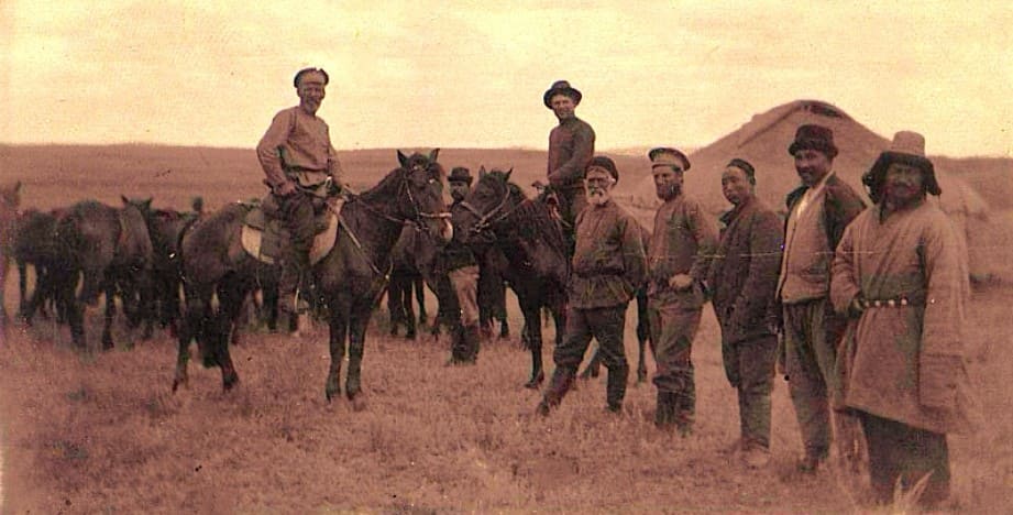
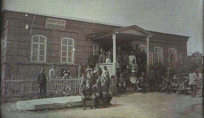
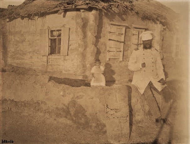
Geographic coordinates of Sergiopol (Mamyrsu) picket: N47°57'01 E80°22'55
13. Ayaguz (Ayaguzka) picket.
Not far from the town, the road leads through the Tatar village of "Old Ayaguz" - where the houses are enclosed by earthen ramparts - and then across the Ayaguz River. This river is quite wide and swift but shallow; however, during floods, it swells significantly.
It flows south toward Lake Balkhash, though it reaches the lake only during the spring high-water season. Rocky hills, which had previously blocked our view of the Tarbagatai Mountains, continued all the way to the second picket - named, if I am not mistaken, after the small "Ai-su" river - where we arrived shortly after eight in the evening.
There, we found a dwelling fit for troglodytes - a highly primitive structure made of clay and stakes, built partially underground. We were able to refresh ourselves with milk there, as the tea held little appeal for us novices due to the brackish water.
"Journey to Western Siberia by Dr. O. Finsch and A. Brehm." 1882.
Beyond Bakanas, the same dreary wormwood steppe stretches on. This same steppe borders the old riverbed of the Ayaguz - marked by willow bushes and small poplars - and extends further to the river itself. The water level in the Ayaguz River, roughly opposite the Malo-Ayaguzsky outpost, had recently receded enough to make fording the river possible.
A multitude of Kyrgyz yurts, held up by the high water, stood on both banks; only yesterday, May 8th, were most of them able to cross to the other side. At the ford, the water reached nearly to the horses' backs, and it was only with the help of camels obtained from the local Kyrgyz that we managed to transport our belongings to the opposite bank without getting them wet.
The Ayaguz valley is overgrown with willow, small poplar, honeysuckle, wild rose, and the occasional Russian olive tree - vegetation that provides nesting grounds for falcons, red-backed shrikes, and warblers. Finally, on May 10th - after six weeks of life in the wilderness - we arrived at the Malo-Ayaguzsky outpost.
The Malo-Ayaguzsky outpost is situated a few versts from the river, amidst steppe terrain of the same character. Thirteen versts from the outpost, on the road to Sergiopol, stands the tall Kyrgyz monument of Kozy-Korpesh; a romantic legend associated with it testifies to the fact that even these semi-wild nomads are not strangers to the poetry of love - with all the torments of unrequited affection and all the frenzies of passion.
From the interpreter’s rambling, broken Russian-Kyrgyz speech, one could grasp only the general outline of the story - a tale that was hardly new, yet one that the Turkic tribes seemed to cherish. Long ago - before the Russian soldier’s uniform had ever appeared amidst the barren steppes of Semirechye, and before the nomadic inhabitants had even dreamed of the new order brought by Russian civilization - there lived a wealthy and influential Kyrgyz man named Kozy-Korpesh.
Having fallen in love with a beautiful woman, he secured her parents' consent to the marriage and paid a handsome bride price. Unfortunately for him, a young but poor warrior had already won the beauty's heart, and his love was returned. He was struck down by his powerful rival just as he was dreaming of his beloved.
Grief-stricken, the young woman - wishing to set an impossible condition for the powerful suitor while harboring a sorrowful resolve of her own - challenged him to erect a towering monument within a very short time. The task was rendered nearly impossible by the fact that the stone had to be quarried in the Arganaty Mountains - some sixty versts away from the construction site.
Yet the power of the Kyrgyz man’s love was immense, and every obstacle crumbled before such a mighty passion. He gathered a vast crowd and stationed them in an unbroken chain stretching from the Arganaty Mountains to the building site.
Stones were passed from hand to hand, and by the appointed deadline, a towering monument stood complete, visible from far and wide across the countryside. But the powerful Kyrgyz man’s triumph was short-lived. The steadfast beauty climbed to the summit of the pyramid and, before the eyes of the crowd and her adoring suitor, cast herself down.
Overcome with despair, Kozy-Korpesh climbed the same monument and, throwing himself from it, ended his life beside the bloodied corpse of his beloved. There are several other - and perhaps more accurate -versions of this story.
A. M. Nikolsky, curator of Zoological Museum at St. Petersburg University. "Journey to Lake Balkhash and Semirechye Region." 1885.
Geographic coordinates of Maly Ayaguz (Ayaguzka) picket: N47°50'15 E80°00'06
14. Taldy-Kuduk picket.
Geographic coordinates of Taldy-Kuduk picket: N47°36'57 E79°47'21
15. Kyzyl-Kuy (Kyzylkiya) picket.
Geographic coordinates of the Kyzyl-Kuy (Kyzylkiya) outpost: N47°25'21 E79°42'15
16. Malo-Ayaguz picket.
Geographic coordinates of Malo-Ayaguz picket: N47°12'40 E79°37'07
17. Juz-Agach picket.
On the morning of March 24, we arrived at the Juz-Agach outpost - the one closest to Lake Balkhash - from where we decided to turn off toward the lake along a pack-animal trail. On May 17, with the same group but a larger number of pack horses - since we had to carry all our luggage and collections with us - we set out from the outpost toward Juz-Agach.
It was impractical to take camels because they cannot tolerate mosquitoes at all. Due to the overflowing of the Ayaguz River, the postal route at this crossing makes a slight detour, and the Jus-Agach picket station itself has been temporarily relocated.
The detour on the way from here to Arganaty is so extensive that it was necessary to establish a temporary waystation. The road from Malo-Ayaguz to Jus-Agach traverses dry steppe covered with wormwood and *kokpek* (saltwort); white-winged larks, black-bellied sandgrouse (P. arenarius), and rosy starlings abound here.
Flocks of the latter - with their lovely pink plumage - crowding the bushes present a remarkably beautiful sight. From Jus-Agach to the waystation, the steppe takes on a more saline character; one frequently encounters thin salt crusts and small ponds frequented by avocets, ruddy shelducks, godwits, and black terns.
A. M. Nikolsky, Curator of Zoological Museum of St. Petersburg University. "Journey to Lake Balkhash and Semirechye Region." 1885.
The Juz-Agach picket station, where Chokan stopped, was a junction for caravan routes leading from Troitsk, Petropavlovsk, and Semipalatinsk. Just five years before Chokan’s arrival, the tireless world traveler Egor Kovalevsky had visited Juz-Agach.
Sergey Nikolaevich Markov. “Those Climbing to Peaks”. 1962.
The road from Semipalatinsk to the town of Sergiopol (formerly the Ayaguz District Administration) spans a distance of 271¼ versts, passing through picket stations spaced at intervals of 22 to 37 versts. These stations are manned by Siberian Line Cossacks and maintain both contract postal horses and horses for the travel of officials.
Communication between the district administrations and the Line now proceeds safely and without interruption along these military roads - though, naturally, a Cossack escort is provided to the traveler as a prudent precaution. From Semipalatinsk, the military road runs toward Kopal and then to Almaty (the "Vernoye" fortification) via the outer districts: Ayaguz, Kopal, and Alatau (leaving Kokpekty to the left).
Leaving the Line, the terrain is initially flat steppe, but further on - before reaching Sergiopol - one encounters the spurs of the Kolbinsky and Chingiz-Tau ranges. The road then runs alongside the Ayaguz River and the tip of Lake Balkhash; after passing Kopal, the route becomes mountainous again all the way to Almaty.
It is a truly unique journey! Cossack and Kyrgyz horses - true steppe breeds - race the carriage along at a magnificent pace (wherever the terrain permits wheeled travel), accompanied by the drivers' wild whooping, the prancing of the escort, and all the trappings of a quintessentially Asian journey.
Amenities are scarce, of course - save for a few well-populated settlements that have since grown into respectable towns, such as Kopal and Almaty. Yet, in the pleasant summer season - or, more precisely, in late May, before the onset of intense heat - life in this part of the steppe, and travel across it, offer not merely enjoyment but a certain poetic charm.
Many areas bear no resemblance to the "steppe" as we commonly define the word; there are numerous mountains - not barren ones, but slopes covered in lush vegetation. Clear, fresh, running water abounds. The verdant grass and vibrant wildflowers are breathtaking.
The towns, steppe outposts, and Cossack settlement differ little from those found deep within Siberia or along the Frontier Line. The way of life is identical, save for the fact that one is further removed from the civilized world - and life is, perhaps, a bit more tedious.
Explorer I. Zavalishin. “Description of Western Siberia, Vol. 3: Siberian-Kyrgyz Steppe”. 1867.
The road from Kopal to the Zhus-Agach outpost also winds through the mountains, featuring fairly steep ascents and descents; one particular stage, while level, is strewn with such large cobblestones that the carriage tosses the traveler violently from side to side.
Yet making this road more comfortable would not seem to be a particularly difficult task; it would only require clearing away or breaking up the cobblestones in certain places - a move that would greatly benefit the private post-service operators by sparing their carriages and horses.
Along the way, you encounter the Karatal, an extremely swift river that rushes down from the mountains, crashing against the rocks; a reasonably solid bridge has been built across it.
P. Galitsky. "From Semipalatinsk to Verny Outpost." Sankt-Peterburgskie Vedomosti. 1868, Nos. 150, 151.
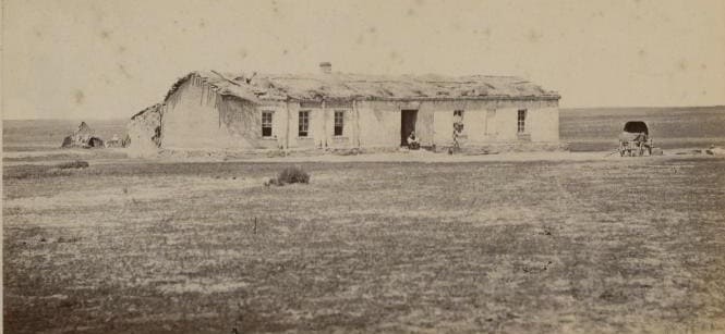
Geographic coordinates of Dzhuz-Agach picket: N46°55'08 E79°32'27
18. Arganatuy picket.
At the fourth station from Ayaguz - Malo-Ayaguzskaya - we parted ways with the Ayaguz River. After covering two more stages (about 60 versts), which we traveled through the night, we reached the Arganatinsky outpost station - the one I was interested in - at dawn on August 10.
This outpost was situated in a gorge within a small mountain cluster composed of black siliceous shale crags, steeply uplifted by porphyry. A spring of clear water flowed through the gorge past the outpost, and the road ascended along this same gorge.
I stopped at the outpost to switch to a riding horse and, accompanied by two Cossacks, set out on an excursion to the reed beds bordering Lake Balkhash - a lake visible from the outpost in clear weather. Unfortunately, after we left the outpost and had traveled a few versts toward Balkhash, storm clouds gathered from all directions and a heavy rain began to fall, soaking us - as the saying goes - to the bone.
The excursion was a failure; we had to return to the outpost.
P. P. Semyonov-Tyan-Shansky. “Journey to Tian-Shan". 1856-1857.
From Dzhus-Agach, we traveled along the track toward Arganaty and, at the 13th verst, turned off into the sands, heading west toward Lake Balkhash. Large numbers of Kyrgyz people, who were migrating at the time, were encamped in these sands.
A. M. Nikolsky, Curator of Zoological Museum at St. Petersburg University. "Journey to Lake Balkhash and the Semirechye Region." 1885.
A magnificent moonlit night once again favored our journey, and at 1:00 a.m. on May 8, we reached the Karakol outpost, where the lieutenant colonel was greeted by eight Cossacks standing in formation. The early morning hour found us awake once more and rewarded us with a stunning view - not only of the Tarbagatai Range to the northeast but even of the snow-capped peaks of the Ala-Tau, the southern limit of the region we were traversing.
Karakol consists of a few mud-brick huts and sheds - apparently built more for horses than for humans - and is situated near the river of the same name, which flows from the Tarbagatai Mountains into the northern end of Lake Sasyk-Kul. The river is quite wide, yet its banks - partially covered with cobbles - indicated that it must swell significantly in size during high water.
The right bank, where we were located, was somewhat elevated and dotted with mounds of wind-blown sand; this landscape harmonized perfectly with the general character of the steppe, which was overgrown with tall, dry grass - some of it nearly as high as a person.
"Journey to Western Siberia by Dr. O. Finsch and A. Brehm." 1882
The road to the Arganatinsky outpost runs across desolate salt flats. There is no vegetation whatsoever, save for low-growing wild rosemary. The Arganamin mountain ridge is not particularly high, yet from one of the peaks near the outpost - in clear weather - one can see Lake Balkhash shimmering blue some 60 versts away.
Access to the lake is extremely difficult, as it is surrounded for a vast distance by shifting sands. Local wildlife includes mountain sheep, but wolves are especially plentiful; they are so bold that, shortly before my arrival, one of them chased a dog right into the outpost barracks, where it was killed by the Cossacks.
As for birds, one frequently encounters little bustards, great bustards, and flocks of Pallas's sandgrouse along the way. The road across the salt flats is unbearably bumpy, while the sandy stretches are exhausting for the horses; furthermore, in windless weather, the carriage kicks up such acrid, intolerable dust that one has nowhere to escape it and finds it hard to breathe.
P. Galitsky. "From Semipalatinsk to Verny Fortification." Sankt-Peterburgskie Vedomosti, 1868, Nos. 150, 151.
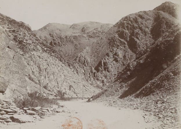
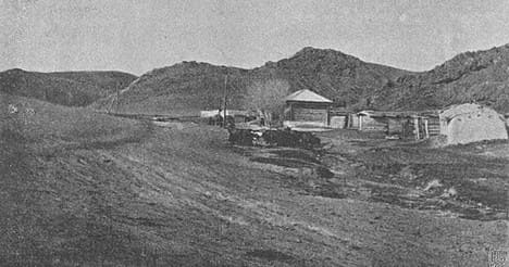
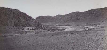
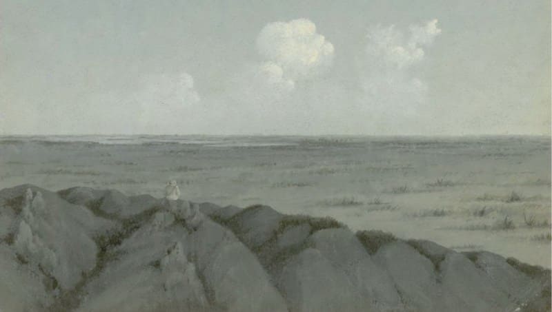
Geographic coordinates of Arganatinsky picket: N46°39'24 E79°39'09
19. Ashybulak picket.
Geographic coordinates of the Ashybulak picket: N46°22'54 E79°37'48
20. Lepsinsk (Koktereksay) picket.
After transferring to a carriage, I decided to continue my journey toward Kopal. After two stages (65 versts), I reached the Lepsinsk picket and arrived at the Lepsa River. This was the first major river of Semirechye.
P. P. Semenov-Tyan-Shansky. “Journey to Tian-Shan”. 1856-1857.
The Lepsinsk picket is a post station near which peasants first settled about ten years ago; there are now some twenty households living there. The surrounding area consists of clayey steppe covered with wormwood, milkvetch, and the like. The forest in the Lepsa valley - onsisting here, as elsewhere, of Russian olive and willow has been heavily logged.
A massive sand dune encroaches from the west side of the settlement, threatening to soon engulf the buildings. According to old-timers, ten years ago this dune was smaller and located about 50 away from the structures; now, however, its leading edge has advanced right up to the fences, which sinking deeper into the sand with each passing year.
Its direction of movement is almost due east - that is, straight toward the settlement itself. The length of the crest is slightly over 300 paces, and the maximum height of the leeward slope is somewhat greater than a person's height. This massive dune formed through the merger of many smaller ones, giving the base of the leeward side a wavy outline.
On the other side of the Lepsa River, at some distance from it, lie numerous dunes scattered haphazardly across the steppe. They are all small in size. The primary occupation of the residents of the Lepsa settlement is the trade in oats and barley, which are sold to the wagon trains traveling along the main route.
Livestock farming also provides significant support to the residents, though its scale is limited by a shortage of meadows and arable land for growing clover. Small tracts of meadowland are found along the Karadzhigda River, a few versts from the settlement.
Agriculture is virtually non-existent here due to the impossibility of artificial irrigation. In the past, water was diverted from the Lepsa via irrigation ditches, but now that the river level has dropped, this irrigation option is no longer available. Small quantities of fish are caught in the river - predominantly marinka (Schizothorax argentatus, Sch. kolpakowskii) and, less frequently, perch (Perca schrenckii) (representatives of the genus Diplophysa (D. labiata, D. strauchi) are also caught in the Lepsa but are not consumed as food).
M. Nikolsky, Curator of Zoological Museum of St. Petersburg University. "Journey to Lake Balkhash and the Semirechye Region." 1885.
The Lepsinsk outpost is situated on the banks of the beautiful Lepsa River, which is crossed by a cable-operated ferry. The riverbanks are covered with small groves and greenery - a welcome sight after the salt flats. The river is home to distinctive steppe fish: "osman:, black perch, and “marinka”; the latter is harmful to those unaccustomed to eating it, and its roe can cause poisoning.
P. Galitsky. "From Semipalatinsk to Verny Fortification." Sankt-Peterburgskie Vedomosti. 1868, Nos. 150, 151.
Geographic coordinates of Lepsinsk (Koktereksay) picket: N46°05'14 E79°28'21
21. Baskan picket.
Furthermore, we saw many great bustards and successfully hunted partridges (Perdix daurica) and black-bellied sandgrouse (Pterocles arenarius). On that day (August 10), I crossed the second major river of Semirechye - the Baskan - at the Baskan outpost, and reached the third river, the Aksu, at the Aksu outpost (after two stages totaling 65 versts from Lepsa), where I spent the night.
P. P. Semyonov-Tyan-Shansky. "Journey to Tian-Shan." 1856-1857.
On July 18, a troika of post horses sped away from the Lepsinsk outpost, pulling a cart along the flat, dusty road; inside lay the luggage, collection crates, and the "Petersburg - as the Kyrgyz people called me. Before reaching the Abakumovsky outpost, the road winds through a clay-and-sand steppe covered in wormwood and, in places, “Lasiagrostis splendens” (chiy) and “Sophora alopecuroides” (ak-mia).
Thirteen versts from the Baskan outpost lies Lake Baskankul; all we learned about it was that it is surrounded by reeds and serves as a favorite haunt for mosquitoes and small, pitch-black perch. During the winter, the Kyrgyz people haul out large quantities of these fish using a hook attached to a pole.
To do this, they cut a hole in the ice and snag the fish - which crowd around the opening - with these small gaffs. The residents of the Abakumovsky settlement engage successfully in agriculture; their irrigation ditches and cultivated fields are a welcome sight to the traveler, weary from the monotony of the barren steppe.
The settlement lies right at the foot of the Abakumovsky Mountains, and from there, the road cuts into their dark gorges. As one approaches the mountains, an extraordinarily sharp boundary - straight as an arrow - between the mountains and the steppe is visible from afar.
This line is defined by the varying contours of prominent surface features and the differing colors of the soil.
A. M. Nikolsky, Curator of Zoological Museum of St. Petersburg University. "Journey to Lake Balkhash and the Semirechye Region." 1885.
Halfway from the Baskan outpost, the peaks of the Alatau Range, capped with eternal snow, begin to come into view. To an eye accustomed to endless plains, it is hard to believe these are mountains; at first, one mistakes them for clouds on the horizon, but as the massive forms draw nearer, they become distinct, and one cannot help but marvel at nature and its colossal scale. After crossing the mountain river Aksu by ferry, I stopped at the outpost for the night. Sleeping in the barracks was impossible due to the swarms of insect "cavalry," so I retreated to my traveling quarters - my wagon - where I listened to the ceaseless whistling sounds that echoed across the steppe all night long.
P. Galitsky. "From Semipalatinsk to Verny Fortification." *Sankt-Peterburgskie Vedomosti*, 1868, Nos. 150-151.
Geographic coordinates of Baskan picket: N45°49'59 E79°39'58
22. Aksu picket.
In addition to maral deer, the area is home to “arkhar” (mountain sheep) - animals with coarse coats and sturdy, backward-curving horns - and “teki” (a type of wild sheep where males have horns and females do not), which possess fine, soft wool and exceptionally delicious meat.
Snow leopards and tigers roam the foothills and reed beds; the tigers reach enormous sizes - for instance, a tiger killed in 1858 measured 18 “chetverts” (approx. 3.2 meters) from snout to tail, while last winter, a tiger killed near the Aksu outpost measured 16 “chetverts" (approx. 2.8 meters).
A week before my arrival, near the Lepsinsk outpost, a tiger killed three Cossack horses. The pelts of these fearsome beasts can be bought here quite cheaply; for instance, I happened to purchase a tiger skin measuring 10 “chetverts” and a snow leopard skin of 8 “chetverts” for 12 rubles; the latter had a fluffy tail measuring 2 "arshins".
Wild boars abound in the reed beds, reaching enormous weights - up to 12 “poods”.
Pyotr Galitsky. "From Semipalatinsk to Verny Fortification." Sankt-Peterburgskie Vedomosti. 1868, Nos. 150, 151.
Geographic coordinates of Aksu picket: N45°37'26 E79°27'54
23. Abakumovsky (Tas-Piket) picket.
On July 18, a team of three post-horses sped a cart away from the Lepsinsk outpost along a flat, dusty road; the cart carried luggage, collection crates, and the "Petersburg “taksyr”" - as the Kyrgyz people called me. The road to the Abakumovsky outpost runs through a clay-and-sand steppe covered in wormwood and, in places, “chiy” grass and “ak-miya” (Sophora alopecuroides).
Alexander Mikhailovich Nikolsky, Curator at Zoological Museum of St. Petersburg University. "Journey to Lake Balkhash and Semirechye Region." 1885.
"After laying this new road further east than the original one, it became necessary to build a new outpost closer to the Bazdyk-Sai Gorge, replacing the one that had stood at the Karasu spring." A picket station has been built on the irrigation canal fed by the Aksu River and named "Abakumov" in honor of Lieutenant Colonel Abakumov.
This picket is the finest of its kind (as is the picket on the Koksu River) in the Semirechye and Zailiysky regions. It features two very spacious rooms - one with a Dutch-style stove and the other with a fireplace - amenities that are essential for travelers in winter.
The rooms are well-furnished with sofas, chairs, and tables. Connected to these rooms by a wide hallway (vestibule) is a barracks that offers comfortable, ample space for the Cossacks. The courtyard contains two large storehouses, a stable, and a covered shelter.
All these structures are built of unbaked brick, plastered, and roofed with painted planking; the walls on three sides are also constructed of the same brick. Thus, the picket resembles a small, attractive fortress Arasan is 27 versts away; from here to Kopal is 29 versts."
Nikolai Alekseyevich Abramov. "Lepsa River." Tobolsk Provincial Gazette. 1861, No. 7 (February 18) and No. 8 (February 25).
The road to the Abakumov picket winds between fields sown mostly with millet. The fields here are irrigated artificially via “aryks” (irrigation canals). These “aryks” are shallow ditches through which water from the mountains is channeled.
Huge flocks of wild mountain pigeons wheel over the fields of millet. Insects found here include tarantulas and karakurts (black spiders); the bite of the latter is highly venomous, capable of killing a horse or camel if timely aid is not provided.
The Abakumov Outpost - named in memory of the detachment commander Abakumov, who contributed so much to the region - is better constructed than the other outposts; It features a tidy, decently furnished room where you can enjoy a rest after your journey across the steppe and gather the strength needed to cross the Gasford Pass (named after the Governor-General of Western Siberia, Mr. Gasford, who discovered the route through the Bazdyk-Sal Gorge in 1867) - that is, to traverse a spur of the Alatau range via mountain gorges (the gorge is known in Kyrgyz as Kisi-Kaus, meaning "crooked mouth"), the peaks of which appear inaccessible. Indeed, our soldiers - who spent three years building this road with almost no remuneration - expended immense effort and toil to blast through or break apart these massive granite strongholds with pickaxes and gunpowder! For ten versts, you ascend the gorge along slopes so steep that one truly marvels at how horses manage to haul a carriage up them.
Traveler and correspondent Pyotr Galitsky. "From Semipalatinsk to Verny Fortification." Sankt-Peterburgskie Vedomosti, 1868, Nos. 150 & 151.
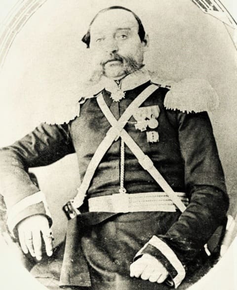
Geographic coordinates of Abakumovsky (Tas-Piket) Picket: N45°24'43 E79°32'39
24. Arasan picket.
In the northern foothills of the Dzungarian Alatau - at the head of the Arasan mountain valley, along the upper reaches of the Bien River - an outpost was established as early as 1848. It was one of twelve such outposts created that year to link Ayaguz with detachment at Kapal.
Cossacks were likely settled at the picket in 1855, or possibly earlier; this is evidenced by the fact that the land allotment for the Arasan settlement was demarcated simultaneously with the Kapal *stanitsa* in 1855, and in his aforementioned order of May 15, 1857, the commander of the Separate Siberian Corps refers to Arasan as an already existing settlement.
In 1858, ten peasant families were added to the existing population here.
Cossack historian N.V. Ledenyov. “History of Semirechye Cossack Host”. 1909.
From the settlement, the road immediately enters the gloomy, wild mountain gorges and climbs halfway to Arasan, from where it descends again. Pigeons (Columba livia?), pied wheatears, and chukars inhabit the sheer black walls of the gorges; their cries echo across these lifeless rocks.
Arasan is renowned for its healing springs, located right in the courtyard of the post station. These springs - both warm and cold - contain high levels of sulfur and are particularly effective in treating rheumatism. In the past, when they were leased to a private individual, the bathhouse facilities offered a degree of comfort; now, however, under state management, they have fallen into complete disrepair.
The water in the warm spring has recently grown significantly cooler; this is attributed to the accidental merging of the two springs - the warm and the cold - during construction work. Others believe the cooling occurred because groundwater seeped into the warm spring during the excavation of the baths, thereby lowering the temperature its temperature.
Alexander Mikhailovich Nikolsky, curator at Zoological Museum of St. Petersburg University. “Journey to Lake Balkhash and Semirechye Region”. 1885.
The Arasan mineral waters are located on the Zhunke Plateau, at the foot of the Dzungarian Alatau, near the Cossack settlement of Arasanskoye (Teploklyuchenskoye). This settlement was founded by Cossacks of the 9th Siberian Regiment - initially as a postal outpost (established in 1848) staffed by twelve Cossacks led by a “uryadnik” (non-commissioned officer).
The word "Arasan" translates from Mongolian as "spring" or "source." Several warm and cold mineral springs had existed at this site since ancient times, used by the Mongols and Dzungars, and later by the Kazakhs. These "Arasan" waters were considered sacred and believed to possess healing properties.
Cossack settlers deepened the spring pools and, in 1850, constructed wooden bathhouses over them. The site served as a place of treatment for the sick from the Kopal garrison as well as from other remote locations in Semirechye. In 1856, an additional twenty Cossack families were settled at the postal outpost of Kopala, which formed the Arasan settlement.
Until recently - as was the case during the Soviet era - a health resort of all-Union and republic-wide significance operated here. Today, it is the village of Arasan in the Aksu District of the Zhetysu Region (Republic of Kazakhstan). The Arasan mineral springs are located near the Arasan picket and “stanitsa” (Cossack settlement), 29 versts from Kopala and 599 versts from the regional city of Semipalatinsk.
Beyond the Arasan springs, the Alatau Range comes into view, its peaks capped with eternal snow. The mineral waters flow from two springs, filling three pools. Before the arrival of the Russians in Semirechye, these waters were used by the Mongols, Dzungars, and Kyrgyz people. In 1850, buildings featuring pools, barracks, and auxiliary facilities were constructed at the mineral springs.
At the behest of the Governor-General of Western Siberia, G.Kh. Gasfort, and through the efforts of Lieutenant Colonel S.M. Abakumov - commander of the 10th Siberian Cossack Regiment - a garden was planted near the Arasan mineral waters in 1855.
It features spruce, poplar, apple, rowan, bird cherry, sea buckthorn, cherry, currant, raspberry, gooseberry, blackthorn, lilac, and barberry, alongside varieties brought from the Chinese city of Kulja: grapes, apricots, pears, peaches, and various flowers.
Water from the springs is channeled throughout the garden, and gazebos have been erected in its center. The main gazebo is built in the Chinese style, featuring a roof topped with a dragon-shaped weather vane. In 1855–1856, several Cossack families from Kopal were resettled here; after building 23 houses, they established the Arasan *stanitsa* (Cossack settlement).
Nikolai Alekseyevich Abramov. "Lepsa River." Tobolsk Provincial Gazett. 1861, No. 7 (February 18) and No. 8 (February 25).
Having passed the steppe town of Sergiopol (formerly the Ayaguz fortification) - which already boasts a church, a hundred houses, a district administration office, and a few merchants - we reached the Arasan mineral springs, located 29 versts from another district town, Kopal, and 328 versts from Ayaguz.
These springs are situated near the Arasan Cossack settlement and flow at the foot of one of the spurs of the Alatau Mountains. Here, the Alatau rises to 11,000 feet above sea level. Its majestic peaks are perpetually snow-capped. The climate here is temperate; the heat is significantly tempered by the cold air from the snowy Alatau summits.
The mineral waters issue from two springs - one warm and one cold: the warm spring measures 28½° Réaumur, and the cold one 16½°. The water has a sulfurous odor and an alkaline, sulfurous taste. It is used beneficially - both in baths and for internal consumption - to treat cachexia, internal obstructions, wounds, and ulcers.
In the Dzungar language, "Arasan" means "sacred water." The Arasan Valley (also known as Dzhaty-Su) is surrounded by spurs of the Alatau and is watered by the small Bienya River. From here, it is only 88 versts south to the vast lake-sea of Balkhash.
According to the latest research by Dr. Svetaev, the true temperature of the large spring does not exceed +25° Réaumur (with an air temperature of 3°), while that of the small spring does not exceed +14° Réaumur (also at an air temperature of 3°).
The water (as he describes it) has an astringent taste and contains a significant amount of hydrogen and oxychloride salts. Vapors smelling of sulfur rise from the surface of the springs. In addition to the aforementioned ailments, the waters are also beneficial for liver induration, rickets, scrofula, syphilis, hysteria, gout, and skin diseases.
The Kyrgyz people claim that these waters cure female infertility. The most suitable time for a course of treatment is from mid-April to mid-June. Travel by carriage from Ayaguz to Kopal is now very convenient. Several Cossack families were settled here in 1857.
Today, the *stanitsa* (Cossack settlement) is quite populous and well-developed; it boasts a church, bathhouses, and a guesthouse for visitors. Peaches, apricots, and pears grow outdoors in a flourishing public garden. Grapevines imported from Crimea and Southern France by General Gasfort have quickly acclimatized.
Kopal is a fine district town. It features a pretty church, up to 300 houses, a population of nearly 2,000 souls of both sexes, the headquarters of the 10th Siberian Cossack Regiment, and the residence of the Kopal Military District Commander. There are merchants of both Russian and Central Asian origin.
Social life (given the significant number of civil and military officials) is quite pleasant. In short, it is gratifying to see, so far from Russia, the beginnings of civilization among this Kyrgyz people - a people who certainly have a better future ahead of them, provided they are properly cared for and its root is “res”, “ros”, “rosa” - meaning "to flow, pour, issue forth, or moisture"; from this come the Slavic ‘rosa’ ("dew"), the Sogdian verb ‘ros’ ("to flow, pour, drip"), the Yaghnobi "rus" ("to flow, spill"), the Sanskrit ‘ars’ ("to flow, glide"), "rs" ("flow/current"), "rsati" ("to flow, stream"), and "rasa" ("sap, liquid, water, moisture"), as well as the Iranian ‘ar’ ("to move, set in motion, reach") and the Sanskrit ‘ars’ ("to flow, glide") and ‘ar’ ("to go").
Researcher I. Zavalishin. “Description of Western Siberia”. Vol. 3: Siberian-Kirghiz Steppe. 1867.
The Kopal fortification was established in 1847 on the Kopalka and Zimovka (Tamchi-bulak) rivers, in the foothills of the Dzungarian Alatau, by a Siberian military detachment led by ”esaul” T.V. Nyukhalov and “Sotnik” S.M. Abakumov. In 1848, the Kopal Cossack settlement was formed near the fortress, populated by Siberian Cossack migrants from the Kuznetsk and Biysk lines.
In 1854, Kopal was designated a district town within the Semipalatinsk Region, and in 1867, it became a district town of the Semirechye Region. The settlement itself was divided into the town proper - including a Tatar quarter - and the Cossack stanitsa. In the late XIXth century, a small "Kyrgyz quarter" was established in the town's outskirts.
The Kyrgyz Steppe stretched for nearly 1,500 versts from the banks of the Irtysh to the Celestial Mountains, and Semenov had to cross it in a wicker carriage, accompanied by four Siberian Cossacks. On August 6, 1856, the journey for which Semenov had prepared so long and passionately began.
Somewhere there, in the gorges of the Semirechye Alatau, lay Kopal - a large Cossack settlement and a Russian outpost in the east. There were still about a hundred versts to go. Pyotr Petrovich spent the night at the Aksu outpost and hurried on his way again at dawn; he was eager to reach Kopal.
The road led toward the mountain pass through a narrow, steep gorge. The bare shale cliffs, the murky shadows they cast, and the grinding of stones beneath the wheels did little to lift Semenov’s spirits. Yet, upon reaching the mountain pass, he breathed deeply.
From an altitude of 1,300 meters, a magnificent view opened up in every direction. The Semirechye Alatau rose from the low-lying Lake Balkhash steppe, soaring far beyond the snow line. Steep cliffs of clay shale stood guard over the summit of the rugged pass.
After traversing a long, barren plateau and a descent of seven versts, Semenov caught sight of the silvery ribbon of the Bien River. The river wound and played, its foam glinting in the valley. Patches of green orchards and golden wheat fields dotted the landscape.
Wheat fields climbed from the Bien valley up onto the Zhunke Plateau; they belonged to the Kopal Cossacks, who had established their agricultural colony just fifteen years earlier. Semenov arrived in Kopal late in the evening. The driver pulled up to the inn, where Pyotr Petrovich spent the night sleeping on fresh, fragrant hay.
He woke early, while the sky was still slowly turning a pale green. The morning cool caressed his cheeks, and large dewdrops rolled across his blanket. Colonel Abakumov, the head of the Kopal District, greeted his unexpected guest with boisterous cheer.
His full face beamed with pleasure when Semenov introduced himself. Semenov had heard of Abakumov back in Omsk as an extraordinary man with a passion for science. The spacious room of the log house was filled with the sharp scent of herbs; dried bundles of them hung along the walls and beneath the ceiling beam.
Glass eyes from stuffed birds stared at Pyotr Petrovich from every side. Boxes containing butterfly and beetle collections sat on the windowsills, while multicolored rock specimens lay scattered beneath the chairs. The colonel’s steppe hospitality was both lavish and varied.
The table was spread with glistening hams of Balkhash wild boar, roasted partridges from the Zhunke Plateau, and grayling fish soup from the Bien River. Platters were piled high with Karatal carp and bream from the Lepsa. Caspian caviar gleamed like a small mound of anthracite on a painted porcelain dish, while “bek-pak” - Dalinsky kumis - fizzed in the bowls.
Rosy apples and yellow dried apricots delighted the eye with the mountain freshness of the Tian-Shan’s wild orchards. After lunch, the colonel showed Pyotr Petrovich the small town he had founded in 1846. With a businesslike air, he praised the sturdy buildings erected by the Cossacks and early Russian settlers, all surrounded by pyramidal poplars.
Young apple and apricot trees were gaining strength in the front gardens, and grape clusters were swelling in the sun. An unfinished fortress church rose above the broad green square. Abakumov noted with pride that the church was being built according to his own design.
The square also housed the garrison barracks, warehouses, and the district commander’s office. From this point began the earthen rampart that encircled the entire town of Kopal. Brass cannons pointed their barrels toward the Kyrgyz steppe.
Kopal had been established as a military fortification to protect the Kyrgyz of the Great Horde who had pledged allegiance to Russia. The town comprised 700 houses, inhabited not only by soldiers and Russian settlers but also by the pacified Kyrgyz tribes of the Dulat and Atban.
The barracks housed Cossacks of the Siberian Host and soldiers from a line battalion.
The colonel said:
"Orders came down to us soldiers: go out into the steppe, settle there, dig in, and live. So the soldier went, settled, and dug in. The Russian peasant loathes military service - he is a tiller of the soil. A peasant takes no pleasure in wrecking and destroying; the land calls to him.
Look at how recently Kopal was founded, yet here we are already sowing wheat, millet, and barley. The harvest yield is twenty-fold. The pumpkins are so heavy you can barely lift them from the ground, and the watermelons look like great bells..."
Andrei Ignatyevich Aldan-Semyonov. A Soviet writer and author of renowned biographical book “Semyonov-Tyan-Shansky”, published in 1965 as part of famous "Lives of Remarkable People" series.
Stretching from the Lepsinskaya station all the way to the town of Kopal are settlements inhabited by either Cossacks or Little Russians; for the most part, they obtain their grain from the Lepsinskaya "stanitsa" (Cossack settlement), which is considered the region's breadbasket. Just before reaching Kopal, one encounters the famous Gasford Pass; crossing it entails considerable difficulty, as travelers must ascend very steep slopes.
The pass itself extends for a distance of seven versts. It lies at the foot of the Alatau mountain range - the source of all the rivers of Semirechye, which flow into the vast and largely unexplored Lake Balkhash. Immediately beyond the Gasford Pass lies the Arasanskaya “stanitsa”, renowned for its warm, alkaline-sulfur springs, which have a temperature of +27° Réaumur.
Past Arasanskaya lies the town of Kopal itself, which is larger and more attractive than Sergiopol. Kopal is situated right at the foot of the Alatau range; consequently, its climate is not excessively hot, as the snow on the peaks tempers the summer heat. Although larger than Sergiopol, Kopal is unremarkable and can hardly compete with even the most modest district town in Siberia or Russia proper.
Its population consists almost entirely of Cossacks - a group not particularly noted for its industriousness - though the surrounding area does boast ample arable land and hayfields. Geographically, Kopal occupies a central position among the most populous areas of Semirechye.
It is the first place where one encounters apples. In earlier times, when Kopal marked the furthest extent of Russian territory, it was a bustling, lively town. A large military force was once stationed here, and its young officers brought an air of cheerfulness and vitality with them.
Now, however, Kopal is all but dead; there is no social life to speak of - let alone a club or a theater. True, there is a modest public garden - featuring a pavilion that proudly houses a rather shabby billiard table and serves as an evening gathering spot for local notables - but that is all.
A-v. Staff correspondent for “Sibir” newspaper. 1878.
https://russiainphoto.ru/search/photo/?page=3&page_size=10&paginate_page=1&index=3&author_ids=4812
From the Arasan outpost, you arrive in Kopal. It is a respectable enough steppe town with a population of 4,000. It lies on a rolling plain at the foot of the Alatau Mountains. The town comprises a fortress - housing various government buildings - the town proper, and a Cossack “stanitsa” (settlement).
The town proper features a spacious square containing a disused church, stone administrative offices, and a trading arcade. In general, the town’s structures are made of wood - specifically, the flimsy spruce timber harvested in the mountains - and consequently, despite the town’s recent founding (Kapal was established as a fortification in 1847 and designated a town in 1854), it contains many dilapidated houses.
Agriculture is highly developed here, as the soil - irrigated by spring water via canals - amply rewards the labor invested in it. Farmland begins just a few sazhens from the town and stretches along the road for nearly the distance of an entire stage.
Along the road from Kapal, one frequently encounters the impoverished encampments of Kalmyks who fled here with their families from Chinese territory to escape the massacres perpetrated by the Dungan people. According to Kapal’s residents, the Kalmyks are a very modest and industrious people.
Our government has allocated suitable land for grain farming to some of them, and they have set about this task with zeal; others have remained in the town or in their encampments, engaging in various forms of heavy labor - such as making unbaked bricks (at a rate of 1½ rubles per thousand), harvesting crops, haymaking, and the like.
Outwardly, the Kalmyks differ from the Kyrgyz in that they shave half their heads while leaving a long braid at the back, much like the Chinese. As an ornament, their women tie two small wooden sticks - wrapped in hair and thread and resembling small spindles - to the ends of their braids; however, neither young girls nor elderly women wear this adornment.
Their dwellings - whether earthen dugouts or yurts - are extremely poor, cramped, dirty, and unkempt; yet, for all that, in every one of them, you will find a small copper deity (“burkhan”) standing in a shrine in a place of honor place. The Kalmyks all smoke tobacco from copper pipes in the Chinese style.
Tea mixed with salt, along with millet, forms their staple diet.
Pyotr Galitsky. "From Semipalatinsk to Verny Fortification." Sankt-Peterburgskie Vedomosti. 1868, Nos. 150, 151.
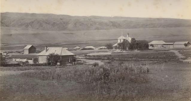
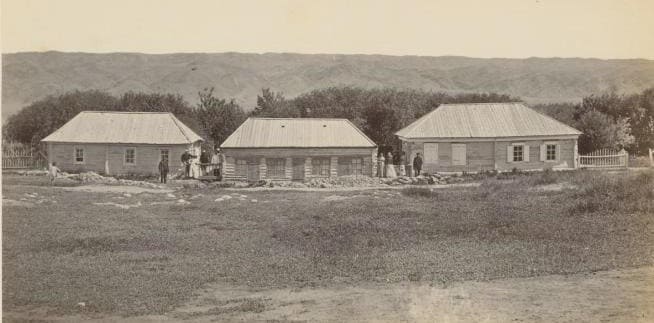
Geographic coordinates of Kapal picket: N45°07'30 E79°02'42
25. Kapal picket.
Even now, a shortage of this life-giving moisture is felt. For instance, there are plans to relocate the town of Kapal - reportedly due solely to a lack of water for irrigating the fields. In the lower reaches of the Ili River, one can see many Kyrgyz farmlands that have been abandoned because it is no longer possible to divert water from the river via irrigation ditches ("aryks") when it is needed.
The town of Kapal is remarkable for having no positive attributes whatsoever, while suffering from a distinct lack of water and firewood. Although irrigation ditches - fed by the Kapalka, a stream no larger than the ditches themselves - run crisscross through the streets, the water supply is insufficient to irrigate the locals' fields, without which agriculture here is impossible.
There were grand schemes for water supply that would have required demolishing entire mountains, but the undertaking would likely have cost more than the entire town of Kapal itself; thus, rather than bringing water to the town, the decision was made to move the town to the water.
A. M. Nikolsky, Curator of Zoological Museum at St. Petersburg University. "Journey to Lake Balkhash and Semirechye Region," 1885.
Kapal is a fine district town. It boasts a pretty church, around 300 houses, a population of nearly 2,000 souls of both sexes, the headquarters of the 10th Siberian Cossack Regiment, and the residence of the Kapal Military District Commander. There are merchants of both Russian and Central Asian origin.
Social life - given the significant number of civil and military officials - is quite pleasant. In short, it is gratifying to see, so far from Russia, the beginnings of civilization among this Kyrgyz people - a people who certainly have a brighter future ahead of them, provided they are properly cared for...
Researcher I. Zavalishin. “Description of Western Siberia”, Vol. 3: Siberian-Kyrgyz Steppe. 1867.
The Kopal fortification was established in 1847 on the Kopalka and Zimovka (Tamchi-bulak) rivers, in the foothills of the Dzungarian Alatau, by a Siberian military detachment led by Captain T.V. Nyukhalov and Lieutenant S.M. Abakumov. In 1848, the Kopal Cossack settlement was formed near the fortress, populated by Siberian Cossack settlers from the Kuznetsk and Biysk lines.
In 1854, Kopal was designated a district town within the Semipalatinsk Region, and in 1867, a county town within the Semirechye Region. The settlement itself was divided into the town proper - including a Tatar quarter - and the Cossack *stanitsa*. In the late XIXth century, a small "Kyrgyz quarter" was established in the town's outskirts.
The Kyrgyz Steppe stretched for nearly 1,500 versts from the banks of the Irtysh to the Celestial Mountains, and Semenov was to cross it in a wicker *tarantas* carriage, accompanied by four Siberian Cossacks. On August 6, 1856, the journey for which Semenov had so long and passionately prepared began.
Somewhere there, in the gorges of the Semirechye Alatau, lay Kopal - a large Cossack settlement and a Russian outpost in the east. It was still about a hundred versts away. Pyotr Petrovich spent the night at the Aksu outpost and hurried on his way again at dawn; he was eager to reach Kopal.
The road led to the mountain pass through a narrow, steep gorge. The bare shale cliffs, the gloomy shadows they cast, and the grinding of stones beneath the wheels did little to lift Semenov’s spirits. Yet, upon reaching the crest of the pass, he breathed deeply.
From an altitude of 1,300 meters, a magnificent view opened up in all directions. Rising from the low-lying Lake Balkhash steppe, the Semirechye Alatau soared far beyond the snow line. Steep cliffs of clay shale stood guard over the summit of the wild pass.
After crossing a long, barren plateau and descending seven versts, Semenov caught sight of the silvery ribbon of the Bien River. The river wound and played, its foam glistening in the valley. Patches of yellowing wheat and green orchards dotted the landscape.
Wheat fields climbed from the Bien valley up to the Zhunke Plateau; they belonged to the Cossacks of Kopal, who had established their agricultural colony just fifteen years earlier. Semyonov arrived in Kopal late in the evening. The driver pulled up to the inn.
Pyotr Petrovich spent the night sleeping on fresh, fragrant hay. He woke early, while the sky was still slowly turning green with the dawn. The morning cool caressed his cheeks, and large beads of dew rolled across his blanket. Colonel Abakumov, the head of the Kopal District, greeted his unexpected guest with boisterous cheer.
His full face beamed with pleasure when Semyonov introduced himself. Back in Omsk, Semyonov had already heard of Abakumov as an extraordinary man with a passion for science. The spacious room of the log house was filled with the pungent scent of herbs; dried bundles of them hung along the walls and beneath the ceiling beams.
Glass eyes from stuffed birds stared at Pyotr Petrovich from every direction. Boxes containing butterfly and beetle collections sat on the windowsills, while multicolored rock samples lay scattered beneath the chairs. The colonel’s steppe hospitality was both lavish and varied.
The table was laden with glistening, fatty haunches of Balkhash wild boar, roasted partridges from the Zhunke Plateau, and grayling fish soup from the Bien River. Platters were piled high with Karatal carp and bream from the Lepsa. Caspian caviar gleamed like a small mound of anthracite on a painted porcelain dish, while “*bek-pak” - Dalinsky koumiss - fizzed in the bowls.
Rosy apples and yellow dried apricots delighted the eye with the mountain freshness of the wild orchards of the Tian Shan. After lunch, the colonel showed Pyotr Petrovich the small town he had founded in 1846. With a businesslike air, he praised the sturdy buildings erected by the Cossacks and the first Russian settlers, all surrounded by pyramidal poplars.
Young apple and apricot trees were thriving in the front gardens, and clusters of grapes were ripening in the sun. An unfinished fortress church rose above the broad green square. Abakumov noted with pride that the church was being built according to his own design.
The square also housed the garrison barracks, warehouses, and the district commander’s office. From this point began the earthen rampart that encircled all of Kopal. Brass cannons pointed their barrels toward the Kyrgyz steppe. Kopal had been established as a military fortification to protect the Kyrgyz of the Great Horde who had pledged allegiance to Russia.
The town comprised 700 houses; in addition to soldiers and Russian settlers, these were inhabited by the pacified Kyrgyz tribes of the Dulat and Atban. The barracks housed Cossacks of the Siberian Host and soldiers of the line battalion.
The colonel said:
- "Orders came down to us soldiers: go out into the steppe, settle there, dig in, and live. So the soldier went, settled, and dug in. The Russian peasant loathes military service - he is a tiller of the soil. A peasant takes no pleasure in breaking and destroying; the land calls to him.
Kopal hasn't been around long, yet look - we are already sowing wheat, millet, and barley. The yield is twenty-fold. The pumpkins are so heavy you can barely lift them from the ground; the watermelons are like great bells".
Andrei Ignatyevich Aldan-Semyonov. A Soviet writer and author of renowned biographical book *Semyonov-Tyan-Shansky*, published in 1965 as part of famous "Lives of Remarkable People" series.
Stretching from the Lepsinskaya station all the way to the town of Kopal is a series of settlements populated by Cossacks or Little Russians; for the most part, they obtain their grain from the Lepsinskaya *stanitsa*, which is considered the breadbasket of the region.
One stage before Kopal lies the famous Gasford Pass; crossing it entails considerable difficulty, as one must climb very steep slopes. The pass itself extends for seven versts. It marks the base of the Alatau mountain range, the source of all the rivers of Semirechye, which flow into the vast, largely unexplored Lake Balkhash.
Just beyond the Gasford Pass lies the Arasan settlement, known for its warm alkaline-sulfur waters, which have a temperature of +27°R. Past Arasan lies the town of Kopal, which is larger and more attractive than Sergiopol. Kopal is situated right at the foot of the Ala-Tau mountains; consequently, its climate is not excessively hot, as the snow on the peaks tempers the summer heat.
Although larger than Sergiopol, Kopal offers nothing remarkable and can hardly compete with even the most unremarkable district town in Siberia or Russia proper. Its population consists almost exclusively of Cossacks - who have not made great strides in terms of industriousness - though there is plenty of arable land and hay-meadows in the vicinity.
Geographically, Kopal occupies a central position among the most populous areas of Semirechye. It is the first place where one encounters apples. In the past, when Kopal marked the furthest extent of Russian territory, it was a bustling place. Large numbers of troops were stationed there, and the young officers brought liveliness and cheer with them.
Now, however, Kopal is virtually dead; there is no social life to speak of, and not a whisper of a club or theater. True, there is a modest public garden - featuring a pavilion that proudly displays a rather shabby billiard table and serves as an evening gathering spot for local notables - but that is all.
A-v. Staff correspondent for “Sibir” newspaper. 1878.
https://russiainphoto.ru/search/photo/?page=3&page_size=10&paginate_page=1&index=3&author_ids=4812
From the Arasan outpost, you arrive in Kopal. It is a respectable steppe town with a population of 4,000, situated on a rolling plain at the foot of the Alatau Mountains. The town comprises a fortress - housing various government buildings - the town proper, and a Cossack settlement.
The town proper features a spacious square containing a disused church, stone administrative offices, and a trading arcade. In general, the town’s structures are made of wood - specifically, the flimsy spruce timber harvested in the mountains - and consequently, despite the town’s recent founding (Kapal was established as a fortification in 1847 and designated a town in 1854), it contains many dilapidated houses.
Agriculture is highly developed here, as the soil - irrigated by spring water via canals - amply rewards the labor invested in it. Farmland begins just a few sazhens from the town and stretches along the road for nearly the distance of an entire stage.
Along the road from Kapal, one frequently encounters the impoverished encampments of Kalmyks who fled here with their families from Chinese territory to escape the massacres perpetrated by the Dungan people. According to Kapal’s residents, the Kalmyks are a very modest and industrious people.
Our government has allocated suitable land for grain farming to some of them, and they have set about this task with zeal; others have remained in the town or in their encampments, engaging in various forms of heavy labor - such as making unbaked bricks (at a rate of 1½ rubles per thousand), harvesting crops, haymaking, and the like.
Outwardly, the Kalmyks differ from the Kyrgyz in that they shave half their heads while leaving a long braid at the back, much like the Chinese. As an ornament, their women tie two small wooden sticks - wrapped in hair and thread and resembling small spindles - to the ends of their braids; however, neither young girls nor elderly women wear this adornment.
Their dwellings - whether earthen dugouts or yurts - are extremely poor, cramped, dirty, and unkempt; yet, for all that, in every one of them, you will find a small copper deity standing in a shrine in a place of honor place. The Kalmyks all smoke tobacco from copper pipes in the Chinese style.
Tea mixed with salt and millet constitute their staple diet.
Pyotr Galitsky. "From Semipalatinsk to Verny Outpost." Sankt-Peterburgskie Vedomosti. 1868, Nos. 150, 151.
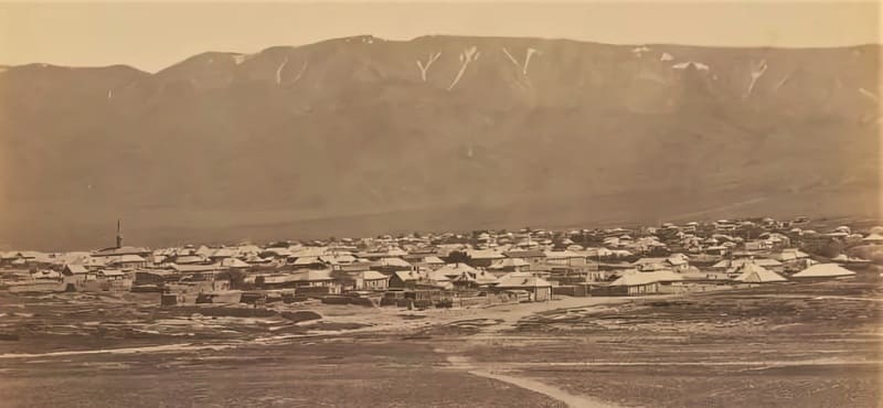
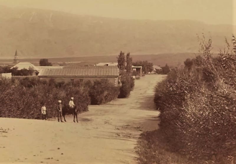
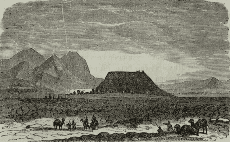
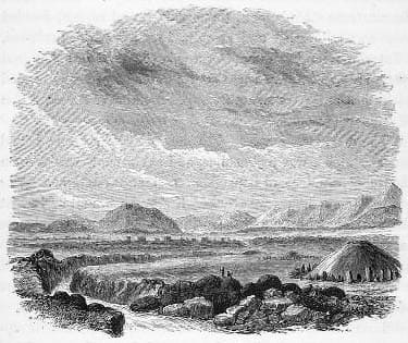
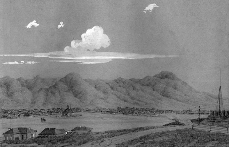
Photo 013 Nikolai Krekov. The photograph from 1877-1878 shows a general view of the town of Kopal set against a mountain panorama (there is also a second part to the photograph titled "Semirechye Region. Town of Kopal"). On the left, the minaret of the Tatar "Upper" Mosque is visible; it was located within the town settlement proper, somewhere in the area of the Tatar Quarter (Tatarskaya Slobodka).
To the right lies a Cossack settlement, bordered on two sides by water barriers - the Kopalka and Zimovka rivers - and featuring the Tamchi-Bulak spring. Also visible are roads leading both into the settlement and past it, including the so-called postal route from Semipalatinsk to Verny. It can be stated with certainty that the vantage point from which the photographer captured the panoramic view of the town of Kopal was the earthen fortress (or fortification) located northwest of the settlement; the road to the town leads directly from this fortress.
To the southwest of the fortress lay (and still lies) an old Russian cemetery - featuring headstones with dates of death from the 1870s and 1880s - which falls outside the frame of the photograph. A Muslim cemetery is also situated away from the town (to the north) and is divided into Tatar and Kazakh sections.
The burial practices of the “Kopaltsev” - the settled Tatars and Sarts (Uzbeks) - differed significantly (and still do) from the nomadic traditions of the Kazakhs, who build domed mausoleums and bury their dead exclusively in ancestral clan cemeteries (the Naiman tribe, specifically the Sadyr and Matay clans, inhabits this area).
Photo 014 "Part of the town of Kopal." From the travel album of Paul Labbé, 1897. This archival photograph (taken in 1885) is attributed to Abram Leybin. The image has survived thanks to the archive of the French traveler and researcher Paul Labbé, who collected ethnographic and anthropological materials during his expeditions across Siberia and Turkestan.
The scholar and ethnographer Paul Labbé did indeed bring this photograph back to Europe. In the 1890s, he undertook a major expedition across Siberia, the Urals, and Kazakhstan, studying the way of life of local peoples. During his travels, Labbé not only took photographs himself but also actively purchased or accepted as gifts works by the best local artisans for his scholarly collection.
When his personal archive was transferred to the holdings of the Musée du Quai Branly in Paris and the French Geographical Society, the photographs were naturally marked "From the Paul Labbé archive." Consequently, many modern publications and blogs automatically credit him as the sole author.
However, through detailed cataloging of the archives and cross-referencing with local collections (including "History of Russia in Photographs"), researchers established the true authorship: the photograph was taken in 1885, a time when Labbé had not yet even visited the region.
The actual creator of the image was Abram Leybin who captured Semirechye long before the French visitor’s arrival. Labbé acted as a meticulous collector, ensuring the image was preserved in pristine condition and has survived to the present day.
Geographic coordinates of Kapal picket: N45°07'30" E79°02'42"
26. Akichken Picket.
The Kapal detachment was to be stationed opposite the Yugontas settlement, on the Kok-Tal River. On April 11, seen off by the townspeople (of Kapal), the detachment left behind - albeit an unenviable one - urban life; they crossed the turbulent Kopalka River and headed along the foothills of the Alatau range toward the first Cossack outpost, Ak-Ichke.
The first leg of a journey is always difficult, but it is even harder when, upon arriving to camp for the night, there is nowhere to take shelter from the cold and inclement weather - conditions that are particularly harsh in the mountains. The Cossack outpost. It cannot meet this requirement.
It serves as a postal station that also houses a small detachment of Cossacks responsible for maintaining order in the Kyrgyz “volosts” and escorting administrative officials. Cossack outposts - or “bekets” - are established along the entire steppe postal route at intervals of 20 to 40 versts.
Each consists of a small building made of unbaked brick, divided into two sections: one houses the Cossacks and postal drivers, while the other is reserved for travelers. A courtyard containing stables and utility outbuildings adjoins the rear of the building.
Some of the outposts were surrounded by a small ditch and rampart; this was because - especially in the early days of our settlement in the steppe - the Kyrgyz, while out on raids to rustle livestock, were not averse to attacking an outpost and would readily make off with Cossack or postal horses.
We stopped near these outposts simply because one could usually find good water and forage for horses and livestock there; the posts offered no other amenities. After completing a thirty-verst march - the first ten versts through the mountains (the First and Second Chambulak) and the remaining twenty along a flat, stony track that sloped gently toward the Ak-Ichka River - the detachment made camp for the night in the open field.
Sleeping on the grass just beginning to sprout from the earth was a miserable experience, especially in the mornings; no reveille was needed, for everyone would rise well before dawn and set about heating their kettles - items every soldier carried, along with a felt mat.
Although transporting such unauthorized gear required an extra supply wagon, the command turned a blind eye, given the exceptional local conditions. Those unable to stock up on tea would dig up licorice or other roots beforehand, but generally, every man in the detachment drank something hot in the morning.
This was the custom among steppe soldiers, particularly the Cossacks. It is, however, a very good custom: thanks to it, there were few cases of illness, despite all the sharp fluctuations between heat and cold - which are so keenly felt in the towns of the Semirechye region - and not to mention the overnight stops on the march, where one might spend the night in the mountains one time and in the valley the next.
A. Shipilov. "A Russian Detachment on Chinese Border in 1863." 1863.
Geographic coordinates of Akichken Picket: N45°13'28 E78°40'46
27. Sarybulak Picket.
Geographic coordinates of Sarybulak Picket: N45°04'58 E78°24'49
28. Karabulak Picket.
Geographic coordinates of Karabulak Picket: N44°55'55 E78°26'44
29. Dzhangyz-Agach Picket.
After spending the night with hospitable crests and drying our soaked clothes, we headed for the Dzhangyz-Agach picket. At first, the road ran through the valley - fairly level and smooth - but as we neared the mountains, we began to encounter deep irrigation ditches that greatly hindered movement, especially for the supply train.
Having bid farewell to the fertile Karatal Valley, the detachment made its way through the low mountains separating the Karatal and Kok-Su river basins. The road once again wound through minor passes - a tedious and monotonous route. After covering ten versts, we descended into a mountain valley; within its gorge, we spotted the Zhangyz-Agach picket post.
We stopped there to spend the night - doing so quite early - having completed a march of 22 versts.
Alexander Shipilov. "Crossing Yugontas: First Encounter and Skirmish with the Chinese." 1863. Military Collection (No. 9). 1881.
https://turgenskiy.livejournal.com/25329.html
Geographic coordinates of Zhangyz-Agach picket: N44°45'30 E78°33'44
30. Koksu Picket.
"In 1855, following the construction of the picket on the Koksu River, the picket's Cossack garrison - likely due to its location at the mouth of a mountain pass through the Dzungarian Alatau leading to that part of the Il f the valley - which remained under the de facto control of China for a long time thereafter - was reinforced by the settlement of a number of Cossack families, who established the future “stanitsa” (Cossack village) of Koksuyskaya there."
Cossack historian N.V. Ledenev. “History of Semirechye Cossack Host”. 1909.
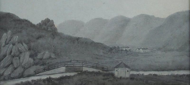
Geographic coordinates of Koksuysky picket: N44°40'16 E78°55'27
31. Ters-Akan picket.
Geographic coordinates of Ters-Akan picket: N44°32'09 E78°53'04
32. Sultan Ali (Kugalinsky) picket.
Geographic coordinates of Sultan Ali picket: N44°27'42 E78°42'01
33. Altyn-Emel picket.
Geographic coordinates of Altyn-Emel picket: N44°19'45 E78°25'46
34. Kuyankuz picket.
Geographic coordinates of Kuyankuz picket: N44°12'27 E78°10'36
35. Karacheki picket.
From the Karacheki station, the road gradually descends and traverses the hilly steppe. The Ili River is already visible from Chingeldy. The Ili settlement is located on the left bank of the river. A large bridge was completed this year - seemingly the finest in all of Asiatic Russia - which cost just under a quarter of a million.
A. M. Nikolsky, Curator of Zoological Museum of St. Petersburg University. “Journey to Lake Balkhash and the Semirechye Region”. 1885.
Geographic coordinates Karachekinsky Picket: N44°05'06 E77°52'13
36. Chingildinsky Picket.
At the Chingildinsky Picket, there is a remarkable spring - or well - with a deceptive bottom. The site is enclosed by a wattle fence. The depth of the water in the spring is no more than two “chetverts” (approx. 36 cm); the bottom is covered with fine sand, yet it is so fluid that a long pole sinks into it easily.
Cossacks told me they had tried to reach the true bottom of this well; they lowered a weighted rope measuring 60 “arshins” (approx. 42 meters) but could not touch the bottom. One officer told me he had wanted to measure the spring's depth precisely and lowered a weighted rope 500 “sazhens” (approx. 1 kilometer) long, yet even that proved too short.
Cossacks bathe in the spring and say it is impossible to drown in its fluid bottom because the upward pressure of the water ejects anyone who sinks in. The water is clear and delicious, and it does not freeze in winter. Half a “verst” (approx. 500 meters) from the spring, the ruins of an ancient fortification are visible; in the past, this site was connected to the spring by earthenware pipes laid underground.
No intact pipes remain today - I saw only small shards - but I was told they were sturdily constructed, designed to fit into one another, with a diameter of 6 “vershoks” (approx. 27 cm) and a length of 1½ “arshins” (approx. 1 meter) per section.
Pyotr Galitsky. "From Semipalatinsk to Verny Fortification." Sankt-Peterburgskie Vedomosti. 1868, Nos. 150, 151.
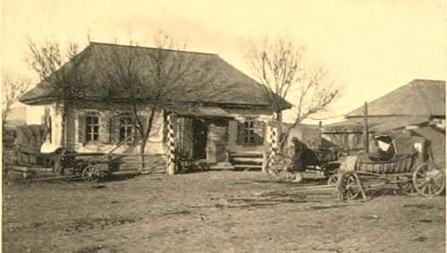
Geographic coordinates of Chingildy picket: N43°58'49 E77°27'45
37. Ili Picket.
The Ili fortification was established in 1854 and enclosed by a rampart made of gabions filled with stones and sand. In addition to the picket itself, the fortification houses a supply depot and other government buildings, while a small Cossack settlement lies just outside the stronghold.
The distance from Ili to the Verny fortification - or Almaty - is 70 versts, a journey made along a fine, level road.
Pyotr Galitsky. "From Semipalatinsk to Verny Fortification." Sankt-Peterburgskie Vedomosti. 1868, Nos. 150, 151.
The closer we drew to the Ili picket, the livelier the landscape became. We constantly encountered long camel caravans or lines of carts and wagons carrying soldiers and the first settlers bound for the Trans-Ili region. There were no permanent structures at the picket itself; it consisted entirely of yurts.
A large, clumsy barge sat on the river just upstream from the picket. It had been built on the western shore of Lake Balkhash, and I met the men who had constructed it and brought it to the Ili picket just a month prior. They had spent two weeks crossing the lake, delayed by adverse winds.
According to their accounts, the lake was generally eight meters deep, though in places the depth dropped to four meters. In the middle of the lake, they encountered a fairly tall island that was visible from afar. They made their way up the Ili River - towing their craft from the bank - to the Ili Outpost, a journey of three hundred versts that took two months.
At the outpost, the Ili River is between 300 and 400 meters wide. Crossing the river proved rather difficult and time-consuming. Although the current near the Ili Outpost is not particularly swift, the water contains many dangerous whirlpools. My “tarantas” was somehow ferried across on a flat-bottomed boat, but I had to cross on horseback, swimming alongside the Cossacks.
During the crossing, one of the Cossacks' horses began to sink; the man was saved only because we were swimming in a group, close together, and he managed to nimbly scramble onto his neighbor's horse, while his own mount vanished underwater and resurfaced only much further downstream.
Once across the river, I got back into the “tarantas”; I still had two stages of the journey left to reach Verny (a distance of 70 versts). The first stage - to the Almaty Outpost - initially traversed the distinctive zone bordering the Ili; at that time, this area was filled with Kyrgyz “auls” (encampments) that had descended from the alpine zone, bringing their herds and flocks with them.
Pyotr Semyonov-Tyan-Shansky. “Journey to Tian-Shan”. 1856-1857.
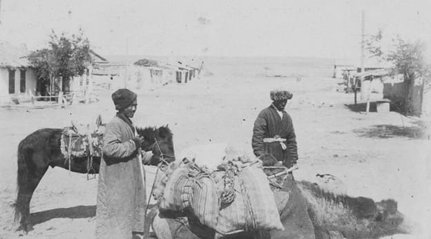
Geographic coordinates of Ili Picket: N43°53'33 E77°07'46
38. Kutentay Picket.
In 1857, a postal outpost known as Kutentay was established on the main route, 46 versts north of the town of Verny. In 1873, a peasant settlement bearing the same name (Kutentai) was established at the site of the picket; over time, it was renamed the village of Nikolayevka, then Zhetigen, and is now the city of Alatau.
It was situated 46 versts north of the city of Verny on the Kopal Tract (now the Ili Tract). The residents' primary occupation was irrigated agriculture, specifically the cultivation of melons and gourds. In 1970, residents from the village of Iliysky - which had been submerged during the filling of the Kapshagay Reservoir - were resettled in Nikolayevka. In 1993, the settlement was renamed Zhetigen (Kazakh: Жетіген).
Geographical coordinates of Kutentai picket: N43°40'29 E77°06'00
30. Karasu Picket.
Geographical coordinates of Karasu picket: 43°26'56 E77°02'59
40. Verny Picket.
On August 20, after a grueling march, we finally reached the Ili settlement, from where I set out for Verny on September 3. The road runs through the same type of steppe terrain, interspersed here and there with cultivated fields. One encounters entire wagon trains of migrants along the way.
These newcomers, hailing from various Russian provinces, are making their way to the districts of the Semirechye region; they subsist on charity during the journey, saving their last pennies to set up their new households. The migration of these farmers into this land of nomads evokes thoughts that are neither new nor particularly cheerful.
A. M. Nikolsky, Curator of Zoological Museum at St. Petersburg University. "Journey to Lake Balkhash and Semirechye Region." 1885.
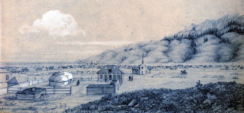
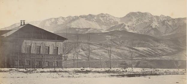
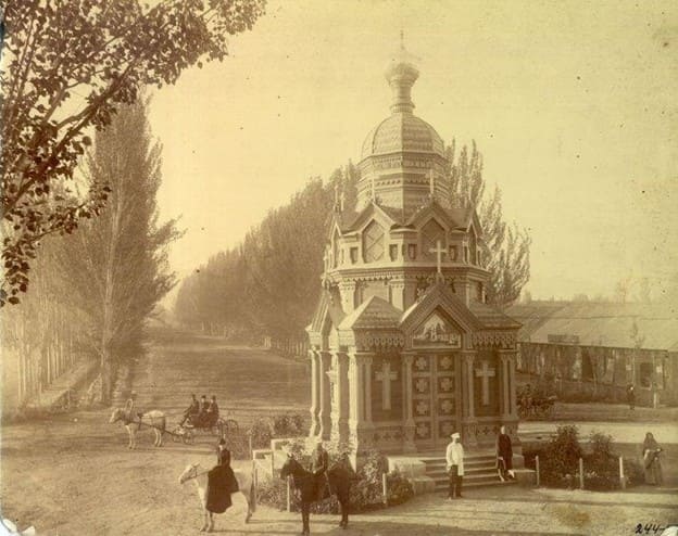
Geographic coordinates of Verny Picket: N43°12'20 E76°58'41
Authority:
Data from the following sources were used in preparing this material:
https://abashin.org
https://ru.wikisource.org
https://www.vostlit.info/Texts/Dokumenty/m.asien.htm
https://rus-turk.livejournal.com
Konstantin Abaza, "Conquest of Turkestan." 2023.