







Вы здесь
Explorer M. V. Pevtsov.
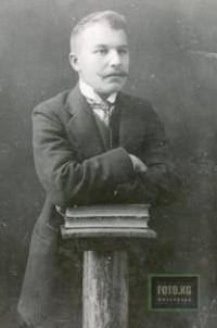
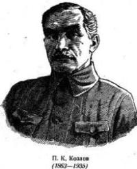
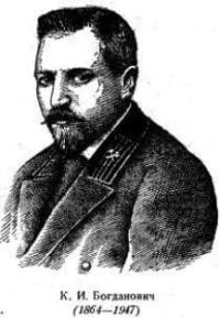
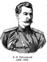
Russian explorers in Central Asia.
“In his work, M. V. Pevtsov provided formulas convenient for calculating latitude using this method, illustrating them with numerous examples from his own observations. By also providing a star catalog and auxiliary tables, M. V. Pevtsov greatly simplified the determination of latitude, and his method is finding increasingly wide application.”
Geodesist I. I. Stebnitsky. “On the Travels and Works of M. V. Pevtsov.” 1891.
“Familiarity with almost all geographical and geological literature concerning Central Asia allows me to assert that the contribution of Russian scientists to the study of this vast region exceeds the combined contribution of all other explorers.”
Academician V. A. Obruchev. “The Contribution of Russian Scientists to the Exploration of Central Asia.” Proceedings of the Second All-Union Geographical Congress, Vol. I. Leningrad. January 25-31, 1947.
Exploration of Central Asia by Russian travelers.
Mikhail Vasilyevich Pevtsov belongs to that remarkable group of pioneering Russian explorers who, in the second half of the XIXth century, rediscovered for science the vast expanses of the Asian continent - stretching from the Khingan Range in the east to Tibet in the south, and to the Pamirs and Tian-Shan in the west.
It was precisely in the second half of the XIXth century that the truly scientific study of the lands of Central Asia began; prior to that time, information about the region had been meager, fragmentary, and often of questionable reliability. “…until that time, Central Asia was a region little better known to geography than the interior of Africa - ‘little better’ only because some light, however dim, had been shed on the geography of Inner Asia by accounts of the travels of Marco Polo and other medieval explorers, as well as by Chinese geographical texts; renowned Sinologists, cartographers, and geographers - such as Abel-Rémusat, Klaproth, Humboldt, and Ritter - had devoted years to translating, interpreting, and correlating these texts with geographical maps.”
A new era in the geographical study of Central Asia was inaugurated by P. P. Semenov, who undertook his famous expedition to the Tian-Shan mountains in 1856-1857. The results of this expedition were remarkable in many respects. They provided the first accurate scientific understanding of the geography and geology of the Tian-Shan mountain system; they refuted the erroneous theory - then dominant in European science - propounded by A. von Humboldt regarding contemporary volcanism and the volcanic origin of the high-mountain regions of Asia; and they yielded the first information concerning the massive glaciation of the Tian-Shan.
Secondly - and most importantly - through his Tian Shan expedition, P. P. Semenov laid the groundwork for a then-novel methodology of comprehensive geographical research. In this regard, the scientific findings of the expedition transcended its specific territorial scope and assumed immense significance for the field of geography as a whole.
They represented the first practical example of a comprehensive study of nature in all its diversity, taking into account the strictly ordered interdependencies of all its elements: climate, topography, fauna and flora, and, finally, the human activity that alters them.
Later, while serving as Vice-President of the Russian Geographical Society, P. P. Semenov-Tyan-Shansky passed on his ideas and methodological principles to hundreds of Russian geographers, including a cohort of pioneering explorers of Central Asia - Przhevalsky, Potanin, Pevtsov, Obruchev, Kozlov, Roborovsky, and many others.
* * *
There is arguably no name in the history of Russian geography as renowned as that of Nikolai Mikhailovich Przhevalsky. The discoveries and explorations he conducted in Central Asia between 1870 and 1885 - particularly in the Gobi, Tsaidam, Northern Tibet, and the Kuku-nor region - marked a new era in geographical science.
The great traveler’s fifteen years of exploratory work came to be known within the Russian Geographical Society as the "era of N. M. Przhevalsky’s expeditions." N. M. Przhevalsky spent more than nine years within Central Asia itself. During this time, he traversed over 30,000 kilometers and mapped these vast territories.
His routes "...form an extensive network spanning the area between the meridians of Beijing and Khotan and between the parallels of the Altai and the headwaters of the Blue River..." Sixty-three astronomical points determined by Przhevalsky link his survey to maps of other parts of the globe sphere.
Two hundred and thirty-one barometric measurements enriched science with new data on the topography of the Central Asian highlands. The plant and animal collections assembled by Przhevalsky retain immense scientific value to this day. "Despite everything accomplished since Przhevalsky's time, the observations from the four expeditions he led alone provided extremely important and valuable material for assessing the climate of Central Asia," wrote A. I. Voeikov, a leading Russian climatologist, regarding Przhevalsky's climatic and meteorological observations.
Such, in broad terms, was Przhevalsky’s multifaceted research activity; yet his contributions to geography went beyond this - he also produced the first superb examples of what was then a new literary form for describing geographical expeditions.
The four volumes of the great traveler’s writings, dedicated to his explorations of Central Asia, hold the reader’s unflagging interest from the first page to the last - captivating both professional geographers and those with no direct connection to the field.
In Przhevalsky’s books, genuine literary brilliance is combined with utmost clarity, precision, and profound scientific substance. Przhevalsky’s works inspired many with a passion for traveling to distant, unexplored lands - a passion driven not by the adventures such journeys might hold, but by the pursuit of new discoveries and research that enrich human science and culture. Przhevalsky dedicated his life to such exploration, setting an example of service to national science for hundreds of Russian travelers.
The words of a brief obituary titled "People of Heroic Deeds," written by Anton Pavlovich Chekhov, are telling in this regard: "It is clear why Przhevalsky spent the best years of his life in Central Asia; the meaning of the dangers and hardships to which he exposed himself is clear; and clear, too, is the full horror of his death far from his homeland, as well as his dying wish to continue his work even after death - to bring life to the desert with his grave.
Upon reading his biography, no one will ask:
'What for? Why? What is the point?' Instead, everyone will say: 'He was right.'"
A letter written to the explorer by the renowned historian M. I. Semevsky - founder and editor of the journal *Russkaya Starina* (Russian Antiquity) - vividly illustrates the impression Przhevalsky’s books made on his contemporaries: "I thank you with all my heart for the pleasure I derived from reading your *Third Journey to Central Asia*.
I have just finished reading this superb work and, while still filled with enthusiasm, have written a review for “Russkaya Starina”. The narrative is concise and simple - devoid of affectation or superfluous words - yet it is never dry; there is not a trace of the listlessness often found in the accounts of other travelers.
It is essential to produce an affordable, popular edition of this book, especially for young readers. In closing, I reiterate: I am delighted with your book. It has been a very long time since I read anything with such pleasure. Having finished it, I find myself - in my imagination - following in your footsteps: from Zaysan, through Khami, to Tibet and the headwaters of the Yellow River."
It is precisely this magnetic appeal and charisma of Przhevalsky - both as an explorer and a writer - that prompted us to dwell on him at somewhat greater length in this brief article about M. V. Pevtsov. There is every reason to believe that when M. V. Pevtsov set out on his first expedition in 1876, he had likely already read Przhevalsky’s report on his travels in the Ussuri region, and possibly the account of his first Central Asian expedition; Pevtsov’s work during his subsequent two expeditions was undoubtedly carried out under the significant influence of N. M. Przhevalsky’s writings.
* * *
Mikhail Vasilyevich Pevtsov was born in the Novgorod Governorate in 1843. Unfortunately, very little is known about Pevtsov’s childhood and youth. This is due to the great modesty so characteristic of him, and, it seems, partly to a particular, somewhat reserved nature.
Pevtsov belonged to that type of scholar who, having devoted themselves entirely to their chosen vocation, give little thought to their personal lives - and speak of them even less. Later, having become a renowned explorer, Pevtsov wrote very sparingly in his works about the hardships and difficulties he personally endured during his life of expeditionary travel.
Perhaps these character traits, and the corresponding nature of his writings, explain why the literature contains only scant, brief, and incomplete information regarding the explorer’s personal life. The few biographical details available to us indicate that the future traveler’s life was difficult from early childhood.
At the age of seven, M. V. Pevtsov was orphaned and taken into the care of a relative - an impoverished St. Petersburg civil servant. The extreme poverty in which the boy lived during those years prevented ...lacked the opportunity to receive a formal education; however, driven by an immense thirst for knowledge, Pevtsov attended the *gymnasium* as an auditor for several years.
Later, he also attempted to audit courses at St. Petersburg University. Yet, a year later, financial hardship forced him to enlist in the military and enroll in a cadet school. The sixteen-year-old cadet’s interests soon became apparent: while excelling in all subjects, Pevtsov particularly distinguished himself through his extensive and profound knowledge of history, geography, and mathematics.
This rare combination of aptitude for both the humanities and the exact sciences played a significant role in M. V. Pevtsov’s future career. His works on expeditions in Central Asia encompassed not only the results of numerous, highly precise astronomical, hypsometric, and gravimetric measurements but also comprehensive geographical and ethnographic descriptions.
His original experiments to determine the speed of sound - conducted twenty years later in the mountains along Tibet’s northern fringes - are also characteristic in this regard.
We find interesting, albeit brief, details about Pevtsov’s life and character during this period in the memoirs of a fellow cadet:
"Pevtsov would read and explain history lessons to us - showing great enthusiasm himself - while Captain Kronman, listening to him, was often amazed by the wealth of historical facts Pevtsov cited. He was renowned at our school as a historian and, even more so, as a mathematician; at Captain Nilovitsky’s suggestion, Pevtsov frequently taught arithmetic and algebra lessons to us in the junior classes."
Of all the subjects taught at the academy, Pevtsov had an excellent command of mathematics, history, and geography. It was during this period that Pevtsov’s love of nature - a passion that would ultimately shape his life’s path - became clearly evident.
While spending his leave in a remote village in the Novgorod Governorate, he would roam the dense forest wilds for weeks on end, accompanied only by his gun, fishing rod, and cooking pot. By his own account, he sought even then to accustom himself to the hardships inherent in expeditions to distant and inaccessible lands.
It was also within the walls of the academy that another facet of the future explorer’s character revealed itself. Contemporaries from his youth describe Pevtsov as an excellent comrade, always ready to come to another’s aid and share whatever he had. M. V. Pevtsov retained this quality throughout his life, and it is reasonable to assume that it contributed significantly to the success of his expeditions.
In this regard, he embodied the qualities N. M. Przhevalsky deemed essential for an explorer - someone who "must possess an even, agreeable temperament, thereby quickly winning the goodwill and friendship of his companions." The great explorer rightly considered this a crucial prerequisite for the success of long-distance expeditions.
In 1862, at the age of nineteen, Pevtsov successfully graduated from the academy and was commissioned as an ensign. He spent the next five years or so serving in the Tomsk Regiment. We know nothing of Pevtsov’s life during this time; however, it is safe to assume that his love of nature and thirst for knowledge never left him, even while serving in the regiment.
By 1867, Pevtsov was already a member of the Russian Geographical Society, and in 1868, he managed to leave his regiment and enroll in the General Staff Academy. Having thus returned to St. Petersburg, Pevtsov - alongside his studies at the Academy - devoted himself enthusiastically to the natural sciences, utilizing the library and museum of St. Petersburg University.
During these years, he mastered the dissection of animals, birds, and fish, and learned the techniques of taxidermy and the preservation of entomological and botanical collections.
According to a fellow officer,
"taking advantage of his time in St. Petersburg, M. V. Pevtsov prepared himself to become an explorer and consciously cultivated all the qualities essential to a naturalist."
While attending the Academy’s general course, Pevtsov remained most interested in the mathematical sciences. He voluntarily attended lectures at the Geodesy Department and successfully completed the geodesy curriculum. During frequent visits to the Pulkovo Observatory, the future explorer studied in detail all the observation techniques for celestial bodies used at the time, as well as the astronomical instruments employed for such observations.
For three years after graduating from the Academy in 1872, Pevtsov continued his service in the Semipalatinsk Region. Finally, this St. Petersburg native saw firsthand the unique landscape of the Kazakh steppes - previously known to him only through books - and encountered their semi-nomadic population. Pevtsov enthusiastically devoted himself to studying the language and way of life of the Kazakh people.
During this same period, he diligently studied Arabic and researched history using a wealth of source materials. ...of China, and - with his characteristic meticulousness - made notes, excerpts, and selections from everything he read.
* * *
In 1875, M. V. Pevtsov was transferred to the city of Omsk. Pevtsov lived in the city for over twelve years; it was from there that he set out on his expeditions across Dzungaria and Mongolia; there that he participated in founding - and subsequently in the activities of - the West Siberian Branch of the Russian Geographical Society; and there, in Omsk, that M. V. Pevtsov’s brief stint as a teacher took place.
Shortly after his arrival, M. V. Pevtsov was invited to teach geography to the middle-level classes at the Siberian Military Gymnasium. Memoirs survive regarding this very brief period of Pevtsov’s life, written by G. E. Katanaev - a fellow teacher at the gymnasium who, like Pevtsov, would later become a founding member and active participant in the West Siberian Branch.
"At the time, I was serving as a supervisor and geography teacher for the junior classes at the Siberian Military Gymnasium," writes Katanaev, "while M. V. Pevtsov taught geography to the middle classes at the same institution. I remember his modest, slight figure - he was a General Staff captain back then - and how he would neatly, almost invisibly (if one might put it that way), slip away from the gymnasium once classes ended, without really socializing with the other teachers or supervisors.
I know, however, that despite his presence at the gymnasium being so brief and strictly confined to specific hours, he made a name for himself among both the faculty and the students. It was said that the students 'loved' and 'listened to' him; There was something about his teaching style that motivated students not only to willingly prepare the assigned textbook lessons but also to read books outside of class on natural phenomena, travel, physical geography, and astronomy. It was said that Pevtsov was no fan of teaching strictly by the textbook - covering material merely "from page X to page Y" - and for his students, geography was not synonymous with that meager, green-bound volume labeled "Introductory Course in [Subject] for (Grade Level) Students."
In this context, it is worth noting that M. V. Pevtsov generally brought a creative approach to every endeavor he undertook. He was not one to limit himself to a rigid, prescribed scope of work - neither as a geography teacher nor, later, as an explorer-geographer.
For instance, at a meeting of the Academic Council of that same Siberian gymnasium, Pevtsov passionately advocated for - and succeeded in getting the Council to adopt - a new curriculum for a course on "knowledge of the homeland." He did so even though the program did not align with any of the recommended elementary geography manuals of the time - a fact that had initially raised doubts among the Council members.
Evidently, the idea of creating a new physical geography textbook took root in Pevtsov’s mind during his time teaching at the gymnasium. He may well have begun writing it back then, but his characteristic modesty led him to keep the work hidden, even from his colleagues.
It was not until 1881, during a brief visit to St. Petersburg, that Pevtsov had a limited number of copies printed. This slim, 105-page volume - The Basic Principles of Mathematical and Physical Geography - is of interest not only for the insight it offers into Pevtsov as an educator but also for the history of Russian educational literature on geography.
In a brief preface, Pevtsov notes that the textbook is intended to serve as a guide to the fundamentals of physical and mathematical geography - subjects the author considers essential as an introduction to a systematic course in descriptive geography.
Pevtsov goes on to outline his views on the ideal chronological order for studying the various branches of geography. He considered it sensible to devote the first year of study to the geography of one’s own country and region, the second year to the subject matter of the textbook itself - namely, the basic principles of mathematical and physical geography - and only then to proceed to descriptive geography.
The presentation of the material is notable for its brevity, clarity of language, and the compelling logic of its arguments.
For instance, the textbook explains the causes of lunar eclipses as follows:
"The Earth, illuminated on one side by the sun's rays and being opaque, casts a conical shadow away from itself, always in the direction opposite the sun. The Moon moves around the Earth near the tip of this terrestrial shadow; at the point where the Moon's path intersects the shadow, the shadow's diameter is significantly larger than that of the Moon.
Consequently, the Moon sometimes enters the Earth's shadow; losing its luster there, it becomes invisible to the naked eye. This is how a lunar eclipse occurs. It may be total, when the entire Moon enters the cone of the Earth's shadow, or partial, when only a portion of its illuminated disk enters the cone and becomes obscured."
It is obvious that lunar eclipses can occur only when the Earth is between the Sun and the Moon - that is, during a full moon. However, one should not assume that a lunar eclipse occurs during every full moon; the Moon does not always pass into Earth's shadow during the full phase but often passes by it.
During a lunar eclipse, as the Moon begins to enter Earth's shadow, a portion of a circular shadow becomes visible on its bright disk - serving as irrefutable proof of the Earth's spherical shape.As in Pevtsov’s other works, this text harmoniously combines accessible language with scientific rigor; this distinguished the textbook - which, unfortunately, never actually reached students - from the many geography manuals of the time.
Another remarkable feature of Pevtsov’s textbook is that it was designed for independent study, without the need for a teacher. It is quite possible that the idea of creating a self-study guide for geography stemmed from memories of his own childhood and youth - years marked by hardship, during which a lack of funds prevented him from attending “gymnasium” or completing university, and when such a manual would have been of immense help.
As previously mentioned, M. V. Pevtsov’s teaching career was short-lived. An unexpected turn of events soon separated him from his students, enabling him to realize a long-held dream of traveling to distant, unexplored lands. A grain caravan was making its way to the small Chinese town of Gucheng, situated at the northern foothills of the Tian-Shan mountains.
Its route lay through the little-known or entirely unexplored regions of Dzungaria - a land enclosed between the vast mountain ranges of the Tian Shan and the Altai. A Cossack “sotnya” (a unit of one hundred) was assigned to escort the grain transport and guard the cargo, with M. V. Pevtsov placed in command.
At the same time, he was tasked with gathering - as far as possible - detailed information about the region the caravan was to traverse, particularly the stretch between Bulun-Tokhoi and Gucheng, an area where no traveler had yet ventured. By early spring 1876, Pevtsov had arrived at the small border settlement of Zaysan, the starting point for the caravan’s long journey.
* * *
In mid-May, M. V. Pevtsov set out from Zaysan on his first expedition. A long and arduous route lay ahead - spanning over 900 kilometers - crossing high mountain passes and the vast, waterless semi-deserts and deserts of Eastern Dzungaria.
For the young traveler, who had no prior experience with expeditions, this first journey required not only mapping the terrain but also describing it in as much detail as possible - all while simultaneously fulfilling the duties of caravan escort commander, tasks that were at times quite burdensome.
After crossing the low Manrak Range, the caravan traversed the monotonous, pebble- and gravel-strewn Chiniktinskaya Plain and, passing through the mountains bordering it to the east, entered Chinese territory. Twelve days after leaving Zaysan, the travelers reached the small Chinese town of Bulun-Tokhoi, situated near the shores of the little-studied Lake Ulyungur.
Upon arriving at Bulun-Tokhoi, the caravan completed the first half of its journey. Ahead lay the most difficult part: traversing desolate and completely unknown expanses about which even the local inhabitants could provide no detailed information.
A severe flood of the Urungu River - along which the caravan was to continue its journey - delayed the travelers in Bulun-Tokhoi for ten days. This circumstance gave Pevtsov the opportunity to explore the town’s surroundings and the as-yet-unexplored Lake Baga-Nor, located approximately seven kilometers from Ulyungur.
The lake’s flat, sandy shores were entirely devoid of vegetation, and the surrounding landscape was monotonous and dreary.
"Due to the extreme salinity of the water," Pevtsov notes, "it likely harbors no animal life - a fact confirmed, incidentally, by the complete absence of waterfowl or wading birds on the lake. Only ruddy shelducks (Casarca rutila), occasionally visiting this desolate lake during migration, fill the air with their plaintive cries, which resemble the moaning of a sick child."
Exploring the lake proved extremely difficult. Scorching heat and a lack of water caused the travelers unbearable suffering. "By the end," Pevtsov recalls in his report, "we could barely stay in our saddles, swaying from side to side, and we dragged ourselves back to the town only with the greatest difficulty, retaining a lasting memory of that grueling day."
On June 9, the caravan left Bulun-Tokhoi and set out once more on a long journey, following the valley of the Urungu River all the way to the foothills of the Mongolian Altai. In our view, the geographical description of this stretch of the route constitutes one of the finest passages in the report on the Dzungarian expedition - M. V. Pevtsov’s first literary work.
"Across the entire expanse from Bulun-Tokhoi to the Southern (Mongolian. - Ya. M.) Altai, this high land..." It is an arid desert covered with the scantiest vegetation, consisting of two or three species of scraggy heather and just as many types of thorny shrubs.
Only here and there, in flat hollows with gleaming, pale-yellow loamy soil, can one find small stands of sparse, stunted *chi* grass - a sure sign of moisture hidden in the ground - and wretched *Caragana frutescens* bushes. If an aeronaut were ever to fly over this region, following the course of the Urungu River upstream, the land below would appear first flat, then gradually rolling, and finally - near the Southern Altai - transitioning into true mountainous terrain dotted with bare peaks and crags.
Amidst this desolate landscape, he would see a deep, trough-like hollow - very wide at first, then narrowing and in places turning into a wild gorge; and on its floor, were it summer, he would discern a multicolored ribbon with a green center and pale-yellow borders, winding like a giant serpent.
The green strip represents the deciduous forests shading the banks of the Urungu, while the pale-yellow borders are the stands of *chi* grass adjoining the forest belt. He would also notice that along the middle and upper reaches of the river - where in places it rushes through the gorge at breakneck speed - the green strip narrows significantly and its pale-yellow borders vanish entirely, only to reappear where the gorge widens into a valley.
Upon reaching the advanced ridge of the Mongolian Altai - known locally as the Kutus Mountains - the caravan left the Urungu Valley and turned south. Soon, near the Kanna spring, the travelers caught their first glimpse on the horizon - barely visible to the naked eye - of the highest snow-capped peaks of the Tian- Shan.
"Among them," writes Pevtsov, "the mighty, cone-shaped Bogdo-Ola Mountain stood out sharply. Illuminated by the last rays of daylight, it gleamed whiter than the others against the distant horizon and, despite the vast distance separating us, was clearly visible through binoculars."
The caravan continued southward, crossing numerous low-lying elevations - the outlying spurs of the Mongolian Altai. Finally, these too were left behind; before the travelers lay a vast plain: the Laman-Kryum Gobi. Here began the true Central Asian desert.
"We felt its hot breath," Pevtsov notes, "the moment we descended onto it from the mountains."
The caravan halted for more than three days at the small Gashun oasis, resting after the arduous trek across the desert.
The flora of this oasis caught Pevtsov’s attention:
"Alongside the few species we had encountered everywhere in previous oases, there appeared here a significant number of species - and even genera and families - that we had not seen at all in those other oases."
This phenomenon, strange at first glance, is explained by the saline soil of the Gashun oasis and the area's significantly lower elevation compared to the neighboring Chuizhe oasis - and, in particular, to the oases in the foothills of the Southern Altai.
The caravan’s subsequent route lay across a sandy desert known to the Chinese as Khan-Zhinelsin and to the Torguts as Gurbun-Tungut. This was the final arduous leg of the journey before reaching Guchen. Ahead, the Tian Shan range rose up like a giant rampart, and the travelers were entering the broad, fertile belt along its northern foothills.
Finally, forty-eight days after departing from Zaysan, the caravan reached its ultimate destination: the city of Guchen. The travelers remained in Guchen until early August; during this time, Pevtsov studied the way of life of the city’s diverse population and undertook a fascinating excursion into the Tian-Shan mountains.
The traveler’s report contains an interesting account of this excursion. Through immense effort - and at times risking a plunge into the abyss - Pevtsov and his three companions managed to reach the snow line on the range's northern slope. "But when we," writes Pevtsov, "having lain on the heights for about a quarter of an hour, regained our composure and surveyed the vast expanse revealed before us, a majestic and grandiose spectacle met our eyes: to the northeast, we saw the Southern (Mongolian - Ya. M.) Altai and its western foothills - a high plateau on the left bank of the Urungu River, rising like a wall above the Gobi Desert.
To the east-southeast, this range receded across the entire visible expanse, gradually fading into the gray haze of the lower horizon. Between the Southern Altai and the Tian-Shan lay a broad, boundless plain that seemed to stretch endlessly toward the east."
"To the west, some 60 versts away, gleamed the queen of the mountains in this part of the Tian-Shan - the colossal beauty Bogdo-Ola; beside it rose another very high peak, which we dubbed Bogdo-Ola’s younger sister. Closer to us - about 40 versts away - rose a massive snow-capped dome, its base likely spanning some 10 versts in circumference; and to the south, at a distance of about 15 versts, the numerous snow-capped peaks of the mountain range itself sparkled, alongside vast fields of snow."
Measurements taken by M. V. Pevtsov showed that he was at an elevation of 3,675 meters above sea level and that the peak he observed - Bogda-Ola - must consequently rise to a height of at least 4,700 meters. On August 7, the caravan set out from the city of Gucheng on its return journey.
Traveling to Bulun-Tokhoi along the same route he had previously taken, Pevtsov verified the information he had gathered earlier and corrected certain inaccuracies. Upon reaching Bulun-Tokhoi, the caravan headed toward Zaysan via a road running north of the Saur Range; this enabled the traveler to explore almost the entire eastern half of the mountainous region of Northern Dzungaria.
* * *
The area between Zaysan and Bulun-Tokhoi, traversed by M. V. Pevtsov during the first half of his Dzungarian expedition, had been visited by other travelers before him. As early as 1654, the Russian envoy Fyodor Bankov crossed Dzungaria along this same route. He provided the first - albeit very brief - accounts of the Saur Range, the Chilikty Plain, and the Kobu Valley.
In 1871, Z. Matusovsky traveled from Zaysan to the city of Manas, crossing the Manrak Range and the Chilikty Valley. The following year, 1872, he traveled from Zaysan to Lake Ulyunpur, skirted the lake, and returned to Russia via the same route.
In that same year, 1872, Yu. A. Sosnovsky, while returning to Zaysan from his expedition across China, visited Lake Ulyungur, traversed the Kobu and Chilikty valleys, and crossed the Manrak Range. Both travelers conducted route surveys and produced maps of northern Dzungaria that, while not free of errors, were the best available at the time.
Nevertheless, even after these expeditions, geographical - and especially geological - information regarding this part of the region remained quite scarce. As previously mentioned, other areas of Dzungaria had not yet been explored at all at that time.
M. V. Pevtsov’s report on his Dzungarian journey was published in 1879 in the first volume of the *Notes* of the West Siberian Branch of the Russian Geographical Society. It attracted the attention of many geographers and geodesists of the era and immediately elevated the young traveler to the ranks of recognized explorers of Central Asia.
The Russian Geographical Society awarded M. V. Pevtsov the Small Gold Medal for this work and subsequently advocated for his deployment on expeditions to Mongolia and China. Let us briefly consider the main scientific results of the Dzungarian expedition.
In addition to geographical descriptions - examples of which we encountered on previous pages - Pevtsov’s report provides extensive information on the population, flora, fauna, and geological structure of the areas he visited. His ethnographic descriptions, which occupy a relatively small portion of the *Sketches* as a whole, are of twofold interest to us.
Firstly, they provide insight into the daily life and living conditions of the Mongol tribes inhabiting Dzungaria, and secondly, they characterize Pevtsov as an observant and multifaceted researcher. It is also interesting to note that, despite the bourgeois limitations of his social and political views, Pevtsov was the first traveler in Central Asia to recognize the unique plight of the Mongol tribes in northwestern China.
Varying in size and history, these tribes were ruthlessly exploited - on the one hand by their own local chieftains, and on the other by the military and civil officials of the Chinese Empire. This dual oppression weighed heavily upon the Torgut Mongols, whom Pevtsov described.
Hardworking and skilled herders, the Torguts lived in a state of constant want due to the numerous levies and acts of extortion to which they were systematically subjected by both their own leaders and Chinese officials.
"At times," writes Pevtsov, "Chinese authorities would launch outright predatory raids against them (the Torguts - Ya. M.), seizing their best livestock..."
The traveler concludes his description of this people with words full of genuine bitterness: " oppressed by Chinese rulers and, to some extent, by their own chieftains, the Torguts live mostly in poverty and drag out, so to speak, a wretched existence."
In addition to the main text, Pevtsov’s report contains five appendices, one of which is titled "Materials on the Zoogeography of Dzungaria." This appendix describes 18 species of mammals and 63 species of birds that Pevtsov encountered during the expedition and collected for his specimens.
The descriptions include information on distribution, distinctive characteristics, and, in some cases, methods of hunting these animals. Of great interest are the results of Pevtsov’s research in the Tian Shan during the brief excursion from the city of Gucheng - an expedition already familiar to us.
As he ascended the northern slope of the range, the traveler observed the changes in vegetation corresponding to altitude and provided the first data for this part of the Tian Shan regarding the upper and lower limits of coniferous forests - specifically the Tian-Shan spruce (Picea schrenkiana) - as well as the elevation of the permanent snow line.
In the appendices - one of which we have already mentioned - Pevtsov presents the results of determining the geographic coordinates of six locations, including the absolute longitude (relative to the Greenwich meridian) of one of them; data on magnetic observations at four sites; and the results of barometric altitude measurements for 17 locations in Dzungaria.
A review of the traveler's work, published in the 1879 report of the Russian Geographical Society, notes that both the observations themselves and the calculations used to arrive at these results demonstrate "...the skill of an experienced observer and a sound grasp of the theoretical aspects of the subject."
Drawing on his own astronomical measurements and those made by other travelers, and utilizing his own route surveys alongside existing topographic materials, Pevtsov compiled a map of Dzungaria; for a portion of the Mongolian Altai, he also incorporated information gathered from the local population.
While M. V. Pevtsov’s map provided the first reasonably accurate cartographic depiction of many areas in Dzungaria, it also contained numerous inaccuracies and errors. One of these errors - arguably the most significant - was the depiction of a mountain junction supposedly connecting the Tarbagatai and Saur ranges with the Urkashar and Semis-tau mountains.
Research conducted by V. A. Obruchev in the region in 1905 revealed that a vast basin lay where the junction had been depicted. The Tarbagatai Range drops off steeply at the basin's western edge, the high wall of the Saur Range rises to the north, and the Kadzhur Mountains - connected to the Semis-tau by a saddle - lie to the south.
Thus, the Tarbagatai and Saur ranges do not actually connect to one another at all; instead, Semis-tau and Kadzhur (the latter not depicted by Pevtsov) are linked to the Saur range by a ridge of low mountains. It is worth noting here that a misconception regarding the relative positioning of the mountain groups in the Saur-Tarbagatai region was widespread among geographers contemporary to Pevtsov.
Even an experienced traveler like Przhevalsky, who traversed the area three times, depicted it with significant errors on the map accompanying the account of his third expedition to Central Asia. Turning to the results of the Dzungarian expedition, it is interesting to note that in his initial studies, Pevtsov devoted particular attention to geological observations.
In his subsequent expeditions, he did not place such marked emphasis on geology. It is difficult to account for this distinctive feature of his early work, especially given that Pevtsov, as is known, lacked specialized geological training. Nevertheless, the data he gathered, along with the hypotheses and conclusions he put forward, held - and continue to hold - significant scientific value for understanding the geological structure of northern and eastern Dzungaria.
The Manrak Range, where Pevtsov began his scientific observations during the expedition, remained geologically unexplored at the time, despite its accessibility and proximity to Zaysan. Indeed, for a long time, this was the fate not only of Manrak but of the entire Border Dzungaria region - the area situated to the north and south of the Russia-China border.
Many travelers - both before and after Pevtsov - traversed this route, contributing to the geographical characterization of the region but adding almost nothing to the understanding of its geology. It was only through the three years of fieldwork (1905, 1906, and 1909) conducted by the eminent Russian geologist V. A. Obruchev that the foundations were laid for our modern understanding of the geological structure and origin of Frontier Dzungaria - a region of great geological interest.
The geological studies Pevtsov conducted in the Manrak Range (as well as elsewhere in Dzungaria) naturally bore the marks of the young researcher's inexperience and lack of specialized training; nevertheless, as V. A. Obruchev noted, compared to other works of that era, they provided the most extensive information regarding the geological structure of the range.
Certain results of Pevtsov’s geological survey of the high Chilikty Plain are also of considerable interest. The southern section of this plain, adjacent to the Tarbagatai Mountains, had previously been surveyed in 1864 by G. N. Potanin and O. V. Struve.
Pevtsov traversed the plain's northeastern section, where, among other things, he examined the deposits filling the valley at several locations.
Through excavation, he discovered a significant thickness of deposits and proposed an intriguing hypothesis:
"It is quite possible that the area in question was once a deeper intermontane depression, filled to its present state by the leveling action of water."
It would be interesting to know whether lacustrine deposits lie hidden here beneath thick layers of alluvium. Subsequent research by a number of scientists, including V. A. Obruchev, confirmed the validity of M. V. Pevtsov’s hypotheses. At the foot of the Manrak Mountains, beneath thick layers of young (Quaternary) deposits - alluvium and proluvium - brought down by streams and ephemeral watercourses, discoveries were made older (Tertiary) deposits, the composition of which suggests that the Chiliktin Plain was once submerged and formed a lake.
During a twelve-day stay at Lake Ulyungur and Bulun-Tokhoi, Pevtsov conducted a detailed study of the Bulun-Tokhoi Depression. While excavating along the shores of Ulyungur, M. V. Pevtsov discovered—at an elevation of 4 to 6 meters above the water level - shells and fish bones belonging to the same species that inhabit the lake today.
Based on these findings, he drew a fascinating conclusion regarding a time when the water level of Ulyungur was significantly higher. Of even greater interest are the results of M. V. Pevtsov’s study of Lake Baga-Nor and his general conclusions concerning the Bulun-Tokhoi Depression as a whole.
As previously mentioned, Yu. A. Sosnovsky visited the area in 1872; prior to his visit, information about the region had been extremely vague. Sosnovsky’s expedition revealed that, contrary to earlier beliefs, there was not just one large lake (Ulyungur) but two: the larger Kyzyl-Bash (Ulyungur) and the smaller Baga-Nor (Mongolian for "Small Lake").
They were separated by an isthmus of considerable width and height, which, according to Sosnovsky, was nevertheless cut through by an outflow channel connecting the two lakes. Upon carefully examining the flat rise separating Lake Ulyungur from Baga-Nor, Pevtsov did not find the channel described by Sosnovsky.
On the contrary, in his *Travel Sketches of Dzungaria*, the traveler states quite definitely that Baga-nor has no connection to Ulyungur. Indeed, there is no permanent link between these lakes. In rare years of exceptionally high floods on the Urungu River - which cause the Ulyungur basin to overflow - excess water drains into Baga-nor.
Yet, many modern maps still incorrectly depict a supposedly permanent watercourse between the two lakes. While excavating a site approximately two and a half kilometers north of Baga-nor, Pevtsov discovered a perfectly preserved pike frontal bone and two empty valves of an *Anodonta* (a freshwater mussel) embedded in hardened clay.
Numerous excavations at other locations yielded further fragments of similar shells and the remains of freshwater fish. As we know, the water in Baga-nor was so saline that it apparently supported no organic life; every single shell Pevtsov retrieved from the lakebed was dead, despite the freshening effect of springs welling up from the bottom.
"Judging by all the evidence," Pevtsov concludes, "one can state with certainty that Lake Baga-nor was once much larger during the era of the freshwater mollusks and fish that exist today, leaving such distinct traces of its former extent on the surrounding landscape that its past existence is beyond doubt.
It is equally certain that the lake originally held fresh water and served as the cradle for the living creatures whose remains are now scattered across its desolate shores." If we add to this the resemblance of freshwater forms - extinct in Baga-nor but still inhabiting Lake Ulyugagur and other small freshwater lakes in the basin - along with the unmistakable signs of Lake Ulyungur’s formerly much greater size and the multitude of lakes, marshes, and salt flats scattered across the Buluntohoi Basin, then hardly any doubt remains that a single, vast freshwater reservoir existed in this basin during the post-Tertiary epoch, though its precise boundaries can no longer be determined.
Addressing the natural question of how such a massive body of water was fed, Pevtsov hypothesized the existence of higher mountain ranges at that time, which would have collected greater amounts of precipitation. As the surrounding mountains lost elevation, the water level in the basin dropped; this led to the fragmentation of the vast reservoir into smaller, separate bodies of water where excessive evaporation - uncompensated by sufficient inflow - caused the brine to concentrate, gradually extinguishing organic life within them.
Many of Pevtsov’s other studies are also of undoubted interest; however, a detailed and in-depth examination of the numerous findings and the course of the Dzungarian expedition would require a separate article. We have dwelt on this journey here only because it was Pevtsov’s first expedition, and it is precisely for this reason that it holds significance for us within this brief overview of his life.
In *A History of the Fifty-Year Activity of the Russian Geographical Society*, P. P. Semenov-Tyan-Shansky, in his assessment of the Dzungarian expedition, wrote: "With this remarkable journey, M. V. Pevtsov achieved to a significant degree what the Geographical Society had so earnestly striven for during the preceding period: namely, a thorough investigation of Lake Ulyungur (or Kyzyl-bash), as well as the southeastern extremity of the Altai and the expanse separating it from the Tian-Shan; and, finally, a first acquaintance with Mount Bogdo-Ola - the most renowned of the Tian-Shan peaks according to indigenous geographical sources - not to mention the determination of the snow line's elevation in the vicinity of Bogdo-Ola's snow-capped summit."
In his superb article "Travel Sketches of Dzungaria" - which serves as the highlight of the first volume of the *Notes* of the West Siberian Branch of the Russian Geographical Society, published in Omsk in 1879 - M. V. Pevtsov demonstrated a masterful ability to describe and characterize the regions he had visited, thereby immediately taking his place among the Society’s distinguished figures.
* * *
In 1887, a highly significant event occurred in the life of the Russian Geographical Society: a new branch, designated the "West Siberian Branch," was established in Omsk. The Siberian Branch of the Geographical Society, which had previously existed in Irkutsk, had done a great deal to study Eastern Siberia; however, regarding Western Siberia - which lies directly adjacent to the European part of Russia and is characterized by a unique natural environment and a large, ethnically diverse population - the information available at the time was far from complete and highly fragmentary, often relying on data of questionable reliability.
The newly formed West Siberian Branch was tasked with filling this gap in the study of Western Siberia and the adjacent regions of Middle and Central Asia. For a full decade, from 1877 to 1886, the Branch’s activities were inextricably linked to the name of M. V. Pevtsov, who served first as its executive secretary and, from 1882, as the first chairman of its steering committee.
Having played an enthusiastic and active role in establishing the young Branch’s scientific work from its very inception, Pevtsov drafted the "Statute" that defined its primary objectives and scope of activity. "The West Siberian Division," states the *Statute*, "is engaged in the study of this region as well as the adjacent countries of Central Asia and Western China across the following fields: geography, geology, natural history, ethnography, statistics, archaeography, and archaeology."
The *Statute* further specifies that, to fulfill these objectives, the Division:
1) Locates and identifies existing information on Western Siberia and the neighboring countries of Central Asia and Western China - whether held in local archives or by private individuals - and evaluates its potential scientific utility.
2) Conducts on-site scholarly research by organizing expeditions to study the region in the aforementioned fields, particularly geography, natural history, ethnography, and statistics.
3) Assists individuals visiting Western Siberia for scholarly purposes as well as local residents studying the region, and generally seeks to engage in its exploration those whose expertise could benefit the Society.
4) Oversees the collection and preservation of scholarly resources relevant to its scope of study - such as books, manuscripts, documents, and maps - and manages the establishment and maintenance of a local museum and collections of mineralogical, natural-historical, ethnographic, and archaeological artifacts."
The activities of the West Siberian Division during its first decade - the period when Pevtsov served as, in the words of one member, its "guiding spirit" - were characterized by a wealth of highly productive expeditions. It was during this period that D. Klements, N. Yadrintsev, A. Nikolsky, I. Solovtsov, Pevtsov himself, and many others undertook their fascinating journeys - accounts of a significant portion of which were published in the Department’s *Notes*.
The *Chronicle* of the West Siberian Department characterizes this period as follows: "In the first 12 years of its existence, the West Siberian Geographical Department carried out the greatest number of its expeditions..." "Thus, the Department’s initial period of activity - particularly the first ten years - can be described as the period of expeditions."
* * *
Almost two years had passed since M. V. Pevtsov returned from his expedition to Dzungaria when a chance circumstance once again presented him with the opportunity to embark on a long-distance journey. This time, the plan involved a vast route across Mongolia and the northern provinces of Inner Mongolia (then part of Inner China).
The unexpected impetus for organizing the expedition was a report received by the Geographical Society from G. N. Potanin, an explorer of Central Asia who was still little known at the time. While in Biysk in 1878, Potanin learned that local merchants were planning to dispatch a large caravan that summer, carrying a cargo of maral antlers (velvet antlers) from the city of Kobdo (Western Mongolia) to Guihuacheng - or Kuku-khoto, as the Mongols called it, meaning "Blue City" (now Guisui, the capital of Suiyuan Province).
Potanin conveyed this information to the Geographical Society. Since the caravan’s route passed through areas never before visited by Europeans, the Society decided to send an experienced geographer and geodesist along with it "to conduct topographic surveys, make astronomical determinations of latitude and longitude, and carry out other scientific research along the expedition's path."
At the recommendation of P. P. Semenov-Tyan-Shansky, Vice-President of the Russian Geographical Society, M. V. Pevtsov was appointed to the task; he had already demonstrated "brilliant aptitude for geographical research" during his previous expedition.
Without going into details of the progress of this expedition here, we will only review its route in the most general terms. At the beginning of August, Pevtsov, topographers Skopin and Chuklin and six Transbaikal Cossacks who knew the Mongolian language left the Altai village of Ust-Kamenogorsk district and headed to the city of Kobdo, where they were supposed to join the trade caravan that was preparing for a long journey there.
Having passed the Ulan-Daba pass through the flat border ridge of Sailgogem, Pevtsov followed to the city of Kobdo along a vast valley between the parallel mountain ranges of the Mongolian Altai and Khangai. From the city of Kobdo, the expedition, together with the caravan, headed southeast along the same intermountain depression.
Numerous lakes filling the lowest parts of this valley gave Pevtsov the basis to assign it the name “Valley of Lakes”, which has survived to this day in geography. Continuing to move southeast, the caravan traveled for more than 400 kilometers, crossing the southern spurs of Khangai.
The further path ran through the desert expanses of the Gobi, along which the travelers traveled 600 kilometers. After a tiring journey in the harshest time of the year through the mountains, steppes and deserts of Mongolia, Pevtsov finally reached the city of Kuku-hoto in early December.
From here the caravan went to the city of Kalgan, where it spent two winter months (January and February). On the way back, the travelers headed to Urga along the trade route through Miigam, Ikhy-ude and Uyts-zyn. From Urga the caravan returned to Russia through the city of Ulyasutai and further to the west, passing the Khangai, again passing through the intermountain valley to the Sailyugem ridge and through the latter to Kosh-Agach.
With his arrival in Kosh-agach, Pevtsov completed a thirteen-month journey through Mongolia and China, covering a total route of over 4,000 kilometers. Soon after returning, in August 1879, to Omsk, Pevtsov made a brief report about this expedition at a general meeting of members of the West Siberian Department.
“With usual modesty, he presented fact by fact, point by point. Like a quiet stream, his speech flowed smoothly, calmly, based on unshakable scientific data and personal observations, without any pathos and without any spectacular, but hasty generalizations,” recalls one of the members of the Department who listened to Pevtsov’s message.
Only in 1881, Pevtsov, distracted by official matters, was able to fully complete the report on this expedition. In 1883, it was published in volume V of the “Notes” of the West Siberian Department of the Russian Geographical Society under the title “Essays on a trip to Mongolia and the northern provinces of Inner China.”
The “Essays” contain detailed and versatile geographical descriptions of territories that no researcher had ever traversed before Pevtsov. They provide information about the climate, vegetation, fauna and geological structure of the places visited by the traveler, as well as the results of numerous ethnographic observations.
In this work one senses greater maturity and experience of the traveler than in the first report on the Dzungarian expedition. Pevtsov boldly makes generalizations and conclusions, many of which were subsequently brilliantly confirmed by the research of other travelers.
Pevtsov’s astronomical observations are of significant value for science, on the basis of which the geographical coordinates of 28 points in Mongolia and China were determined with great accuracy. “Essays on a trip to Mongolia and the northern provinces of Inner China” secured Pevtsov’s reputation as a talented and conscientious researcher.
The Russian Geographical Society awarded him one of its highest awards, the Litke Medal. For a long time, this work by M. V. Pevtsov, along with the work “Essays on North-Western Mongolia” by G. N. Potanin, served as the only source of scientific geographical information about Mongolia and the northern provinces of China.
M. V. Pevtsov lived in Omsk for more than seven years after returning from Mongolia. During these years, he carried out a number of official assignments as a surveyor and topographer, and devoted his free time to work in the West Siberian Department of the Geographical Society and to studying astronomy.
In a small observatory that Pevtsov set up in the courtyard of his house, he systematically made various astronomical observations. Here, Pevtsov’s world-famous method for determining the geographic latitude of a place from the corresponding altitudes of two stars was finally developed and tested by numerous experiments.
Back in 1874, the prominent Russian astronomer N.Ya. Tsinger proposed an original method for determining time by the corresponding altitudes of two stars. However, this method did not immediately become widespread, since tables were not compiled at the same time for easily and quickly finding the luminaries needed for observation. M.V. Pevtsov, who appreciated the advantages and convenience of this method and used it during observations on his expeditions, developed it further and compiled formulas that made it possible to determine the geographic latitude of the observation site from the heights of two stars.
Much later, in 1888, he published a description of this method with the appendix of a star map, a catalog of stars and the necessary auxiliary tables (“Notes” of the Russian Geographical Society, vol. XVII, issue 5). According to the review of surveyor I.I. Stebnitsky, famous for his work in the Caucasus, Transcaspia and Persia:
"M.V. Pevtsov in his work gave formulas convenient for calculating latitude using this method, explaining them with many examples from his observations. By providing a catalog of stars and auxiliary tables, M.V. Pevtsov made it much easier to determine latitude, and its method is finding more and more widespread use.”
Thanks to this method, there was no longer any need to carry complex and very heavy astronomical instruments with you on a trip: the theodolite, which was much lighter and simpler in design, provided no less accurate data for determining the geographic latitude and longitude of a place using Pevtsov’s formulas.
On one of the last days of January 1887, colleagues and members of the West Siberian Department of the Russian Geographical Society saw off M.V. Pevtsov, who was leaving Omsk forever. Many warm, sincere words and heartfelt wishes were expressed.
Having given Pevtsov a large malachite album with their photographs as a parting gift, his comrades carried Pevtsov in their arms to the waiting crew. After fifteen years of life in Western Siberia, the traveler returned to St. Petersburg again...
* * *
Over these 15 years, thanks to the expeditions of the Russian Geographical Society, enormous results have been achieved in Russia in the study of the nature and population of Central Asia. In 1873, N. M. Przhevalsky returned from his first Central Asian trip.
His route, with a total length of 12,000 kilometers, embraced Eastern and Central Mongolia, the northern outskirts of Ordos, Alashan, eastern Nanshan, Lake Kuku-nor, Tsaidam and northeastern Tibet. In the book “Mongolia and the Country of the Tanguts” (1875-1876) - a report on this journey - Przhevalsky for the first time reported information about countries hitherto known from confusing and inaccessible Chinese works, fantastic descriptions of medieval travelers, or, at best, from the mapless work of the missionaries Huck and Gabe, where behind flowery and pompous phrases was hidden scanty and in some places simply unreliable geographical material.
In 1876, when Pevtsov made his first trip to Dzungaria, two expeditions of the Russian Geographical Society were already working within Central Asia: the second Central Asian expedition of N. M. Przhevalsky and the Mongolian expedition of G. N. Potanin.
This time, Przhevalsky walked from the west from the city of Kulja through the Eastern Tien Shan, crossed the Small Yuldus plateau and descended into the depression of the Tarim Basin, where he discovered the legendary Lake Lob-nor and the Altyn-Tag ridge, separating the Tarim depression from the Tibetan Plateau.
He was the first European to visit Lop-nor; he found that in reality this lake is located much further south than it was shown on Chinese maps.On the same trip, Przhevalsky discovered and described a wild camel and a wild horse, previously unknown to science (later called “Przhevalsky’s horses”).
The report on this journey - “From Kulja beyond the Tien Shan and to Lob-nor” - was first published in the Izvestia of the Russian Geographical Society, vol. XIII, 1877. The expedition of G. N. Potanin, in which his wife A. V. Potanina and the later famous ethnographer A. M. Pozdneev also took part, conducted research in northwestern Mongolia.
In 1879, the Geographical Society, at the suggestion of G.N. Potanin himself, again sent him to northwestern Mongolia. The results of these two expeditions were presented by Potanin in the four-volume work “Essays on North-Western Mongolia” (St. Petersburg, 1881-1883).
Simultaneously with the second expedition of G. N. Potanin, the Russian Geographical Society equipped the third Central Asian expedition of N. M. Przhevalsky. On this expedition, Przhevalsky was accompanied by V.I. Roborovsky, who himself later became a major traveler and leader of expeditions in Central Asia.
As a result of this journey, northern and eastern Dzungaria, the Khamiya Desert, new territories in Altyn Tag, Tsai Dam and Tibet were studied, and the vast Amdo Highlands were explored for the first time. Przhevalsky’s work “From Zaisan through Hami to Tibet and the upper reaches of the Yellow River,” first published in 1883, is devoted to a description of the journey.
In November 1883, N. M. Przhevalsky set out from Urga on his fourth expedition to Central Asia. In addition to V. I. Roborovsky, he was accompanied this time by another assistant, P. K. Kozlov, who would also go on to become a major explorer of Central Asia’s natural world.
During this journey, new research was conducted in the Kunlun Mountains, Tibet, the Qaidam Basin, and the Tarim Basin; furthermore, lakes discovered in the headwaters of the Yellow River were named "Expedition" and "Russian" by Przhevalsky.
Przhevalsky detailed this fourth expedition in the book *From Kyakhta to the Sources of the Yellow River: Exploration of the Northern Fringe of Tibet and the Route via Lop Nur through the Tarim Basin*, which was first published in 1888. Also in 1883 - the same year Przhevalsky departed - G. N. Potanin set out on his third expedition across China and Mongolia (the expedition team also included A. V. Potanina, topographer A. I. Skason, and zoologist M. N. Berezovsky).
The expedition visited China's northern provinces, Ordos, the Nan Shan range, the Amdo Plateau, the eastern fringes of Tibet, the Mongolian Altai, and the Khangai Mountains. G. N. Potanin presented the results of this extensive and fascinating expedition in a two-volume work titled *The Tangut-Tibetan Borderlands of China and Central Mongolia* (St. Petersburg, 1893).
In addition to the aforementioned expeditions organized by the Russian Geographical Society, other Russian travelers visited Central Asia during this period. Many of them produced accounts of their journeys, providing further information on the natural environment and populations of Mongolia and China.
Summarizing the work of the Russian Geographical Society’s expeditions in Central Asia during that period, P. P. Semenov-Tyan-Shansky wrote:
"The four brilliant expeditions of N. M. Przhevalsky - which spanned the territory of the Chinese Empire beyond the Great Wall, between the Tian-Shan and Kunlun ranges - along with the two expeditions of Potanin (the 1883-1885 expedition is mentioned somewhat later - Ya. M.) and his companions Pozdneev and Berezovsky, and the two expeditions of M. V. Pevtsov - totaling eight expeditions that facilitated a multifaceted study of the vast region between the Altai-Sayan and Tian-Shan - Yin Shan mountain systems and between the Tian-Shan and Kunlun ranges - realized the Society’s ambition during this period to explore parts of Inner Asia within the Chinese Empire beyond the Great Wall that had previously remained inaccessible."
Such were the significant advances in the scientific understanding of Central Asia by the time M. V. Pevtsov returned to St. Petersburg.
* * *
Upon completing the report on his fourth journey through Central Asia, N. M. Przhevalsky submitted a memorandum to the Geographical Society in March 1888, outlining a grand plan - long in the making - for a new expedition to Tibet. This time, the explorer intended to focus his research on northwestern and northeastern Tibet and to penetrate the heart of the Tibetan Plateau, reaching the Dalai Lama’s residence: the mysterious city of Lhasa.
The Russian Geographical Society approved Przhevalsky’s proposed plan; the expedition team included his assistants V. I. Roborovsky and P. K. Kozlov - veterans of his previous journeys - along with two interpreters (for the Turkic and Mongolian languages) and a 22-man escort.
In mid-August 1888, eager to return to the vast expanses of Central Asia, Przhevalsky departed St. Petersburg for the expedition’s starting point: the town of Karakol. Not far from Pishpek (now Frunze), the explorer contracted typhoid fever after drinking untreated water during a hunting trip; following a brief illness, he passed away in Karakol on November 1 (New Style).
N. M. Przhevalsky was laid to rest on the shores of Lake Issyk-Kul, near the border of the very land to whose exploration he had dedicated his remarkable life. The expedition, fully prepared for the long journey ahead, was left bereft of its leader.
However, the scientific exploration of Central Asia, so brilliantly initiated by the great traveler, did not cease. As early as the following year, 1889, the Russian Geographical Society dispatched three expeditions to Central Asia. One of these - led by B. L. Grombchevsky - surveyed the eastern slope of the Mus-tagh Range and the Raskem River basin, and traversed the northwestern part of the Tibetan Plateau, south and west of the city of Ning.
Another expedition - led by the Grum-Grzhimailo brothers - surveyed the Eastern Tian Shan, penetrated deep into the Dzungarian Gobi (where they obtained several specimens of Przewalski's wild horse), discovered the Turfan Depression at the southern foot of the Eastern Tian-Shan, and also explored the Bei-shan Desert, the central part of the Nan Shan, and the mountains south of the city of Xining.
The most significant expedition - both in terms of its objectives and the results achieved - was the reorganized Przewalski expedition. At the request of the Russian Geographical Society, command of this expedition was entrusted to M. V. Pevtsov.
The expedition program originally outlined by N. M. Przhevalsky for Tibet was scaled back; the focus of Pevtsov’s work shifted primarily to the mountainous regions bordering the Tibetan Plateau to the north, while exploration of the plateau itself was to be limited to a narrow strip extending roughly to the 35th parallel.
However, since the new expedition’s objectives included - among other things - studying existing passes into Tibet, and its activities were intended to pave the way for future research on the Tibetan Plateau itself, it retained its original designation: the "Tibetan Expedition."
The expedition team included V. I. Roborovsky and P. K. Kozlov - young assistants originally selected by Przhevalsky - as well as K. I. Bogdanovich, a geologist assigned to conduct geological research. Prior to this journey, Vsevolod Ivanovich Roborovsky had gained experience in geographical exploration during two of Przhevalsky’s expeditions.
It was there that he first developed a serious interest in botany, subsequently devoting a significant portion of his research to studying the flora of Central Asia. M. V. Pevtsov’s other companion, Pyotr Kuzmich Kozlov - who would later become a world-renowned explorer of Mongolia and Tibet - had already gained some experience in geographical exploration by participating in N. M. Przhevalsky’s fourth Central Asian expedition. Kozlov had first met Przhevalsky when he was just nineteen years old.
The great traveler’s stories ignited in him a burning desire to take part in distant expeditions himself. When P. K. Kozlov set out for Central Asia in 1883, he lacked specialized knowledge in the natural sciences; he acquired this expertise firsthand through practical experience during the journey, under the guidance of Przhevalsky.
t was an excellent training ground, and the pupil proved worthy of his mentor: by the time of the Tibet expedition, he was already conducting independent research with great competence. Among other things, his mentor’s influence was evident in Kozlov’s heightened interest in zoology, particularly in birds.
Scientific duties were assigned to V. I. Roborovsky and P. K. Kozlov based on their established interests: the former focused primarily on studying flora and collecting herbarium specimens, while the latter concentrated on zoological research. However, during their extensive side excursions, both men independently carried out a full range of geographical observations.
The expeditions led by Przhevalsky, Potanin, Pevtsov, and various other explorers yielded brilliant results regarding the region’s population, climate, fauna, and flora - in short, the overall geographical character of Central Asia - yet the geological data provided by these expeditions remained extremely fragmentary and meager.
"Neither Przhevalsky nor any of his companions possessed the ability to decipher the hieroglyphs - inscribed upon mountain ranges and hills, in valleys and ravines - that constitute the ancient chronicles of the globe; consequently, despite his four expeditions, the history of the origin and evolution of the Earth's surface forms remained unread."
To fill this gap in the study of Central Asia’s natural environment, the Russian Geographical Society strengthened the scientific component of the Tibet Expedition by assigning K. I. Bogdanovich to the team. At the time, K. I. Bogdanovich was still a young scientist, having graduated from the St. Petersburg Mining Institute just three years earlier.
For the two years following his graduation, he worked as a geologist on the construction of the Samarkand section of the Trans-Caspian Railway. It was there that his exceptional abilities and passion for science became immediately apparent, reflecting the brilliant training he had received as a protégé of A. P. Karpinsky - a preeminent Russian geologist who would later become President of the USSR Academy of Sciences.
During the Tibet Expedition, K. I. Bogdanovich largely followed independent routes, conducting the first comprehensive geological surveys of the region and amassing a fascinating collection of rock samples. In particular, he elucidated the structure of the Tarim Basin and the massive mountain ranges bordering it to the north and west, while also investigating rich jade and gold deposits in the Kunlun Mountains.
We shall not dwell in greater detail on the independent work carried out during this expedition by V. I. Roborovsky, P. K. Kozlov, and K. I. Bogdanovich, as it is of secondary importance to the subject of this article on M. V. Pevtsov. Readers may find additional information regarding their work in the commentaries provided at the end of the book.
It should be noted here that the work of all the members of the Tibet Expedition was of immense scientific importance, and the finest pages of the book to be written on the history of the exploration of Central Asia’s natural world will be dedicated to them.
* * *
The winter of 1891. About two years had passed since the Tibet Expedition had left Russian territory. For the last eight months, no news of it had reached the homeland. For the same period, Russian consuls in Kashgar and Urga also knew nothing of the expedition's fate.
Concern was mounting when, at last, word reached St. Petersburg that Pevtsov and his companions had safely arrived at the Zaysan outpost.
On January 3, 1891, the people of Zaysan welcomed the intrepid Russian travelers who had blazed yet another trail through the remote regions of Central Asia. Pevtsov recalled the scene in the settlement’s streets:
"crowds of people packed the entire route to our assigned quarters, having gathered to witness the return of their compatriots from a long journey through distant lands."
The following day, a flood of telegrams bearing greetings and congratulations began to arrive - the first coming from Omsk, sent by the West Siberian Branch of the Russian Geographical Society. Thus concluded M. V. Pevtsov’s third and final expedition to Central Asia.
On October 2, 1891, at a formal gathering of the Russian Geographical Society, M. V. Pevtsov delivered a preliminary report on his expedition's findings, following a welcoming address by the Society’s Vice-President, P. P. Semenov-Tyan-Shansky. In 1895 - the year marking the Russian Geographical Society’s fiftieth anniversary - Pevtsov’s full report was published as the first volume of the *Proceedings of the Tibet Expedition*.
How did this expedition enrich the science of geography? What new scientific insights regarding Central Asia did it yield? Some geographers - both contemporaries of M. V. Pevtsov and even those living today - have tended to view the Tibet Expedition, despite all its achievements, merely as a scaled-down version of Przhevalsky’s expedition.
Pevtsov was even criticized for having "limited his task to the further exploration of certain regions of Eastern Turkestan and northern Tibet." This view, however, cannot be accepted. It is true that the expedition’s plan - originally targeting Eastern Tibet - was curtailed, and the primary object of study changed accordingly.
Yet, the Tibet Expedition also adopted a somewhat different research methodology. This shift was necessitated by the fact that, by that time, the level of preliminary reconnaissance regarding Eastern Turkestan had already advanced. Therefore, the Tibet Expedition should not be regarded merely as a mechanically reorganized version of Przhevalsky’s expedition, led by M. V. Pevtsov simply "by a twist of fate."
It was a new expedition with its own program, objectives, and methods; the resulting work of Pevtsov, Roborovsky, Kozlov, and Bogdanovich yielded findings that would scarcely have been possible under different circumstances. N. M. Przhevalsky, who pioneered bold routes into the heart of Central Asia, dispelled the prevailing notion among the global scientific community that these territories were inaccessible.
Boldly turning the pages of the book of Central Asia’s nature, Przhevalsky did not linger over any single one. Driven by the quest for new geographical discoveries, he hastened toward regions where the veil of the "unknown" had not yet been lifted.
“The Geographical Society, however – viewing - as did Przhevalsky himself - his bold routes as preliminary scientific reconnaissances of unknown lands (the value of which stemmed from N. M. Przhevalsky’s exceptional personal qualities and talent) - naturally recognized that much remained to be done later along the paths boldly blazed by the traveler…”
By temperament and cast of mind, M. V. Pevtsov belonged to a different type of explorer. Unknown lands did not beckon him as powerfully as they did Przhevalsky, nor did he harbor such an intense passion for the act of traveling itself. In this regard, Pevtsov was more akin to G. N. Potanin; both men’s research was directed primarily toward the deep, detailed study of a region and the acquisition of highly accurate, rigorously verified data.
The methodology Pevtsov adopted for the Tibet Expedition represented a transition to the next stage of geographical research - following Przhevalsky’s reconnaissances - a stage that would only reach full maturity in modern expeditions. If Przhevalsky’s research could be described as “linear” in terms of spatial scope, Pevtsov’s expedition was, to some extent, “areal” in nature; if the former consisted of “fleeting reconnaissances” in terms of time, the latter incorporated distinct elements of “stationary” research.
Finally, there was another methodological feature of the Tibet Expedition. Przhevalsky believed that “the sole guarantee of his enterprises’ success was their absolute subordination to a single, vigorous will; thus, while treating his companions with fraternal humanity, he maintained strict disciplinary control over them.”
Przewalski strove to carry out all the most critical scientific work himself, entrusting his assistants only with secondary tasks. The expedition's practice of making scheduled stops of varying duration at specific locations, combined with its overall pace of travel, enabled Pevtsov to dispatch his companions on extended, independent excursions.
"This aspect of M. V. Pevtsov’s leadership was a distinct asset, providing P. K. Kozlov with valuable experience, practical skills, and a sense of direction for the independent journeys that relied entirely on his own judgment." Roborovsky underwent a similar apprenticeship in independent research under Pevtsov.
However, the primary outcome of this approach was a significant expansion of the total area covered by the Tibetan expedition's research. Thus, Pevtsov’s expedition to Kashgaria and the Kunlun Mountains not only surveyed territories previously unvisited by explorers but also yielded new, multifaceted scientific data regarding areas where Przhevalsky had already been - data derived from precise, detailed observations conducted over extended periods at fixed locations.
Let us now turn directly to the expedition's principal scientific findings.
While en route to the primary objective of his journey - the Kunlun mountain range - Pevtsov mapped and described a previously unexplored region along the caravan route stretching from Aksu to Yakka-Khuduk and continuing southward along the valley of the Yarkand Darya, Kashgaria’s largest river.
M. V. Pevtsov conducted his first series of stationary observations over a forty-five-day period at the Tokhta-Khon site, situated at an elevation of 2,832 meters above sea level in the northern foothills of the Kunlun range. As a result, the location's longitude and latitude, as well as magnetic inclination and declination, were determined with great precision; additionally, its elevation above sea level was established through twenty-eight barometric measurements.
Furthermore, in the vicinity of the Tokhta-khon tract, M. V. Pevtsov determined for the first time the upper and lower altitudinal limits of spruce distribution in the Kunlun Mountains. Meanwhile, the expedition’s geologist, K. I. Bogdanovich, undertook an extensive excursion westward to the Yarkand Darya; P. K. Kozlov traveled to the upper valley of the Kholostan Darya; and Roborovsky collected an interesting herbarium in the surrounding mountains at an altitude corresponding to the permanent snow line in our latitudes.
The prolonged stay in this area enabled M. V. Pevtsov to gain firsthand insight into the local population, a description of which he included in his report. The expedition gathered scientific material of immense value during its five-month stay at the Niya oasis.
There, M. V. Pevtsov set up a meteorological station and, starting January 1, 1889, conducted a full cycle of meteorological observations. For the first time, systematic meteorological observations and measurements using stationary instruments were carried out deep within the Central Asian highlands, at the foot of the Tibetan Plateau.
The eminent Russian climatologist A. I. Voeikov, in his renowned article "On the Climate of Central Asia," cites almost the entirety of these observation results and the characterization of the Kashgaria climate provided by Pevtsov.
In this regard, A. I. Voeikov notes:
"It is well known to what extent the expedition under his (M. V. Pevtsov’s) command enriched science with information about Eastern Turkestan and its neighboring countries."
M. V. Pevtsov later synthesized the numerous meteorological and climatic observations he made in Niya and other parts of this region of Western China into an excellent article titled "The Climate of Kashgaria," which we shall discuss in greater detail later on.
Arguably one of the most significant results of the expedition’s stay in Niya was the ethnographic descriptions, to which Pevtsov devoted a chapter of his report. In this context, it is necessary to say a few words about Pevtsov’s ethnographic research.
While this work is of undoubted interest and value to modern ethnography, many parts of it are now outdated and require revision in light of contemporary scientific principles. The reader should bear in mind that when Pevtsov is - so to speak- sketching from life or reporting factual data, he displays keen, multifaceted powers of observation and a talent for describing daily life; however, as soon as the traveler attempts to delve into social or political issues, his inherent bourgeois limitations and ignorance of the laws governing the development of human society immediately become apparent.
His prolonged stay among the Kashgarians - with whom he maintained the most sincere, friendly relations - provided him with a wealth of factual material, enabling him to paint a vivid picture of the people's way of life, customs, and occupations.
In addition to general ethnographic descriptions, Pevtsov provides a detailed account of agriculture in Kashgaria - covering land-use patterns and cultivation methods—as well as data on the growing seasons for various crops and yield figures for the region's four districts.
Pevtsov also offers brief information on industry, artisanal production, and both domestic and foreign trade in Kashgaria. Thanks to these economic-geographic studies, Pevtsov’s accounts hold a distinctive place among the works of other Central Asian explorers.
From Niya, M. V. Pevtsov - accompanied by P. K. Kozlov and K. I. Bogdanovich - undertook an expedition northward into the depths of the Taklamakan Desert to the Mazar of Jafar; he was the first to determine the geographical coordinates of this site and significantly expanded knowledge regarding the desert's southern fringe and the valley of the Niya-Darya River.
From Niya Separate excursions were also undertaken: Bogdanovich explored the area along the northern foothills of the Kunlun Mountains, while Roborovsky traveled northeast - passing through the town of Cherchen to the headwaters of the Cherchen-Darya River and continuing to the flat Gulja-Davan Pass, which leads to the Tibetan Plateau.
The next key point on the expedition’s route was the Kara-Sai locality, situated at the northern foot of the Russian Range. From there, Pevtsov’s associates undertook two independent excursions in search of viable passes into Tibet. Roborovsky crossed the Kunlun range via the Saryk-Tuz Pass and penetrated approximately 85 kilometers southward onto the Tibetan Plateau.
P. K. Kozlov ascended the Bostan-Tograk River valley to Lake Dashi-Kul; from there, he traveled about 100 kilometers northeast, moving upstream along the river that flows into the lake. While at Kara-Sai, M. V. Pevtsov carried out his standard series of astronomical, magnetic, and barometric observations and conducted various geographical studies in the surrounding areas.
Of particular significance are the results of Pevtsov’s study regarding the cool winds blowing from the scorching expanses of the Taklamakan Desert. This paradoxical phenomenon caught the observant traveler's attention, and he used his time in Kara-Sai to investigate it.
In addition to providing a detailed description of the winds, Pevtsov offers - within the pages of his report - a fundamentally correct explanation of the nature of this phenomenon. In addition to the independent expeditions undertaken by V. I. Roborovsky and P. K. Kozlov, M. V. Pevtsov - together with them - traversed a route into the completely unexplored region of Lake Dashi-kul. Here, Pevtsov became the first researcher of the mountainous regions of Inner Central Asia to employ the geodetic method of triangulation, using it to measure the relative height of the Ak-tag Range with great precision.
Equally noteworthy was Pevtsov’s measurement, conducted near Dashi-kul, of the speed of sound propagation in the rarefied air at an altitude of 4,000 m. a. s. l. Pevtsov conducted further highly significant geographical research between the spurs of the Kunlun Mountains - specifically, the Altyn-tag and Przhevalsky ranges.
As a result of these studies, the vast territory along Tibet’s northern fringe was depicted with entirely new contours on geographical maps. Concurrently with this expedition, V. I. Roborovsky - following a separate route - traveled to Lake Nezamerzayushcheye ("Non-freezing Lake"), which had been discovered by Przhevalsky during his final journey; in doing so, he linked Przhevalsky’s route with that of Pevtsov’s expedition in this section of the Kunlun range.
The discovery and exploration of the Toksun Depression - the western section of the vast Turfan Depression - by the Tibet Expedition is also of undoubted interest. Approximately a year prior to Pevtsov, in October 1889, the expedition led by the Grum-Grzhimailo brothers had discovered the Lukchun Depression - the eastern section of that same Turfan basin, which lies below sea level.
The discovery and exploration of the vast depression situated almost at the very center of the Asian continent were of immense scientific significance. This discovery shed light on many previously unexplained climatic features of the Turfan Oasis itself and, most importantly, opened up new possibilities for conducting highly precise meteorological observations across the entire Central Asian highland region.
Prior to this discovery, obtaining data on temperature changes related to altitude required comparisons with readings from coastal locations - sites that naturally possessed entirely different climatic characteristics. Now, however, meteorological measurements reflecting "sea-level" conditions could be taken within the Turfan Depression - located almost at the very heart of the Asian continent.
Here, we have briefly outlined what we consider to be some of the most important results of the Tibet expedition; a detailed account of the expedition is provided in the previously mentioned report by M. V. Pevtsov, titled *A Journey Through Eastern Turkestan, the Kunlun Mountains, the Northern Fringe of the Tibetan Plateau, and Dzungaria in 1889 and 1890* (St. Petersburg, 1895).
This report had not yet been written, and the collections had not yet been fully sorted and processed, when an article appeared by the renowned Russian geodesist I. I. Stebnitsky. It offered the highest praise for M. V. Pevtsov’s research during the Tibet expedition: “one cannot help but conclude that by awarding him its highest honor - the Constantine Medal - the Russian Geographical Society would be paying fitting tribute to a scholarly and industrious geographer-explorer.”
* * *
Pevtsov’s constitution - which had successfully withstood the heat and cold of the Central Asian highlands and endured the hardships and grueling labor of long expeditions - struggled to cope with St. Petersburg winters. After returning from the Tibet expedition, M. V. Pevtsov began to suffer from frequent illnesses.
“For the third winter running, I have been ailing with influenza,” M. V. Pevtsov wrote in a letter dated March 20, 1897, “an illness I cannot shake off by any means or method... Only one option remains - "to get away from here in good time - something I will, in all likelihood, have to do this spring..."
However, various circumstances prevented M. V. Pevtsov from carrying out this plan, and he lived out the rest of his days in St. Petersburg. After completing the report on his expedition, M. V. Pevtsov continued to devote all his free time to his favorite scientific disciplines: geodesy, geography, and astronomy.
In 1894, M. V. Pevtsov’s article "The Climate of Kashgaria (Eastern Turkestan)" appeared in the *Meteorological Bulletin*. The interesting data presented by the traveler remain, to this day, virtually the only source of information for assessing the climate of this part of Central Asia.
Of particular interest is his description of dust storms - phenomena common not only in Eastern Turkestan but also in many other parts of Central Asia (and, within the Soviet Union, in Central Asia and Ukraine). "Dust fogs," writes Pevtsov, "are a very common phenomenon in Kashgaria.
Their formation is caused entirely by the wind; consequently, the windiest months - especially February - experience the highest number of days with dry (dusty) fogs. After every severe storm - invariably accompanied by a terrifying haze of dust so thick that reading outdoors in broad daylight can sometimes be difficult - the dry fog persists for another two or three days, even though the storm is followed by absolute calm.
During this time, the finest mineral dust, which had been suspended in the air for a long period, constantly settles from above - albeit very slowly and imperceptibly." It sometimes covers the ground with a layer two to four *liniyas* thick, and the tracks of humans and animals are clearly imprinted in this mineral dust.”
The article also presents information on prevailing wind directions, temperature and humidity measurements, the timing of ice cover on rivers and lakes, and a general characterization of precipitation in Kashgaria. M. V. Pevtsov synthesized the vast experience in barometric altitude measurement he had gained during his expeditions in an article titled “On Barometric Leveling,” published in Volume XXIX of the *Memoirs* of the Russian Geographical Society (1896).
Somewhat later, Pevtsov published another article, “List of Locations in Inner Asia Whose Altitudes Were Determined Using Barometers” (Volume XXXI of the *Memoirs* of the Russian Geographical Society). These articles remain a highly valuable resource for both geographers studying Central Asia and mapmakers.
During this same period, M. V. Pevtsov also conducted research on various astronomical topics. In 1901, the *Bulletin* of the Russian Astronomical Society published his article “A Simplified Method for Pre-calculating Lunar Occultations of Fixed Stars and Solar Eclipses for Specific Locations.”
This was M. V. Pevtsov’s final published work. Frequent bouts of illness - which grew increasingly severe and prolonged over the years - took a toll on the explorer’s health, and on February 25, 1902, following a brief but grave illness, M. V. Pevtsov passed away.
* * *
In concluding this sketch of the life and geographical work of M. V. Pevtsov, I would like to quote a few passages from the excellent comparative assessment provided by Academician V. A. Obruchev regarding the three greatest explorers of Central Asia.
"When the history of geographical discoveries and explorations in Inner Asia during the second half of the 19th century comes to be written, the names of three Russian travelers - G. N. Potanin, N. M. Przhevalsky, and M. V. Pevtsov - will occupy a place of honor and stand side by side on its pages."
"If we plot the routes of all three on a single map, we see that Inner Asia is crisscrossed by them in various directions; there remains not a single region - save for the southern half of Tibet - where the route of at least one of them did not pass."
"It is difficult to determine who among them accomplished more than the others, or to assign first, second, and third place to them as explorers of Inner Asia. The correct answer is this: Potanin achieved more for certain regions (for example, Northern Mongolia, Ordos, and the eastern fringes of Tibet), Przhevalsky for others (Alashan, Qaidam, and Northern Tibet), and Pevtsov for still others (Dzungaria and the Western Kunlun).
Yet Potanin and Przhevalsky also gathered extensive data on Dzungaria; Przhevalsky did so for Ordos, Pevtsov for Northern Tibet, and so forth." "The travel accounts of all three pioneers are essential reference works for the modern naturalist studying the nature and inhabitants of Inner Asia - not only for the geographer and ethnographer, but also for the geologist, zoologist, botanist, and even the climatologist and archaeologist."
* * *
The book presented here is the second edition of M. V. Pevtsov’s account of his expedition to Kashgaria and the Kunlun Mountains in 1889-1891. For this new edition, the editors deemed it appropriate to omit the first chapter - which provided a brief overview of the history of East Turkestan - as it did not directly pertain to the author’s travels and contained material that was, in places, outdated or not entirely accurate historical material. Also omitted were certain minor, incidental, and essentially inaccurate socio-cultural details that Pevtsov had cited based on hearsay rather than his own observations.
Furthermore, Appendix I (astronomical observations) was slightly abridged by removing detailed explanations of the mathematical methods the author used to calculate geographic coordinates - material of interest only to specialists. In this edition, we have retained the transcription of geographical names adopted by Pevtsov, both in the text and on the accompanying map.
Only in very rare instances - where a name in the first edition did not match the standardized spelling firmly established in geographical literature and on modern maps - were changes made; for example, *Khlassa* was corrected to *Lhasa*, *Chzhungariya* to *Dzhungariya*, *Terskey-ala-tau* to *Terskey Ala-tau*, and so on. However, we reiterate that such changes were few; the examples cited account for almost all of them.
In M. V. Pevtsov’s time, there was no universally accepted name for the regions now collectively termed "Central Asia"; in his works, he refers to them variously as "Inner Asia," "Central Asia," and sometimes "Middle Asia." The territorial definition of the geographical concept "Central Asia" evolved as knowledge of the Asian continent's interior grew.
Prior to the Russian Geographical Society expeditions of the late XIXth century, this term encompassed vast expanses of the southern half of Asia - excluding its coastal lowlands and peninsulas - despite the fact that these areas differed radically in their geological history and contemporary geographical character.
In Soviet geographical science, the term "Central Asia" - following the definition by V. A. Obruchev - is understood to designate the territory bounded to the north and west by the USSR state border; to the east by the watershed of the Greater Khingan Range; and to the south by the Great Wall of China as far as the city of Lanzhou (Gaodian, Gansu Province) and, continuing from there, by the foothills of the Kunlun Mountains.
Authority:
Introductory article and commentary by Ya. A. Margolin. Moscow, State Publishing House of Geographical Literature, 1949. Mikhail Vasilyevich Pevtsov. *Journey to Kashgaria and Kunlun*. April 1894.