







Вы здесь
Glaciers in Chon-Kemin River basin.
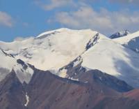
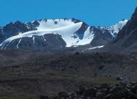
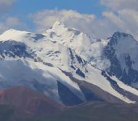
Glaciers on southern slope of Zailiysky Alatau.
"The more extensive and massive the perennial snows, the more significant the glaciers they form. The study of the Zailiysky glaciers began about 50 years ago. It has been conducted with particular intensity and productivity since the Great October Revolution. The All-Union Geographical Society, the Kazakh Administration of the Hydrometeorological Service, and the Academy of Sciences of the Kazakh SSR participated in the study of the Zailiysky glaciers. Individually, the work was initiated by glaciologist S. E. Dmitriev, continued by local historian V. G. Gorbunov, and is being expanded by glaciologist N. N. Palgov."
N. N. Palgov. "Nature of Kazakhstan in Sketches and Pictures". 1950.
Tributaries of Chon-Kemin River.
The southern slope of the Zailiysky Alatau belongs to two river systems - the Chon-Kemin and the Chilik - which flow in opposite directions. A total of 71 glaciers, covering an area of 187 sq. km, have been recorded across the entire southern slope.
This figure represents 63% of the glaciated area of the northern slope. This significant percentage is due to the fact that, across the greater part of the Chilik basin, the southern side of the ridge faces east rather than south. Furthermore, the largest glaciers are concentrated in this section of the slope.
A characteristic feature of glaciation on the southern side of the ridge is its uneven distribution between the western and eastern halves. While its western boundaries align with the same meridian as those on the northern side, the southern extent of the glaciated area in the east is 25 km shorter than in the north.
Climatic factors play a primary role in this uneven distribution - specifically the transport of moisture by air masses, a significant portion of which is deposited on the Chiliko-Kemin watershed.
Glaciers in Chon-Kemin River basin.
According to available data, there are up to 29 glaciers in the basin, with a total area estimated at 46 sq. km. The westernmost glaciers in the area are those located at the headwaters of the Kichik-Kemin and Tegirmentysu rivers. The headwaters of the former lie within a broad basin.
This basin is enclosed to the north by the ridge of the main range - averaging 4,000 m in height and reaching a peak of 4,190 m (Teketoo Peak) - and to the rear and south by the Tesakemin lateral spur. Originating at "Uzlovoy" Peak (4,098 m), this spur features the peaks of Northern Starovatov (4,160 m) and Trezubets (4,190 m). Two valley glaciers lie within the basin, separated from one another by a short ridge.
Severny (Northern) Glacier in Chon-Kemin River basin.
The glacier situated closer to the main range is named Severny (Northern), while the one adjacent to the Tesakemin spur - located further south than the former - is named Yuzhny (Southern). Starovatov Glacier in the Chon-Kemin River basin.
The Starovatogo Glacier lies on the southern side of the Tesakemin Spur, in the headwaters of the Tegirmentysu River. It is a valley glacier fronted by a substantial train of moraine deposits, with a small lake situated at their terminus. It measures approximately 2.5 km in length.
Slightly smaller glaciers are located further east, at the headwaters of the following rivers on the range's southern slope: Buzulgansky, Kokolubulak, Almaty, Tarachibulak, Tuyukalmaty, and Kolalmaty. Two glaciers are situated at the headwaters of the Almaty River.
They have a southeastern aspect and lie within a short gorge; the gorge walls feature towering peaks, columns, and sharp spires formed by intense weathering. Each glacier is no more than 1.5 km long. In the headwaters of the same river - east of the high-altitude trail leading to the valley of the Prokhodnaya branch of the Big Almaty - a buried hanging glacier is located on the southern slope of the ridge.
Beyond the Kel-Almaty tributary, glaciation in the Chon-Kemin Valley becomes somewhat more extensive. This is favored by the presence of higher peaks and the fact that the Chilik-Kemin watershed intercepts cyclonic air masses moving in from the west.
Glaciation in the headwaters of the Kashkasu and Southwestern Talgar rivers is associated with the southern slope of the range in this area (T. Sh. Tokombaev, 1969).
Kashkasu Glacier in Chon-Kemin River basin.
The Kashkasu Glacier can be classified as a valley glacier. It is situated behind the headwalls of the cirques belonging to two other glaciers - Perevalny and Cherny - in the upper reaches of the Bolshaya Almatinka River, and its entire length is oriented southward.
The glacier is 3 km long, or over 5 km if including the frontal moraine deposits (beneath which the ice continues for some distance). Its area exceeds 2.5 sq. km. In addition to the main glacier, another small cirque glacier is located in the upper reaches of the Kashkasu basin.
It lies in a right-hand side gorge of the valley, with its mouth opening slightly downstream from the terminus of the main glacier. Its area is barely more than 0.5 sq. km.
Sapozhnikov Glacier in Chon-Kemin River basin.
Nine glaciers have been recorded in the headwaters of the Southwestern Talgar River. The Sapozhnikov Glacier is located in the right half of the valley's widened head section and has a southern aspect. Three other glaciers lie in the same right half of the valley.
One is a small cirque glacier. The second appears to be a gorge glacier. The third merges with the Sapozhnikov Glacier.
Mashkovtsev Glacier in Chon-Kemin River basin.
The Mashkovtsev Glacier lies in the left half of the river's head basin. The rear wall of its cirque, rising to an elevation of 4,250 m, forms part of the Chiliko-Kemin watershed; its northernmost point is a junction peak - Peak TsDKA. Four other glaciers belong to the same group as the Mashkovtsev Glacier.
Three of them are situated high up on the mountain slope within small cirques. In the northern half of the Chon-Kemin River basin, the glaciated area associated with the headwaters of the Southwestern Talgar represents the largest such zone. Its total area is 14 square kilometers.
The presence of this larger glaciated area in this specific location is due to highly favorable conditions - hypsometric, orographic, and climatic. The mountain range here is higher than anywhere else in the west; the river's headwaters are deeply incised into the mountain slopes and form a relatively extensive network; and a high barrier stands in the path of cyclonic air masses, forcing them to deposit a significant portion of their moisture within the river basin.
Conclusions regarding glaciation of southern slope of Zailiysky Alatau Range.
The upper reaches of the Chilik River occupy a longitudinal valley situated between the Zailiysky Alatau and Kungey Alatau ranges. Glaciation within the basin occurs in both ranges. The total glaciated area - estimated by N. N. Palgov at 300 sq. km. - is distributed almost equally between the two ranges.
Part of this area consists of the Zhangyryk (Dzhangyryk) Glacier, which is shared by both ranges. If one-third of the Zhangyryk Glacier is attributed to the Zailiysky Alatau, the total glaciated area on the northern side of the Chilik basin (belonging to the Zailiysky Alatau) amounts to 141 square kilometers.
More than 41 glaciers are found in this territory. The main glaciation is concentrated on the eastern slopes of the principal range. The most massive glaciers - Korzhenevsky, Bogatyr, and Zhangyryk - are concentrated here. The combined area of just the first two, including their tributaries and firn fields, accounts for approximately 75% of the total glaciation in the northern part of the Chilik River basin.
Like other glaciers in the Zailiysky Alatau, these two giants (by local standards) are remnants of much larger glaciers from the past. It is possible that they were once joined during historical times, and that the Zhangyryk Glacier also reached them during an even earlier period.
An old terminal moraine - which blocks the Chilik Valley downstream from the confluence of the Southeastern Talgar - dates back to the phase when all three glaciers existed as a single, united system. In recent years, research conducted under various programs has yielded extensive data on glaciers and other snow-and-ice formations.
Currently, mountain glaciers worldwide are generally characterized by a negative mass balance, leading to glacial retreat and a reduction in both surface area and volume. This is a global trend affecting mountain glaciation. Against this general backdrop, however, some individual glaciers advance - sometimes rapidly and up to a certain limit - before abruptly shifting to a phase of retreat.
These are known as surging glaciers. Analysis of long-term observations indicates that glaciation in the Zailiysky Alatau, following a prolonged period of decline, gradually increased and reached its maximum in the mid- The study of surging glaciers is of immense practical importance.
The primary danger associated with glacier surges is the formation of ice-dammed lakes; their subsequent outbursts trigger catastrophic floods. K. G. Makarevich classifies the following glaciers in the Zailiysky Alatau range as surging glaciers: Konstitutsii, Korzhenevskogo, Shokalskogo, Zhangyryk, Mametovoy, Krasina, and Talgar Yuzhny.
The Shokalsky Glacier (area: 9.51 km²; length: 4.18 km; 1990 data) is an active, surging glacier. Catastrophic phenomena such as ice collapses - or glacial avalanches - are also associated with glaciers. The causes of these ice collapses vary: glacier advances, abrupt changes in the longitudinal profile of the glacier bed (such as a rapid increase in steepness or the presence of a precipice), earthquakes, the breaching of englacial cavities or ice-dammed lakes, and intense summer ice melt.
Major catastrophes involving ice collapses and surging glaciers typically affect a smaller area than floods and mudflows of glacial origin. Furthermore, it is known that such catastrophes often occur precisely as a result of floods and mudflows. Great attention is paid to the study of these phenomena in Kazakhstan.
When formulating comprehensive research objectives, it is crucial to clearly define the subject of study and precisely articulate the problem at hand. Otherwise, the effectiveness of the research will be very low.
References:
Gvozdetsky N. A., Nikolaev V. A. *Kazakhstan*. Moscow: Mysl, 1971.
Gvozdetsky N. A., Mikhailov N. I. *Physical Geography of the USSR*. Moscow: Mysl, 1978.
Zhivago N. V., Piotrovsky V. V. Geomorphology with Fundamentals of Geology. Moscow: Nedra, 1971.
Catalogue of Glaciers of the USSR. Leningrad, 1967, Vol. 13, Issue 2, Part 1.
Catalogue of Glaciers of the USSR. Leningrad, 1967, Vol. 13, Issue 2, Part 2.
Tuyuksu Glaciers (Northern Tien Shan). Leningrad: Gidrometeoizdat, 1984.
Glaciation of the Tien Shan. Ed. N. B. Dyurgerov. Moscow, 1995.
"Glaciation of the Zailiysky Alatau." Moscow: Nauka, 1969.
Palgov N. N. The Bolshaya Almatinka Glaciation Cluster in the Zailiysky Alatau Range. *Izvestiya Vsesoyuznogo geograficheskogo obshchestva* [Proceedings of the All-Union Geographical Society], 1948, Vol. 80, Issue 1.
Palgov N. N. Shokalsky Glacier in the Zailiysky Alatau Range. *Izvestiya Vsesoyuznogo geograficheskogo obshchestva* [Proceedings of the All-Union Geographical Society], 1948, Vol. 80, Issue 1.
Palgov N. N. Trip to the Tuyuksu Glacier in the Summer of 1922 (Offprint from *Izvestiya GRGO*, Vol. LVIII), 1926.
Tokmagambetov G. A. Glaciers of the Zailiysky Alatau. Alma-Ata, 1976.
Tokmagambetov G. A. Secrets of Kazakhstan's Natural Ice. Alma-Ata: Nauka, 1978.
Svarichevskaya Z. A. *Geomorphology of Kazakhstan and Central Asia*. 1965.
Chedaya O. K. *Morphostructures and Recent Tectogenesis of the Tien-Shan*. Frunze: Ilim, 1986.
Material prepared using data from:
Glaciological studies and works by scientists: S. E. Dmitrieva, N. N. Palgova, G. A. Tokmagambetova (*Glaciers of the Zailiysky Alatau*, 1976), K. G. Makarevich, and E. N. Vilesov.
Article: "Glacial Structures of the Northern Tien Shan – Zailiysky Alatau."
http://www.bigmir.net
https://elib.rgo.ru/safe-view/123456789/226999/1/0LPQtdC+0LsuMjRfVGFsZ2FyLCBnbGF2bmF5YSB2ZXJzaGluYSBaYWlsaWlza29nbyBBbGF0YXUsIGJsaXoucGRm