







Вы здесь
Glaciers in Small Almaty River basin.
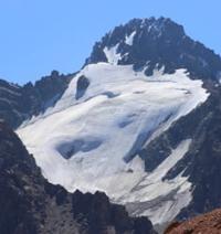
Glacial basins of Small Almaty River.
"Between 1937 and 1947, the Central Tuyuksu Glacier lost 2.3% of its surface area. In terms of volume, this amounted to 1.4 million cubic meters (water equivalent). The Central Tuyuksu Glacier experienced a more significant reduction compared to the Main Bolshaya Almatinka Glacier due to its lower elevation above sea level and the resulting higher summer temperatures. While the annual ice melt at the terminus of the Main Bolshaya Almatinka Glacier averages a depth of about 2 meters, the thickness of the melted ice layer on the Central Tuyuksu Glacier averages 3 meters. Winters with heavy snowfall slow down glacial retreat; it has been calculated that a 100 mm increase in precipitation causes the firn line on the Central Tuyuksu Glacier to drop by 43 meters."
N.N. Palgov. “Nature of Kazakhstan in Sketches and Pictures”. 1950.
A trip to glaciers of Small Almaty Gorge.
The fourth group comprises glaciers located in the headwaters of two right-bank tributaries of the Big Almaty River. At the head of the first tributary lies a small cirque glacier situated between two spurs. Three glaciers have been recorded in the headwaters of the second tributary.
Tuyuksu glacial basin.
The Tuyuksu glacial basin constitutes the upper section of the river basin of the Small Almaty River, which flows down the northern slope of the Zailiysky Alatau Range and empties into the Kaskelen River. Modern glaciation in the Tuyuksu mountain-glacial basin is represented by ten glaciers encompassing almost all morphological types characteristic of the region's glaciation.
The total area is 7.9 sq. km (41% of the basin's area). This includes two valley glaciers and eight mountain-slope glaciers; the latter comprise four hanging glaciers, two cirque glaciers, one hanging-cirque glacier, and one apron (slope-foot) glacier.
Due to the terrain, there are no flat-summit glaciers here - types found on the eastern flank of the range, where remnants of ancient denudation surfaces persist and host such glaciers.
Central Tuyuksu Glacier.
It is situated almost symmetrically in the center of the cirque that terminates the valley and extends from south to north. This is a classic valley glacier, featuring a distinct accumulation zone and an elongated tongue. The average elevation of the peaks and ridges surrounding the glacier's firn basin is 4,120 m.
The glacier's accumulation zone, located on the slopes and at the foot of Pogrebetsky Peak, has gradients of 35-40° in its upper section and is crisscrossed by numerous crevasses, which are typically covered by snow in winter. The upper part of the glacier tongue descends smoothly to the final rock bar (riegel), where it breaks up into a multitude of wide (up to 2 m) and deep (10-15 m) crevasses.
Below an elevation of 3,600 m, the crevasses disappear and do not reappear for the remainder of the glacier's length. At the same time, moraine material appears on the ice surface here, increasing in quantity toward the lower end. Currently, the terminus of the glacier tongue is flattened and covered with surface moraine.
The very end of the tongue is marked by a rim of cone-shaped mounds - resembling anthills - reaching heights of 1.5 to 2 meters; the exposed tongue terminates in two slightly convex lobes.
Igly Tuyuksu Glacier.
Below the rock bar, the Igly Tuyuksu Glacier approaches the Tuyuksu Glacier tongue from the east. This is a valley glacier that descends northwestward from the slopes of the ridge of the same name and from the summit of Tuyuksu (4,220 m).
Despite the considerable steepness of the cirque wall, it is entirely snow-covered. The average elevation of the cirque's headwalls is 4,190 m. The cirque itself forms a short, relatively gentle gorge. The exposed glacier tongue is 1.6 km long. The stagnant ice of the buried section - much like that of the Tuyuksu Glacier - descends to an elevation of 3,200 m and merges into the general mass of buried ice shared by all the glaciers in the basin.
Zoya Kosmodemyanskaya Glacier.
To the west of the Tuyuksu Glacier, on the eastern slope of the Kumbel Spur, lie four glaciers: Zoya Kosmodemyanskaya, Molodezhny, and two hanging glaciers (1 and 2). The Zoya Kosmodemyanskaya Glacier is a cirque glacier originating at the peak of the same name (4,108 m); at an elevation of 3,610 m, it merges openly with the Tuyuksu Glacier.
Its small cirque forms a narrow basin where snow accumulates from the cirque's northern and eastern slopes. The southern slope is bare. The cirque's headwall is high and precipitous. A relatively gentle 200-meter-long field begins at the foot of the wall, terminating in a steep glacier tongue.
Moraines are poorly developed on the glacier. The left lateral moraine extends to the Tuyuksu Glacier, where it meets its own glacier's frontal moraine. Together, they are carried along by the Tuyuksu Glacier, appearing on its surface as scattered boulders, piles of debris, and the like.
The Molodezhny Glacier is an apron-type glacier occupying a short, northeast-facing gorge situated west of the Tuyuksu Glacier.
Molodezhny Glacier in headwaters of Small Almaty River.
The spur bounding the glacier to the south is crowned by Molodezhnaya Peak (4,103 m), the slopes of which are covered with snow and firn masses. The glacier's short tongue begins at the base of the slope and descends at an angle of 11-13 degrees to an outwash plain (sandur), at the base of which lies glacial ice. In summer, the outwash basin (sandur), surrounded by moraines, fills with meltwater, forming Lake No. 1 immediately behind the glacier.
The southern slope of the gorge is free of ice and is separated from the modern glacier by ridges of moraines of varying ages.
Visyachiy glaciers on northern slope of Zailiysky Alatau Range.
The Visyachiy 1 and Visyachiy 2 glaciers lie in narrow, short hollows on the slope of the spur that bounds the Molodezhny Glacier to the north. Both glaciers are small in size and have the narrowest vertical ice range (190-370 m). For these glaciers, the negative component of the ice balance is more than double the positive component.
Furthermore, the Visyachiy 2 glacier has the lowest glaciation coefficient of all the glaciers - 0.20. Consequently, during years with low snowfall, the entire surface of these glaciers lies within the ablation zone. Both glaciers are bordered by small moraines.
There are no surface streams on these moraines. Among all the glaciers in the Tuyuksu glacial basin, Visyachiy 1 and Visyachiy 2 face the least favorable conditions for existence.
Partizan Zapadny (West Partisan) Glacier in Small Almaty River basin.
The remaining four glaciers (Partizan, Ordzhonikidze, Mayakovskogo, and Mametovoy) lie on the western slope of the Maloalmatinsky Spur. All of them have a westerly aspect. The Partizan Glacier is a hanging glacier occupying the highest hypsometric levels in the basin (from 3,710 to 4,370 m); consequently, it enjoys the most favorable conditions for its existence.
This is confirmed by the fact that the positive glacial balance component exceeds the negative one by more than six times, as well as by the highest glaciation coefficient (2.5). In years with heavy snowfall - or even in years with normal precipitation - it lies entirely within the accumulation zone; consequently, N.N. Palgov described it as a "glacier consisting of a single firn field."
It is the only glacier in the basin that is free of lateral and frontal moraines.
West Ordzhonikidze Glacier in Small Almaty River basin.
The Ordzhonikidze Glacier is a cirque-hanging glacier situated on the western slope of the peak of the same name. It exhibits equal values for the positive and negative components of the glacial balance (330 m) and a glaciation coefficient close to 1.
The buried section of its tongue merges with the combined buried ice mass of the Tuyuksu and Igla Tuyuksu glaciers.
Mayakovsky Glacier in Malaya Almatinka River basin.
The Mayakovsky Glacier lies north of the Ordzhonikidze Glacier and is classified as a hanging glacier. Its basin is carved into the western slope of Mayakovsky Peak. A small cirque faces the southern side of the Mayakovsky Glacier basin. This cirque is carved into the northern slope of a mountain spur.
It typically contains a perennial snowpatch, the lower part of which is divided into three lobes.
Manshuk Mametova Glacier is located in Small Almaty River basin.
It is the northernmost glacier of the Tuyuksu glacial basin. This hanging cirque glacier lies on the western slope of Manshuk Mametova Peak (4,189.8 m). The glacier is 1.1 km long. Due to the steepness of the Manshuk Mametova slope (up to 50°), snow accumulation is minimal; ice forms here below the ridge and the adjacent rocky crags.
The glacier features right and left lateral moraines that are significantly wider than the terminus of the exposed glacier tongue.


References:
Gvozdetsky N. A., Nikolaev V. A. *Kazakhstan*. Moscow: Mysl, 1971.
Gvozdetsky N. A., Mikhailov N. I. *Physical Geography of the USSR*. Moscow: Mysl, 1978.
Zhivago N. V., Piotrovsky V. V. Geomorphology with Fundamentals of Geology. Moscow: Nedra, 1971.
Catalogue of Glaciers of the USSR. Leningrad, 1967, Vol. 13, Issue 2, Part 1.
Catalogue of Glaciers of the USSR. Leningrad, 1967, Vol. 13, Issue 2, Part 2.
Tuyuksu Glaciers (Northern Tien Shan). Leningrad: Gidrometeoizdat, 1984.
Glaciation of the Tien Shan. Ed. N. B. Dyurgerov. Moscow, 1995.
"Glaciation of the Zailiysky Alatau." Moscow: Nauka, 1969.
Palgov N. N. The Bolshaya Almatinka Glaciation Cluster in the Zailiysky Alatau Range. *Izvestiya Vsesoyuznogo geograficheskogo obshchestva* [Proceedings of the All-Union Geographical Society], 1948, Vol. 80, Issue 1.
Palgov N. N. Shokalsky Glacier in the Zailiysky Alatau Range. *Izvestiya Vsesoyuznogo geograficheskogo obshchestva* [Proceedings of the All-Union Geographical Society], 1948, Vol. 80, Issue 1.
Palgov N. N. Trip to the Tuyuksu Glacier in the Summer of 1922 (Offprint from *Izvestiya GRGO*, Vol. LVIII), 1926.
Tokmagambetov G. A. Glaciers of the Zailiysky Alatau. Alma-Ata, 1976.
Tokmagambetov G. A. Secrets of Kazakhstan's Natural Ice. Alma-Ata: Nauka, 1978.
Svarichevskaya Z. A. *Geomorphology of Kazakhstan and Central Asia*. 1965.
Chedaya O. K. *Morphostructures and Recent Tectogenesis of the Tien-Shan*. Frunze: Ilim, 1986.
Material prepared using data from:
Glaciological studies and works by scientists: S. E. Dmitrieva, N. N. Palgova, G. A. Tokmagambetova (*Glaciers of the Zailiysky Alatau*, 1976), K. G. Makarevich, and E. N. Vilesov.
Article: "Glacial Structures of the Northern Tien Shan – Zailiysky Alatau."
http://www.bigmir.net
https://elib.rgo.ru/safe-view/123456789/226999/1/0LPQtdC+0LsuMjRfVGFsZ2FyLCBnbGF2bmF5YSB2ZXJzaGluYSBaYWlsaWlza29nbyBBbGF0YXUsIGJsaXoucGRm
Photos by:
Alexander Petrov.