


![]()
Вы здесь
Tour on Mangyshlak.


Tours and travels on Mangyshlak.
«Travel form intellect of youth and deform trousers»
Moris Dekobr.
Short description of a route of tours across Mangyshlak:
Aktau - Blue bay - town Fort-Shevchenko - settlement Bautino - canyon Tamshaly – downwarping Zhygylgan - underground mosque Sultan epe - canyon Kapamsai - mosque Shakpak ata - canyon Shakpakatasai - mountain Akmaya - valley Akespe - cretaceous valley Usak - valley Torysh (spherical stone concretion) - mountain Otpan-tau - gorge Samal - valley Akmysh - ancient settlement Kyzyl-kala - mount Sherkala – valley Airakty - valley Zharmysh - saline land Tuzbair - underground mosque Shopan ata – mount Bokty – valley Boszhira - underground mosque Beket ata – reserve Ustyurt - depression Karynzharyk - cave Balayk - hollow Utebai - Zhanaozen town - depression Karagie - town Aktau.
Distance of route: 1504 km.
Season: April - September.
Best time for travel: April, May, June, September.
Duration tour: 14 days, 13 nights.
Detailed program of tour day after day on natural and historical sights Mangistau region:
Flashpacker on Mangyshlak.
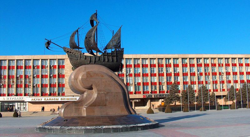
1 day. Aktau.
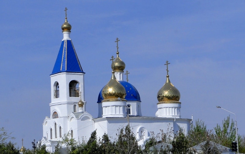
Arrival in Aktau, a meeting at the airport, transfer to hotel, accommodation. Excursion on city: visiting of town historical museum, orthodox church the Blagoveshchensk meeting house, visiting of town mosque Beket-ata, walk on central city area Intymak, monument Taras Shevchenko on coast of Caspian sea, quay of city, walk in vicinities of cape Cretaceous, walk in vicinities of city quay with panorama on town, sightseeing tour on city. Lunch in the cafe. Dinner and overnight in hotel.
2 day. Aktau - canyon Tamshaly (226 km).
Breakfast. After a breakfast we leave city in a direction of the airport, we pass village Akshukur, villages opposite on the right there is necropolis Kashkar-ata (20 km). Visiting of necropolis Kashkar-ata.
Further transfer: necropolis Kashkar-ata - necropolis Esmambet-ata (12 km). We pass settlement Karamandy and behind settlement it is turned to the right to necropolis Esmambet-ata (XVIII - XIX c.c.), Visiting a necropolis.
The further transfer: necropolis Esmambet-Ata - the Devil's finger in the Blue bay of Caspian sea (47 km). With western cliff, it is well visible boundless a blue smooth surface of Caspian sea. Transfer to the Blue bay (3 km). Visiting of the Blue bay, walk in vicinities.
The further transfer to canyon Saura (13 km), walk to vicinities of a canyon. Lunch on coast of Caspian sea.
Transfer: canyon Saura - city the Fort-Shevchenko (65 km). Arrival in city, visiting of an ethnographic museum, museum Taras Shevchenko. A sightseeing tour on city, visiting of Christian Armenian church, a Muslim mosque, a sea beacon, monument Taras Shevchenko, a monument to Stalin reprisals, a monument Kazakh national hero.
Transfer: Fort-Shevchenko - Bautino (6 km). The sightseeing tour on settlement, visiting of old houses, a bust to Alexei Bautin, visiting of the house of Z.K.Dubskiy (1910).
Transfer: Bautino - necropolis Biisenbay - canyon Tamshaly (54 km). On a way visiting of necropolis Biisenbay. Arrival to canyon Tamshaly. Walk in vicinities of a canyon. Dinner and overnight in tents on edge of a canyon.
3 day. Canyon Tamshaly - canyon Kapamsai (98 km).
Breakfast. Transfer through vicinities Karagan to lake Tamshaly (10 km). Transfer from cliff on northern coast of Caspian sea. On a way a short stop in the thrown settlement of fishermen Karagan, photographing of ruins of settlement. Walk in a canyon and to lake Tamshaly.
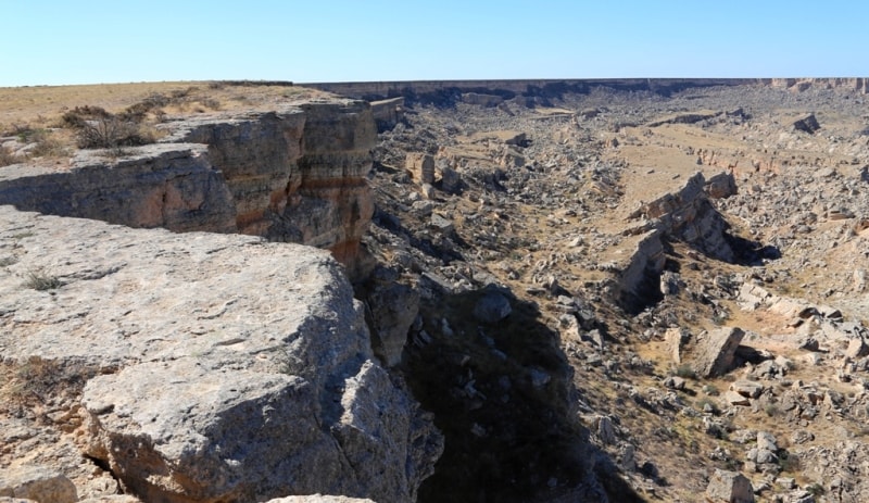
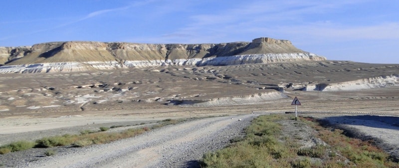
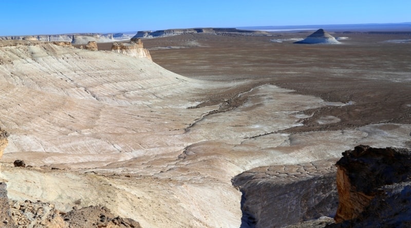
Transfer: Tamshaly - downwarping Zhygylgan (30 km). After canyon Tamshaly we shall eat along coast of Caspian sea and soon we rise on cliff a plateau. Our further way along an edge cliff up to a panoramic platform on downwarping Zhygylgan. Arrival to downwarping Zhygylgan, walks in vicinities of a panoramic platform. Lunch on downwarping Zhygylgan.
Foot walk to prints of traces prehistoric animal (2 km). Here on vertical plates of a shell rock there were traces of the prehistoric animals, one of traces belongs to a tiger. Transfer: downwarping Zhygylgan - a necropolis the Kenty-baba (32 km). Arrival on a necropolis. Walk in vicinities, photographing kulpytas, tomb of the saint, the mausoleums.
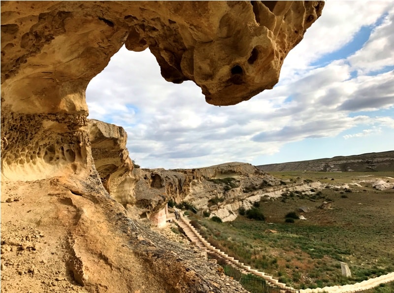
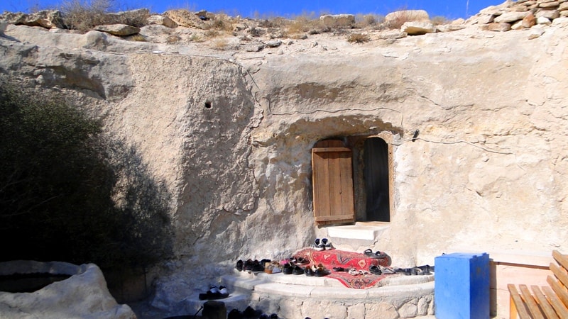
The further transfer to a underground mosque the Sultan-epe (2 km). Arrival to a underground mosque the Sultan-Epe. Walk in vicinities, survey of a underground mosque. Here there is a well with crystal-clear, cold and tasty water.
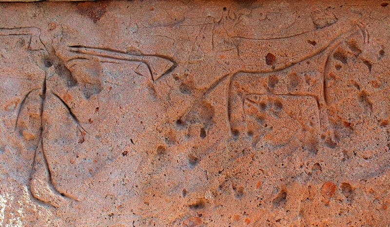
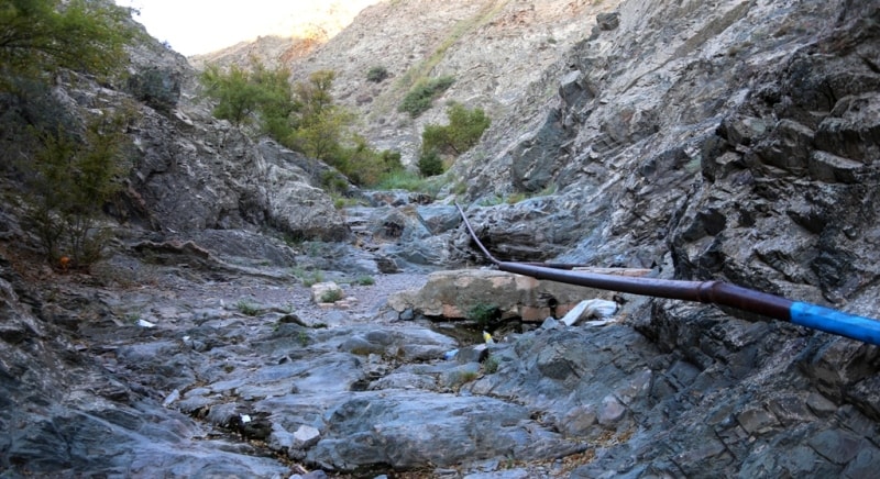
Transfer: a mosque the Sultan-epe - canyon Kapamsai (22 km). Arrival in canyon Kapamsai, walks in vicinities, photographing atmogenic aerations which are similar on comb. On slopes of a canyon shelters for hunting for wild animals were saved. Dinner and overnight in tents in canyon Kapamsai.
4 day. Canyon Kapamsai - valley Akespe (88 km).
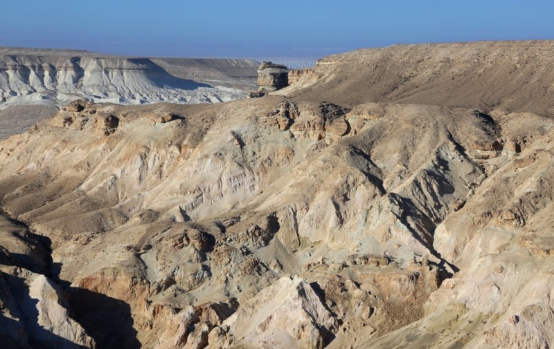
Breakfast. Transfer: canyon Kapamsai - underground mosque Shakpak-ata (8 km). Arrival to mosque Shakpak-ata. Rise to a underground mosque which is constructed in a shell rock on edge of a rocky ledge. Visiting of a mosque, walk on cliff. Descent with cliff, visiting of ancient necropolis Shakpak-Ata.
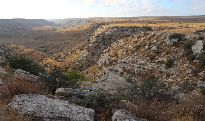
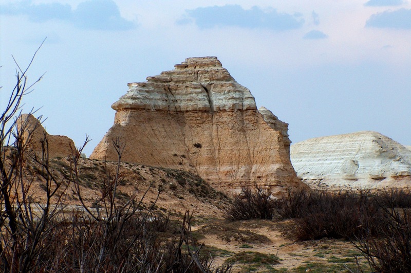
Transfer: mosque Shakpak-ata - canyon Shakpakatasai (36 km). Arrival in canyon Shakpakatasai, walk in vicinities, photographing of freakish cretaceous sculptures.
Transfer: canyon Shakpakatasai - Cretaceous a canyon (47 km). Walk in vicinities of the Cretaceous canyon.
Transfer: Cretaceous a canyon - mountain Akmaya (10 km). Walk in vicinities of mountain Akmaya, photographing of the well-known aperture in mountain.
The further transfer: mountain Akmaya - valley Usak (10 km). Walk in valley Usak, searches of paleontologic fauna - the spark teeth, photographing of picturesque vicinities. Lunch in a way.
Transfer: valley Usak - valley Akespe (13 km). Walk in vicinities valley Akespe, photographing of cretaceous slopes. Dinner and overnight in tents.
5 day. Valley Akespe - gorge Samal (107 km).
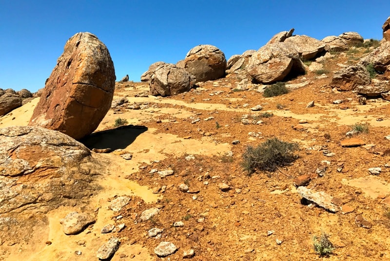
Breakfast. Transfer: valley Akespe - valley Torysh (14 km). On a way visiting of city-scenery for film «Abasta». After valley Akespe it is come back to mountain Akmaya, we cross motorway Tauchik - Zhyngyldy and we shall go on a southeast to the beginning stone spherical concretion valleys Torysh. Geological excursions on a way to natural boundary. Arrival in valley Torysh. Lunch in a way.
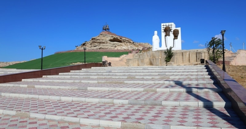
Transfer: valley Torysh - settlement Zhyngyldy - mountain Otpan-tau of 532 meters above sea level - monument Adai-ata (47км). After valley Torysh we leave on a motorway the leader in settlement Shetpe and it is turned on a southeast. For 11 kilometers before settlement Tauchubek to the right of road there is a beautiful multi-coloured failure similar to the Kazakh national tool - Kobyz. Visiting of a failure, photographing of vicinities.
From settlement Tauchubek up to mountain Otpan-Tau of 4 kilometers. On mountain Otpan-Tau, in Western Karatau, meter monument Adai and two stele-minarets is constructed 37. Adai is one of ancestors of the Kazakh tribe adai. Visiting of complex Adai, photographing of vicinities, mountains Karatau.
Transfer: mountain Otpan-Tau - settlement Shetpe - mountains Karatau - gorge Samal (42 km). Arrival in valley Samal, walk in vicinities. Dinner and overnight in tents.
6 day. Gorge Samala - a stream at valley Zharmysh (79 km).
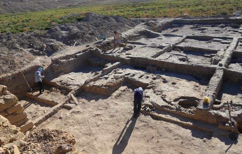
Breakfast. Transfer: gorge Samal - mountain Sherkala (9 km). On a way visiting of valley Akmysh, here among high trees flows a stream, there is a sculpture of the girl-kazakh woman. Short walk in vicinities of natural boundary, visiting of excavation of an ancient site of ancient settlement Kyzyl-kala.
Transfer to mountain Sherkalа. On a way visiting spherical stone concretion freakish forms, visiting ancient tomb of the saint and a necropolis, located from the western party of mountain Sherkala. Photographing of vicinities, paleontologic finds of bowls ammonite. T
he further transfer: Sherkala - valley Zhairakty - cliff Ktairakty - spurs Airakty (30 km). We go round mountain Sherkala from the north and we go to natural boundary Zhairakty and Ktairakty, after visiting these most beautiful natural phenomena we go to spurs of valley Akmyshtau. Visiting of valleys, photographing of cretaceous landscapes.
Transfer: valley Akmyshtau - settlement Shetpe - a stream in vicinities of valley Zharmysh (40 km). In this picturesque place beautiful rocks and a pure stream. Walk in vicinities, dinner and overnight in tents.
7 day. A stream of valley Zharmysh - mountain Bokty (230 km).
Breakfast. Transfer: the Stream of valley Zharmysh - valley Zharmysh (15 km). On a way a stop in settlement Shetpe, here in shop we shall buy water and products. Arrival in valley. Walks in vicinities of valley Zharmysh in mountains East Karatau. Near to a place of our lodging for the night there is a beautiful mountain Besshoky in height of 556 meters above sea level.
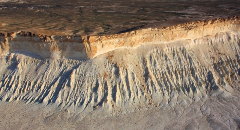
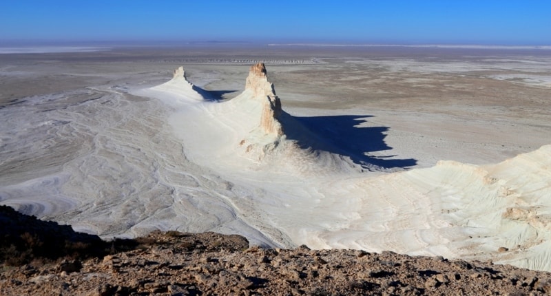
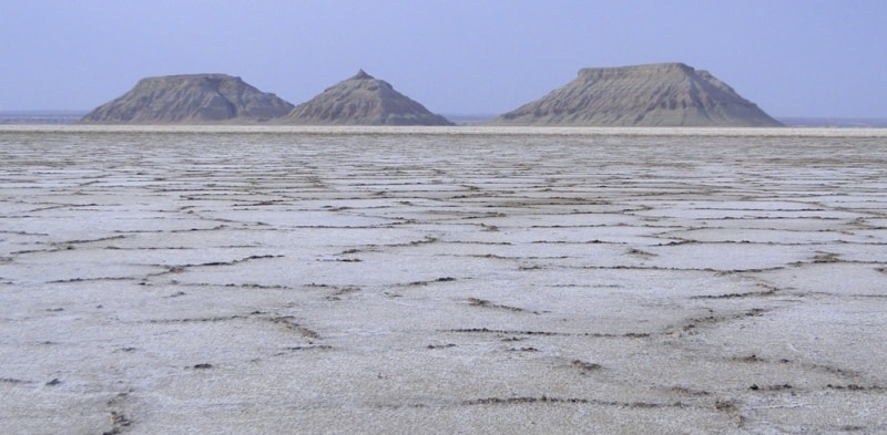
Transfer: valley Zharmysh - tomb of the saint Manata-ata - pass Manata - Western cliff Ustyurt - pass Manata (85 km). A stop at tomb of the saint Manata-ata, photographing of the most beautiful, multi-coloured mountain to the left of road. Rise on cliff Ustyurt, a stop on edge cliff, photographing of a panorama saline land Tuzbair.
Transfer along Western cliff Ustyurt (14 km). From height cliff we shall see saline land Tuzbair - hillock Tortkol 285 meters above sea level, hillock Tuzbair 272 meters above sea level. Lunch in a way. Stop on edge cliff walks in vicinities saline land Tuzbair.
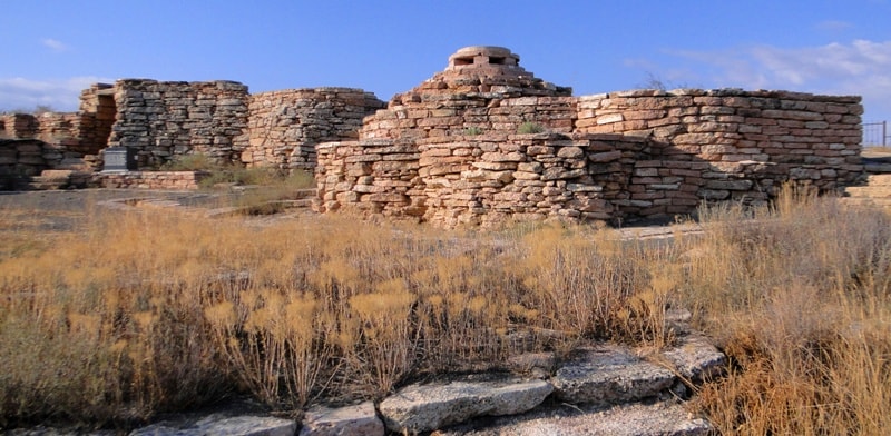
Transfer: saline land Tuzbair - descent with cliff Ustyurt - the mausoleum Kuy-Tam (XIII c.) (68 km). Our way lays on a southeast to a place, Mangyshlak the Muslim relics, one of them whence begin - the mausoleum Kuy-tam, which opens a way for pilgrims to the most significant mosques of Mangyshlak. Soon to the left of road there is a platform for machines, here there is a mausoleum Kuy-tam, visiting of the mausoleum, photographing.
Transfer: the mausoleum Kuy-Tam - necropolis Shopan-ata in valley Kyzylsu (2 km). Arrival on necropolis Shopan-ata. Walk to a underground mosque and a necropolis, photographing, ritual pass by the top part of a underground mosque. Transfer: Shopan-ata - mountain Bokty (46 km). Arrival to mountain Bokty. Dinner and overnight in tents.
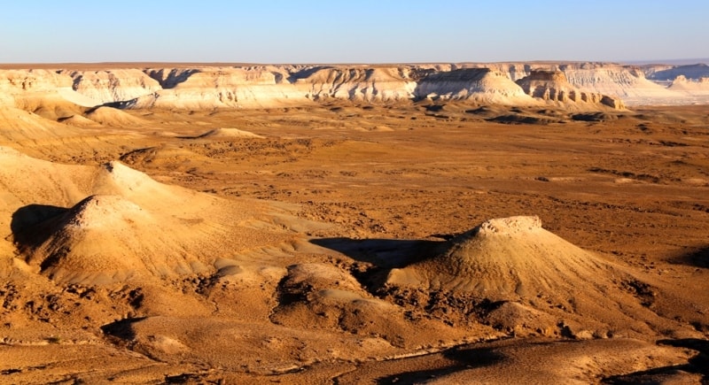
8 day. Mountain Bokty - valley Boszhira (35 km).
Breakfast. Walk in vicinities of mountain Bokty. Mountain this most beautiful and unforgettable creation of the nature which so has distinctly drawn slopes of a cretaceous, correct and multi-coloured pyramid, photographing.
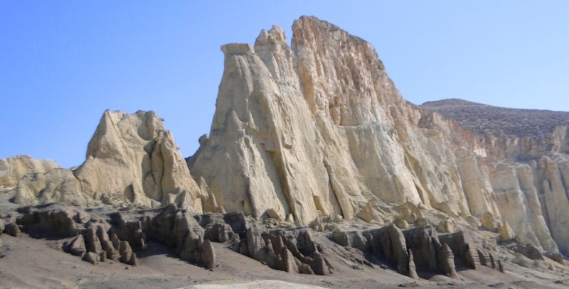
Transfer: mountain Bokty - valley Boszhira (35 km). Our way to valley Boszhira there passes on edge of a picturesque cretaceous hollow which is on the right, walk on a hollow, photographing of vicinities. Arrival in valley Boszhira. Walk in vicinities, photographing of Azu tisteri Boszhira and other places of interest of valley. Transfer to cretaceous bottom of mountain Ulken keme.
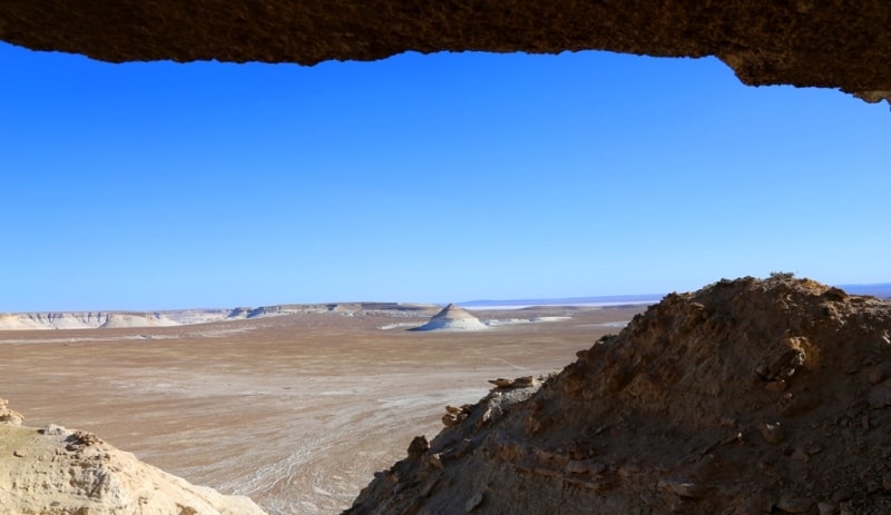
Rise on a cretaceous slope on a plateau which is located between a rock the Borly tau and Ulken keme on plateu we leave to the Deep canyon. Photographing of a canyon from nearby rocks and vicinities.
From here in northwest the dome-shaped cretaceous mountain which is represented on 1000 tenge to a banknote of Kazakhstan is well visible. Lunch in a way. Ascention on mountain Ulken keme, we pass on east cretaceous a slope to ancient walls constructed of a stone. It is possible to assume, what is it the hunting shelters - arans or time shelter of people. Gradually we rise on a flat surface of mountain and it is gone to a southern extremity of mountain.
From here from edge of breakage of mountain the tremendous kind on Azu tisteri Boszhira opens, all southern part of natural boundary Boszhira from here is well looked through. Returning in camp on a way rise. Dinner and overnight in tents in valley Boszhira.
9 day. Valley Boszhira - mosque Beket-ata (73 km).
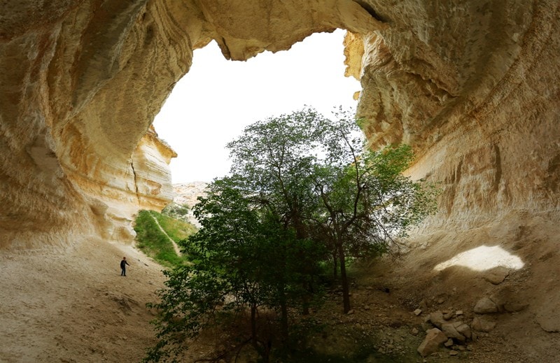
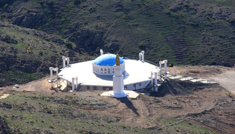
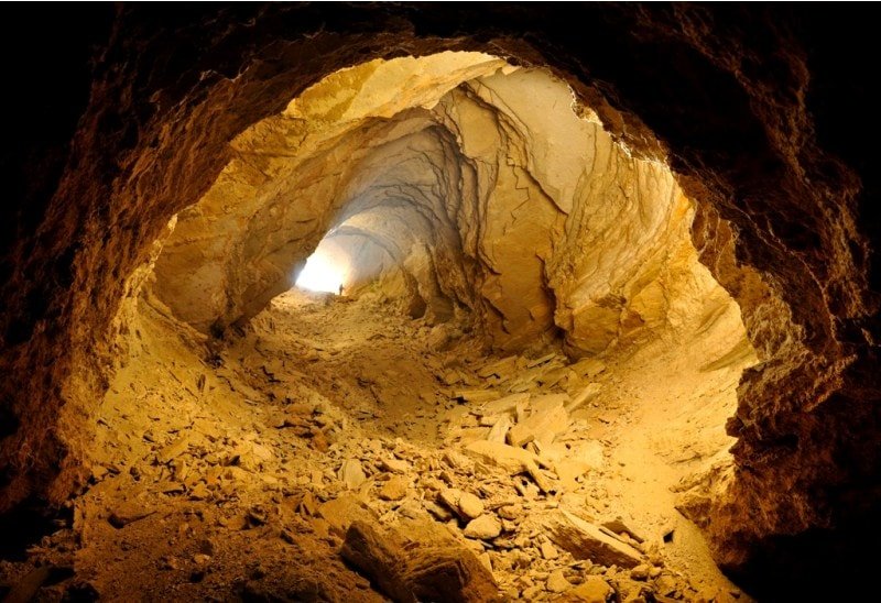
Breakfast. Transfer: valley Boszhira - mosque Beket-ata (44 km). Arrival to mosque Beket-ata. Visitings of mausoleum Oglandy-Ata, then walk to underground mosque Beket-ata, we go down on steps from shelly plates to underground mosque Beket-ata. The distance from descent up to a underground mosque, approximately, 1 kilometer of 200 meters, it will borrow from 25 - 30 minutes. Difference on height makes about 200 meters.
Visiting of mosque Beket-ata. Walk to the most ancient necropolis which is below a mosque, approximately, on 300 meters. Under legends, Beket-Ata veins in two cretaceous rooms cut down in a shell rock. Returning on steps to top mosque Beket-ata (45 minutes).
A fine ornament of visiting of underground mosque Beket-ata can be meetings with Ustyrt moufflons which have chosen valley Oglandy for the dwelling, here they live and are breeding multiple copies under protection sacred Beket-ata. Visiting of top mosque Beket-ata, tea drinking, lunch.
Transfer: mosque Beket-ata - the first panorama of valley Boszhira (22 km). We come back in valley Boszhira, through 16 kilometers after a mosque we turn on the left and we go to the first panorama of valley Boszhira. Arrival on a place of a panorama, photographing of vicinities.
Transfer: on second panorama Boszhira (10 km). From the second panorama the surprising kind on huge cretaceous a canyon which branches in southern and northern direction opens. On the north the canyon extends and gradually passes in plain which grows white further in the south. Photographing of surprising vicinities Boszhira.
Transfer, to the third panorama of valley Boszhira (5 km). Photographing of vicinities Boszhira. The kind on two huge roach which are extended from the south on the north From here opens.
Transfer on fourth panorama Boszhira (8 km). Photographing of vicinities from high breakage of vicinities of valley Boszhira. Visiting of fifth and sixth panoramas Boszhira. Dinner and overnight on edge of breakage Boszhira.
10 day. Valley Boszhira - hollow Karyn-Zharyk (130 km).
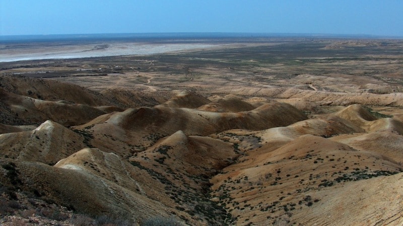
Breakfast. Transfer: natural boundary Boszhira - settlement Ak-Kuduk - plateau Ak-Kuduk - sand Karyn-Zharyk - reserve Ustjurtsky - hollow Karyn-Zharyk (130 km). We leave one of the most beautiful places of Mangyshlak and road conducts us on the south to new and novel beauty Mangyshlak. On a way the small settlement Ak-Kuduk which has got lost in sand of Mangyshlak is passed, here it is possible to fill up stocks of water.
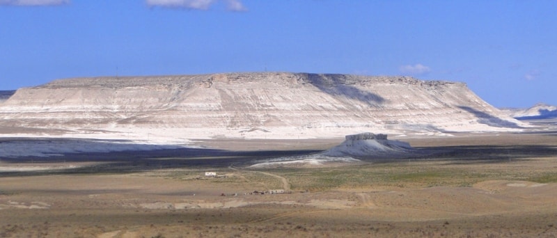
On a way visiting of small plateau Ak-Kuduk with which wonderful and unforgettable kinds on surrounding steppes open. Further we cross sand Karyn-Zharyk with beautiful panoramas of cretaceous adjournment in the western part of sand. We pass sand and our way proceeds on an equal surface of plain which borders on hollow Karyn-Zharyk which is on 75 meters below a sea level.
Lunch in a way. Visiting of a cordon of reserve Ustyrt, transfer to a southeast extremity of a hollow. Placing of camp on the western slope of a hollow. Directly before us kinds on unique islands Three Brothers in saline land, located in a southern part saline land. Dinner and overnight in the tents.
11 day. Hollow Karyn-Zharyk - cave Balayk (58 km).
Breakfast. Transfer: hollow Karyn-Zharyk - hollow Utebai (58 km). Arrival on hollow Utebai, descent, walk on friable ground and a deep dust in the main branch of a hollow, extent more than 70 meters, photographing. Visiting of a jack of an owl. Rise on a surface.
Transfer: hollow Utebai - cave Balayk (11 km). A lunch. This one of deserted places of our way, on this way is only roads leaders in the different parties. From cave Balayk of 25 kilometers up to border with Republic Uzbekistan. Arrival on cave Balayk, preparation for descent in a cave.
Descent in a cave, overcoming of rocky ledges with use of the insurance. Length of a cave about 200 meters, an average and sometimes a steep bias. At the bottom of a cave there is a crystal-clear blue lake, water in lake salty and cold. Returning from a cave on a surface. Dinner and overnight in tents at a cave.
12 day. Cave Balayk - Zhanaozen city (230 km).
Breakfast. Transfer: cave Balayk - reserve Ustyurt - settlement Ak-Kuduk - settlement Senek - sand Tuiesu (180 km). In northern part of settlement Senek the most beautiful sand of Mangyshlak - Tuiesu are located. Walk on sand Tuiesu, photographing. Lunch in vicinities.
The further transfer: sand Tuiesu - settlement Kyzylsai - the city of Zhanaozen (50 km). Arrival in Zhanaozen, transfer to hotel, accommodation. Evening walk by the central part of city. Dinner and overnight.
13 day. Zhanaozen - Aktau (150 km).
Breakfast. Transfer: Zhanaozen - Aktau. For 60 kilometers before the city of Aktau descent in the deepest hollow in Kazakhstan - Karagie begins, its depth makes 132 meters below a level of Baltic sea. Sightseeing of vicinities of a hollow from a viewing platform near to Aktau. Arrival in Aktau, a farewell lunch local restaurant. The end of the program.


Note:
Author program is Alexander Petrov. Copying and introduction - from the sanction of the author petrovsra@mail.ru
Alexander Petrov
photos.