


![]()
Вы здесь
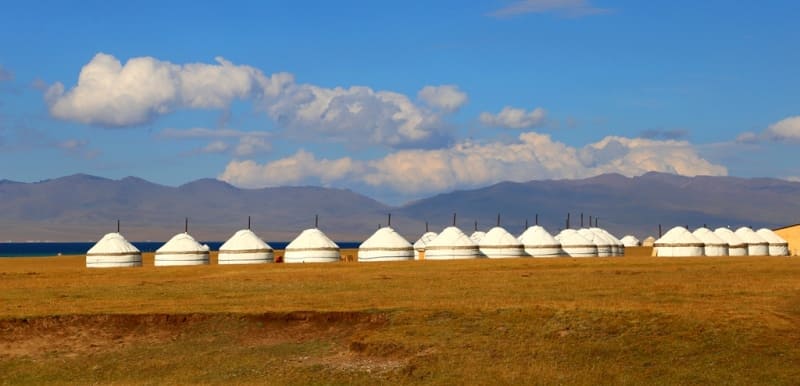
Son-Kol Lake.
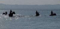
Trip on high-mountain lake Son-Kol.
“Nature encourages no looseness, pardons no errors”
Ralph Waldo Emerson.
Tours to Son-Kol lake.
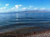
The lake Son-Kol is located in territories of four districts of the Naryn region - Kochkor, Zhumgalsky, Ak-Talinssky and Naryn. This second-large lake of Kyrgyzstan after the lake Issk-Kul, is at the height of 3013,6 meters above sea level.
The lake Son-Kol is in a huge intermountain hollow which was stretched on 40 kilometers. The hollow begins from the pass 3132 meters high Terskey-Torpok above sea level located in the southeast of a hollow near the river Song-Kol.
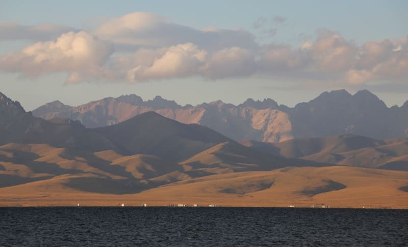
The hollow in the northeast under the pass the Uzbek 3375,8 meters high above sea level comes to an end. The lake is located between ridges which close the lake around. In the east the ridge Moldo-Tau to the north which lie the mountain Balykty borders on the lake.
From North side the lake frames the ridge of Song-Kol-Too with the dominating anonymous peak 3482,8 meters high above sea level. In the east the lake borders on the mountains Aktash with anonymous peak 3853,5 meters high above sea level and the western spurs of the ridge Baydauula with the dominating peak 3957,9 meters high above sea level.
From South side the lake is limited to the width ridge Bauralbas in the western part with the dominating height of 3788,6 meters above sea level and mountains Itelgi-Uya with the dominating height of 3811,1 meters above sea level and northern spurs of the mountains Korgo.
More than 25 rivers big and small, large of which the river Song-Kol in a southeast part flow into the lake, from the East two small rivers Burgun-Suu and Karakiche flow into the lake. From the North several small streams - the Uzbek, Kyrk-Jo, Kara-Kya, Tyz-Ashuu flow into the lake.
From the East large inflow of Ak-Tash flows into the lake. Coast of the lake boggy. The area of a water mirror is 270 kilometers square, the volume of water is 2,64 kilometers of cubic. Lake length from the mouth of the river Song-Kol and to the coast between mouths of the rivers Uzbek and Kyrg-Dzhol of 27 Kilometers 500 Meters.
Lake width from the mouth of the river Burgun-Suu in the southwest and to the natural boundary Kylak in the northeast of 17 kilometers. Water temperature in the summer 11 ° - 12 °C, in the winter - 3 °C. The lake freezes in November, is opened in May.
Considerable part of a hollow is occupied by the piedmont plain having a uvalisty relief. In east part of a hollow the small hills is developed. In the southeast the tectonic raising created by lake waters. The only river Kazhyrty which expenses during intensive snowmelt make 3 - 5 cubic meters a second follows from the lake, in the rest of the time they are insignificant.
The basin of the lake Son-Kol is characterized by poorly developed network of superficial water currents and existence of a considerable underground drain. In total within syrt of Song-Kul is water erosive meadows, streams and small rivers on which water can come to the lake.
Almost all river network in the basin of the lake is temporarily acting. Rather water sated she is only during the periods of snow thawing and rains. The hollow of the lake contains large reserves of underground waters. Lake bottom similar to a saucer, smoothed.
The deep-water zone is displaced to a northern part of the water area. East zone of a shallow water areas, gradual increase of depth to 4 - 5 m is observed on the site in 7 - 8 km from a river Son-Kol source, and at distance of 10 - 11 km from a source.
The maximum water temperature and air most often coincide and fall on 16 hours. Most strongly water is cooled in the morning at 4 - 5 o'clock. Daily amplitude of water temperature makes 3 - 35°, the maximum water temperature is in limits 20 - 23°.
The lake Son-Kol in the second half of October freezes. The first gulfs, shallow water, coastal sites become covered with ice. Lake Son-Kol waters on the chemical composition belong to the hydrocarbonate class, the second type of magnesian group.
The mineralization of lake water changes on average from 465 mg/l in the summer. And in winter time of 306 mg/l. Ancient terraces on its coast demonstrate that lake level in the past was 100 - 150 meters higher than modern.
The last lowering of the level on 2 meters happened at the end of XIX - the beginning of the XX century. The crests of mountains surrounding it rise over it by only 600 - 900 meters. The lake is flowing therefore water in it transparent and fresh.
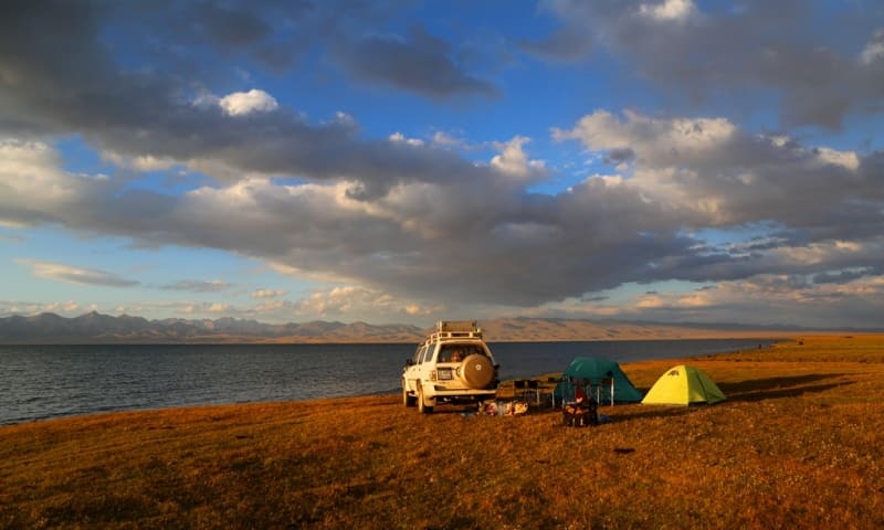
Coast of the lake are partially boggy and covered with reed, the climate of a lake hollow severe since September the lake already becomes covered with ice which keeps to the middle of June. Cold strong winds here the frequent phenomenon, the summer period lasts no more than one and a half months.
Climate at the lake continental. Average annual temperature - 3,5C, January, - 20 C, July 11 S. Active weather of 350 - 400 mm a year. Soils in the neighborhood of the lake mountain and meadow. Species of vegetation are characteristic meadow and steppe, subalpine (3000 - 2400 meters above sea level) and Alpine (3400 - 3500 meters above sea level).
The lake approach it is a little expensive, one from the East from the settlement of Kochkorka through the pass 3446,6 meters high of Kalmak-Ashuu above sea level. Second Highway approaches the lake from settlements Cara-oh and Dzhangi-Talap through the pass 3201,8 meters high of Moldo-Ashuu above sea level.
The third road approaches from the settlements of Kairma, Bash-Kuuganda through the pass Karakichi 3364 meters high above sea level. Distance from the lake Son-Kol to the settlement of Kochkorka of 130 kilometers.


Authority and photos by
Alexander Petrov.