Вы здесь
Bukhtarma Reservoir.

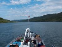
Walk on boats on Bukhtarma reservoir.
“The miracles of earth are the laws of heaven”
Jean Paul Richter.
Rafting on Irtysh river to Bukhtarma reservoir.
Many reservoirs have been built on the territory of Kazakhstan, the largest of them intended for irrigation and energy purposes, is Bukhtarma. The height of the dam Bukhtarminskaya HPP is 90 meters. The Bukhtarma reservoir is located in the East Kazakhstan region, in the middle of the Altai Mountains.
It was formed in the first half of the sixties of the last century at the Bukhtarma hydroelectric station on the Irtysh. The construction of the hydroelectric power station began in 1953, the filling of the reservoir began in 1960. After the construction of the dam, the level of Lake Zaysan rose by 7 m, the area of the lake increased 3 times and it became part of the Bukhtarma Sea.
The dimensions of the reservoir are truly impressive: 5500 km2, volume 53 km3, length more than 500 km, maximum width 35 km, average depth 9.6 m. In the valleys of the Bukhtarma, Narym and Monchekur Depression - bays 30 - 50 km long and wide up to 10 km.
The Bukhtarma Sea is of great importance for increasing the provided capacity and generating electricity of the Bukhtarma and Ust-Kamenogorsk hydroelectric power stations. Spring releases are annually carried out from the reservoir to irrigate hundreds of thousands of hectares of floodplain meadows in East Kazakhstan, Pavlodar, and other regions.
The reservoir creates a deepwater path and improves the navigation conditions of ships along the Irtysh to Omsk. Fisheries are developed on the reservoir (carp, bream, sturgeon, etc.). Dozens of sanatoriums, boarding houses, and recreation centers have been built on Bukhtarm. Almost anyone can buy a ticket to any recreation center.
The Bukhtarma Sea, in its size, is one of the largest artificial reservoirs in the world: it consists of 2 sections: river - along the valley of the river. Irtysh, and Lake Zaysan, on the site of which a wide stretch was formed. Area 5500 km2, volume 53 km3, length more than 500 km, maximum width 35 km, average depth 9.6 m. In the valleys of the Bukhtarma, Narym and Monchekur Depression - bays 30-50 km long and up to 10 km wide.
Because of such an impressive size, the Bukhtarma reservoir is called the sea, which really corresponds to the truth.
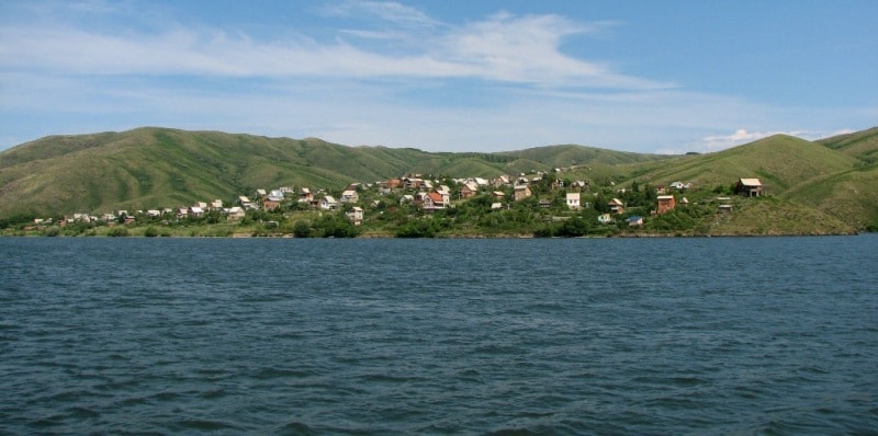
In some corners, sitting on the shore at the water's edge, looking into the distance, you see how the opposite edge of the lake merges with the horizon, and the sound of the surf gently caresses your hearing. Fancy cliffs, picturesque landscapes, sandy beaches and thoughtful calm bays create an unforgettable coastal panorama and a magnificent environment for your relaxation.
The reservoir is formed by the water-resistant structures of the Bukhtarma hydroelectric complex, located slightly below the Bukhtarma river. The hydropower unit was commissioned in 1976. It consists of: a retaining-type hydroelectric power station building with a capacity of 675 thousand kW (9 hydropower units) located on the left bank, a concrete dam, consisting of a catchment and a blind part, a four-chamber navigable lock located in the rock mass of the right the coast.
The total length of the pressure head of the hydraulic system is 450 m, the design head is 67.5 m. The Bukhtarma reservoir is located in several areas of the East Kazakhstan region of Kazakhstan. On the banks of the reservoir hospitably opened their doors to more than twenty recreation centers, which are ready to receive tourists from Kazakhstan and from other countries.
From various information sources. It does not really look like one, but Bukhtarminsk Reservoir (Bukhtarminskoye vodokbranilishchye) is not only the largest reservoir in Kazakhstan but among the largest of its kind in the world.
Only a small slice of land was lost when the Irtysh was diverted to this water basin, 340 kilometres long, 25 kilometres wide and up to 68 metres deep. A valley with rocky subsoil was filled up, resulting in a clean, natural-looking lake.
Around 120 kilometres from Oskemen, the lake has become a weekend resort for city residents, who come to relax, make use of the beaches and clean water, and watch the pretty sunsets. Popular places include the bays of Ayuda and Altai, the more remote location where the Bukhtarma River flows into the reservoir, and most of all Blue Bay (Goluboy zaliv).
This is on the northern shore of the lake not far from the road to Zyryanovsk, just beyond the hamlet of Bukhtarma, where there are small cottages and rest homes for rent. Booking through a travel agency is recommended, since Blue Bay is in great demand during the holiday season, although off-season there is often nobody there at all.
Temperatures are good for swimming until early September. Buses from Oskemen to Blue Bay are cheap and take two hours, but a more enjoyable way to get there is to take to the river on a raketa - a reconstructed Soviet hydrofoil, which in summer shuttles between Oskemen and the reservoir.
They shoot upstream to the lock at Serebryanka, where the dam is bypassed. A water-borne experience can be had by crossing on one of the boats that ferry people and vehicles from shore to shore, reducing travel time between Oskemen and the far northeast reaches of the region.
In most places the western shore is flat and bare, and to the south of the Kurshum ferry there are even desert dunes. The eastern shore is lined with hills, and on the northernmost bays the forests reach down to the shore, offering a wonderful contrast with the clear, blue water in autumn.
One can drive around the entire lake, and the road often remains close to the water along the east shore, before heading into hills filled with groves of silver birch. In spring and summer the road is lined with bright-yellow flowers, the rolling green hills punctuated with ploughed fields of black earth, showing how mineral-rich the soil is.
Villages in the Altai foothills are filled with modest but well-built houses, with steep-sided roofs (to shed the heavy falls of snow that shroud the land in winter) and bright-blue window shutters - a common theme throughout Kazakhstan, but particularly attractive here, surrounded by such a vivid display of nature's colours.
The road heads east away from the reservoir and eventually crosses the hilly heights, revealing a sweeping panorama of the broad Narym River Valley and the line of 3000 - 4500 metre Altai peaks that hide Markakol Lake and the Chinese border beyond.
A popular tour route taking in Bukhtarminsk Reservoir and the region to its south goes via the town of Kaznakovka, either from the lakes of Sibinsk or from Asubulak, then crosses the reservoir by ferry to the east shore and heads down through Kurshum to Aksuat on Zaysan Lake.


Authority:
“The guidebook across Kazakhstan”. Authors Dagmar Schreiber and Jeremy Tredinnick. Publishing house "Odyssey".2010.
Photos
Alexander Petrov.


