


![]()
Вы здесь
History Istaravshan.


Excursion in Istaravshan.
Istaravshan (Urat-Tube) is one of the oldest cities in the world. He was more than 2,500 years. It is located in the north of Tajikistan, in the foothills of the Turkestan Range. Istaravshan, and last Kiropol (Kurushkada), named after the founder of the Persian empire of Cyrus, Kurush (529 - 559 years. B.C,).
Kiropol owes its origin to the growth of handicraft production and trade. By the time Alexander Makedonsky conquered Central Asia (IV century B.C.), was already a big Kurushkada well-fortified city.
This is where staen of Alexander of Macedon first gets ranenie.Iz the frequent rebellions city was destroyed by Alexander of Macedon. Later, under different names, the city is mentioned in various sources. The town was first called.
At the end of the XV century the town was under the rule of the Timurid ruler Sultan Mahmudhona. In his decree (the label), dated 900 (1449) Ura-Tube called "Ura-Tube." In the 40 - 50 XVIII century there was formed an independent Uratyubinskoe fief.
It consisted of the city of Khujand, Jeezy, Penjikent, open Fastening points Zamin, Em, and the upper reaches of Zarafshan, Match and Falgar. Persians called the town Kurukada, and the Sogdians Kurushkada.
Contemporary scholars identify it with antique Cyropol or, according to Ptolemy, with Kireschata. In the 6th century B.C. the town was fortified with three rows of walls, had a citadel surrounded by walls 6,000 meters in length and was famous for its skilful craftsmen and lucrative trading.
Some scholars believe that in the I – II centuries B.C. and I - II centuries A.D. Istravshan was known as Ustrushana and was part of the independent region called Ustrushana with a capital in Bundjikat.
It was an important commercial centre, since roads from here lead towards Khujand, Bukhara, Samarqand and the Ferghana Valley. In 822, during the period of Arab rule, Istravshan, which became a caliphate province, was widely known in the Muslim medieval east as a trade and cultural centre.
Here new forms of Islamic buildings were developed (mosques, madrassahs, mausoleums, minarets, etc.), based on developments in dome design. In the XIII century the development of Istravshan was interruted by the invasion of Genghis Khan's troops.
They began robbing, and destroying the local population, and as a result many settlements were turned into ruins, irrigation systems were destroyed, and towns were deserted. Historical information about the town is also available for the end of the XIV century, when the powerful Timurid Empire, with its capital in Samarqand, was gaining power and Maveraunnahr was in its heyday.
The town was then called Ura-Tyube. The town was becoming a dynamic populous centre of the new state. Residential quarters were expanding, and the urban area was improving. The population was supplied with water through irrigation canals, underground pipes, and wells.
In order to meet the local population's water needs, recreation areas with ponds and covered reservoirs of water were built in each quarter. In the XVI century Maveraunnahr and Uroteppa fell from their positions of importance and prestige as a result of the founding of a new state with a capital in Bukhara, ruled by the Sheibanid Dynasty.
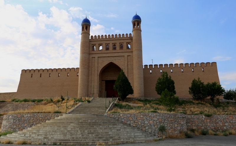
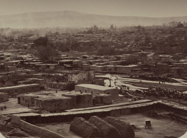
Transit trade from India was monopolized by other countries. Further development came to Urateppa in the XVIII century. At that time the citadel and fortress walls were fortified, the old fortified structures restored, and new ones were built capable of withstanding the numerous assaults of nomadic Turkic-Mongolian tribes, who continuously attacked the town. The urban area where the ancient citadel, mosques, madrassah, six bath-houses and many teahouses were situated was 527 hectares.
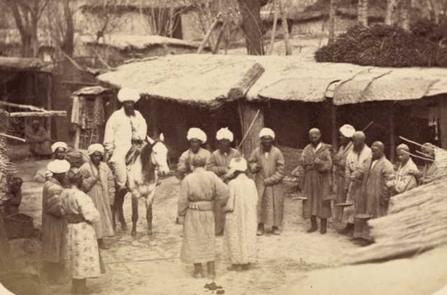
In just one year, 1886, before joining Russia, there were 17 different rulers in Uroteppa (some of them ruled less, than a week). During this period the town was marauded 50 times.
At the end of the XIX century there were 68 mosques, 16 caravanserais, 5 dairies, 7 mills, and 7 bath-houses in Uroteppa as well as many markets: wheat, carrot, meat, melon, livestock, as well as mat, wool, cloverleaf, cotton dresses, thread, cotton robes, down, knives, salt and tea.
Up till this time a number of interesting historical monuments had been preserved in Istravshan. The double-domed mausoleum, Hazratishoh, built in the XVIII century, was considered by the Istravshan population to be the tomb of Prophet Muhammad's cousin - Kusama ibn Abbas.
In the western part of town is the Abdulatif Sultan mosque-madrassah, also known as Kok-Gumbaz due to its tiled "Blue Dome". This XVI century structure was built at the initiative of Abdulatif, son of the famous astronomer and philosopher Ulugbek.
Folk legend about the Kok-Gumbaz building says that after a quarrel with his father, Abdulatif left his parents' house and was employed by an old peasant digging an irrigation canal for his plot of land. For this work he should have received 100 tenge (pennies).
Meanwhile Abdulatif's father was searching for him. Having learnt where his son was working, he took the money which Abdulatif had honestly earned from the peasant, added his own money, and built a madrassah.
In the late XIX century it had 8 teachers, and 44 students were studying there. The main building of Kok-Gumbaz is made of square bricks and there is a large, square room inside with four deep alcoves on the sides.
There is an alcove with a mehrob (for the imam) decorated with a rich, sculpted, alabaster arch. The interior walls are painted. The front portal and dome have a majolica coating. Bath-houses (hammom) frequently served not only utilitarian purposes but were also used for purifying rituals before prayer, and were joined to mosques.
As a rule, they were built from baked bricks. Bath rooms were situated below and had a waterproof cover. There were also special rooms for relaxing and drinking tea, where visitors could spend their time in leisurely talk, use the barber's services or play chess.
There were bath-houses in every quarter (guzar) of Istravshan. Such public facilities built in the XIX and XX centuries have remained intact thus far in the guzars of Korgardon, Darvozai Bolo, Havzi Moron, and several others.
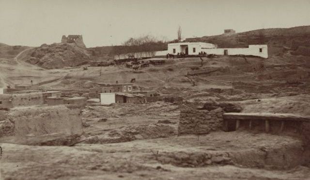
One of the town's more remarkable historical sites is the ancient settlement on Mugh hill, where a local ruler's residence was located. Unfortunately, only the gates and a dome with columns on each side now remain intact.
Present-day Istravshan is a town of folk craftsmen and an architectural complex and an important economic and cultural centre in Tajikistan. Up to the present day there have been different quarters for each group of craftsmen - weavers, potters, blacksmiths, etc.
Samples of carving, decorative textiles, wall and ornamental painting, artistic ceramics, jewellery, embroidery, architectural decor, and epigraphic design are an excellent illustration of the town's high level of craftsmanship and their inexhaustible creative spirit.
The roots of this rich, diverse and vivid art originate in ancient times. The local market is a great place to see the creative process and the results of local craftsmen's work with your own eyes. Istravshan is connected with Khujand (the main city in the region) by a good paved road.
The Kattasay reservoir is 6 km from Istravshan, the sandy shores of which are a favourite recreational area for townspeople. This man-made sea was built in 1964. The dam is 60m in height, 800m in length, has a maximum depth of 43 m, and a capacity of about 55 million cubic metres.
Next to the reservoir is the Uroteppa sanitarium and several recreational zones. It is possible to get to the reservoir by public transport or by taxi from Istravshan. At the beginning of the XIX century Uratyubinskoe lost a number of territories that were captured Bukhara and Kokand Khanate.
After joining Russia have been preserved old plumbing Uratyubt ownership. In 1887 the region was Uratyubinsky of the newly formed Samarkand region.
Authorship:
Javad Abed Khorasani. http://www.asraresokhan.com
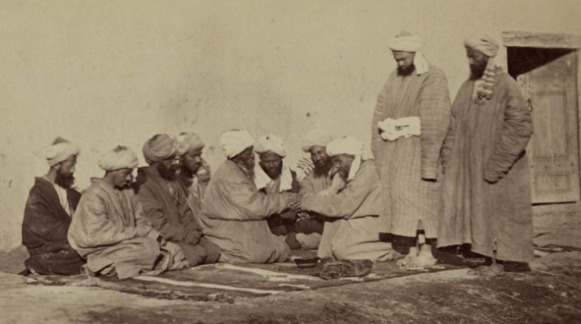
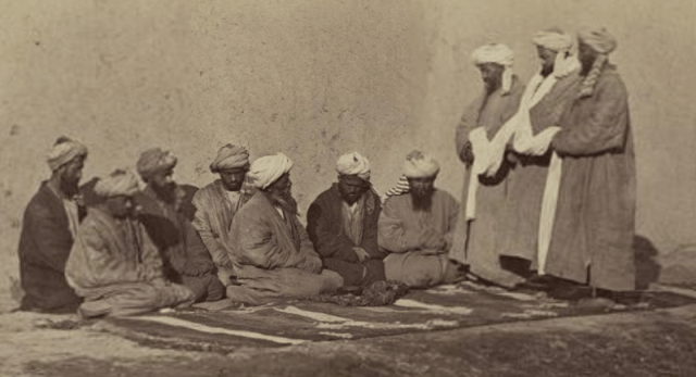
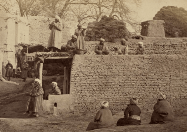
Photos
From the Turkestan album, general Konstantin Petrovich fon-Kaufman created on the order a background (1818 - 1882), the Russian Turkestan first the general-governor, consists of four parts in six volumes. Composers of the Turkestan album the Russian orientalist Kun Alexander Lyudvigovich a background (1818 - 1882) by means of N.V. Bogaevckiy.