Вы здесь
Tour Around Lake Balkhash.
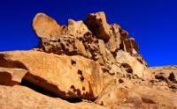
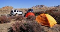
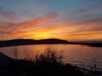
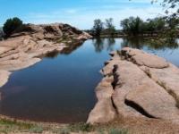
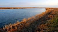
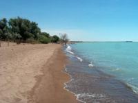

Sights of Lake Balkhash.
"Will the time ever come when governments will no longer be surprised by people's desire to travel solely to study peoples, rather than to conquer or exploit them?"
Academician Karl Maksimovich Baer.
Short description of fact-finding tour to Lake Balkhash:
Almaty - lake Sorbulak - Kurty reservoir - desert Taukum – Lake Balkhash - settlement of Saryshagan - town of Balkhash - mountain Bektau Аta - town of Balkhash – train station Azhaydak - peninsula Balaytubek - settlement of Kara-Kum - settlement of Sayak - peninsula Keuntubek - peninsula Korzhintobe - mountain Shumek of 387 m. a. s. l. - ford through the river Ayagoz – train station Karatas – train station Arganata - settlement of Lepsy – Paradise lakes - station Matay - town of Taldykorgan - Kapshagay reservoir - Almaty.
Distance route: 1912 km.
Season: June - September.
Duration of tour: 6 days and 5 nights.
Accommodation: 5 nights in tents.
Best time for tour: June - August.
Detailed program of tour on jeeps from town of Balkhash to settlements of Sayak and Lepsy:
Travel to Lake Balkhash.
Physical and geographical review of Lake Balkhash.
Southeast of Karaganda, at the junction of the Karaganda and the Almaty oblasts, is Lake Balkhash. It is one of the largest lakes in the world (about 18 thousand square kilometers). The uniqueness of Balkhash is that the half of the lake is fresh and another half is salty (the salty eastern and the fresh western parts are divided by a narrow strait Uzyn-Aral).
The depth of Balkhash does not exceed 26 meters, and its length is more than 600 kilometers. Balkhash is the third lake in Kazakhstan by the territory after the Caspian and Aral Seas. It is located in the south-east of the country in Balkhash-Alakol Depression (342 m. a. s. l.).
The area of the lake is 18.2 thousand km2, the length is 614 km, the largest width is 74 km, the length of the bank line is 2383 km. Water volume is 106 km3. Balkhash is divided into two parts: western and eastern. The depth of the western part is 6 - 12 m, the depth of the eastern part is around 15 - 26 m.
The lake is cut by multiple peninsulas and bays. The largest islands are Basaral and Tasaral. Besides Ili, Balkhash has such tributaries as Karatal, Aksu, Lepsy, Ayaguz, Bakanas and other rivers. Significant amount of water (675) in the lake is brought from Ili River.
The phenomenon of Balkhash is in different mineralization of its western and eastern parts connected by the narrow belt. The western basin that receives water from Ili River is fresh water and the eastern part is saline water.
The nature of Balkhash is amazing and full of contrasts.
There are more than 20 species of fish in Balkhash including six local species that are there from the ancient times (Ili blue-head, Balkhash blue-head, Balkhash perch and others), the rest were brought from other water reservoirs (barbel, barbel sturgeon, pike perch). Commercial fish is sazan, pike perch, Balkhash perch and others.
Day 1. Almaty - mountain Bektau Аta (735 km).
Transfer: Almaty – train station Shamalgan - lake Soorbulak - Kurty reservoir - settlement of Kanshengel - desert Taukum - settlement Aksuyek - lake Alakol - Lake Balkhash - settlement of Shyganak - settlement of Kashkanteniz - settlement of Saryshagan - settlement of Gulshat - city of Balkhash – mountains Bektau Аta.
After the settlement Mezhdurechensk to lake Sorbulak, settlements will not be any more, and the following small settlement of Kanshengel will meet to us after the Kurty reservoir. We pass the desert Taukum which is to the right of the road. In summer months from the settlements of Aydarly and Bozoy on the road bring melons and water-melons, these flavovirent mountains of a melon and water-melons will accompany us several tens of kilometers.
In the vicinities of the settlement of Aksuyek there passes the administrative border of the Jambyl and Almaty regions. Through 360 kilometers after Almaty on the right side from the road we will see Lake Balkhash which will accompany us several days. A lunch in way. We pass the settlements of Saryshagan and Gulshat.
To the settlement of Priozersk of 9 kilometers, it to be to the right of the road on the bank of Lake Balkhash. We pass the city of Balkhash, from here to the mountains Bektau ata there are 69 kilometers. Arrival in Bektau Аta valley, placement in tents, dinner and overnight.
Day 2. Mountain Bektau Ata.
Breakfast. Walks in the vicinities of the mountains Bektau ata, visit of the massif Sarykulzha (kaz. - mountain argali) 1082 meters above sea level, Konyrkulzha of 976 meters above sea level, Zhaltas 824 meters above sea level, Karashoky 893 meters above sea level. Return to the camp, dinner and overnight in the tents.
Day 3. Mountain Bektau Ata - city of Balkhash - Lake Balkhash (169 km).
Breakfast. Transfer: mountain Bektau ata - city of Balkhash (69 km).
Arrival in the cities of Balkhash. Development of Pribalkhashya began the exploration works headed by the geological engineer M. P. Rusakov in 1928. After prospecting work on the Kounrad field the expedition came to a conclusion that there are richest reserves of copper ore, on their base it is possible to build the copper-smelting plant.
This event served the birth of the city of Balkhash. In February, 1937 the first Udarnik movie theater, in July - the first bus lines in the city opened. Visit of museum of local lore of the city, visit of a monument to the geologist M. P. Rusakov, visit of the central square of the city, visit of “Metallurg” recreation center, visit of a memorial monument Victory. A lunch in cafe of the city.
Transfer: city of Balkhash - peninsula Balaytubek (100 km).
Our way from the city of Balkhash lies on the northern coast of Lake Balkhash, along the railroad which connects the city of Balkhash and the mine Sayak to the nodal village Aktogay. The railway station Akzhaydak is on the bank of the gulf Akzhaydak.
Arrival on the peninsula Balaytubek, placement in tents, dinner and overnight.
Day 4. The peninsula Balaytubek - the settlement of Kara-Kum - settlement of Sayak - peninsula Araltobe (200 km).
Breakfast. Transfer: peninsula Balaytubek - fishing settlement of Kara-Kum (110 km). We pass the gulf Sarymsakty. To the south of the valley Askantyktuz is the peninsula Shaukar. The peninsula Kentubek has very picturesque, magnificent beaches here.
In a southeast part of the peninsula there is tongue of sand which is removed to the lake on 1 kilometer. Photowalks in the neighborhood of the peninsula Kentubek. Lunch. Transfer: peninsula Kentubek - peninsula Korzhintobe (50 km). Walk in vicinities, installation of tents, placement, dinner, lodging for the night.
Day 5. The peninsula Korzhintobe - Paradise lakes (218 km).
Breakfast. We leave from the peninsula Korzhintobe, we pass the most northeast tip of Lake Balkhash and from here our way gradually leaves on the South along the easternmost tip of Lake Balkhash. We pass the mountain Shumek and we go to the ford through the river Ayagoz, from here our way lies to transfer through the railroad on travel Karatas. A lunch in way.
Along a southeast part of Lake Balkhash we go to the settlement of Lepsy. From the settlement of Lepsy we move the South and after the settlement of Matay we turn to the right and we move towards the settlement of Kuraksu. T
hrough 35 kilometers we turn left and 25 kilometers to Paradise lakes we move on Koshkarbasa sands.
Arrival on the lake, placement of tents, dinner and overnight.
Day 6. Paradise lakes - Taldykorgan - settlement of Saryozek - settlement of Kanshengel - city Konaev - Almaty (430 km).
Breakfast. Transfer: Paradise lakes - city of Taldykorgan (170 km).
Taldykorgan, this former Ukrainian-Russian village of Gavrilovka which arose in the seventies the XIXth century. In 1999 the administrative center of Almaty region is transferred to the city of Taldykorgan. Arrival in Taldykorgan, visit of museum of local lore of Tynyshbayev. A lunch in cafe of the city.
Transfer: Taldykorgan - Almaty (260 km). Arrival in Almaty, end of a trip.
The note:
Author program of Alexander Petrov. Copying and introduction - from the sanction of the author.
Alexander Petrov
Photos by:


