


![]()
Вы здесь
Lake Iskanderkul history.

Travel on Lake Iskanderkul.
«Memory is the treasure house of the mind wherein the monuments thereof are kept and preserved»
Thomas Fuller.
Trip from Dushanbe to lake Iskanderkul.
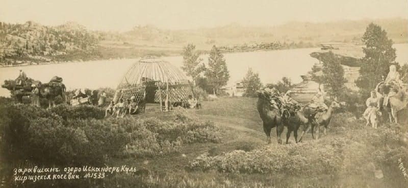
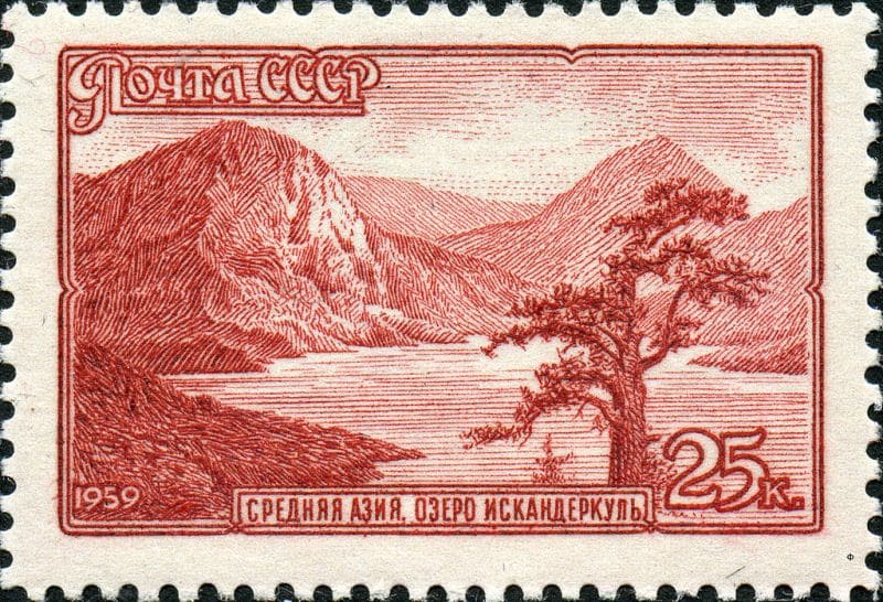
Fresh, flowing lake Iskanderkul (taj. Iskandarkul) is located at an altitude of 2,194.8 meters above sea level, located in the west of the Khazormech mountains, in the east of the Bartursofi valley, in the spurs of the Kuhistan mountain knot, between the western extremities of the Gissar and Zerafshan ranges in the Penjikent region Sughd region.
According to the legend, it arose when Alexander the Great soldiers flooded the rebellious city. From historical chronicles it is known that in 329 Alexander the Great at the head of the Greek army intruded in Sogd (Sogdiana) - the ancient Central Asian state.
Only in three years Greeks managed to occupy mountain settlements of Sogds peoples. During this war Alexander the Great with the soldiers visited the lake which called Iskanderkul subsequently - "Alexander Lake".
The legend says that during fight the famous commander lost here the fighting horse of Bucephalus who broke from a steep slope and drowned in the lake. There is a Legend that Bucephalus in summer moonlight nights leaves water and is grazed on pastures in mouths of the rivers flowing into the lake.
The lake Iskanderkul is at the height of 2195 meters above sea level on the expanded site of the river valley which was filled with the glaciers which were going down from neighboring tops several tens of thousands years ago.
When they receded, from a steep slope nearly 2 kilometers high to the valley of the river Iskanderdaryi enormous blocks of limestones broke. The dam 400 meters high and more than 5 kilometers long was formed.
On huge calcareous blocks of a blockage travelers like to leave autographs. Iskanderdarya which is poured through a blockage forms 24-meter falls which are concealed from curious eyes in very narrow and deep canyon.
Right after a collapse the sizes of the lake and its depth were more. The river, gradually cut a dam, reduced the lake level and therefore on its coast traces of the previous level of water are well noticeable now (100 m higher than modern).
Does not raise doubts that this lake arose after a freezing, but long before the well-known campaigns of Alexander the Great. In 1870 scientific activity of a number of officials of military authorities of the Turkestan general governorship began.
Among them A. Horoshkhin, G. A. Arandarenko, V. F. Oshanin, N. A. Mayev who in the works showed also ethnographies of the local Tajik population. In 1870 the Iskanderkul expedition under the command of the general K. A. Abramov which had originally military reconnoitring character took place. However a number of scientists was entered into its structure: the baron P. A. Aminov directed the surveys made by topographers A. I. Skassi and Startsev, the mining engineer D. K. Myshenkov, making geological researches, the famous scientist and the traveler A. P. Fedchenko sent by the Moscow society of fans of natural sciences for which this expedition became the first in a series of travel.
S. V. Dmitriyev and A. P. Fedchenko spouse of O. A. Fedchenko made natural-historical researches, and the orientalist A. L. Kuhn - ethnographic. Active part in work of an expedition was taken also by the captain A. D. Grebenkin, it published a number of articles.
The expedition took place all valley of Zeravshan to the glacier and on the way back came on the Lake Iskanderkul. Members of an expedition made mapping of unknown to Europeans of areas hitherto, they got acquainted with a local environment.
The baron P. A. Aminov by results of work of an expedition published a topographical sketch of the valley of Zeravshan. The general K. A. Abramov in "to the Note …", RGO published in News, provides short data from foreign literature on this region (the mullah's travel Abdul Medzhida), reports data on Garm, his governor of that time of Muzaffar-hane (who "makes the sort from descendants of Iskander-Kul-Karneyra", i.e.
Alexander the Great), kishlaks and groups of kishlaks around it, about local population which make only "galch", their life, marriage customs, agricultural culture, crafts (weaving and iron production), mountain crafts (gold mining and withdrawal pains of rock salt), hunting, life etc.
Geographic coordinates of Lake Iskanderkul: N39 ° 04'30.75 "E68 ° 21'50.76"
Authority:
"Ethnography of Tajiks in works of the Russian scientists of XIX - the beginnings of the 20th century of century" http://www.kunstkamera.ru