


![]()
Вы здесь
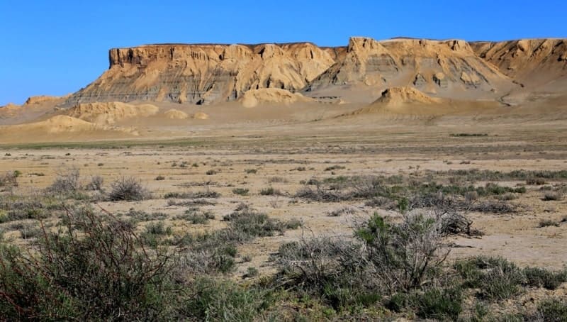
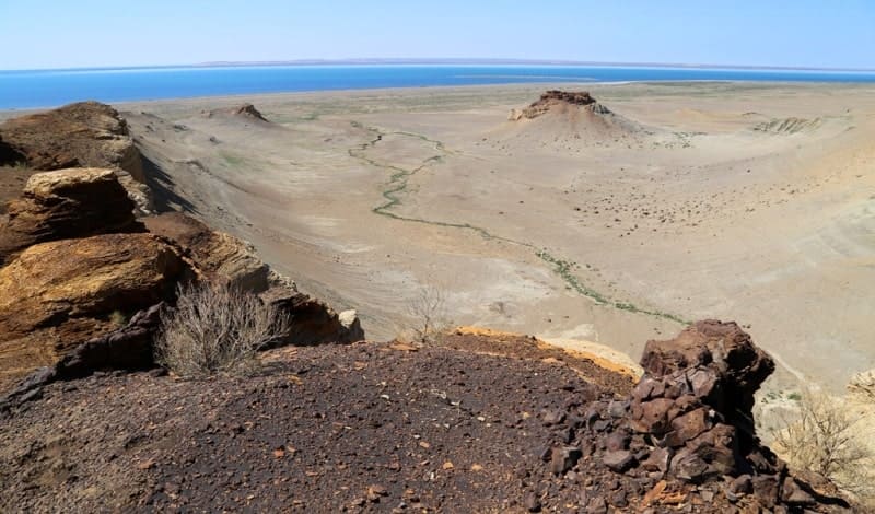
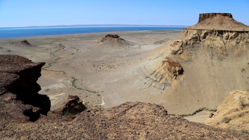
Western cliff Plateau Ustyurt.


The jeep tours on Western Ustyurt.
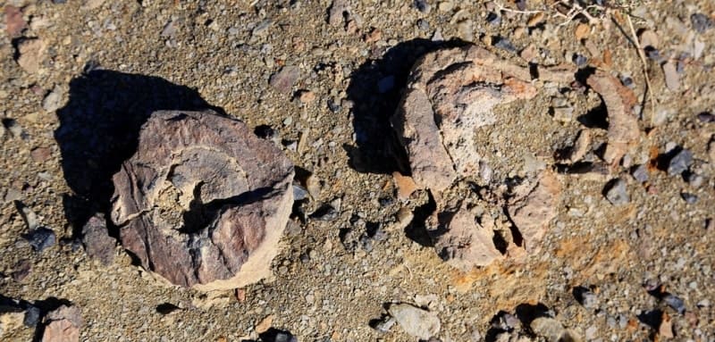
"The chink consists of two ledges, and a low-lying sandy ridge runs along its base. To reach the chink, one must cross the ridge, then climb the terrace, and finally reach its very ledge. The ascent to the chink is extremely picturesque and instructive. The sandy ridge rises 2.5 fathoms above the sea, is up to half a mile wide, and consists of sand and pebbles of various types, all of which make up the chink; a beautiful strip of bright green saxaul bushes is usually visible on its surface. This ridge is obviously a former coastal embankment, indicating that the Aral Sea once had both greater horizontal dimensions and a greater height. The terrace of the cliff varies in height and is not continuous; its width is over a verst. This terrace consists of slumped and collapsed strata, and therefore its layers are bent and fractured in every conceivable way. From a distance, the terrace is extremely picturesque, as its upper edge presents rows of rocks in the form of towers, pillars, and temples. Driving along this terrace, one is amazed by the terrifying chaos of the mineral strata here: one might think there was a powerful earthquake. Beyond this terrace, the upper white ledge or cornice of the cliff forms a vertical wall. The strata within it are horizontal and consist of limestones and marls of white, white-pink, and greenish-white colors. The limestones are mostly phyolitic in composition and contain imprints and cores of Tapes gregaria, Ervilia podolica, Mactra podolica, Cardium obsoletum, G. plicatum, Buccinum duplicatum, and Trochus pius. The marls sometimes contain intergrowths of the same color as these, and as a result, have a conglomerate appearance. From the top of the crag, there is an excellent view of the sea and the upper terrace, the surface of which appears very hilly. From beneath the cornice, springs of good water emerge onto the second terrace.
"Through Mangyshlak and Ustyurt to Turkestan." Barbot de Marnie. 1889.
Walks on Mangyshlak at Caspian Sea.
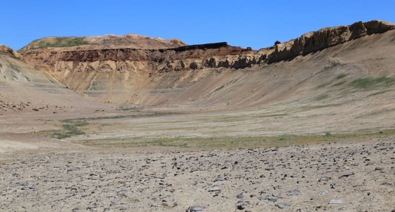
Eastern cliff of Ustyurt plateau stretches 594 kilometers from south to east and then north. Southern end of escarpment begins in southeasternmost part of Ustyurt Plateau, east of Kalajbaba natural landmark, located in Keneurgench district of Dashoguz region of Turkmenistan. State border between Turkmenistan and Republic of Uzbekistan runs for approximately 123 kilometers along Eastern Escarpment of Ustyurt Plateau. Escarpment then runs along western coast of Western Aral Sea through Republic of Karakalpakstan of Uzbekistan and ends south of Northern Escarpment of Ustyurt Plateau and south of settlemente of Bozoy in Shalkar district of Aktobe region.
Geographical location of Eastern Escarpment of cliff of Ustyurt.
Eastern cliff of the Ustyurt Plateau is part of the vast territory of the Ustyurt Plateau, located between the Aral Sea to the east and the Caspian Sea to the west, as well as between the lands of the Southern Aral Sea region, including the former Aral Sea basin.
The Eastern Ustyurt cliff borders one of the largest (150 kilometers long and 90 kilometers wide) and deepest (45 meters) endorheic basins in Central Asia. The bottom of this flat, oval basin is covered by the sediments of ancient lakes, covered in places by wind-blown sand.
Salt lakes are located in the lowest part of the basin. To the south is Lake Sarykamysh, which formed in the 1970s as a result of the flooding of the Sarykamysh basin by wastewater. The plateau lies within the administrative boundaries of three neighboring countries: Kazakhstan, Uzbekistan, and Turkmenistan, but approximately 70% of its area is in Uzbekistan.
Climate of Eastern Escarpment of cliff of Ustyurt.
The Ustyurt area is extremely dry, with annual precipitation just over 100 mm. The heaviest precipitation falls in March and April, with up to 16-20 mm. July and August usually see no rain. There is no consistent snow cover. Summers are not only dry but also hot; average July temperatures range from 25°C to 28°C, with maximums exceeding 40°C.
During the winter months, the influence of the Caspian Sea significantly impacts air temperatures, and they vary greatly near the coast and in the eastern parts of the plateau. Throughout the winter, near the sea. Temperatures above 0°C are observed, and in the eastern parts, down to -7 to -11°C.
Minimum temperatures on the coast are -20°C, while inland, they are -30 to -33°C. The duration of the frost-free period decreases from west to east: 260 days from the coast, and 200 days in the interior and eastern regions.
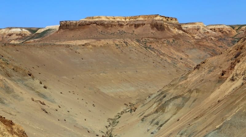
Relief and Geology of Eastern Cliff of Ustyurt Plateau.
The Eastern Cliff of the Ustyurt Plateau is an elevated plain with absolute elevations of 100 to 190 m. a. s. l., bounded by clearly defined ledges (cliff). The entire surface of the Eastern Cliff of the Ustyurt Plateau is composed predominantly of marine Tertiary (Sarmatian) carbonate rocks.
Since the beginning of its continental development, this territory has not been exposed to the influence of permanent streams; the desert environment has had little influence on the formation of the relief. The most significant changes to the original relief resulted in the creation of flat, shallow, endorheic basins such as Barsakelmes, Assakeaudan, and Sarykamysh, with a relative depth of 50-100 m. a. s.
Tectonically, Ustyurt is part of the Turan Epi-Hercynian Plate, whose cross-section includes a Jurassic-Cenozoic platform cover, an Upper Permian-Triassic transitional complex, and a heterogeneous folded basement composed of Paleozoic and pre-Paleozoic rocks.
The landscape is characterized by clayey and clayey-gravelly desert. There are also areas of saline land and sandy desert. There are no permanent streams on the plateau. Temporary freshwater lakes form on clayey soils after rainfall.
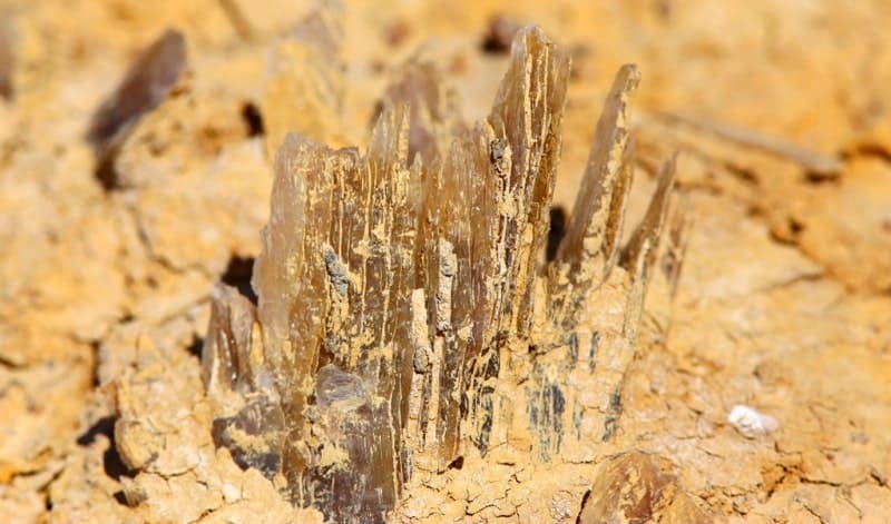
Flora of Eastern Cliff of Ustyurt Plateau.
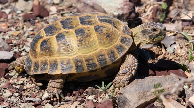
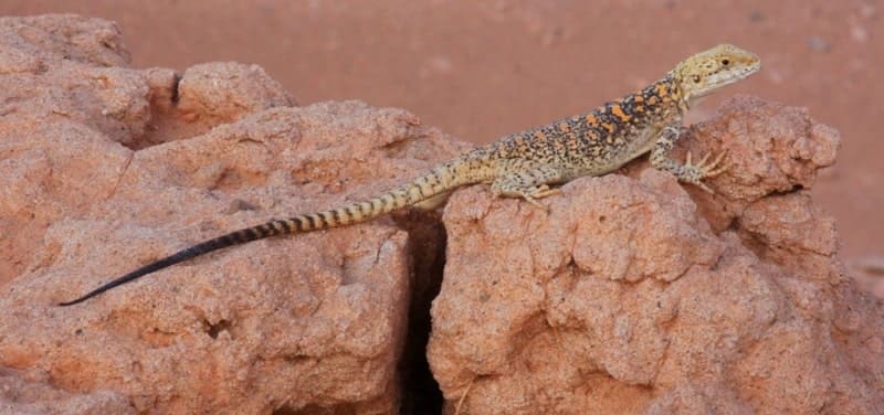
Over 300 vertebrate species, including migratory birds, are found in the Ustyurt region of Uzbekistan. Regional endemics include the Central Asian steppe tortoise (Agrionemys horsfieldi), the variegated lizard (Eremias arguta), the Severtsov's jerboa (Allactaga severtzovi), and the tamarisk sand eel (Meriones tamariscinus).
Rare vertebrate species included in the IUCN Red Lists and the national Red Book (2009) include: the steppe tortoise, the four-striped snake Elaphe quatuorlineata, the long-spined hedgehog Hemiechinus hypomelas, the honey badger Mellivora capensis, the corsac fox Vulpes corsac, the caracal Felis caracal, the goitered gazelle Gazella subgutturosa, the Ustyurt urial Ovis vignei arkal and the saiga antelope (Saiga tatarica), as well as the steppe eagle Aquila rapax, the imperial eagle Aguila heliaca, the golden eagle Aguila chrysaetos, the white-tailed eagle Haliaeetus albicilla, the short-toed eagle Circaetus gallicus and the houbara bustard Chlamydotis undulate, which are also encountered at nesting sites. Cliff have excellent protective properties due to the formation of crevices, voids, depressions, ledges, ravines, and canyons, which attract many animal species. All this determines the high level of species richness and diversity of this natural and climatic zone and its importance for maintaining the overall biodiversity of the Ustyurt region.
Geographical coordinates of Eastern Cliff of Ustyurt Plateau: N44°43'21 E58°13'35
Geographical coordinates of southern end of Eastern Cliff of Ustyurt Plateau: N42°14'30 E58°40'26
Geographical coordinates of Eastern Cliff of Ustyurt Plateau: N45°58'51 E58°42'19
Authority:
"Geoecology of the Ustyurt Plateau. Republic of Uzbekistan." Ed. by P.V. Pankratyev. Orenburg, 2009.
"Ustyurt plateau geoecology. Republic of Uzbekistan". Under the editorship of P. V. Pankratyev. Orenburg, 2009.
Bykova E. A. "Fauna of land vertebrata of East chink of the Ustyurt plateau". E. A. Bykova, A. V. Yesipov, D.E. Golovtsov, D. A. Nuridzhanov. Bulletin of the Tyumen state university. Ecology and environmental management. 2017. Volume 3. No. 4.
http://big-archive.ru
Photo by:
Alexander Petrov.