


![]()
Вы здесь
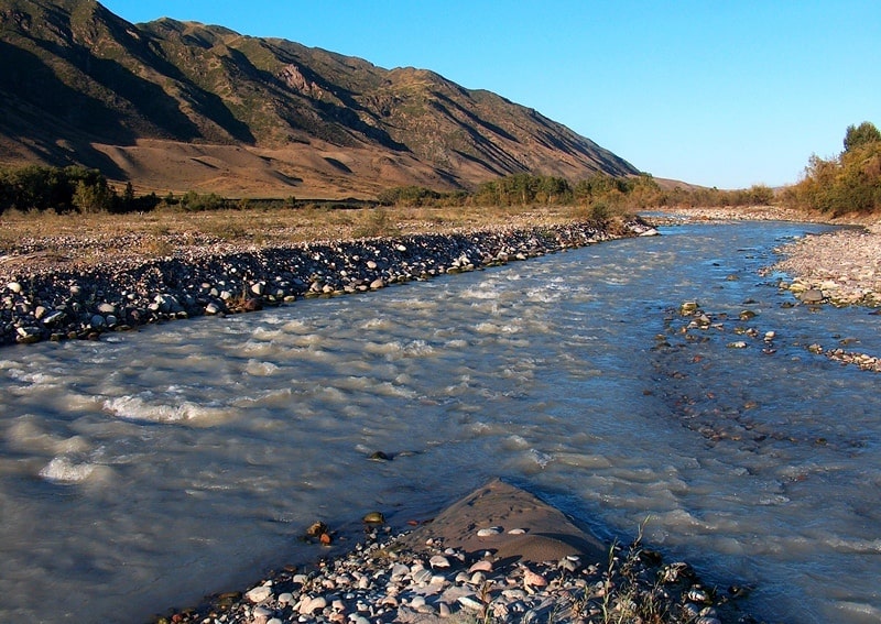
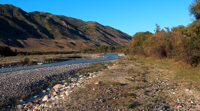
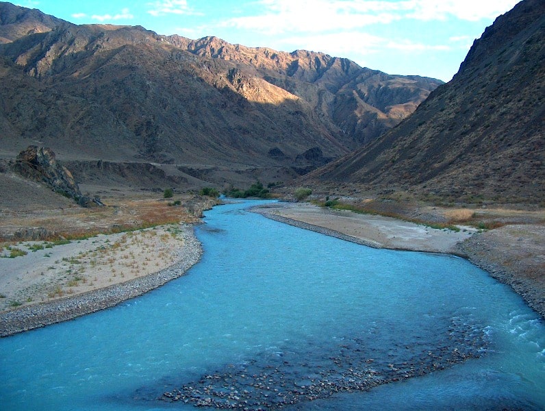
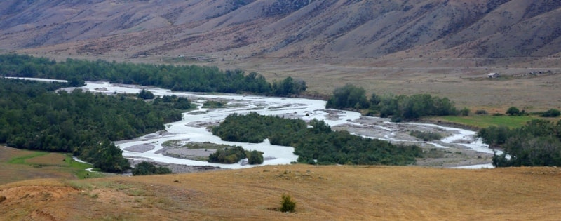
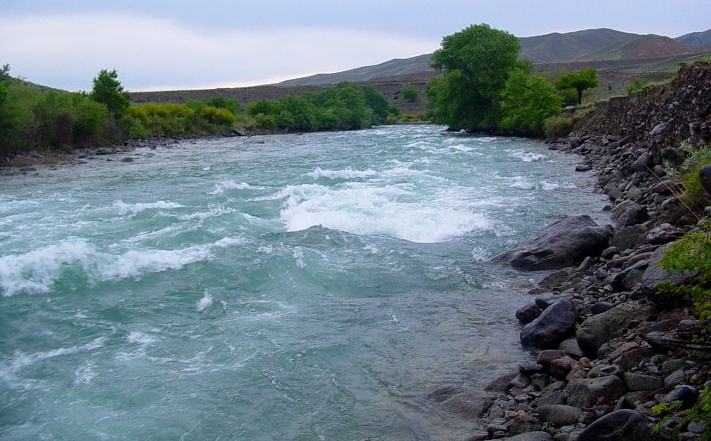
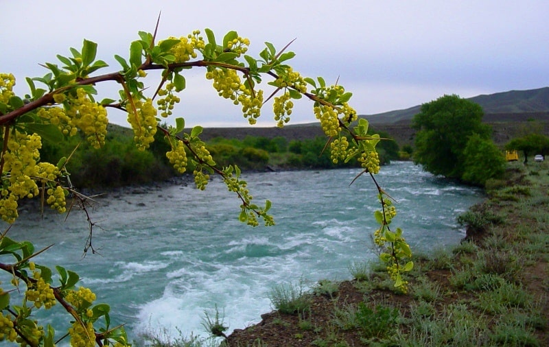
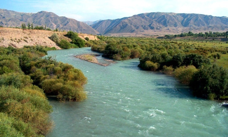
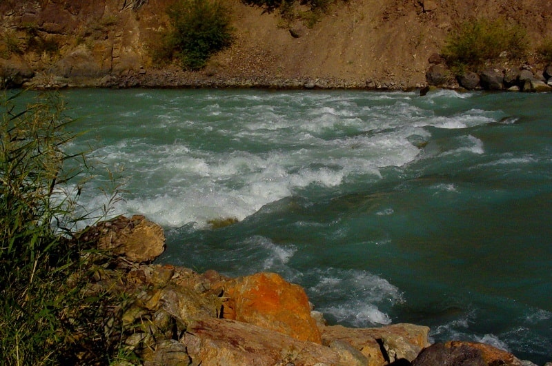
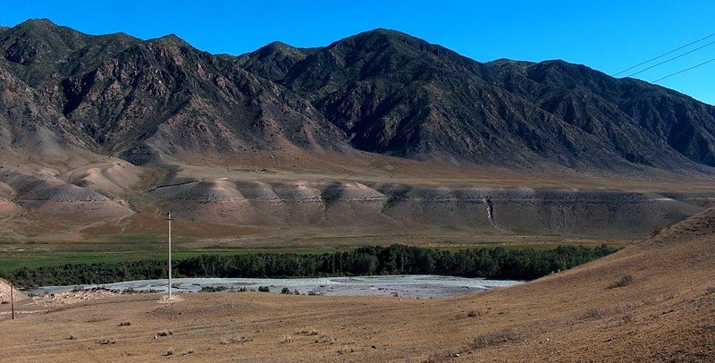
River Chilik.

Silk Road Destinations Almaty.
“The real voyage of discovery consists not in seeking new landscapes, but in having new eyes”
Marcel Proust.
Tours Kazakhstan Dzhungarskiy Ala-Tau.
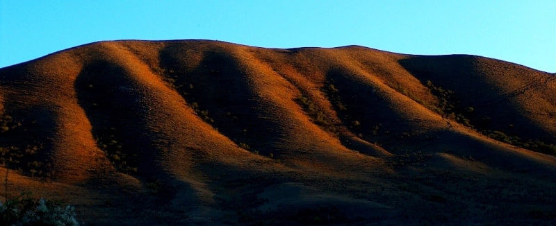
Chilik River (Shilik, Chelek) is a watershed between the Zailiyskiy Alatau mountain ranges in north and Kungey Alatau (Motley Mountains) in south, located in Enbekshikazakh and Kegen districts of Almaty region.
Chilik River, largest river in Zailiyskiy Alatau.
The sources of the river begin on the eastern slope of the mountain cofferdam connecting the Zailiyskiy Alatau with the Kungei Alatau ridge, at an altitude of 2907.1 m. a. s. l. The river is formed from the confluence of the South Issyk and South-East Talgar rivers.
The length of the South Issyk river is 5.5 kilometers and originates from an altitude of 3287.2 m. a. s. l. from the southeastern branch of the Korzhenevsky glacier. In turn, the South Issyk in the middle reaches the Kebin tributary with a length of 3 kilometers, which originates from the glacier located on the eastern slope of the Bely peak at an altitude of m. a. s. l.
From the south-west to the South Issyk river, the South-East Talgar river, 8 kilometers long, rises from the eastern branch of the Bogatyr glacier at an altitude of 3400 m. a. s. l.
Geographic coordinates of South Issyk River: N43°02'35 E77°24'03
Literally 1 kilometer after the source, the South-East Talgar river passes through the moraine lake Bogatyr located at an altitude of 3470 m. a. s. l. After the source, the river overflows and forms a wide floodplain up to 500 meters wide, then the channel narrows before entering a narrow gorge and in this place forms a lake.
Geographic coordinates of South-East Talgar river: N43°00'29 E77°22'44
It should be noted that some part of the Chilik River and its tributaries are located on the territory of the Almaty Nature Reserve and the Kolsai Kolderi Natural Park. The forest zone on the Chilik River is located at an altitude of 2755 m. a. s. l.
The catchment area of the river is 5309 cubic kilometers.
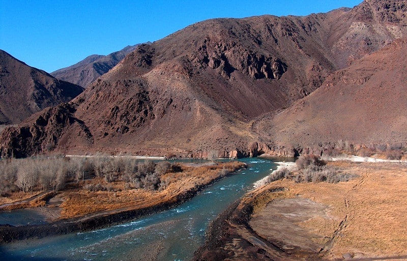
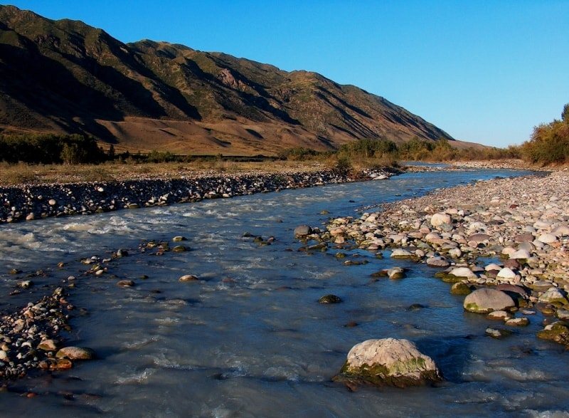
The river basin area is 4980 square kilometers. The length of the river is 175 kilometers from the confluence of the South Issyk and South-East Talgar rivers. In the vicinity of the village of Kaztai Ultarakov, the Taranchinsky canal departs from the river to the left and just below the village, the river is called Kurshilik.
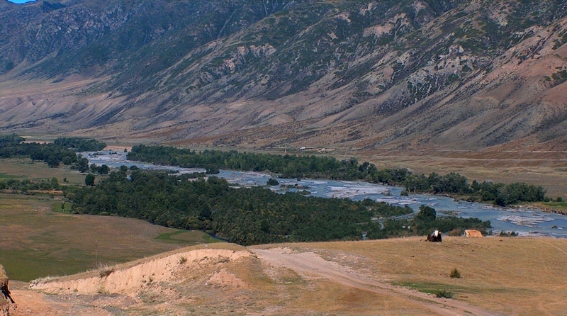
The river receives its food from glaciers, snow, springs and precipitation. Chilik is a typical mountain river with a turbulent current and a steep fall, the width of the channel in the upper reaches is 5 - 6 meters, in the middle reaches of 10 - 15 meters, in wider areas and in the lower reaches of 100 - 200 meters, the maximum depth is 1.5 - 2 meters.
Chilik has a well-pronounced glacial type of nutrition, its average annual flow is 32.7 cubic meters per second. High waters in Chilik are observed only with the onset of the hottest period of the year - from the second half of June to mid-September.
During this time, several flood waves pass along the river (up to 4 - 5 floods). The main flow occurs in the summer. Only for July - August, it is 40% of the annual expense. In September, the discharge of the river drops sharply, in March it reaches its lowest volume.
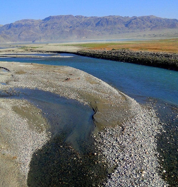
The maximum average monthly discharge of the river is 7-10 times higher than the lowest. Chilik, the most muddy river of the Zailiyskiy Alatau. Its average annual turbidity near the outlet from the mountains is 571 grams per cubic meter, which is approximately similar to the indicators of such rivers as the Terek and Nile.
The average annual amount of dissolved, suspended and bottom sediments of the river is 1702 thousands of tons. Chile has great hydropower potential and is one of the largest sources of artificial irrigation in the foothills of the Zailiyskiy Alatau.
The Big Almaty Canal was built on the basis of the waters of the Chilik River. In the hottest period, the flood waters in Chilik fall, as a rule, in April and May. Water flow in Chilik: April 13.7, May 29.6, June 42.3, July 75.6, August 77.0, September 42.1 meters per second.
At the exit of the river from the mountains, on the right and on the left side there are villages: Zhanasharua, Malybai, Kairat, Khusaina Bizhanova, Baiseit, Kaztai Ultarakov, 1.5 kilometers to the west, on the left bank is the village of the same name, the former regional center of the Chilik region of Almaty region (now merged with the Enbekshikazakh region).
Chilik flows 130 kilometers to the Bartogay reservoir. At 150 km, the river rushes out of the mountains just south of the village of Malybai, which is located on the right bank. Here, 150 kilometers after the source, on the left bank of the river, a water intake of the Big Almaty Canal was built, from here most of the water in the spring and summer months goes to irrigate agricultural land.
Chilik River has 52 tributaries.
Right tributaries of the Chilik River.
Zhangaryk river. After the formation of the channel of the Chilik River, two kilometers later, on the right, there is the mouth of a large tributary of the Zhangaryk with a length of 17 kilometers. The Zhangaryk River is formed from 7 small streams originating from the Zhangaryk glacier at an altitude of 3347.4 m. a. s. l. also from the glaciers located to the north and south of the main glacier.
Soon, Zhangaryk on the right receives a new tributary Novy with a length of 3 kilometers, which originates from the Novy glacier, at an altitude of 3294.5 m. a. s. l. After 5 kilometers, the river receives on the right an unnamed tributary 5.5 kilometers long, originating from the glaciers of the northern slope of the Kungey Alatau ridge.
After 1.5 kilometers on the right, Zhangaryk receives a tributary of Zharbulak, 5 kilometers long, which originates from the glaciers of the northern slope of the Kungey Alatau ridge.
Geographic coordinates of Zharbulak river: N42°57'22E77°23'37
fter 1 kilometer, an unnamed tributary with a length of 4 kilometers flows into Zhangaryk on the right.
Geographic coordinates of river of an unnamed tributary of Chilik River: N42°57'55 E77°24'24
Immediately behind it, the next right tributary of the Zhangaryk River - the Kugantir, 6 kilometers long, originating from the glaciers of the northern slope of the Kungey Alatau in the ridge, which is located the Kugantir pass with a height of 3908 m. a. s. l.
Geographic coordinates of Kuhantyr River: N42°57'47 E77°26'11
On the left, Zhangyryk receives 6 small unnamed tributaries, one of the tributaries 3 kilometers long, originating from an altitude of 3818 m. a. s. l.
Geographic coordinates of Zhangaryk River: N42°58'37 E77°21'30
An unnamed tributary of Chilik River eastern Zhangaryk river.
7 kilometers after the confluence of the Zhangyryk River, three nameless tributaries will flow into Chilik - two of them are not significant, the last tributary is 5 kilometers long, its sources are located at an altitude of 4091.1 m. a. s. l. and originates from a glacier located on the northern slope of the Kungei ridge Alatau.
Geographical coordinates an unnamed tributary of Chilik River eastern Zhangaryk river: N42°59'10 E77°27'16
River Kairakty.
After 6 kilometers downstream on the right, the Kairakty River, 9.5 kilometers long, flows into the river, which originates from a complex glacier located on the northern ridge of the Kungey Alatau ridge at an altitude of 3731.8 m. a. s. l.
The Kairakty tributary, in turn, consists of two left small tributaries and 4 right unnamed tributaries.
Geographic coordinates of Kairakty River: N42 59'45 E77°29'39
Zhamanbulak river.
Soon, after 4.2 kilometers, Chilik receives another tributary of the Zhamanbulak 6 kilometers long, the tributary flows out of a glacier located at an altitude of 4457.5m. a. s. l.
Geographic coordinates of Zhamanbulak river: N43°01'07 E77°32'36
Korumdyk river.
In the immediate vicinity, 900 meters below on the right, Chilik receives the 8 km long Korumdyk tributary flowing from the Korumdyk glacier at an altitude of 3648.8 m. a. s. l. In the main ridge of the Kungey Alatau ridge, above the headwaters of the Korumdyk River, there is the Dzhel-Karagai pass with a height of 4044.2 m. a. s. l.
The mouth of the Korumdyk River is located at an altitude of 2522 m. a. s. l.
Geographic coordinates of the Korumdyk River: N43°00'07 E77°33'40
Taldy river.
3.5 kilometers separate from the Korumdyk River a new, right, small tributary of the Taldy, 5 kilometers long, originating at an altitude of 4076.3 m. a. s. l.
Geographic coordinates of Taldy River: N43°01'28 E77°36'03
Sutbulak river.
The long tributary Sutbulak is located at a distance of 3.5 kilometers from the previous one, downstream, with a length of 14 kilometers. The bed of the Sutbulak river is formed at an altitude of 3307.5 m. a. s. l. Consists of 4 tributaries originating from the Sutbulak glacier located at a significant altitude for this region - 4758 m. a. s. l. and numerous moraine lakes.
In the central part of the Sutbulak glacier, in the main ridge of the Kungey Alatau ridge, there is the Sutbulak pass with a height of 3924 m. a. s. l., the path through which leads to the southern slope of the Kungei Alatau ridge in the Kichi-Ak-Suu gorge in the Republic of Kyrgyzstan.
After the formation of the main channel, the Sutbulak receives 5 small tributaries on the right.
Geographic coordinates of Sutbulak River: N43°00'11 E77°37'35
An unnamed tributary between the Sutbulak and Tulkisay rivers.
For 10.5 kilometers to the next right tributary, 4 small nameless rivers flow into the Chilik.
Geographic coordinates an unnamed tributary between Sutbulak and Tulkisay rivers: N43°02'04 E77°43'36
Tulkisay river.
The next long tributary Tulkisay is 16.5 kilometers long, its channel is formed at an altitude of 3298.7 m. a. s. l., consisting of two tributaries.
Geographic coordinates of Tulkisay River: N43°00'17 E77°41'33
Karasai River.
After 7 kilometers, in the vicinity of the Abyke forestry (the post of the rangers of the Kolsai Kolderi park on the left bank of the river), on the right side there is the mouth of the Karasai river, one of the longest tributaries of the Chilik, its length is 20.5 kilometers.
The sources of the Karasai River are located at an altitude of 3803.2, the mouth at an altitude of 2084 m. a. s. l. The river flows along the northern slope of the Kungey Alatau ridge, on the territory of the Kolsai Kolderi natural park in the Kegen district of the Almaty region.
The sources of Karasai are located on the northern slope of the Kungey Alatau ridge and begin from two lakes located in a cascade, 220 meters from one another - the Lower Karasai Lake and the Upper Karasai Lake. The lower moraine, flowing lake Karasai, is located at an altitude of 3376 m. a. s. l.
It stretches from south-east to north-west 546 meters and the greatest width in the southern part - 308 meters. The upper moraine, flowing, dammed lake Karasai is located 220 meters south of the Lower Lake at an altitude of 3414 m. a. s. l.
It is 487 meters long and 290 meters wide in the southern part.
These are the most beautiful lakes of the northern slope of the Kungey Alatau in the Kolsai Kolderi park. At 15 km from the source, Karasai receives a tributary from the right - Kaskasu with a length of 13 km. Kaskasu originates from a lake located at an altitude of 3710 m. a. s. l., the lake is located 2.7 kilometers northeast of the Burgu-Suu pass with a height of 3755.5 m. a. s. l..
In the upper reaches of the Kaskasu River there are 6 moraine dammed lakes. One of them - Blue Lake Kaskasu is located at an altitude of 3165.4 m. a. s. l. The lake has an elongated shape, pointed downward, 290 meters long and up to 105 meters wide in the southern part.
The unique blue color adds a truly magical color to natural creation.
Geographic coordinates of Karasai River: N43°00'33 E77°46'24
Karakiya river.
Already 5 kilometers after the Karasai River, on the right, the Karakiya tributary with a length of 21 kilometers, which originates from the Ashu-Ter glaciers, adjoins. In the western part of the main ridge of the Kungey Alatau ridge, there is the Ashu-Ter pass with a height of 3774.7 m. a. s. l.
At an altitude of 2991 m. a. s. l.l, the Karakiya River flows through a moraine lake 254 meters long and 110 meters wide in the central part. The lake is pear-shaped, the north side is like a bottleneck. 1.5 kilometers below, the river flows into another moraine dammed lake Karakiya 443 meters long and 144 meters wide in the central part.
The lake was formed due to a landslide that descended from the eastern slope of the gorge. Along its entire length, Karasai has 8 right tributaries, on the left it receives 8 small tributaries-streams.
Geographic coordinates of Karakiya River: N42°59'12 E77°52'16
Big Uryukty River.
Soon, after 8 kilometers of water, Chilika replenishes a 20-kilometer long tributary of the Bolshaya Uryukta. Bolshoi Uryukty starts from the northern slope of the Kungey Alatau from a small glacier under the Chong-Uryukty pass, 3961.4 m. a. s. l.
At an altitude of 3047.3 m. a. s. l., the river flows into a large, blue lake - Bolshoy Uryukty. The length of the lake is 397 meters, the width of the lake in the central part reaches 176 meters, the lake is stretched from the southwest to the northeast.
The lake is very picturesque in the summer months, surrounded by abundant alpine vegetation, among which flowers - primrose and edelweiss - occupy a significant place. For 5, 5 kilometers before the mouth, the river flows into one of the most beautiful lakes Kungey Alatau Chon- Dam-type uryukts located at an altitude of 2163 m. a. s. l.
The lake was formed due to the left-bank slope collapse, which has a length of 1.5 kilometers from the western slope of the upper part of the gorge. The length of the lake is 494 meters, the lake is stretched along the gorge from southwest to northeast and has a width of 71 meters in the central part.
The lake reflects the spruce forest in the southeastern part of the lake, which covers the shores of the lake. On the left side, the Bolshoi Uryukty river has 8 small tributaries, on the left side there are 4 tributaries, one of them is of spring origin.
Geographic coordinates of Bolshoi Uryukta River: N42°57'02 E77°54'33
Malye Uryukty River.
After 3 kilometers on the right, Chilik receives a 19-kilometer long tributary Malye Uryukty, which originates from small glaciers located on the northern slope of the Kungey Alatau ridge and located at an altitude of 3510.7 m. a. s. l. On the right, the river has 3 unnamed tributaries, on the left, 6 unnamed tributaries. In the southwestern part of the sources of Malye Uryukty there is a pass located in the main ridge of the Kungey Alatau - Orto-Uryukty, 3618 m. a. s. l.
Geographic coordinates of Malye Uryukty River: N42°57'24 E77°59'00
Kutyrgan river.
Chilik does not accept tributaries on the right for 11.5 kilometers. Near the Kutyrgan forestry, at an altitude of 1758 m. a. s. l., the Kutyrgan River, 20 kilometers long, flows into Chilik. The main channel of the river is formed at an altitude of 2682 m. a. s. l.
The left (western) source of the river is located on the northern slope of the ridge and starts from the Kuturga pass, 3403 m. a. s. l., located in the main ridge of the Kungey Alatau. The moraine flowing lake Kuturga lies 1.3 kilometers to the north-east of the pass.
The lake is located at an altitude of 3263 m. a. s. l.. The length of the lake from the south-east to the north-west is 498 meters, the greatest width in the northern part of the lake is 186 meters. A small stream flows into the lake from the south, flowing from the foot of the Kuturga pass.
A significant tributary flows into the southwestern part of the lake, flowing alternately from four lakes that are located in the west and southwest of the lake. The group of four lakes is dominated by the large lake Kuturga Zapadnoye located at an altitude of 3396 m. a. s. l., lying 415 meters northwest of the Kuturga pass.
The lake is moraine, flowing has a length from west to east 390 meters, width from south to north 279 meters. The right tributary with a length of 7 kilometers originates from three moraine, nameless, flowing lakes located on the northern slope of the Kungei Alatau ridge.
Geographic coordinates of Kutyrgan River: N42°56'34 E78°05'12
An unnamed tributary between Kutyrgan and Taldy rivers.
Through 7 kilometers on the river on the right there is a spring, unnamed tributary with a length of 2 kilometers, its beginning in the western part of Mount Aktobe with a height of 2435 m. a. s. l.
Geographic coordinates of unnamed tributary between rivers Kuturgan and Taldy: N43°01'22 E78°13'02
Taldy river.
Passing an unnamed stream, the river, through 3.4 kilometers at an altitude of 1600 m. a. s. l., receives a tributary of the Talda with a length of 24.5 kilometers on the right. The Taldy River originates from three lakes located on the northern slope of the Kungey Alatau ridge.
The lakes are located in a hollow that closes the upper part of the glacier valley. The lakes lie at an altitude of 3299 to 3444 m. a. s. l.
Geographic coordinates of Talid River: N42°59'05 E78°13'03
River Kurmenty.
6.5 kilometers after the Taldy River, the Kurmenty tributary flows into Chilik. The mouth of the river is located at an altitude of 1527.8 m. a. s. l. The length of the inflow is 22.5 kilometers. From the source to the village of Kurmeti (kaz. Urmeti), the river is called Kurmenty, after the village the river changes its name to Kurmekty.
After the Kurmeti settlement, the river is divided into several branches. Throughout its entire length, the river has only three small nameless tributaries on the right, two tributaries on the left. The river originates from Lake Kurmenty located at an altitude of 3319 m. a. s. l. on the northern slope of the Kungey Alatau ridge.
The length of the stained, flowing lake from south to north is 573 meters, width is 247 meters. The perimeter of the lake is 1452 meters, the area is 103,226 square meters. The lake lies 750 meters northeast of the Kurmenty Pass, located in the main ridge of the ridge at an altitude of 3445 m. a. s. l.
Geographic coordinates of Kurmenty River: N42°59'10 E78°16'49
Kolsai River.
Chilik, for 3 kilometers after the Kurmenty River, does not receive tributaries, but soon the Kolsai tributary, 25 kilometers long, flows on the right. The Kolsay River is one of the longest rivers of the right tributaries of the Chilik. There are three lakes on the Kolsai River: Lower, Middle and Upper.
The middle lake Kolsay unites 5 tributaries, which originate from the northern slopes of the Kungey Alatau ridge. After the Middle Lake, the river flows in one channel and bears the name - Kolsai. One from the eastern tributaries their moraine lake Sarybulak originates and after 6 kilometers flows into the Upper Lake Kolsai.
In the gorge of the Kolsai River, starting from the Lower Lake, many tourist sites have been built, such as hotels, guest houses, yurt camps, cafes. An asphalt road has been laid to Lake Nizhniy Kolsai; a large parking lot has been built on the northwestern upper terrace of the lake.
Geographic coordinates of Kolsai River: N42°59'45 E78°19'54
Saty river.
6.7 kilometers after the confluence of the Kolsai, the Chilik River receives the Saty tributary, 25 kilometers long, flowing down from the northern slope of the Kungei Alatau ridge. The sources of the river begin from the northern side of the Saty Pass, 3295 m. a. s. l.
The mouth of the Saty River is located at an altitude of 1429.1 meters above sea level. At an altitude of 2699 m. a. s. l., the Saty River, after its source, receives the first, right unnamed tributary. After 2.3 kilometers below, the second minor stream.
There are only two left tributaries on the river. At an altitude of 1590 m. a. s. l., 2 kilometers in front of the village of Saty on the river, there is a dam caused by a landslide from the left bank of the gorge. In this place, there is a slight backwater, and the flood of the river with the formation of several channels.
There are no glaciers or moraine lakes in the upper reaches of the Saty gorge. In the middle part, the slopes of the gorge are covered with spruce forest, the high-altitude zone is covered with alpine meadows.
Geographic coordinates of Saty River: N43°00'12 E78°23'14
Kayindy river.
Just 1.6 kilometers after the confluence of the Saty river into Chilik, the Kayindy river with a length of 21 kilometers flows into the right. The sources of the Kayinda River are located at an altitude of 3138 m. a. s. l. The mouth of the river is located at an altitude of 1402 m. a. s. l.
There are no glaciers in the Kayindy river gorge. After 9 kilometers after the source, the river flows into Lake Kayindy, which was formed as a result of a landslide that descended from the western slope of the gorge in 1973 of the last century.
On the right, after 17 kilometers from the sources, the tributary Zhamanbulak flows into the Kayindy.
The length of the small river Zhamanbulak is 4.4 kilometers, a river of spring origin. In total, on the right side of the Kayinda it receives 4 tributaries, on the left side there are two tributaries, one of them is a small stream and a tributary with a length of 1.5 kilometers.
Geographic coordinates of Kayindy River: N43°00'43 E78°26'30
Karabulak river.
After 8 kilometers below, the Karabulak tributary with a length of 5.5 kilometers flows into the right. In the village of Karabulak, two rivers merge: Eastern Karabulak and Western Karabulak, as a result, the Karabulak river is formed. The length of the Vostochny Karabulak river is 12.5 kilometers.
The sources of the river begin from two tributaries on the northern side of an unnamed mountain 3787.9 m. a. s. l. From here, the source of the Western Karabulak River, 16.5 kilometers long, begins with two small streams. 3 kilometers before the confluence with the Eastern Karabulak, the left tributary Taldybulak, 7 kilometers long, flows into the Western Karabulak.
Below, 2.2 kilometers from Taldybulak, Western Karabulak receives an unnamed tributary with a length of 5.5 kilometers.
Geographic coordinates of Karabulak River: N43°04'34 E78°32'04
An unnamed tributary below Karabulak River.
After the confluence of the Karabulak, for 5.3 kilometers, Chilik receives three minor tributaries of spring origin on the right. The first tributary, 8 kilometers long, originates from the southeastern side of Mount Degeres, 1839.4 m. a. s. l. The mouth of the tributary is located at an altitude of 1311.7 m. a. s. l.
The third tributary, 15.5 kilometers long, branches off from the Vostochny Karabulak River.
Geographic coordinates an unnamed tributary below Karabulak River: N43°07'30 E78°33'47
There are 29 right tributaries on Chilik River.
Left tributaries of Chilik River
Zhanaaryk river.
Immediately after the formation of the channel of the Chilik River, on the left of the upper reaches of the Shubararsha tract, the river receives a small tributary of Zhanaaryk with a length of 4.2 kilometers. The beginning of the Shubararsha River begins at an altitude of 3979 m. a. s. l. from the southern slope of the Zailiyskiy Alatau ridge.
The mouth of the river is located at an altitude of 2797 m. a. s. l.. There are no glaciers or moraine lakes in the upper reaches of the gorge.
Geographic coordinates of Zhanaaryk River: N43°00'43 E77°25'53
Zhangyzkarasai river.
4.5 kilometers after the confluence of the Zhanaaryk, the Zhangyzkarasai River, 4.5 kilometers long, flows into the Chilik on the left. The river begins from the southern branches of the Grigoriev Glacier at an altitude of 3831 m. a. s. l. The mouth of the river is located below the exit from the gorge at an altitude of 2798 m. a. s. l.
Geographic coordinates of Zhangyzkarasai River: N43°01'30 E77°27'07
Shubar river.
The Shubar River flows into Chilik on the left 3.2 kilometers after the Zhanaaryk River. The sources of the river begin at an altitude of 3353 m. a. s. l. from the southern tongues of the Grigoriev glacier, the mouth of the river is at an altitude of 2757 m. a. s. l., the length of the river is 4 kilometers.
Geographic coordinates of Shubar River: N43°01'49 E77°28'18
Koshbulak river.
2 kilometers after the Shubar tributary, the Koshbulak river, 2 kilometers long, flows into the Chilik on the left. The source of the river is located at an altitude of 3370 m. a. s. l. on a moraine fan, the mouth of the river is at an altitude of 2751 m. a. s. l.
The river originates from the southern branch of the Grigoriev glacier, 2.4 kilometers long. The glacier lies partly in the watershed ridge on the southern slope along and partly along the main ridge of the Zailiyskiy Alatau ridge. Having reached the Koshbulak gorge, the glacier goes down.
The glacier area is 1.05 square kilometers. There are three moraine lakes in the immediate vicinity to the southeast of the glacier.
Geographic coordinates of Koshbulak River: N43°02'21 E77°29'16
Tazshyi river.
A small left tributary of the Tazshy, 2.5 kilometers long, is located 50 meters to the east, just behind the mouth of the Koshbulak. The sources of the river are located at an altitude of 3400 m. a. s. l. and begin from the upper gorge, where there is a valley glacier with an area of 3.9 square kilometers, located on the southern slope of the Zailiyskiy Alatau ridge.
The glacier is 1.2 kilometers long. The mouth of the river is located at an altitude of 2747 m. a. s. l. In the main ridge of the Zailiyskiy ridge, just to the west of the glacier, there is the peak of the 25th anniversary of Kazakhstan with a height of 4494.9 m. a. s. l.
Geographic coordinates of Tazshi River: N43°02'21 E77°29'48
An unnamed tributary between Koshbulak and Tashy rivers.
The sources of the river are located at an altitude of 3631 m. a. s. l., the river is born in a stormy stream, bursting out from the bottom of the moraine. In the upper reaches of the river there are two glaciers, these are the southern branches of the Palgov glacier. It should be noted that the glacier occupies a significant place on the northern side of the Zailiyskiy Alatau ridge.
The western glacier is 1.05 square kilometers, the eastern one is 395498 square meters. The mouth of the river is located at an altitude of 2600 m. a. s. l.
Geographic coordinates an unnamed tributary between Koshbulak and Tashy rivers: N43°02'15 E77°31'01
Zhelkaragai river.
3.3 kilometers downstream, on the left, after an unnamed tributary, the river Zhelkaraga flows into the river with a length of 5.8 kilometers. The source of the river is at an altitude of 3345 meters above sea level, the mouth is at an altitude of 2540 m. a. s. l.
In the northeastern part of the river mouth, on the terrace of the left side of the Chilik river valley, there is the ancient necropolis of Shegatai.
Geographic coordinates of Zhelkaragai River: N43°02'53 E77°33'10
Karkymbay river.
4.8 kilometers after the Zhelkaragay River on the left is the Karkymbay tributary with a length of 5.4 kilometers. The source of the river is at an altitude of 3567 m. a. s. l., the mouth is at an altitude of 2485 m. a. s. l. In the upper reaches of the river in the western part of the gorge there are two small moraine lakes, one at an altitude of 3622 m. a. s. l., the second at an altitude of 3737 m. a. s. l.
At an altitude of 2797 m. a. s. l., the Karkymbay on the right receives an unnamed tributary with a length of 3 kilometers, its sources are at an altitude of 3554 m. a. s. l.
Geographic coordinates of the Karkymbay River: N43°04'13 E77°36'15
An unnamed tributary between Yarkymbay and Odensay rivers.
Literally 300 meters after Karkymbay, Chilik receives an unnamed tributary originating from the southern slope of the Zailiyskiy Alatau ridge. At an altitude of 3077 m. a. s. l., two tributaries merge to form the main channel of an unnamed tributary 4.5 kilometers long.
The sources of the river are located at an altitude of 3705 m. a. s. l., the mouth is at an altitude of 2476 m. a. s. l. There are no glaciers at the headwaters of the river.
Geographic coordinates an unnamed tributary between the Yarkymbay and Odensay rivers: N43°03'56 E77°36'50
Odensay River.
After 7.2 kilometers on the left, after an unnamed tributary, on the left, the Odensay River flows into Chilik. The river has two sources - east and south, at an altitude of 2458 meters above sea level, the sources merge into one channel.
The length of the southern tributary is 5 kilometers.
The sources of the Odensay River begin from a moraine lake located at an altitude of 3643 m. a. s. l. on the southern slope of the Zailiyskiy Alatau ridge. The length of the flowing, moraine lake from the south-east to the north-west is 98 meters, the width from the south-west to the north-east is 106 meters.
A small glacier descends into the northeastern part of the lake. The lake has a perimeter of 316 meters and an area of 7352 square meters. The mouth of the Odensay River is located at an altitude of 2310.8 m. a. s. l.
Geographic coordinates of Odensai River: N43°04'21E77°40'49
Shaymoinak river.
Through 3.7 kilometers after the confluence of the Odensay River, Chilik takes on the left a tributary of the Shaymoinak, 7 kilometers long, which originates on the southern slope of the Zailiyskiy Alatau ridge. Between the Odensay and Shaymoinak gorges, on the left bank of the Chilik, Mount Shaymoinak rises with a height of 3247.2 m. a. s. l.
The headwaters of the Shaymoinak River are located at an altitude of 3515 m. a. s. l., the mouth of the river is at an altitude of 2242 m. a. s. l. Opposite the mouth of the Shaimynak, on the opposite (right) bank of the Chilik River, there is the mouth of the Tulkisay River.
After the confluence of the two tributaries at an altitude of 2824 m. a. s. l., the main channel of the river is formed.
Geographic coordinates of the Shaymoinak River: N43°04'26 E77°43'34
Sharu river.
Through 1.7 kilometers from the mouth of the Shaymoinak, Chilik receives the waters of the Sharu rivers, 8 kilometers long, originating from the southern slope of the Zailiyskiy Alatau ridge. The sources of the river are at an altitude of 3505 m. a. s. l., and the mouths are at an altitude of 2213 m. a. s. l.
There are no glaciers and moraine lakes in the upper reaches of the gorge.
Geographic coordinates of Sharu River: N43°04'14 E77°44'53
Shukyrshak river.
5 kilometers after the Sharu River, a 10.5-kilometer tributary of the Shakurshak flows into the Chilik. The river forms the main channel at an altitude of 2652.3 m. a. s. l., the main source of the river begins from the Shakurshak tract located on the southern slope of the Zailiyskiy Alatau ridge.
The river has two main sources, south and west. The sources of the river are located at an altitude of 3545 m. a. s. l.l, the mouth of the river is at an altitude of 2212 m. a. s. l. The Susurzhan necropolis is located 600 meters above the mouth on the right bank of the Shakurshak River.
330 meters below the mouth of the Chilik River, there is a bridge from which the road leading to the Karasai gorge begins.
Geographic coordinates of Sharu River: N43°05'01 E77°48'13
Amanzhol river.
2 kilometers after the mouth of the Shakurshak, on the left, a 10-kilometer-long Amanzhol tributary flows into the Chilik, originating from the southern side of the Amanzhol pass, 3519 m. a. s. l. at an altitude of 3472 m. a. s. l. East of the source of the river at an altitude of 3452 m. a. s. l., there is a moraine lake 139 meters long from south-east to north-west and 67 meters wide.
The perimeter of the lake is 418 meters, the area is 6881 square meters. 760 meters from the mouth of the river on the right bank there is a forestry cordon from the natural park "Kolsai Kolderi" located at an altitude of 2129.7 meters above sea level.
At an altitude of 2828 m. a. s. l., a road descends to the river, laid along the Amanzhol gorge for 6 kilometers. The Abyke necropolis is located 250 meters northwest of the river mouth.
Geographic coordinates of Amanzhol River: N43°05'02 E77°50'13
Sarylyksay river.
2 kilometers below the mouth of the Amanzhol River on the left bank, there is the mouth of the Sarlyksay River with a length of 7.5 kilometers. The source of the river begins at an altitude of 3070 m. a. s. l., the mouth at an altitude of 2077 m. a. s. l.
There are no glaciers and moraine lakes in the gorge. The river is filled with spring, snow and rain. To the north of the headwaters of the Sarylyksai are the headwaters of the Zhinishke River. At an altitude of 2926 m. a. s. l., the gorge is crossed by a road leading from the watershed plateau between the Zhinishke and Chilik rivers to the Amanzhol gorge and further to the Karasai gorge.
Geographic coordinates of Sarylyksai River: N43°05'04 E77°51'54
An unnamed tributary between Sarylyksa and Bolduruksay rivers.
10.7 kilometers separate the mouth of the Sarlyksai from the mouth of an unnamed tributary with a length of 4.7 kilometers. At this distance, the watershed ridge with the valley of the Zhinishke River approaches quite close to the left bank of the Chilik, therefore, the river network is poorly developed in this area.
The sources of the river are located in the southern part of the Atzharganzhot tract at an altitude of 3209 m. a. s. l.. The main channel of the river is formed from three tributaries originating on the southern watershed slope between the rivers Zhinishke and Chilik.
At an altitude of 2348 m. a. s. l., the unnamed river receives a 2 km long tributary from the right. The mouth of the river is located at an altitude of 1948 m. a. s. l.
Geographic coordinates of unnamed tributary between rivers Sarilyksa and Bolduruksay: N43°02'13 E77°58'34
Bolduruksay river.
1.3 kilometers separate the unnamed tributary from the mouth of the Bolduruksai River, which is 4.8 kilometers long. The sources of the river are located at an altitude of 3214.5 m. a. s. l., just below the road leading from the valley of the Zhinishke river to the Amanzhol gorge.
The mouth of the river is located at an altitude of 1923 m. a. s. l., 200 meters downstream on the right bank is the mouth of the Bolshiye Uryukty River. At an altitude of 2870 m. a. s. l., the forest zone ends in the Bolduruksay gorge.
Geographic coordinates of Bolduruksay River: N43°02'00 E78°00'06
Shybyndysay river.
The sources of the river begin at an altitude of 3179 m. a. s. l., literally just below the road leading from the Zhinishke valley to the Amanzhol gorge. The length of the river is 7 kilometers, the mouth is at an altitude of 1861 m. a. s. l. There are no glaciers or moraine lakes in the gorge.
Geographic coordinates of Shybyndysay River: N43°01'15 E78°02'15
Orly River.
The mouth of the Orly River is 4 kilometers from the mouth of the Shybyndysai. The length of the river is 2 kilometers, the mouth of the Orlt river is located in the Sarykerege tract at an altitude of 1807 m. a. s. l. The source of the river begins on a steep southern slope from springs at an altitude of 2509 m. a. s. l.
Geographical coordinates of Orly River: N43°01'11 E78°04'31
Maybulak river.
6.2 kilometers after the Orla, the Maibulak tributary tends to the Chilik waters length of 10.4 kilometers. The sources of the river begin in the Shybyn tract from springs, at an altitude of 3078.6 m. a. s. l., the mouth of the river at 1710 meters above sea level.
At an altitude of 2380.5 m. a. s. l., three tributaries form the main channel of the Maybulak. All three sources originate on the southern watershed slope with the Zhinishke River.
Geographic coordinates of Maybulak River: N43°03'48 E78°07'47
Akambay river.
In only 5.5 kilometers, Chilik tends to the next small, drying up Akambay tributary with a length of 6.3 kilometers. The river begins from springs in the eastern part of the Ashykdala and Shetendy tracts at an altitude of 2416 m. a. s. l., the mouth of the river is at an altitude of 1657 m. a. s. l.
The main channel is formed from two tributaries.
Geographic coordinates of Akambai River: N43°02'53 E78°11'33
Okyrkara river. The distance along the Chilik River from the Akambay tributary to the Okyrkara River is 2.5 kilometers. The sources of the spring river are located at an altitude of 2563.3 m. a. s. l., the mouth of the river is at an altitude of 1615 m. a. s. l.
The river is 3.4 kilometers long.
Geographic coordinates of Okyrkara River: N43°03'12 E78°14'23
Zhinishke river.
For 40 kilometers on Chilik there are no tributaries to the left after the Okyrkara river. The Zhinishke River belongs to the basin of the Kapshagai reservoir, located in the eastern part of the Kungey Alatau ridge between its northern slope and the southern slope of the Sarytau ridge in the Kegen district of the Almaty region.
The Zhenishke River originates in the western part of the Sarytau ridge at the junction with the eastern end of the Zailiyskiy Alatau ridge. The main channel of the river is formed of three tributaries, the northernmost one originates from the eastern slope of an unnamed peak 3550.9 m. a. s. l., the southern tributary from the eastern slopes of an unnamed peak 3292.5 m. a. s. l.
Directly at the source of the river in the western direction is the Amanzhol pass with a height of 3649.1 m. a. s. l.
Geographic coordinates of Zhinishke River: N43°09'00 E78°12'49
There are 23 left tributaries on Chilik River.
Geographic coordinates of Shilik River: N43°05'48 E78°28'58
Authority:
Alexander Petrov.
"Zhetysu is the Land of tourism”. A Tourist Guide-book. Almaty. 2003. 68 p.
Photos by:
Alexander Petrov.