







Вы здесь
Gorge of Barskoon.
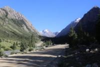
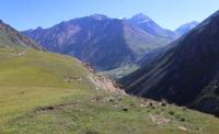
Travel tour to Kyrgyzstan.
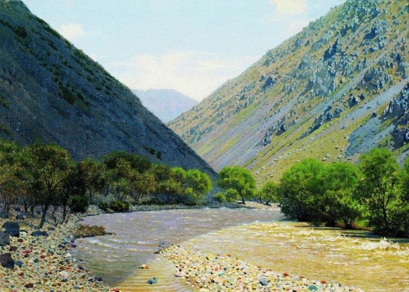
“The entrance to the gorge is convenient on both banks, so that there is nothing to cross through the deep ravine of the lower Barskaun; in the gorge itself, the crossings are also convenient. In the lower part of the gorge, and moreover in places where its edges consist of clay, and further of limestone, there are also old glacial moraines with huge blocks of granite, more than three fathoms in diameter; I have never seen such huge ones. In the valley there is only bush; firs higher up, and the first spruce forest below is also on the moraine; above it, under the granite cliffs that form the edges of the valley here, the glacial traces are less clear; avalanches are mixed with the moraines, recognizable, however, by the greater freshness of their stones, but the degrees of this freshness are countless, and the moraines themselves were formed from avalanches on the surface of the glacier, carried by the movement of the ice. From a height of about 6,500 feet. the valley widens, now covered with magnificent meadows; these are the successive Firnmeere of the ancient glacier, as it melted and retreated upwards from the snow line at the end of the Ice Age; the most extensive is at the mouth of the Döngerem. For this river I heard two names from my companions - Döngerem and Karakol.0 and Keregetas in Barskaun."
"Travel through Turkestan region and exploration of mountainous country of Tien-Shan." N. A. Severtsov. 1873.
Hiking tour in Barskoon gorge.
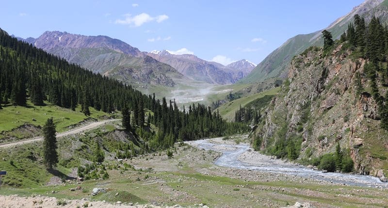
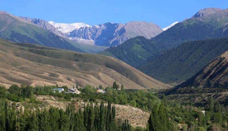
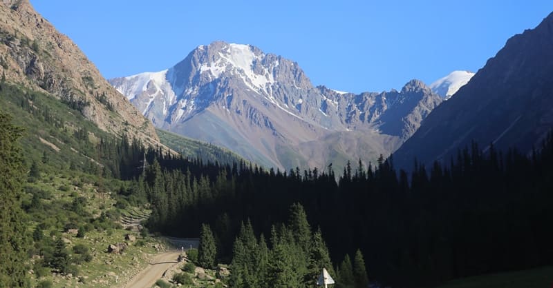
High-mountain gorge Barskoon ("Barskoon" is same as "barskan". "Barskan" is a blacksmith's hammer or mace, it is possible that name is associated with settlement of same name in gorge where fortress was located), located at an altitude of 1810 to 3754 m. a. s. l., is located on northern slopes of Terskey Ala-Too ridge, between gorges of Chon-Dzhargylchak in east and Tamgy in west in Jety-Oguz district of Issyk-Kul region.
The gorge cuts across the northern slope of the ridge, running primarily north-to-south (meridionally), though it turns westward at its headwaters, where the basin of the Kerege-Tash River is located. It extends from the axial line of the Terskey Alatau Range to the narrow lakeside plain on the southern shore of Lake Issyk-Kul; spanning approximately 57 kilometers, it assumes an east-west orientation only in its upper reaches.
It stretches from the axial line of the Terskey Alatau Range to the narrow lakeside plain on the southern shore of Issyk-Kul. The elevation of the gorge floor ranges from 1,800 to 3,500 m. a. s. l. Its length - from the headwaters of the river of the same name to the lakeside plain - is 57 km.
The height of the canyon walls above the floor ranges from 300-500 meters to 1,000-1,200 meters; the slopes are steep and often sheer. The headwaters of the gorge are characterized by active glaciation, featuring glacial valleys, cirques, and diverse moraine landforms.
The height of the slopes above the gorge floor varies from 300-500 m in the foothills to 1,000-1,200 m. The slopes are steep (with an incline exceeding 45 degrees) and often sheer. Active glaciation dominates the upper reaches, featuring glacial valleys and cirque formations.
The floor of the Barskoon Gorge is narrow (no more than 100-150 m), though it widens in places (up to 300-400 m); it has been carved and deepened by the Barskoon River and its tributaries. The lower section of the gorge, characterized by hanging glaciers and snowfields, lies within the foothills and is composed of Tertiary (primarily Neogene) conglomerates and Anthropogene loess-like loams.
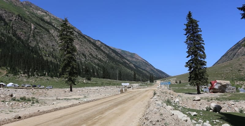
The area is used for pasture. A highway runs through the Barskoon Gorge, leading to the Upper Naryn and Akshyirak “syrts” (high-altitude plateaus). Forest conservation and reforestation efforts are underway. The lower part of the gorge - featuring hanging glaciers and ice accumulations - is formed within the foothills from Tertiary (predominantly Neogene) conglomerates and loams of Anthropogene origin.
The river of the same name flows through the gorge; it is 62 kilometers long and has a drainage basin of 352 sq. km. The Barskoon River has over 40 tributaries, the largest of which include the Dungyuryomo, Sharkyrak, At-Jailoo, Jany-Korgon, and Kerege-Tash rivers.
Its primary water sources are snowmelt and glacial meltwater. The Barskoon Gorge serves as pastureland and a vital transportation corridor, with a road leading to the Upper Naryn Valley, the Kumtor mine, the Karasai outpost, and the settlement of Uch-Koshkon.
Forest conservation and restoration work is also carried out in the gorge. One of its natural attractions is the Barskoon Waterfall. The gorge begins immediately beyond the southernmost houses of the Barskoon settlement. The settlement of Barskoon is located 75 kilometers southeast of the city of Karakol and 260 kilometers southeast of the city of Bishkek.
From the A-363 Karakol-Balykchy highway to the secondary At the 21-kilometer mark of the gorge, a parking area and seasonal cafes serving shashlik (skewered meat) operate during the summer tourist season; from here, visitors can take walking tours to a series of waterfalls situated along the course of an unnamed river.
Waterfalls in the Barskoon Gorge.
The first waterfall is "Tears of the Snow Leopard" (*Slezy Barsa*); the walk to reach it takes about 30-35 minutes at a leisurely pace. It is located at an altitude of 2,470 meters above sea level. The waterfall is approximately two meters wide and up to 20 meters high, with its lower section consisting of several cascades.
From "Tears of the Snow Leopard," one can walk along the slope to the northeast to reach the "Champagne Spray" (*Bryzgi Shampanskogo*) waterfall. Situated at an altitude of 2,500 meters above sea level, this is the middle waterfall in the series found on the unnamed stream on the left side of the Barskoon Gorge.
It is about two meters wide, with the water plunging up to 15 meters from a sheer ledge. The highest and most distant waterfall, "Manas's Bowl" (*Chasha Manasa*), is located at an altitude of 2,700 meters above sea level. The left side of the gorge at this location is sheer, while the right side is more gradual.
The waterfall consists of two cascades: the upper one reaches a height of up to 20 meters, while the lower one crashes against the rocks in the riverbed as it drops over two ledges, each 1 to 1.5 meters high. The "Wide" (“Shirokiy”) waterfall is located to the west of the three previously mentioned waterfalls.
The hike to the waterfalls takes between 4 and 5 hours. The "Skalisty" (Rocky) Waterfall is situated in a narrow, sheer gorge on the right side of the Barskoon Valley. The waterfall is clearly visible from the road leading to the first pass, Sary-Moynok, which sits at an altitude of 3,442 m. a. s. l.
Monument to cosmonaut Yuri Gagarin in Barskoon Gorge.
The complex of historical, archaeological, and natural landmarks in Barskoon Gorge includes a large stone boulder located in a forest clearing near the waterfalls; a bas-relief of the first cosmonaut, Yuri Gagarin, is carved onto it. Near the boulder, a bust of the first cosmonaut stands on a stele, bearing the inscription "Yu.A. Gagarin, first cosmonaut in the world"
The initiative and execution for creating the bas-relief of Yuri Gagarin on the western side of the boulder came from Valentin Dmitrievich Barskov, a former military man who worked as a decorator at the "Tamga" sanatorium.
"Tagai Biy" stone in Barskoon Gorge.
Two hundred meters above the Yuri Gagarin monument lies a massive boulder enclosed by a small metal fence known as "Tagai Biy." According to historical sources, the headquarters of Tagai-Biy (Mukhammed Kyrgyz) - one of the founders of the Kyrgyz state-was located in the vicinity of the gorge during the XVIth century.
In 2011, through the efforts of the local community, a metal fence and a plaque reading "Tagai Biy Babazdyn. Yiyk Tashi. 1469-1533" were installed around the stone.
Petroglyphs in Barskoon Gorge.
The Barskoon rock art sites are located in the lower part of the gorge, within the Barskoon River floodplain - primarily along its left bank - spanning the area from the lakeshore to the gorge entrance. Images of wild animals - such as mountain goats, deer, horses, and camels - as well as hunting scenes and other motifs, are carved into the stones and rock faces.
Figures of mountain goats predominate. Many of the images are executed in the finest traditions of the Scytho-Siberian animal style. These drawings were created by Saka tribes who inhabited the Barskoon Valley between the VIIth and IIIrd centuries BCE. The petroglyphs were discovered by D. F. Vinnik in 1959.
The Barskoon Gorge Settlement.
An the Barskoon settlement consists bearing the same name is located in the gorge at an elevation of 1,961 m. a. s. l.; it lies 158 meters from the right bank of the Barskoon River and 5.3 kilometers south of the village of Barskoon. The site consists of a central ruin complex (comprising a citadel and a "shahristan", or inner city) and an area enclosed by a long wall.
The total area of the settlement is 3,970.86 sq. m., with a perimeter of 252.3 meters. The settlement is square in plan; the northern and southern walls measure 61 meters in length, while the western and eastern walls measure 63 meters. It is identified as the city of Barskan, which is mentioned in written sources dating from the IXth to the XIIIth centuries.
The site was discovered by D. F. Vinnik in 1959.
The medieval city of Barskan (also known as Barsgan or Barskhan) - which gave its name to a principality on the southeastern shore of Issyk-Kul Lake (VIIIth-XIIIth centuries) - was located in the vicinity of the gorge. By the XIth century, the semi-nomadic population of Barskan was distinguished by a unique dialect among the Karakhanid Turks.
The city was renowned for its strategic location on the northern branch of the Silk Road and is recorded in Muslim sources from the 9th to the 13th centuries under names such as "Barskhan," "Upper Barskhan" (read as "Nushjan" in some Arabic sources), and "Upper Nushjan."
The Barskoon Hoard in Barskoon Gorge.
In 1968, local schoolchildren discovered the Barskoon Hoard in a burial mound southeast of the village of Barskoon (on the southern shore of Lake Issyk-Kul). The hoard contained approximately 120 stamped copper plaques of 12 different types, as well as scraps of sheet metal, fragments of bowls, and other items.
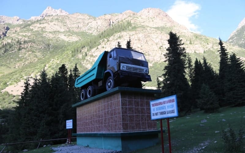
The plaques feature zoomorphic images and various forms of geometric and floral ornamentation (including the "Tree of Life" motif). In 1998, an accident occurred in Barskoon Gorge when a Kumtor Operating Company truck overturned, resulting in 1,740 kilograms of cyanide spilling into the Barskoon River.
Local residents suffered the consequences, and there were fatalities. A monument to the KamAZ-55111 truck stands on a substantial pedestal 1.3 kilometers to the north - located on the right side of the road and 244 meters from the right bank of the Barskoon River.
These vehicles were used in the construction of the road through the Barskoon Gorge. A roadway runs through the gorge, connecting the southern shore of Lake Issyk-Kul with the Kumtor mine (located in the western part of the Ak-Shiyrak Range), the Karasay border outpost, the headwaters of the Naryn River, the remote high-altitude settlement of Uch-Koshon (situated at 3,134 m. a. s. l.), and the Ashu-Suu Pass (3,840 m. a. s. l.); from there, the road continues into the valleys of the Uzenge-Kush and Aksay rivers in the Naryn Region.
A high-voltage power transmission line runs across the pass, and the road through the gorge remains open year-round.
The Barskoon-Bedel Highway.
Road reconstruction and construction in the Barskoon Gorge area comprise two major projects: the high-altitude Barskoon–Bedel route heading toward China, and the upgrading of a section of the Barskoon–Karakol ring road along Lake Issyk-Kul.
The road spans approximately 161 km. Construction timeline for the Barskoon–Bedel road: work began on August 27, 2025, with completion scheduled for 2030. The road traverses high-altitude terrain (exceeding 3,000 meters above sea level).
The project involves excavating two major tunnels (beneath the Sook and Ashuu-Suu passes) and constructing over 50 bridges. The goal is to establish a new transport corridor to the Chinese border that allows for year-round traffic. The Chinese corporation CRBC is serving as the general contractor.
Reconstruction of the Barskoon-Karakol highway.
A section of the ring road around Issyk-Kul, stretching from the village of Barskoon to the city of Karakol (km 141–216). The project involves upgrading the road to a four-lane Category II highway and developing associated infrastructure (underpasses, sidewalks).
Work is proceeding at an intensive pace, with hundreds of pieces of machinery deployed.
Mikhail Pevtsov on Barskoon Gorge in 1894.
From the campsite on the lakeshore, the caravan traveled another twelve versts along the valley, crossing ravines strewn with boulders and large rounded stones; it then turned south and headed up the Barskoon River, which flows from the Terskey Alatau Range into Lake Issyk-Kul.
We soon entered the river's picturesque gorge and, after covering ten versts, stopped for the night at the lower edge of the spruce forest, in a beautiful meadow abundantly watered by springs. South of and above our campsite lay the spruce forest zone - which, however, covered only the northern mountain slopes, while the southern inclines remained treeless.
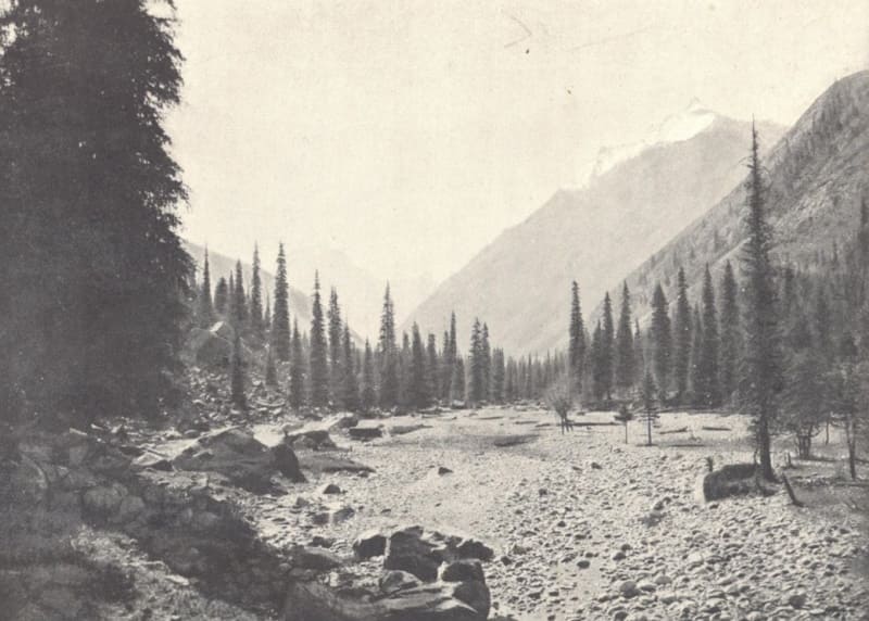
The floor of the gorge itself, conversely, was covered in dense spruce forest and strewn with massive boulders. Through this secluded forest, the Barskoon River rushed noisily along a rocky bed that cascaded in steps in places, its roar echoing far through the thick woods.
As we made our way slowly up the gorge the following day along a narrow path winding between the boulders, we unexpectedly encountered a transverse trench - over two «arshins» deep and about four *arshins* wide. Judging by the freshness of the excavation, it had been carved just a few days earlier by a powerful, ephemeral torrent - likely unleashed when a temporary natural dam on a nearby height had burst.
We were forced to halt at this obstacle and use shovels to cut down its steep banks to ensure a safe crossing. Throughout the entire length of the Barskoon Gorge - extending all the way to the headwaters of the river of the same name that flows through it - not a single side gorge branches off; consequently, the river has no significant tributaries.
The sides of this gloomy gorge are exceedingly steep and high; the dense spruce forest covering the valley floor only intensifies the prevailing darkness. At the river's headwaters, the gorge opens into a narrow, treeless valley - though forests do cover the adjacent mountain slopes up to an elevation of 10,000 feet.
Facing the arduous crossing of the Terskey Alatau ridge that lay ahead, the expedition halted here for a day of rest.
Mikhail Vasilyevich Pevtsov. «Journey to Kashgaria and Kunlun». 1894.
Geographical coordinates of Barskoon gorge: N42°01'11 E77°36'28
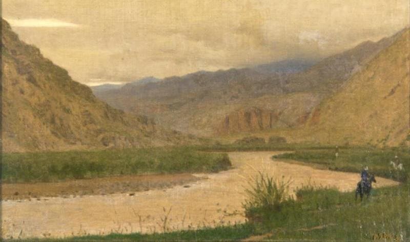
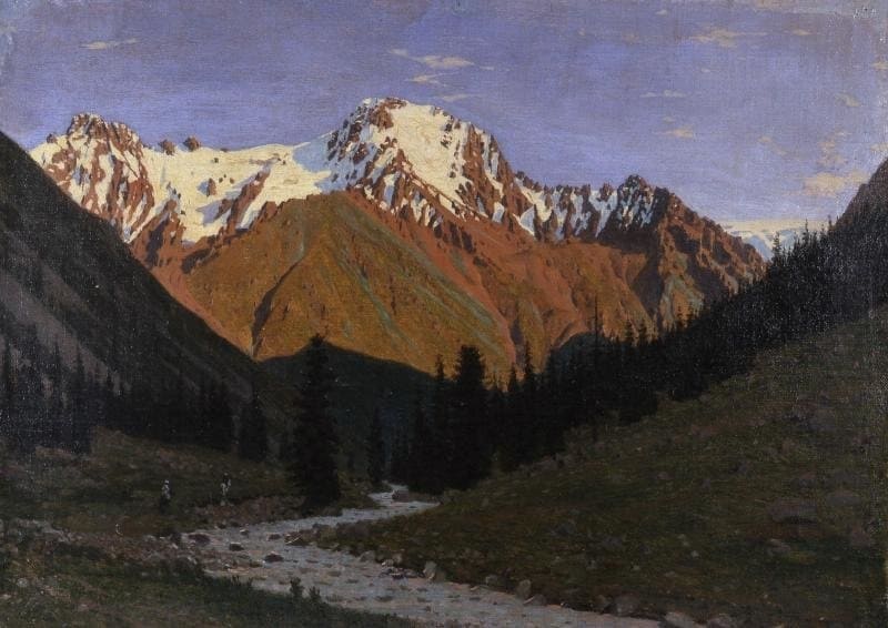
Author and photos by:
Alexander Petrov.