Вы здесь
Climate of Kopetdag.

Landmarks of Turkmenistan.
“Nature encourages no looseness, pardons no errors”
Ralph Waldo Emerson.
Seven Wonders of Turkmenistan.
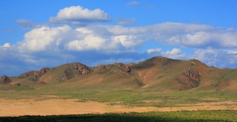
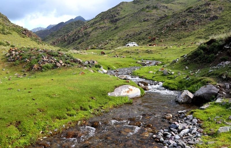
Kopetdag ridge (Turkic "multi-mountain", Turkm. Köpetdag) is located in the eastern part of the Balkan velayat, in the southern and southwestern parts of the Akhal velayat. The highest peak in the Turkmen part of the Kopetdag is Mount Chapan with a height of 2889, 2 meters above sea level, located in the main ridge of the Kopetdag on the border with Iran.
The northern slopes of the mountain are located on the territory of Turkmenistan, the southern slopes are on the territory of Iran. The second highest mountain of the Kopetdag ridge is Mount Shah-Shah with a height of 2863.7 meters above sea level, located 2.9 kilometers east of Mount Chapan in the main ridge of the Kopetdag.
The third highest mountain is Mount Bozy-Yamo with a height of 2690.7 meters above sea level, located 14.4 kilometers southeast of Mount Chapan, located in the Saandak border range on the border with Iran. The highest mountain of the Kopetdag ridge - Riza is located on the territory of Iran with a height of 2942.1 meters above sea level in the southeast of Mount Chapan.
The air in Kopetdag is very dry in summer due to the drying out influence of the neighboring deserts of Central Asia and Iran. Compared with desert plains, summer in the mountains is cooler, frost-free and vegetative periods are shorter.
The amount of precipitation is slightly more than in the neighboring deserts (to the south of Ashgabat at an altitude of about 1500 m - 217 mm per year, in some areas of the Kopetdag - up to 350 mm). Their maximum is observed not in March - April, as in deserts, but in May.
Lower Cretaceous limestones serve as a reservoir for fissure water that feeds sources with fairly warm water, associated with the longitudinal zone of discontinuities on the northern slope of the Forward Chain. The same groundwater is brought to the surface for irrigation with the help of a complex system of canals - underground galleries with clearing wells opening to the surface.
Through the canals, water flows by gravity to the oases. The canal system is now in a neglected state, since groundwater is used more efficiently with the help of artesian wells. The thermal springs are connected with the longitudinal rupture zone in the north of Kopetdag, as well as the underground lake Kou (Kow ata) with warm hydrogen sulfide water, located in an extensive karst cave near the village of Bakharden.
The altitudinal zonality of the Kopetdag landscapes due to the absence of a mountain forest zone is less pronounced than in many other mountains. Piedmont plains and low foothills (up to 350 m of altitude) are occupied by desert landscapes.
The soil cover on contact with takyrs on the plains is marked by the belt of takyr of gray lands, but mostly in the desert high-altitude zone there are developed light gray lands of different mechanical composition, from dust loamy on loesslike deposits to loamy gravelly on pro-aluvial plumes and outcrops of hard bedrocks. There are salt marshes.
Geographic coordinates of Kopetdag ridge: N38°48'11.69" E56°23'19.14"
Geographic coordinates of Mount Chapan: N37°48'19.16" E58°02'39.09"
Geographic coordinates of Mount Shah Shah: N37°48'24.77" E58°04'37.44"
eographical coordinates of Mount Bozyk-Yamo: N37°46'34.85" E58°12'14.15"


Authority:
N. A. Gvozdetsky, N. I. Mikhaylov. "Physical geography of the USSR. Asian part. The edition third corrected and added. Moscow "Thought" of 1978. http://tapemark.narod.ru/geograf/1_5_5.html
Photos by
Alexander Petrov.


