


![]()
Вы здесь
Ridge Kopetdag.
Tours in Mountains Kopetdag.
"Before a look of the observer examining Kopet Dagh from any dominating top the extensive equal or wavy space going far to borders of Iran is spread. Here, above, the impression about the highland, about deep almost impassable gorges Advanced and other ridges almost absolutely disappears"
E. M. Velikovskaya. "Geography questions", 1947.
Travel in Mountains Kopetdag.
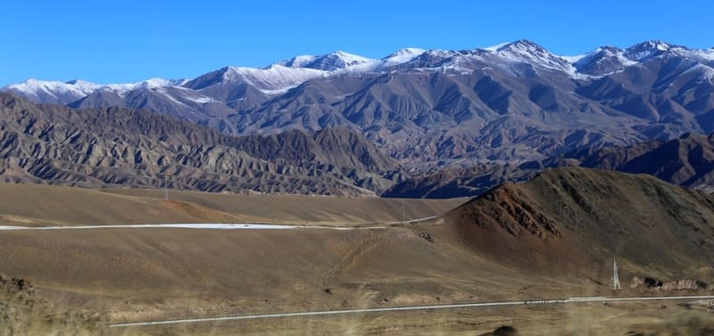
Kopetdag ridge (Turkic "multi-mountain", Turkm. Köpetdag) is located in the eastern part of the Balkan velayat, in the southern and southwestern parts of the Akhal velayat. The highest peak in the Turkmen part of the Kopetdag is Mount Chapan with a height of 2889, 2 m. a. s. l., located in the main ridge of the Kopetdag on the border with Iran.
The northern slopes of the mountain are located on the territory of Turkmenistan, the southern slopes are on the territory of Iran. The second highest mountain of the Kopetdag ridge is Mount Shah-Shah with a height of 2863.7 meters above sea level, located 2.9 kilometers east of Mount Chapan in the main ridge of the Kopetdag.
The third highest mountain is Mount Bozy-Yamo with a height of 2690.7 m. a. s. l., located 14.4 kilometers southeast of Mount Chapan, located in the Saandak border range on the border with Iran. The highest mountain of the Kopetdag ridge - Riza is located on the territory of Iran with a height of 2942.1 m. a. s. l. in the southeast of Mount Chapan.
The Kopetdag ridge is the marginal zone of the Turkmen-Khorasan mountains, which form the northern frame of the Iranian highlands. The Kopetdag ridge is the marginal zone of the Turkmen-Khorasan mountains, which form the northern frame of the Iranian highlands.
On the Turkmen territory, the Kopetdag is located with its northern outskirts, narrow in the east and expanding to the west, consisting of a large number of separate border, latitudinal and sublatitudinal ranges and mountain heights.
In western part, Kopetdag ridge consists of following ranges:
Kurendag with the highest peak 971.6 m. a. s. l., Tenglyadyk with the highest peak 484.2 m. a. s. l., Uzendag with the highest peak 749.7 m. a. s. l., Bakja with the highest peak 748.6 m. a. s. l., Ilanly with the highest peak Yilanlydere 701.6 m. a. s. l., Karajagatdag with the highest peak 454 m. a. s. l., Yailacik with the highest peak 839.8 m. a. s. l., Sariji with the highest peak 739.6 m. a. s. l., Ezzetdag with the highest peak Ezzetdag high 1005.6 m. a. s. l., Kapragez with the highest peak Kyaryssafaun 929.3 m. a. s. l., Karadag with the highest peak Karadag 742.2 m. a. s. l.l, Kalenja with the highest peak 579.6 m. a. s. l., Shurcha with the highest peak at 507.8 m. a. s. l.l, Gengerishgedik with the highest peak 569.9 m. a. s. l., Ekgerishgedik with the highest peak 629.3 m. a. s. l., Turfe with the highest peak 622.2 m. a. s. l., Orazdov with the highest peak Orazdov 621 m. a. s. l., Torgoydyar with the highest peak 925.6 m. a. s. l., Kachidag with the highest peak 493.7 m. a. s. l., Koisedag with the highest peak 659.5 m. a. s. l., Akdag with the highest peak Akdag with a height of 784.6 m. a. s. l., Gapylar with the highest peak with a height of 449.6 m. a. s. l., Khosardag with the highest peak Ervuch with a height of 1332.6 m. a. s. l., Kyaklik with the highest peak with a height of 1247 ,8 m. a. s. l., Umgali with the highest peak 691.8 m. a. s. l., Kalaus with the highest peak 710.1 m. a. s. l., Beglik with the highest peak you hundredth 594.8 m. a. s. l., Betovibair with the highest peak Betovi 442.7 m. a. s. l., Dyngolan with the highest peak Changli-Bashi 488.1 m. a. s. l., Kyaryssafaun with the highest peak 661.6 m. a. s. l. meters above sea level, Monzhukly with the highest peak 1069.4 m. a. s. l., Kyaryssafaun with the highest peak 661.6m. a. s. l.
In central part, Kopetdag ridge consists of following ranges and mountains:
Kaptalchesme ridge with the highest peak 1869 m. a. s. l., Gyuki ridge with the highest peak Tagarev 2244.2 m. a. s. l., Table Mountains with the highest peak 1139 m. a. s. l., Sedlovina ridge with the highest peak 1627.9 m. a. s. l., Ulydepe ridge with the highest peak Ulydepe 1631.6 m. a. s. l., Kyzylkaya ridge with the highest peak 1195.2 m. a. s. l., Devabayne ridge with the highest peak Karajar 1145.5 m. a. s. l.l, Layarhdag ridge with the highest peak 1245.2 m. a. s. l., Kozin-Takhtasy ridge with the highest peak high 182,5 m. a. s. l., Missinev ridge with the highest peak Missinev-Dag with a height of 2480.3 m. a. s. l., Kecha-Kamali ridge with the highest peak 2509.7 m. a. s. l., Deva-Baine ridge with the highest peak 1903.2 m. a. s. l., Karadag ridge with the highest peak 1033.3 m. a. s. l., Kyaryssafaun with the highest peak 661.6 m. a. s. l., Buluriyadag ridge with the highest peak 1183.8 m. a. s. l., Geabüldag ridge with the highest peak 964.5 m. a. s. l., Pir-Ali-Koahli ridge with the highest peak Khorcheim-Bashi 2361.8 m. a. s. l., Uzun-Daradag ridge with the highest peak of Tagalma with a height of 909 m. a. s. l., the Dalancha border ridge with the highest peak 2442 m. a. s. l., the Koshmir border ridge with the highest peak 1973.7 m. a. s. l., the Rashid-Dagg border ridge with the highest peak Kenarz with a height of 2388.4 m. a. s. l., Stony ridge with the highest peak 2594.8 m. a. s. l., Gaish border ridge with the highest peak Mirza-Bagir-Chil (height not specified), Saandak border ridge with the highest peak Bozyk-Yamo is 2690.7 m. a. s. l.
In southern part, Kopetdag ridge consists of following ridges and mountains:
Berdar border ridge with the highest peak 2612.1 m. a. s. l., Aselma with the highest peak Malaya Huncha 1316.9 m. a. s. l., Kyaryssafaun with the highest peak 1316.9 m. a. s. l., Ekukutel with the highest peak 697.1 m. a. s. ll, Kuspuhu with the highest peak 617.9 m. a. s. l., Harvar with the highest peak 754 m. a. s. l., Tekechingasi with the highest peak is Toparinkore with a height of 849.8 m. a. s. l., Tukhchi with the highest peak with a height of 697.3 m. a. s. l., Gyaursadagh with the highest peak with a height of 961.8 m. a. s. l., Galgalaa with the highest peak Karakamar with a height of 582, 8 m. a. s. l. and a peak 598.4 m. a. s. l., Agamat (Kashin) with the highest peak 588.1 m. a. s. l., Kekeny-Sarany with the most high peak 955 m. a. s. l., Zarakev with the highest peak 1322.3 m. a. s. l., the Kara-Tepe border ridge with the highest peak 2262.4 m. a. s. l., and the easternmost ridges: Kyzyl-Bair with the highest peak, 481 m. a. s. l., of the border ridge Zarakev (Ziruku) with the highest peak Bezymyannaya, 1366 m. a. s. l.
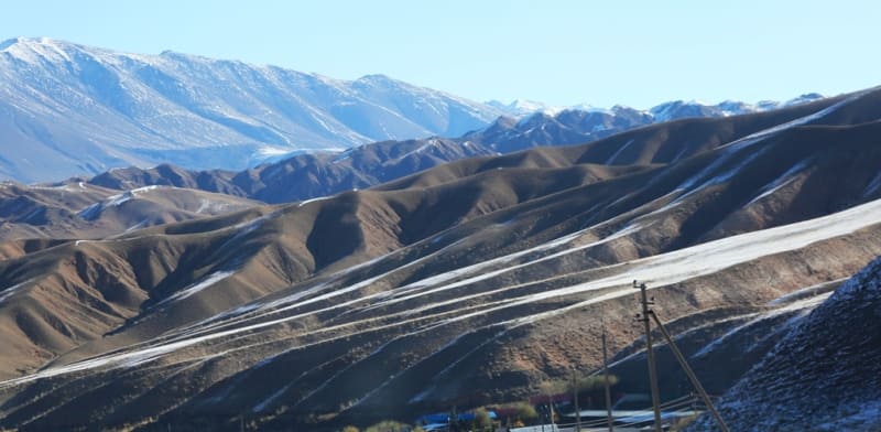
Relatively low, but steep and rocky on the north side, the Kopetdag Mountains are in sharp contrast with the plain of the Karakum desert spreading to the north. There are no eternal snows and glaciers on the Kopetdag, therefore the valleys in the mountains are shallow, and the mountains themselves are deserted.
There are also no ancient mountain-glacial forms of relief here. In the central part, the mountains consist of three parallel ridges, to the east, only foothills and sections of the frontal chains enter the Turkmen territory, and in the west of the Turkmen part of the Kopetdag, the width of the space with a complexly dissected mountainous relief reaches 110 kilometers.
Numerous short ridges of sublatitudinal strike stretch here. In the extreme western section, they change direction to latitudinal and at the end bend to the southwest, and only the Peredovaya chain retains a sublatitudinal strike almost to the very end.
All these rocky ridges correspond mainly to brachyanticlines, which are often overturned to the north and complicated by reverse faults, which is why they have a sharply asymmetric profile: their southern slopes are flat, and the northern slopes look like almost sheer cliffs, dissected by short gorges.
In the west, there is a great ravine dissection, and the relief of the low-mountain extremity of the Kopetdag acquires the character of a badland there. This is observed in the distribution areas of the Upper Cretaceous and Paleogene deposits of predominantly clayey marl composition.
In general, the ranges of the Kopetdag ranges are formed mainly by dense Lower Cretaceous rocks (limestones, sandstones, partly marls, siltstones). The slopes are often composed of armored Albeck sandstones that are difficult to erode.
Neogene deposits, which are relatively easily eroded.
The foothills are usually formed by bairs - hills and ridges of 100-300 meters relative height, with gentle peaks and strongly dissected slopes. They stretch in front of the steep, often impregnable northern slopes of the Forefront. In the Kopetdag, the connection between the relief forms and the tectonic structure is clearly revealed.
The chains of the ridges of the western Kopetdag correspond to the systems of anticlinal uplifts. As a result of local subsidence and uplift of the hinges of large folded structures, they were divided into a number of folds of the second order. The ridges are brachianticlinal folds, less often - their wings. It is found in the western Kopetdag and inverted relief.
The folded structure of the Kopetdag is complicated by a large overthrust in the zone of its northern Peredovaya chain and a number of smaller faults. All structural elements are united in the Kopetdag meganticlinorium. The ridges of the western part of the Kopetdag, grouped into rows of the main mountain ranges, are separated by longitudinal valleys several kilometers wide - Khodjakala, Sumbar, Chandyr, which basically correspond to the axes of synclinal structures.
Narrow transverse valleys open up in them.
The northern Forward chain of the western Kopetdag and the more southern chains have a height mainly within 1000-2000 meters. A characteristic common feature of the Kopetdag ranges is the flat shape of their peaks and crests. “In front of the gaze of an observer looking at the Kopetdag from any dominant peak, there is a vast, even or slightly undulating space, extending far into the borders of Iran.
Here, at the top, the impression of a mountainous country, of the deep, difficult gorges of Peredovoe and other ranges of the Kopetdag, almost completely disappears” (Velikovskaya 1947, pp. 131-132). Kopetdag belongs to the region of Alpine (Cenozoic) folding. Unlike the Greater Caucasus, it has a “northern vergence of folding and overthrusts (Vyalov et al., 1981, p. 5).
In the place of the current mountains in the Mesozoic and Paleogene, there was a geosynclinal trough, in which powerful sedimentary strata accumulated. Uplifts occurred at the border of the Paleogene and Neogene. The creation of mountain relief began in the lower half of the Neogene.
During the entire Neogene and Quaternary period, the relief was formed with the leading role of tectonic movements and erosion-accumulative processes occurring against their background. Intensive uplifts alternated with relative subsidences, and then the leveling surfaces were formed, grouped into 3 height tiers of different ages (Rezanov, 1977).
The current appearance of the Kopetdag was obtained as a result of young, Upper Quaternary, tectonic uplifts and the accompanying erosional dismemberment. In the Quaternary, the formation of folded structures continued. Active tectonic life of the Kopetdag is still going on. In the zone of foothills, as a result of movements along faults in the depths in the surface strata of the earth's crust, the development of brachianticlide structures continues, with which the seismicity of the region is associated.
The epicenter of the devastating Ashgabad earthquake of 1948 was located 25 kilometers southeast of Ashgabat, in the region of the Khalitz hill. The magnitude of the earthquake at the epicenter reached 10 points. Ashgabat was almost completely destroyed.
From horizontal shocks, the walls of one-story houses, made of mud bricks fastened with clay mortar, crumbled, and the roof collapsed on a pile of bricks. Single large buildings built according to the rules of anti-seismic construction were almost not damaged (textile factory, power plant, etc.).
The air in the Kopetdag is dry in summer, which is due to the influence of the neighboring deserts of Central Asia and Iran. Summer in the mountains is cooler than in the deserts, frost-free and growing seasons are shorter. In comparison with neighboring deserts, precipitation is slightly more (an average of 300 mm per year, in some areas up to 350 mm), their maximum is observed in May.
The lower Cretaceous limestones contain fissure underground waters, which feed sources with rather warm water, connected with the longitudinal thrust zone of the northern slope of the Peredovaya chain of the Kopetdag. The same groundwater is brought to the surface for irrigation using a system of underground galleries with treatment wells - kyariz.
Groundwater is used more efficiently with the help of artesian wells, so the karezes are now in a neglected state or completely abandoned. Thermal springs are connected with the longitudinal thrust zone in the north of the Kopetdag, as well as the underground lake Kou (Kov-ata) with warm hydrogen sulfide water in a vast karst cave near the village of Bakharden.
You can easily go down into the depths of the huge stone bag of the cave and swim there in the warm water under the stone arches. Due to the absence of a zone of real mountain forests on the slopes of the mountains (there is only juniper sparse forests), the altitudinal zoning of landscapes in the Kopetdag mountains is less obvious than in many other mountains.
Piedmont plains and low foothills (up to 350 meters of absolute height) are occupied by desert landscapes of the southern (subtropical) zone. In the desert high-altitude zone, light serozems of different mechanical composition are mainly developed, from dusty and loamy on loess-like deposits to loamy and gravel on proluvial plumes and outcrops of hard bedrock.
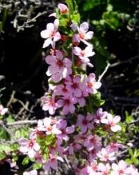
The vegetation cover is dominated by ephemeral sedge and bluegrass communities with a predominance of thick-columned sedge, viviparous bluegrass and characteristic representatives of large grasses, which are replaced higher by ephemeral and wormwood communities.
In the zone of high foothills and partly low mountains (350 - 500 meters), semi-desert (desert-steppe) landscapes are widespread. Light gray earths are replaced here by ordinary ones in combination with dark ones, occupying the highest parts of low mountains and shaded slopes.
On ordinary sierozems, vegetation of ephemeral and wormwood semi-deserts is widespread, and on dark sierozems, subtropical steppes are developed with the dominance of hairy wheatgrass. Wormwood and ephemeroid subtropical semi-desert were encountered by us in a longitudinal valley-basin behind the high Peredovy ridge of the Kopetdag, effectively cut through by the Firyuzinsky gorge near Ashgabad.
The transition from the low mountains to the middle mountains of the Kopetdag corresponds to the high-altitude zone of large-grass subtropical steppes (500-1150 meters). The mountain slopes dissected by gorges have brown soils. In the subtropical mountain steppes, on fine-earth soils, couch grass communities dominate, and on rubble - bearded ones. In this zone, Turkmen maple, carcass and shrubs grow on the slopes of deep gorges.
Together with them, the Turkmen archa appears here. In the valleys there are also pistachios, and in the Western Kopetdag - forest areas of walnuts. Under the maple and shrubs on the shaded slopes, mountain forest brown soils are developed, mainly carbonate.
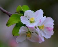
On the bottoms of the gorges of the southwestern Kopetdag, along the streams, dense shrubbery with wild grapes and fruit trees (fig, medlar, apple, pear) develop. There are also plane trees, pomegranates. Porcupine and mountain sheep are found in the mountain steppes of the Kopetdag. In tree and shrub thickets gorges inhabited by wild boar, leopard.
In shaded damp places, in bushes along river valleys and on the slopes near mountain springs, you can meet with a cobra. Its bite is fatal to humans. In the range from 1150 to 2500 m. a. s. l., there is an altitudinal zone of mountain feather-grass-fescue (in the upper belt mainly fescue) steppes, upland xerophytes (acantho-lemon, kachim, astragalus, etc.) and juniper forests.
The juniper (juniper) light forests are clearly visible on the southern slope of the high Peredovoy Ridge, at its crest from the highway behind this ridge between the Chulinsky and Firyuzinsky gorges. Now significant work is underway in the Kopetdag mountains to restore juniper, which should improve their hydrological regime and serve as an important anti-mudflow measure.
The soil cover of the described high-altitude zone, especially in its upper zone, is becoming more and more broken due to the abundance of rocks and screes. The soils are of the mountain brown type, but in the upper belt under the fescue sod and cushion-like upland xerophytes, weakly leached loamy-rubbly subalpine soils are developed.
In this altitudinal zone, there are also wild boar, occasionally a leopard; on steep rocks - a bezoar goat. In the shade of juniper trees in summer the mountain sheep finds coolness. On large juniper trees, a black vulture arranges nests. The snow vole and the Caspian snowcock live in the highest mountains.
In the western Kopetdag, deposits of barite and witherite were found, which are used to obtain barium salts, cinnabar. Limestones, sandstones, and gypsum, widely distributed in the Kopetdag mountains, serve as building materials. Mineral water springs are a kind of mineral resource.
The basis of the natural resources of Kopet-Dag are summer (in the upper parts of the mountains) and spring (in the lower parts) pastures. The local Turkmen population uses the fruits of wild fruit trees and shrubs growing in the gorges of the southwestern Kopetdag.
On the piedmont plains and in the longitudinal valleys are the main agricultural oases of Turkmenistan. Oases of the foothill plains they now receive water from the Karakum canal. In some places in the mountains of Kopetdag rainfed agriculture is possible (wheat and barley are cultivated).
Protected by ridges from the northern winds, the valleys of the southwestern Kopetdag are areas of subtropical agriculture. Its expansion will be facilitated by the construction of the left branch of the Kairakkum Canal. Promising cultivation of olives, dates, pomegranates, lemons.
Geographic coordinates of Kopetdag ridge: N38°48'11 E56°23'19
Geographic coordinates of Mount Chapan: N37°48'19 E58°02'39
Geographic coordinates of Mount Shah Shah: N37°48'24 E58°04'37
Geographical coordinates of Mount Bozyk-Yamo: N37°46'34 E58°12'14

Authority:
N. A. Gvozdetsky, N. I. Mikhaylov. "Physical geography of the USSR. Asian part. The edition third corrected and added. Moscow "Thought" of 1978.
http://tapemark.narod.ru/geograf/1_5_5.html
Photos by:
Alexander Petrov.