Вы здесь
Climate of Central Asia.


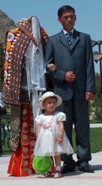

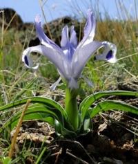
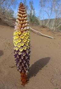
Natural and unnatural wonders of Turkmenistan.
“may came home with a smooth round stone as small as a world and as large as alone”
E.E. Cummings.
Wonders of Silk Road – Turkmenistan.
Climatic features of the territory of Central Asia and Central Kazakhstan are determined by:
1) their internal continental position and remoteness from the oceans - the main sources of atmospheric moisture brought here;
2) located at relatively low latitudes, which causes a relatively large amount of radiation balance;
3) device surface, which is largely dependent peculiarities of the circulation processes.
The position of the territory in the inner part of Eurasia, at a great distance from the oceans causes a pronounced continentality, and the intense radiation associated with the southern position imparts a continental climate to the low plains of the main part of the territory arid character; Under these conditions, desert landscapes develop.
The value of the total radiation (direct plus diffuse) in the north of the territory is about 100, in the south more than 160 kcal / cm2. The radiation balance in the north is about 22, and in the south - over 40 kcal / cm2 per year. In the territory under consideration, the air of temperate latitudes predominates, which in summer in its most part is vigorously transformed into tropical.
In the south, the seasonal change of the air prevailing in winter at temperate latitudes, tropical, which dominates in summer, is due to the seasonal movement of the front at temperate latitudes characteristic of the subtropical belt. The seasonal migration of the Iranian part of the front of the temperate latitudes determines the change of rainy and dry periods in the south of Central Asia.
In winter, the front of temperate latitudes is usually located south of the borders of Central Asia, but its existence causes cyclonic activity and precipitation, especially intense on the south-western and western slopes of mountain ranges. In spring, the Iranian part of the front begins to move north and, passing through the southern parts of Central Asia, causes a pronounced spring maximum of precipitation (in March - April), which creates favorable conditions for the development of ephemeral vegetation in the southern desert areas.
In summer, the front becomes strongly blurred, as the transformation of air of temperate latitudes into tropical smooths out the temperature differences between the air masses on both sides of the front on the desert plains of the north of the Turan lowland and in Kazakhstan semi-deserts.
This causes a weakening of cyclonic activity and leads to the establishment of clear dry weather. Cyclonic activity in summer is manifested only in high-mountainous areas, where under the influence of mountain barriers, fronts are activated, and in the north of Central Kazakhstan, exposed to the influence of western cyclones and during the summer season.
Over the desert plains of Central Asia, even convective sediments do not fall; the level of condensation in the summer here is at such a high altitude that thermal convection does not reach it. The air of temperate latitudes in the north is bordered by arctic air.
The Arctic front, which is located in winter at an average latitude of 65 - 70 °, often enters Central Asia, and sometimes even descends to southern regions. More often, the western spur of the Asian anticyclone passes through Central Kazakhstan and north of Central Asia.
From its area in winter, cold and dry continental air intrudes into Central Asia in the north and northeast. Cold air masses penetrate freely into Central Kazakhstan and further to the south, to the western regions of Central Asia. In the east of Central Asia, the Tien-Shan mountain barriers impede their penetration to the south.
Cold air masses usually have a small thickness, therefore even relatively low ridges, for example, the Karatau ridge, Mountain systems located outside of it have a great influence on the climate of Central Asia. These are not only the barriers protecting Central Asia from the south (from the penetration of the South Asian monsoons), but also the mountains to the west and south-west (the Greater and Lesser Caucasus, the Armenian Highlands, Zagros, etc.).
They form a barrier exceeding 3,000 km in length and have a deforming effect on the height frontal zones, which significantly affects the development of cyclonic activity in Central Asia. As shown by climatologist I. V. Bout, the atmospheric waves caused by this mountain barrier cause the development of strong hair dryers that preclude precipitation.
The effect of such processes is practically observed over the entire territory of Turkmenistan. In winter, they are associated with clear dry weather with a sharp increase in temperature. The mountain barrier significantly reduces the amount of precipitation brought to Central Asia by western, and especially southwestern (Mediterranean) cyclones.
An indicator of the continental climate of Central Asia is temperature conditions. In summer, the Central Asian deserts are hotter than in the tropics. The average July temperature here is 26–32 °, whereas in the tropics it is 24 – 28 °.
The absolute maximum air temperature reaches 50 ° (Southeast Karakum, Termez on the Amu Darya), and the sand surface in the desert heats up to 79 ° (Repetek in Karakum).
But the plains of Central Asia have a cold winter that does not correspond to the geographical latitude, and the average annual amplitudes of air temperature here reach very high values (32 - 40 °). Also characterized by large fluctuations in temperature from year to year, sharp daily fluctuations in temperature, the sharpness of transitions from season to season (especially from winter to summer), small amount of precipitation (less than 200 mm per year, on large areas - less than 100 mm, even in some places less than 75 mm), little cloudiness, a large number of hours of sunshine, dry air (on summer days, relative humidity averages 20 – 25%, but descends and is much lower).
The radiation index of dryness, which characterizes the ratio of the annual radiation balance to the annual precipitation, in the deserts of Central Asia is more than 3 (extremely inadequate humidification). In Central Kazakhstan, the summer heat is somewhat milder, and winter is becoming more severe.
There is a little more precipitation. Radiation index of dryness is from 2 to 3 in semi-desert (insufficient moisture) and less than 2 in the north, in the steppe zone (moderately insufficient moisture). In the mountainous regions of Central Asia, high-altitude climatic zonality manifests itself.
The lower zones are affected by the same air masses and circulation processes as the neighboring deserts. On the slopes of the mountains is an aggravation of the frontal processes. In the upper zones, the role of the western air transport in the middle layers of the troposphere is increasing.
On the windward slopes it produces a significant amount of precipitation (in some places more than 1600 mm), in the “barrier shade” it drops sharply (in the Eastern Pamir, the annual precipitation rate is as low as in the most anhydrous regions of the Turan lowland).
B. P. Alisov (1969) identifies the following climatic regions on the territory of Central Asia and Central Kazakhstan.
Temperate zone Central Asia.
1. Continental steppe area. The climate of this area is formed with significant exposure to radiation factors. Characterized by rapidly increasing aridity to the south. The southern boundary of the region coincides with the northern boundary of the desert zone. January temperature is –18 °, −15 °, July 22 ° –25 °.
The annual precipitation is 200 - 300 mm. Snow cover thin.
2. The continental North-Turan region occupies the middle and northern parts of the Turan lowland and Balkhash region. The formation of the climate is decisively influenced by radiation factors, especially in the summer. In winter, the prevailing northeastern winds bring continental Siberian air.
In summer, the north and north-west winds bring continental air from Western Siberia and the south-eastern regions of the European part. These air masses within the region undergo a second phase of transformation, approaching in their properties to tropical air masses.
Temperature differences between this transformed air and tropical air of southern origin are smoothed out, cyclonic activity is reduced. January temperature is from −15 ° in the north to −3 ° in the south, July temperature is 25 - 30 °.
Annual rainfall is 200 - 100 mm or less. 3. The mountainous region of Tien-Shan occupies the main part of this mountain system.
The climate develops under the action of circulation processes developing over Kazakhstan and Western Siberia, and under the influence of altitudinal zonality. Mountainous terrain enhances cyclonic activity and precipitation. The temperature drops with height in January by 0.5 °, in July - by 0.7 ° for every 100 m.
On the western slopes, on average, about 800 mm of precipitation falls annually (in some places more than 1600 mm).
Subtropical belt Central Asia.
4. The continental South-Turan region occupies the southern part of the Turan lowland, corresponding to the southern subtropical desert zone. The main climate-forming factors are the radiation and cyclonic activity of the Iranian branch of the front at temperate latitudes.
January temperature varies from −3 ° in the north to + 2 ° in the south (between the western tip of the Kopetdag and the Caspian Sea + 4 °), the temperature in July is 30 - 32 °. The annual rainfall is 150 - 200 mm. Spring precipitation and abrupt change of weather conditions in winter are characteristic.
5. The mountainous area of Pamir-Alai. The main climate-forming factors are radiation, cyclonic activity of the Iranian branch of the front at moderate latitudes, and altitudinal zonality. The average January temperature in the foothills is from −5 ° in the north to + 2 ° in the south, and on high plateaus (about 4000 m) - to −20 °.
The average July temperature in the foothills is 25–30 °, at high plateaus (about 4000 m) it is 8 °. In the high-altitude zone with forests, more than 1000 mm of precipitation falls annually, in some places more than 1600 mm, on the Fedchenko Glacier in the Western Pamirs - 2236 mm, on the plateau of the Eastern Pamirs - about 100 mm.
The climatic conditions of Central Asia and Central Kazakhstan are such that only irrigated agriculture is possible in the main part of the territory. Only in the north of Central Kazakhstan, as well as in the mountains of Central Asia and partly on the elevated piedmont plains of the south, where, due to the influence of neighboring mountains, the amount of precipitation somewhat increases, agriculture is carried out without irrigation.
The dry subtropics of the south of Central Asia are characterized by a very high amount of annual temperatures and the duration of the frost-free Period (200-230 days per year). Plants that require large amounts of heat can grow here: fine-fiber cotton, figs, pomegranate, etc.
More precocious cotton varieties penetrate into Central Asia further to the north. But even in the southern regions, the cultivation of a number of perennial subtropical plants is difficult due to the winter cold snaps. Therefore, for the subtropical agriculture, of particular interest are those southern areas that are protected from the cold northern winds by the mountains - the Atrek and Sumbar valleys in western Turkmenistan, southwestern Tajikistan.
In the hot and dry climate of Central Asia, fruit trees grow easily and bear fruit and endure low winter temperatures - apple trees, pears, plums, apricots, peaches. Grapes and melons (melons, watermelons) ripen perfectly. The abundance of light and heat contributes to the improvement of the sugar content of fruits.
Dry autumn is favorable for harvesting cotton and fruit. The instability of winter weather, a change in thaws with frost sometimes lead to the formation of ice. In the desert pastures of Kazakhstan and Uzbekistan, cattle that had previously been grazed only on pasture, could not get their food from under the ice crust in winter.
The massive death of livestock from starvation as a result of ice was known by the name of "jute". Now they are struggling with this disaster by procuring insurance stocks of winter fodder. The dry climate of Central Asia with an abundance of sunlight, despite temperature contrasts, is generally favorable for human health.
Summer heat due to the dryness of the air is transferred relatively easily. The hot climate of the Central Asian plains is contraindicated only to people with lung and heart disease. Climatic conditions of mountainous areas are favorable for the creation of resorts.
The duration of sunshine and the intensity of radiation in summertime make the territory of Central Asia promising in terms of the technical use of solar energy. So far, experiments are being conducted on its use mainly for domestic needs and desalination of salt water. It is promising to use the energy of the sun to combat insects - cotton pests.
At night, they seek the light. To destroy them, arrange light trap with toxic substances. The source of power for an electric light bulb in a trap is a battery that is charged during the day using a solar installation. The problem of direct conversion of solar energy into electricity using semiconductors is being developed.
The most efficient converters are thermoelectric, photoelectric and thermal generators, which are less cumbersome than thermal power machines. In the future, solar energy should be widely used for the development of the natural resources of the desert.
Authority:
N. A. Gvozdetsky, N. I. Mikhaylov. "Physical geography of the USSR. Asian part. The edition third corrected and added. Moscow "Thought" of 1978. http://tapemark.narod.ru/geograf/1_5_5.html
Photos by:
Alexander Petrov.


