


![]()
Вы здесь
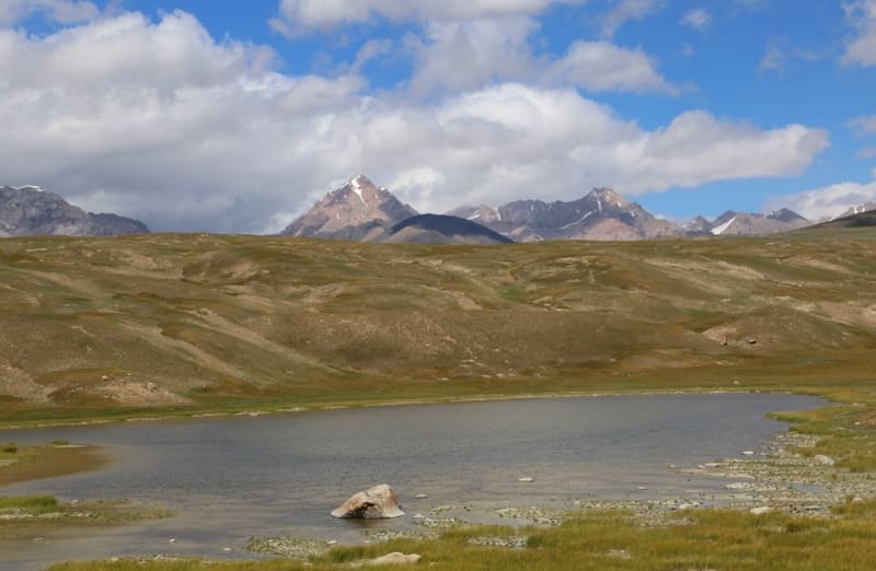
Lakes in Karagermes River Valley.
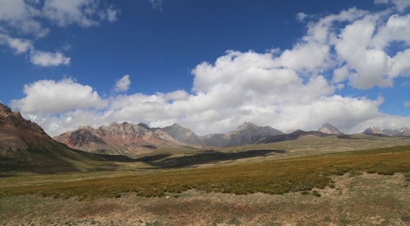
Lakes in Eastern Aksai River Valley, Naryn Region.
“Having crossed the Aksai, we began to climb along its high right bank, i.e. along the northern slopes of the foothills of the Aksai Tien Shan. The grass here was especially good. On the left, the rocky Tien Shan was already visible not far away, and closer there were huge boulders, largely worn and as if polished. These stones, lying freely on the grassy surface, gave a strange impression.”
“Travel along the Western Aksai River Valley.” Through the mountainous regions of Russian Turkestan. V. I. Lipsky. 1906.
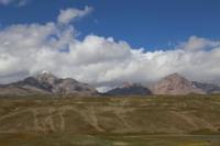
Natural Sights in Eastern Aksai River Valley.
High-mountain, fresh lakes in Karagermes River valley are located at an altitude of 3472 to 3748 meters above sea level, are located on floodplain terrace from 840 to 1300 meters from left bank of Eastern Aksu River, between Akbaytal River in west and Mustyr River in east in At-Bashinsky district, Naryn region.
There are 9 large moraine lakes and about 50 small lakes, which are located on the floodplain terrace of the southern, gentle slope of the Dzhanydzher ridge limited by the high side of the Eastern Aksai River and the northern slopes of the Kokshaal-Too ridge.
The border of the lakes in the east is the Akbaytal South River, which originates from the spur of the same name located on the southern slopes of the Dzhanydzher ridge. In the east, the border of the lakes is the Mustyr River and the sources of the Kyzyl-Unet River.
The Karagermes River, 20 kilometers long, originates from small glaciers located on the southern slope of the Janydzher Range. After 11.2 kilometers from the beginning of the sources at an altitude of 3624 meters above sea level, the river forms the main channel.
In the upper reaches of 11 small tributaries, the main channel of the Karagermes River takes. The lakes located on the extended terrace of the southern slope of the Janydzher Range can be attributed to syrty lakes. The area, abundant in lakes, is a plateau formed as a result of long-term processes of relief leveling associated with the impact of glaciers, water and wind.
These areas have preserved the remains of relict forms of the ancient plain, subjected to mountain-building processes in the Tertiary period, which led to a significant uplift of individual massifs. The Karagermes River Valley contains numerous glacial boulders and moraine deposits covering large areas of its surface.
There are many small saucer-shaped lakes here, and the marshy areas known to locals as "saz" are particularly widespread. Water in these areas stagnates due to the presence of frozen soils, which prevent it from penetrating into the deeper layers.
As a result of weak evaporation, swamps are formed in the gentle basins of the syrts, which have a significant impact on the local ecosystem. Snow is not uncommon on the plateaus of the syrts in the summer. In some years, heavy snowfalls and frosts that occur in early autumn can damage pastures, affecting their productivity.
The modern appearance of the syrts was formed due to ancient glaciation, traces of which are evident in the relief: moraines frozen in the ground, large boulders, ram's foreheads, as well as numerous marshy areas and small lakes with soft banks.
These lakes are usually shallow and have an area of less than 1 square kilometer. Permafrost, a relic of ancient glaciation, is preserved at an altitude of over 3,400 meters above sea level. Its upper layer lies in the soil at a depth of 1 to 1.3 meters.
Permafrost significantly affects the hydrological regime, preventing water from seeping deep into the soil and causing the formation of wetlands.
Geographic coordinates of lakes in Karagermes River valley: N41°10'08 E77°10'37

Authority and photos by:
Alexander Petrov
“Having crossed the Aksai, we began to climb along its high right bank, i.e. along the northern slopes of the foothills of the Aksai Tien Shan. The grass here was especially good. On the left, the rocky Tien Shan was already visible not far away, and closer there were huge boulders, largely worn and as if polished. These stones, lying freely on the grassy surface, gave a strange impression.”
“Travel along the Western Aksai River Valley.” Through the mountainous regions of Russian Turkestan. V. I. Lipsky. 1906.