


![]()
Вы здесь
History of Lake Alakol.


Sightseeing tours to Lake Alakol.
“Lakes Alakul and Balkhash in all likelihood, very recently, constituted one common reservoir, because even now during the spring floods Ala-kul, according to the Kyrgyz, directly communicates with Balkhash through the salt marshes”
Shokan Valikhanov.
A trip from Usharal to Lake Alakol.
“Ala-kul (Kyrgyz is a motley lake) - two lakes of the Semipalatinsk region, on the Chinese border, 90 versts east of the tip of Balkhash, on the lowland steppe, between the high ridges of Tarbagatai and Semirechensky Alatau.
1. Eastern or Big Alakul, also known as Ashikul; it covers an area of 1514 square versts, with a length of 55 versts and a width of up to 40 versts. Depth 14 feet. Its shores are mostly low-lying or overgrown with reeds.
Only two secluded mountain peaks rise from its surface on the northeast side of it: the Aral-tyube island and the Baygazy-tyube mountain; the latter, combining a flat scythe with a low coast, forms a peninsula; both consist of porphyry and schists and do not contain volcanic rocks, although before travel Al. Schrenka was mistakenly considered volcanoes.
The testimonies of the Tatars about the eruptions of the Aral-Tube, repeated by Humboldt, and after him by Ritter, and passed into many European scholarly works, turned out to be fictions, which have no basis. On the southeast side, adjacent to Lake Alakul is a small lake Kichikul, 20 versts long and 8 versts wide, separated from Bolshoi Alakul as if by a natural dam, known by the name of Naryn-uzak and consisting of solid rocks, namely clay shale. Kichikul is also called Lesser Alakul.
Here, the foothills of Barlyk, the spur of Alatau, are most suitable for the lake, which waves throw pieces of coal onto the shores. The presence of a high island on Bolshoi Alakul explains its name, because the Kyrgyz call lakes with islands “motley” lakes.
2. Western Alakul is also known as Ssyazyk-Kul; It is separated from the eastern one by a swampy isthmus of versts 20 wide, overgrown with reeds dotted with small lagoons that are connected by ducts. At some times of the year and in other years, the isthmus becomes impassable, to such an extent it is flooded with water; without a doubt, both lakes were formerly one basin, separated by the drying of the lake.
To the west of Western Alakul, towards the northeastern end of Balkhash, there is a sandy and solonetzic strip of Aitaktyn-karakum, indicating, as it were, a trace of the former connection of Balkhash with Alakul, of which the latter represents the separated extremity of the first.
Western Alakul at 40 versts of length has up to 15 widths, its shores are low and overgrown with reeds. ”[GSS, Ala-kul article, pp. 42 - 43]. A detailed description of the lake, containing many details that cannot be given here because of their vastness, see the article by A. Golubev [Golubev].
B.E. Kumekov in 1971 wrote: "As is now established, the lakes located in this hollow (Alakol, Koshkarkol and Sasykkol) constituted one whole in the first half of our millennium." [Kumekov. Page 196 - 197]. The height of the lake Sasykkol, located between Alakol and Balkhash - 354 meters, lake.
Alakol lies 7 meters below. Raising the level of Lake Alakol by 10 - 12 meters would certainly have caused its connection with Lake. Sasykkol. These two lakes are currently only separated by a salt marsh and a small isthmus.
It is likely that Lake Sasykkol, in turn, was connected with Lake Balkhash along the swampy tract Kyla and the Ayaguz River; the height of the isthmus separating them is only 10 meters higher than the current level of Lake Sasykkol.
When, due to global climate change, the flow from Sasykkol to Balkhash decreased, the weak current could no longer cope with the increased amount of sand brought by the desert to the territory of the channel. And gradually formed a low sandy isthmus.
Schmidt also shared opinions on the existence of a single Balkhash lake in the 13th century, consisting of modern Balkhash, Alakol and Sasykkol. Page 45 - 46], and Rockhill [Rockhill. Pp. 159 - 160, note 2]. "Lakes Alakul and Balkhash most likely, very recently, constituted one common reservoir, because even now during the spring floods Ala-kul, according to the Kyrgyz, directly communicates with Balkhash via a salt marshy strip." [Valikhanov. Page 190]
"This can be confirmed by the still-saline stream Aitaktyn-Karakum, which has a direction from the western coast of Ala-kul to the northwestern tip of Balkhash." [Babkov. P.339]. Thus, Rubruk did not at all confuse two large lakes with each other. It’s just that in his time these modern separate lakes did not exist, but there was one “sea” Balkhash.
5. The lake "seemed to us as stormy as the ocean." Travelers observed the waves on December 2 according to the Julian calendar. The lag of the calendar relative to the astronomical date in the XIII century was already a week, i.e. according to the modern calendar, the lake was still not covered with ice on December 9th.
Modern Balkhash in its eastern part is covered with ice almost a month earlier. Lake Alakol freezes only in January, and the reason for this is not the mineralization of water, but the strongest winds. “There is a difficult wind regime over the lake.
The maximum wind speed over the northern parts of the lake reaches 40-50 m / s, over the southeastern and central 50 - 60 m / s. The most active winds are in the autumn-winter period, when the wave height can be up to 2 - 2.5 m. The duration of freezing is about 2 months (February-March).
The largest ice thickness is 0.8 m (in February).” Traveler Kukushkin describes the effect of the Ibe wind on the freezing of Lake Ebi-nur: “The very shore of the latter struck us with its forms; it consisted of blocks of ice, a whole quarter thick, scattered on top of each other in total disarray in the recumbent, inclined and upright positions.
Between them there was still visible snow somewhere, but for the most part the blocks were deprived of it. Obviously, these were miniature hummocks of polar ice, piled up during Ibe, who first cracked the ice of a frozen lake and then threw its blocks along the coast.
The north wind excited the lake, which was completely opened. Its southern coast was visible in the distance, also with a white rim of hummocks. We circled the lake along the eastern shore, which took more than an hour; walked along a hard beach, fortified by frost, between ice hummocks on the right and the old coastline on the left.
Already to the left rose the flat hills of the outskirts of the Miley Range, which went east. The southern shore of the lake was also represented by hummocks, but the waves raised by the north wind came here, and ice hummocking continued before our eyes; the ice floes collided, climbed one another, capsized, piled up, rustling was heard all the time; the waves rushed, shifted and tugged ice floes. ”[Obruchev].
This description helps to visualize the picture of ice formation on Lake Alakol, exposed to the same wind, often also blowing in the opposite direction.
See also [Schmidt. Page 46 - 47] Summing up, we can confidently say that from the city of Kaylak Rubruk headed north to Lake Alakol. Having done 150 km in three days, he went to the south coast on December 2.
From the point of access to the shore, travelers “saw on it a large island”, which could only be the island of Ulken-Araltobe. The "capital of this region" accordingly lay at a certain distance from the coast. Possible localization is the area of the modern village of Ucharal on the Tentek River.
“The Semirechye archaeological expedition in this area discovered and examined three sites. Two of them are located in the valley of the river. Tentek - the first on the north-eastern outskirts of the village. Uch-Aral, the second - 8 km south-west of the mentioned village. The lifting ceramic material from the two hillforts is similar and does not differ from the dishes of the dated complexes of the hillforts Antonovskoye, Sumbe, Dungen and belongs to the X-XIII centuries. Based on the message of al-Idrisi about the city of Saraus and the image on the map, it is possible to identify it with the first fortification located in Uch-Aral. ”[Kumekov. P.197] Undoubtedly, one of the three settlements found can be considered the remains of the “capital of the region” mentioned by Rubruk.
Then the travelers “crossed the valley, heading north, to the large mountains (Note in the text - Probably Tarbagatai), covered with deep snow, which then lay on the ground.” The note gives an absolutely incredible direction, since the Tarbagatai ridge, when moving through the Dzhungar Gate, remained behind the travelers.
Rubruk had in mind the mountains, which were much closer - the north-eastern "wall" of the Dzungar Gate, a continuation of the Dzungar Alatau. Due to strong winds, the valley had to be crossed along the shortest path, in this case from the south-west to the north-east.
If Rubruk really headed to Tarbagatay, then crossing the valley was not necessary, the route would run along the shore of Lake Alakol.
Authority:
http://www.pretich.narod.ru/Zemlia/Geografia/alakol.html
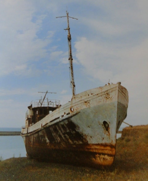
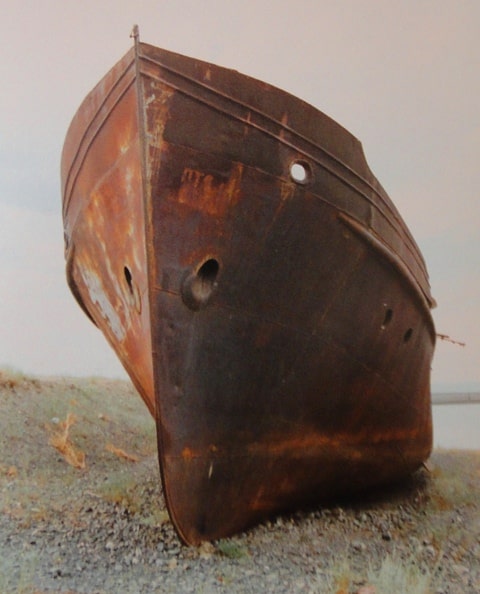
Photos
Alexander Petrov.