


![]()
Вы здесь
Beloubinsky lakes on Kazakhstan Altai.


Tours to Beloubinsky lakes.
“may came home with a smooth round stone as small as a world and as large as alone”
E.E. Cummings.
Beloubinsky lakes in West-Altai Natural Reserve.
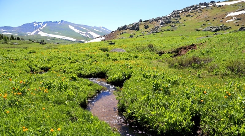
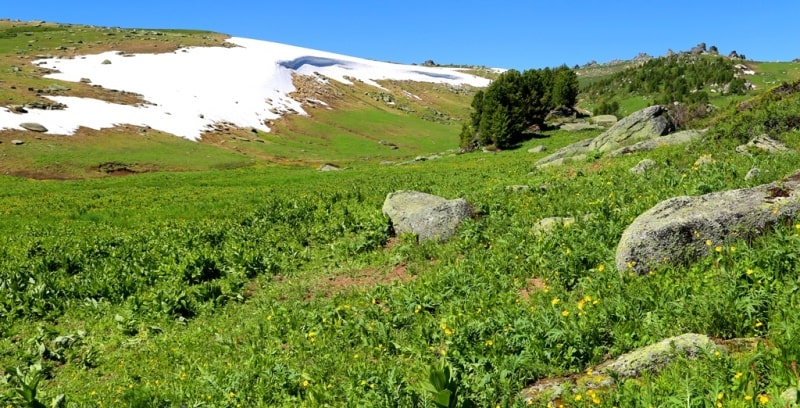
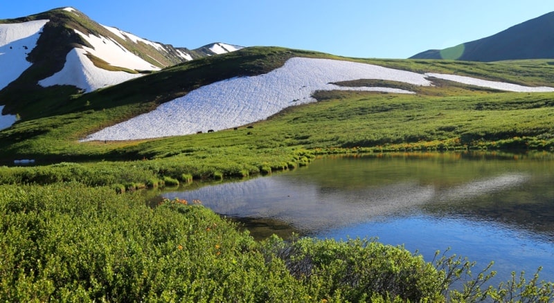
A group of Beloubinsky lakes are located at an altitude of more than 2000 meters at sea level in the Ridder region of East Kazakhstan region. The lakes are located in the eastern part of the Ivanovo ridge on the territory of the West-Altai Natural National Reserve.
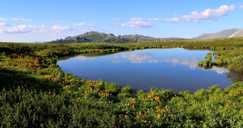
The main group of six lakes is located 6 kilometers to southern-west from the Linea Poles, these six lakes are quite large compared with the lakes located southeast at a distance of about 4 kilometers. In the southern group of lakes, Dinara and Kizbala lakes are the largest.
So Lake Dinara has a length of 242 meters and the largest width of 116 meters. Kizbala Lake is 207 meters long and 143 meters wide. To the east of the group of lakes is the latitudinal ridge Kholzun, which is the border with the Russian Federation.
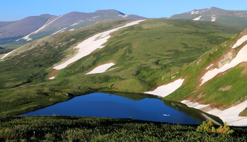
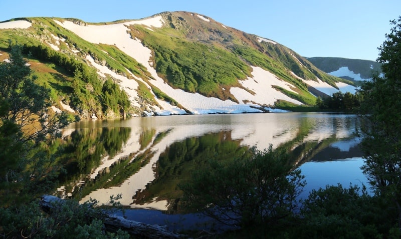
The largest and most picturesque lake among this group is Lake Kedrovoye, the next in size, is Lake Shcherbakova, former Listvyazhnoe. The sources of the Belaya Uba River begin from these lakes, hence the name of the lakes - Beloubinskie - appeared. The following is a summary of the group's lakes.
The thin lake Kedroboye is located in east part of the Ivanovskiy ridge, it is the biggest of group of 5 lakes located nearby. One lake are at distance of 1000 meters in the northwest from the Cedar lake, in the South and the southeast at distance of 750 and 800 meters there are three more small lakes.
Length of the Kedrovoye lake about the West on the East of 350 meters, width is 120 meters, depth is about 20 meters. From all five lakes take sources of the river Black Uba which leaves from the lake on the northwest.
The lake is in the territory of the central part of West Altai Nature Reserve and is located in the administrative territory of the city of Ridder at the height about 2000 meters above sea level. The coast on a thin shaft is surrounded with the dense cedar wood.
This lake was included into the list of unique, natural sights of West Altai Nature Reserve. The lake is the most mysterious, warm, beautiful, unusual and attractive. From a large number of the thin lakes of Ivanovskiy of the ridge water in this lake is the warmest.
Beautiful it is considered for unusual, beautiful coast not characteristic of mountain lakes. The coastline of the lake on the one hand is protected by a steep slope of peak Beloubinsky, from other three parties, is surrounded with the dense cedar wood.
From far away this lake can be seen only from the top point dominating in the natural boundary Lineysky columns. In good weather magnificent cedars and coast with outlines of Lineysky columns with the clouds floating in height are reflected in a water smooth surface of the lake.
On a mountain slope the whole summer lies a small glacier which gives special attractiveness to the general landscape.
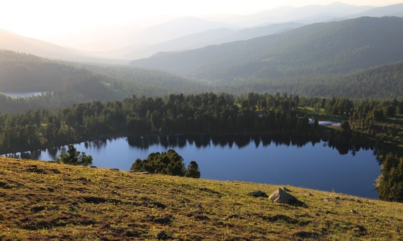
Shcherbakova Lake is located in the northwestern part of Kedrovoye Lake at an altitude of 1775 meters above sea level. The distance from Lake Kedrovoy to Lake Shcherbakova is 1.5 kilometers. Earlier, Shcherbakova Lake was named Listvyazhnoye, and in 2002 it received the name Shcherbakova Lake.
The lake is named after natural scientist Boris Shcherbakov. This was done by decision of the Institute of Geography of the Academy of Sciences of the Republic of Kazakhstan during the compilation of a map of reserves.
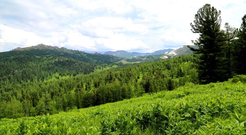
Shcherbakova Lake is located on the territory of the West Altai Reserve, which was created on the initiative of B. Shcherbakov, in the Ridder district of East Kazakhstan region. The path to the lake is very picturesque and runs along the northern slope of the Ulba Range.
The length of Shcherbakova Lake is 306 meters and the greatest width is 154 meters, the greatest depth is 40 meters. The depth of the lake was investigated by employees of the East Kazakhstan Ministry of Emergency Situations in August 2019.
The shores of the lake are steep, inaccessible and only in the western part at the place where a small river flows into the lake, you can easily set out to the shore of the lake. Steep slopes of the Ulba ridge adjoin the lake from the south.
On the eastern, northern and western sides of the lake is in the coniferous frame of trees mainly consisting of cedar. The lake is closed, the filtration from the lake is carried out by groundwater.
The first Beloubinsky lake is located at an altitude of 2035 meters above sea level, 2 kilometers southeast of Lake Kedrovoye. The lake is located in the Ridder district of the East Kazakhstan region in the eastern part of the Ivanovo ridge.
From the lake begin the sources of the Belaya Uba River. The width of the lake is 314 meters, the length of the lake is 288 meters, the largest depth of the lake is up to 10 meters. The lake is filled with snowfields that are concentrated on a steep southern slope.
A small river flows from the northern part of the lake and here, not far from each other, there are three small lakes. The southern slope of the lake is steep and snowy, the shores of the northern, western and eastern parts of the lake are gently sloping overgrown with dwarf birch trees.
The lake is very picturesque against the background of snowfields of the northern and eastern slopes.
The Second Beloubinsky lake is located at an altitude of 2055 meters above sea level, 100 meters east of the First Beloubinsky lake. The lake is located in the Ridder district of the East Kazakhstan region in the eastern part of the Ivanovo ridge.
From the lake begin the sources of the Belaya Uba River. The length of the Second Beloubinsky Lake is 195 meters, the width is 156 meters. The southern slope of the lake is steep and snowy, the shores of the northern, western and eastern parts of the lake are gently sloping overgrown with dwarf birch trees.
The lake is filled with snowfields that are concentrated on a steep southern slope. The lake is very picturesque against the background of snowfields.
The Third moraine Beloubinsky lake is located at an altitude of 2135 meters above sea level, 1 kilometer southeast of the First Beloubinsky lake. The lake is located in the Ridder district of the East Kazakhstan region in the eastern part of the Ivanovo ridge.
From the lake begin the sources of the Belaya Uba River. The length of the lake is 278 meters, the greatest width is 184 meters. The moraine Third Beloubinskoe Lake is located on the eastern slope of the Ivanovo Range in an intermountain circus with steep and steep slopes.
The northern shore of the lake is more gentle and easily accessible for visiting.
Authority and photos:
Alexander Petrov.