


![]()
Вы здесь
Ridge of Saur.

Exclusive tours in Kazakhstan.
“Ask nature, it preserves all the truths and will answer your questions without fail and satisfactorily”
R. Bacon.
Sightseeing tours in Kazakhstan.
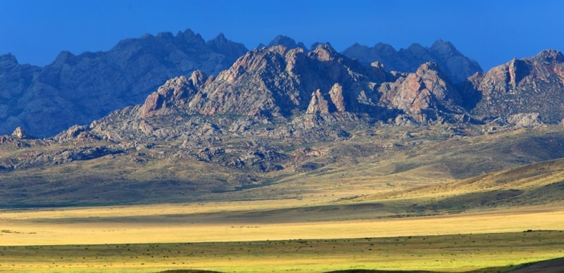
Saur and Tarbagatai ranges sharply rise above the Zaysan Mezhgornaya hollow separating the Saur-Tarbagatai system from Altai and characterized by the spread of desert and semi-desert landscapes. Lake 3aysan, flowing, fresh, shallow, belongs to the upper Irtysh.
The Black Irtysh flows into it, and the Irtysh begins from it. The water backwater caused by the construction of the Bukhtarma Hydroelectric Power Station on the Irtysh River led to the connection of the lake with its reservoir and captured the lake itself, flooding, in particular, the swampy delta of the Black Irtysh, which made the lake much larger (length from 100 kilometers increased to 150 kilometers).
Significant are its fish wealth. The Saur Range is connected to the Manyrak mountain range. The northern foot of Saura abuts against Zaysan Lake and Cherny Irtysh, and the southern one borders on the Shilikty Basin. The highest point of the mountain system Saur-Tarbagatay is located in Saur - Muztau peak 3816 m. a. s. l.
The northern slope of Saura is similar in geological structure to the Altai Mountains, and the southern slope is steep and rocky with the Central Asian mountains. The snow line in Saur is located at an altitude of 3300 m. Therefore, its peaks are constantly covered with snow.
Massive Saur exceeds 3,500 m. a. s. l. in the border ridge and has small glaciers. The Saur Ridge has massive block elevations and is composed of a Hercynian folded structure. In the post Hercynian period denudation processes took place here.
In the Mesozoic and Paleogene, the territory had a continental platform mode with small amplitudes of vibrational movements. The relief, apparently, resembled the modern surface of the Kazakh small hills. The ridges have reached their present height and as a result of powerful uplifts occurring in the Neogene and the beginning of the Quaternary.
In Saur, effusive rocks are widely distributed, which are represented by porphyries and porphyrites.The Saur Ridge is composed of strongly dislocated Paleozoic sedimentary rocks (schists, limestones, sandstones), broken by acidic intrusions (granites, etc.).
On Saur there are deposits of coal (Kendyrlik) and oil shale. The slopes of the Saur ridge are deeply divided by valleys. The lower parts of the slopes of the Saur ridge are occupied by semi-desert and higher steppe vegetation. On the northern slope of Saura, mid-mountain meadows and forests from Siberian larch (Larix sibirica) and Tien-Shan spruce are widespread.
Siberian fir occurs as an impurity in spruce forests. In the river valleys, forests rise to a height of about 2600 m. Like the Dzungarian Alatau, the Saur ridge, by nature, occupies an intermediate position between the mountains of South Siberia and Central Asia, but their nature is even closer to Siberian, as evidenced, for example, by the spread of Siberian larch on the Saur ridge.
Flora and fauna of the Saur Range. In accordance with the natural features of the Saur-Tarbagatai mountain system is divided into mountain-steppe territory of Tarbagatai, mountain forest-meadow steppes of Saura. In the Tarbagatai steppe shrubbery vegetation predominates.
On the northern slopes of the mountains, the landscape consists of plants of alpine meadows, on the southern of shrubbery plants. Sievers apple trees, aspen, and silver poplar grow in ravines. Tarbagatai high meadows came from Altai, and species such as an apple tree and Turkestan juniper from the Tie- Shan.
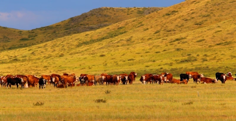
The low-lying steppes of the southern slopes are used as pastures: many species of wormwood grow there. In the vicinity of the mountains sowing land and grazing land are located. The western slopes of the mountains are occupied by orchards and vineyards.
The foot of the Saur Ridge to a height of 700 m belongs to the semi-desert zone, semi-desert plants grow on its solonetzic chestnut soils. Forests consist of Siberian gray spruce and Tien Shan spruce. This once again proves that the territory between Siberia and Central Asia is a transitional place.
The semi-desert steppe of Shilikty occupies the gap between the south of Saur and the eastern part of Tarbagatai. The soil is solonchak-gray and stony, stone grass, wormwood, and fescue grow. The foothills of the Saur Mountains are convenient for crops, hayfields and pastures.
The fauna of Saura is diverse. Brown bears, deer, roe deer, mountain goats, arkhara, wolves, foxes and others live here. Mountain, steppe and semi-desert species of animals are found. In these regions, from animals live a striated strident scallop (snake), white-headed crane, bustard, saj, Ular, golden eagle, peregrine falcon, saker falcon, eagle owl, listed in the Red Book of Kazakhstan.

Authority:
N.A. Gvozdetsky, N.I. Mikhailov. “Physical geography of the USSR. Asian part. Third edition, amended and supplemented. Moscow “Thought” 1978. http://tapemark.narod.ru/geograf/1_5_5.html
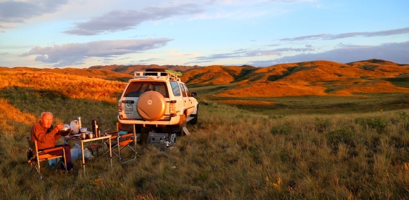
Photos by:
Alexander Petrov.