


![]()
Вы здесь
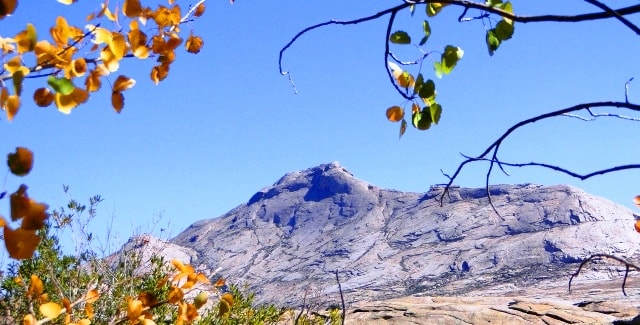
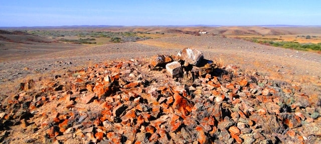
Turgai Plateau.
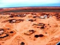
Tours to the Turgai Plateau.
“On the side of the steppe, from birth to my dear,
I expected the wind in early spring,
And a warm fidget wind rose
And in a moment dressed the steppe in a colored outfit. ”
Saken Seyfullin. "In the steppe." Spring of 1917. Akmolinsk. Translation by S. Narovchatov.
Car trips to the Turgai plateau.
The Turgai plateau is located between the South Urals and the Mugodzhars in the west and the Kazakh small hills with the uplifts of the Kokchetav mountains and the Ulutau mountains in the east. The average height is 200 - 300 meters.
In its central part there is a wide depression (hollow), stretching from north to south for 750 kilometers. It is called the Turgai Strait, or Turgai Gate. In the Cenozoic, it was a strait connecting the West Siberian Sea with the Turgai Sea.
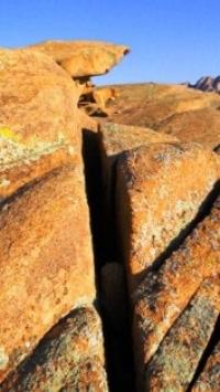
The western and eastern sides of the lowering are a markedly dissected cracked plain. The plateau consists mainly of marine sediments and continental rocks. Their power reaches 5,000 meters. The modern relief is composed of clay and sandy rocks.
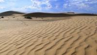
In the vicinity of the Aral Sea there are large sandy areas. The Aral Karakum are located between the Aral Sea and Lake Shalkar and are a low-hilly plain up to 100 meters high. According to the age of education, it is relatively ancient, changed under the influence of winds.
The sands of Big and Small Badgers located in the north of the Aral Sea are similar in type of relief to the Aral Karakum. They are formed from sandy deposits of Neogene. The plain, located with a slope towards the Aral Sea, and the valley of the Syr Darya river are called the Syr Darya and alluvial plains. It is composed of sandstones and clay deposits.
Unlike the neighboring territories mentioned above, where folded Paleozoic structures mostly come to the surface, the Turgai plateau is an epigercin platform formation with a relatively deep occurrence of the Paleozoic basement.
Tectonically, it corresponds to the Turgai syneclise complicated by faults, connecting the West Siberian plate with the Turan plate, and the northern ledge of the Turan plate. In the middle of the described territory almost in the meridional direction there is a lowered narrow strip, expanding to the south. This is the Turgai hollow.
The absolute heights here are 100 - 125 m. A chain of numerous lakes extended along the hollow with a large lake Kushmurun in the north, into which the Ubagan River flows, in the south, the Turgai River flows. At the bottom of the hollow there is a cover of ancient alluvial and lake-alluvial deposits.
To the west and east of the Turgai hollow, heights increase to 200, sometimes up to 300 m. The surface is composed of horizontally lying layers of Paleogene and Neogene deposits. The Paleogene (Oligocene) is represented by marine sediments, mainly saline clays, and lake-alluvial sediments, Neogene (Miocene) - mainly by continental sands.
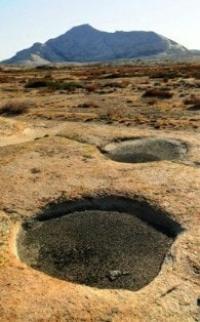
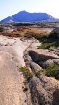
The northern part of the Turgai plateau is poorly divided. It is characterized by low hills and ridges, shallow lake troughs. To the south of the plateau is dissected by a system of hollows into isolated dining elevations. Some of them are lowered and turned into flat-headed outcrops that rise just a few tens of meters above the flat-bottomed hollows.
The remand plain has a network of beams and wide valleys of drying rivers, gently sloping depressions in which salt lakes lie. It is believed that the disintegration of the plateau-like surface into table heights occurred as a result of increased erosion during the period with a more humid than now climate corresponding to the era of maximum glaciation in northern Eurasia.
Later, in conditions of sharply continental dry climate, deflation and ravine dismemberment of the edges of the table elevations developed. The northern, weakly dissected part of the Turgai plateau, as well as the northern and middle parts of the Kazakh small hills belong to the steppe zone.
The remoteness of the steppes of Central Kazakhstan from the oceans, especially from the Atlantic - the main supplier of moisture in these latitudes, determines the sharp continentality of the climate, which is expressed in the severity of winter, high summer temperatures, short duration of spring and autumn, large annual and daily amplitudes of air temperature, air dryness, low rainfall.
Rainfall varies greatly from year to year, averaging around 300 mm per year. In the north, it is slightly larger (up to 350 mm), in the south it gradually decreases (up to 200 mm). The best moisturization is mountain ranges, on which about 400 mm of precipitation falls during the year.
Along with a decrease in precipitation to the south, air temperature rises, evaporation increases, and summer moisture deficiency increases. Features of the cold season are due to the existence of a spur of high pressure (extending from the Asian anticyclone), the axis of which extends approximately 50 ° C. sh., that is, it divides almost in half the territory of the Turgai Plateau and the Kazakh small hills.
Anticyclonic conditions contribute to the cooling of the territory.
The average January temperatures are quite low (−17 −18 °). To the center of the anticyclone, temperatures drop, so the eastern regions are the coldest in winter. A strong cooling is associated with anticyclone weather, the temperature often drops to −30 −40 °.
In winter, cold masses of arctic air and air of temperate latitudes with a small supply of moisture prevail. Frontal activity is weak. Precipitation is low (from November to March, only 50 - 75 mm). Snow cover has a small thickness (average - up to 40 cm), which leads to freezing of the soil; and yet, snow is the main source of moisture in the soil, as well as the nutrition of rivers, lakes and groundwater, since summer precipitation is almost entirely spent on evaporation.
To the north of the axis of the spur of the anticyclone, the pressure drops. Therefore, in the winter, south-westerly winds prevail in the steppe zone, reaching great strength, which is facilitated by the vastness of the plain spaces. Winter snowstorms and snowdrifts are characteristic.
The transition from winter to summer is sharp. Air temperature rises rapidly due to warming of the earth's surface and the penetration of warm Turanian air from the south. The destruction of the winter anticyclone occurs, and high summer temperatures are established (average July temperature 20 - 24 °).
Daytime temperatures in summer sometimes rise to 35 °. In summer, continental air of temperate latitudes and Central Asian tropical air penetrate both the semi-desert and the steppe zones. Summer precipitation is mainly related to the position of the front (temperate latitudes) that occurs at the border of these air masses.
In the warm season, from April to October, up to 250 mm of precipitation falls, with a maximum in June. By mid-summer, the air masses are very warm and the temperature differences between them are smoothed out, the frontal activity is weakened, there is little rainfall.
During almost the entire second half of summer, clear, sunny weather of the anticyclonal type is maintained. Strong winds of the warm half of the year cause soil to blow, dust storms and contribute to the general desiccation of the territory.
Often there are droughts. Intrusions of cold air masses from the West Siberian Plain cause spring and autumn frosts. The frost-free period is about 110 days. Compared with the surrounding plains, lowland massifs have a more moderate and humid climate, which even with a small scale of heights determines the altitudinal zonality of landscapes and the formation of a forest-steppe altitudinal zone.
Microclimatic differences are characteristic of both low mountains and low-mountain plains due to the dissection of the relief. In summer days, the lowest temperature is usually observed at the tops of hills, while in the lowlands it is most warm.
True, the difference in temperature at this time is small. During periods of spring and autumn frosts in the intersection hollows due to radiation cooling, dripping and stagnation of cold air it is 8 - 9 ° colder than on the tops of hills with heights of up to 80 - 100 m.
Non-irrigated farming is possible in the steppe zone of Central Kazakhstan. Temperature conditions here are mainly favorable for the development of agricultural plants. Moistening conditions are much less favorable, both in terms of rainfall and their seasonal distribution.
Therefore, the main crop here is wheat, which is quite drought-resistant (due to winter freezing of the soil, spring wheat is cultivated). Millet, corn, barley, oil flax, and sunflower also grow well. The steppe zone of Central Kazakhstan mainly refers to the Irtysh basin, and only the Nura River in the very south of the zone, carrying its waters to the Tengizkurgaldzhinsky Depression, already belongs to the Central Asian region of internal flow.
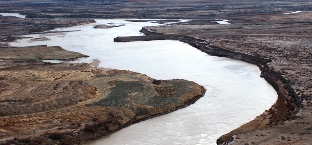
True, many rivers rushing to the Irtysh River do not reach their waters and end in small drainless lakes in the south of the West Siberian Plain. Due to the continental and dry climate, the rivers are shallow. Most of them dry up in the summer or break up into streams connected by an underground stream in the river alluvium, and only the largest (Tobol in the extreme northwest, Ishim, Nura, Shiderty, Selety) retain water throughout the year.
The drain mode is extremely uneven. River nutrition is mainly spring, snow, and partially ground. In spring, during the melting of seasonal snow, rivers receive a large amount of water. For example, the Nura River in spring has 88% of the annual flow.
High water occurs in late March - early April and lasts from two to three weeks to one to two months, and the water level in the river can rise by 2 - 3 m. During the rest of the year, river nutrition decreases sharply (the flow of the Nura River in summer is only 3 % annual, in autumn - 2%, in winter - 7%) and is carried out mainly due to groundwater.
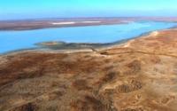
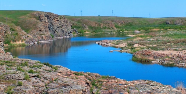
The runoff is very variable over the years, due to fluctuations in the amount of precipitation. With uneven there are many lakes on the territory of the Kazakh small hills and Turgai plateau within the steppe zone (Kushmurun, Koybagar, Karasor, a group of Kokchetav and Borovsky lakes). The origin of the lake basins is diverse. There are basins of tectonic origin. There are small subsidence basins. Small lakes are widespread, formed when the streams are loaded with clastic material, demolished from the slopes of hills.
Many lakes in river valleys. According to A.E. Mikhailov, part of them arose in river valleys, crossed across by anticlinal folds that experienced tectonic uplifts, which dammed the rivers. Weakened in arid climate, river erosion could not cut through the barriers that arose.
Lakes, like rivers, receive their main food in spring due to melting snow. In the summer they become shallow. Fluctuations in lake level are associated with fluctuations in rainfall. The degree of mineralization of lake waters varies seasonally, reaching a maximum in summer.
Many lakes gradually become shallow and overgrown. There are so-called grass lakes, only filled with water in spring, and used as hayfields in summer. Various salts are mined in the lakes, and in some places healing mud. Rivers and lakes, due to the exceptional irregularity of the regime, cannot serve as a reliable source of water supply.
However, on the rivers it is possible to construct artificial reservoirs fed by the flow of melt snow water.

Authority:
N.A. Gvozdetsky, N.I. Mikhailov. Physical geography of the USSR. Asian part, Third edition, revised and supplemented, Moscow "Thought" 1978
Photos
Alexander Petrov.