


![]()
Вы здесь
Murzaev about Kara-Bogaz-Gol Bay.
Tours in Gulf of Kara-Bogaz-Gol.
“A stay, even for a short time, in the waters of this bay,” he wrote, “gives rise to a feeling of great loneliness and longing for blooming and populated places. For hundreds of miles I have not met a single person on all the shores of the bay, and, except for the hottest wormwood and dry weeds, I have not picked a single blade of grass ... Tokmo salt, sand and all the killing heat dominate these inhospitable shores and waters"
Lieutenant Zherebtsov. 1847.
Drive from Turkmenbashi to Kara-Bogaz-Gol Bay.
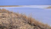
Locals often call Kara-Bogaz Adzhidarya, that is, the bitter sea. This is a huge bay, with an area exceeding the largest freshwater lake in Europe - Ladozhskoe. Kara-Bogaz is the Dead Sea. A living creature, falling into its muddy and bitter waters, immediately dies.
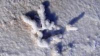
We often saw dead fish thrown by the waves on the shores of the bay. It is not without reason that the strait connecting the Caspian with the Gulf is called by the Turkmens Kara-Bogaz - the black mouth. The strait has a length of 5.5 kilometers and a width of 200 meters to 2 kilometers.
Through it, a lot of water flows from the sea to the bay. All inflowing Caspian water evaporates in the bay. Summer is dry and sultry, the banks are deserted, not a single river flows into the bay from the high and flat Ustyurt.
Ustyurt and Mangyshlak break off to the bay with high, inaccessible and steep walls. In the context of such coasts, their geological history is easily read. Layers of greenish clays, limestones with the remains of abundant shell fauna, marls, and gypsums are clearly visible from the soil and vegetation cover.
Once the sea stretched on the site of Ustyurt, and at the bottom of the Cretaceous and Tertiary basin limestones, clays, marls were deposited. In the next time, mountain-building movements touched this area a little, and marine deposits here mostly lie calmly, horizontally.
Only in rare places are the rocks crushed, their layers are tilted, broken. Kara-Bogaz Bay is shallow, in summer it warms up well, and this also increases evaporation from its surface. It is estimated that the bay annually loses a layer of water up to 130 centimeters of power, which is restored by profit from the Caspian.
Each year, the Caspian Sea discharges 25 cubic kilometers of water into the Kara-Bogaz breach, depending on the difference in sea and gulf levels. The water in it evaporates, but the salts remain in the gulf, they accumulate here from year to year and now make up over 20 percent of the total volume of water in the gulf.
These salts, mainly sodium sulfate, are very necessary for the household. On the eastern eastern coast of the Caspian, industry developed. And our expedition was only part of a large scientific team that studied the area of this new industrial center.
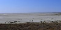
Kara-Bogaz-Gol and now remains one of the world's largest salt deposits. But the regime of the bay has changed significantly. The reason is the decrease in the level of the Caspian Sea, which over the past forty years amounted to two and a half meters.
This led to a decrease in runoff into the bay, which decreased in area, but at the same time the strait between Kara-Bogaz-Gol and the sea was extended by almost three kilometers. As a result, the chemical regime of the bay has also changed.
The concentration of salts in the brine of the bay increased sharply. It has become saturated and common salt. During winter cold, not only mirabilite, but also a mixture of salts is released from brine, which makes it difficult to obtain a pure product.
Chemists were forced to look for new ways to obtain mirabilite. Now it is mined from the bottom of the bay from buried horizons. Hydraulics are developing an original project for regulating the hydrological regime of the bay.
They propose to build a dam across the strait, thereby isolating it from the Caspian Sea. Locking hatches will be arranged in the dam, through which, if necessary, a metered amount of sea water can be passed. This will make it possible to isolate a significant area of evaporation from the Caspian and to some extent prevent a further decrease in sea level.
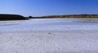
And this is very important for shipping and fisheries. But in this case, the Kara-Bogaz-Gol Bay will dry up or almost dry, in its place a huge salt lake will sparkle with salt crystals. What about the production of sodium sulfate? What will happen to her?
Strongly packed lake brine will be a source of a number of valuable salts, not just mirabilite. This is the general scheme. In reality, its implementation is full of contradictions and not as simple as I have outlined.
Geographic coordinates of the Kara-Bogaz-Gol gulf: N41 ° 24'01.61 "E53 ° 32'42.89"
Authority:
"Years of searching in Asia." Murzaev Eduard Makarovich.
Photo
Alexander Petrov.