


![]()
Вы здесь
Petroglyphs Talas Valley.
Tours to Petroglyphs Kyrgyzstan.
“He who conquers himself is the mightiest warrior”
Confucius.
Petroglyphs in Kyrgyzstan.
Talas Valley General characteristics of the area Talas Valley is located in the north-west of Kyrgyzstan. The terrain consists of an intermountain trough bounded by the Kyrgyz Alatoo Range in the north-east and the Talas Ala-Too Range in the south, which converge in the east and then diverge in the west.
The northern slope of the Kyrgyz Range is steep, glaciers and large fern fields are absent. The slopes of the opposite Talas Range are better hydrated, strongly dissected and form a complex system of foothills. Low mountains – Koshoy-Too, Ortok-Too, Echkili-Too, Ak-Tash, stretching in parallel to the major ranges– constitute an important ensemble.
The main stream is the Talas River, from the confluence of the Karakol and Uch-Koshoy rivers with headstreams in glaciers and snowfields. The largest right tributaries are the Kenkol and the Nyldy. The left tributaries –the Kalba, Besh-Tash, Ur-Maral, Kumushtak, and Kara-Buura – are more numerous and abound in water.
The valley is 230km long with a maximum width of 80km. Absolute altitude within the valley ranges from 650 to 4,500m. The climate is continental, with distinct seasons. Institute of History and Cultural Heritage of the National Academy of Sciences of the Republic of Kyrgyzstan.
National Historical and Archeological Museum Complex “Manas-Ordo” Administratively, Talas Valley is divided into four districts. It is a relatively small and somewhat detached part of Kyrgyzstan occupying 6% of the country’s territory.
The population is upwards of 200,000 people. Predominant are the Kyrgyz, but other ethnic groups are also represented – Russians, Germans, Kurds, and others. Agriculture, crop and livestock farming are the main occupations (Encyclopedia 1995).
Archeological Context The Talas valley was peopled in the Old Stone Age. During the Late Bronze Age, it was inhabited by tribes categorized as Andronovo historical-cultural community, as evidenced by findings from burial grounds Tash-Tubye-2, Tosh-Bashat, Besh-Tash, and others (History1984: 109).
Sites of Early Iron Age ancient nomads are well represented; especially, in the Talas Valley where catacomb burials dated to “the great migration of peoples” were found for the first time. The Middle Ages are represented by the coexistence of nomadic and settled agricultural cultures, whose multiple sites –ancient settlements, mines, burials, stone statues, epigraphy and rock art- are wellknown (Bernshtam 1997; Archeological 1963).
During that period, Talas Valley was one of the mining centers that supplied silver to most of the Muslim world. After the 13th century, sedentary life was nearly over, while the middle and upper reaches of the River were mostly home to nomads.
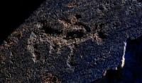
Sites with ancient Turkic runic script, for the first time found in Central Asia, and petroglyphs (not yet fully registered) are the most importante sites in the Talas Valley. Research Status of Sites Early information about petroglyphs in the Talas Valley dates to the late XIXth century, when, in 1896, Kallaur V.A. during his search for runic inscriptions in its upper reaches, registered petroglyphs at Chiyim-Tash (Kallaur 1897: 1 - 7).
In 1937, Chiyim-Ota Gorge petroglyphs were apparently rediscovered by an expedition from the Kyrgyz State Institute of Pedagogy (Zima 1968: 112-114). According to all contemporary researchers, the above name refers to Kulan-Say Gorge located to the north-east of Talas City, where Arabic and Sogdian inscriptions were found (Goryacheva & Peregudova 1995: 37).
Bernshtam A.-N., who examined them in 1938 (Bernshtam 1997: 381), also mentions drawings and inscriptions in Chiyim-Tash (Kulan-Say), as well as petroglyphs in the valley of the Obo River, a Kenkol River tributary.
In 1956, the Talas Valley petroglyphs were examined by teacher-regional ethnographer, Gaponenko V.-M., with schoolchildren from the History and Archeology Activity Club of Frunze City (modern Bishkek). Their locations were pinpointed in different parts of the valley – in Teke-Tash, Kurgan-Tash, Terek, Kulan, Karakol, Kugandy, Kurkuro-Suu and Ur-Mara (Zhaltyrak-Tash) (Gaponenko 1963: 101 – 110). Gaponenko made the first attempt to describe, systematize, and summarize findings on rock art sites in the valley.
In 1974 – 1985, schoolchildren-regional ethnographers from Activity Club “Iskatel” (Explorer), School No.2 in Talas City, explored the area under the guidance of a geography teacher, Rysakova R.-Ya. During these hikes, petroglyph locations were registered in 18 points in the valley, with 1,570 surfaces with drawings.
Maps of routes and locations of these sites were made, as well as descriptions and photos of the most interesting drawings (Rysakova 1982: 47 - 50). According to Rysakova, the largest number of drawings - 546 surfaces - is found in the intermountain valleys of Kenkol River and its tributaries.
She points out that the petroglyphs are made on spurs of rock, rock debris and boulders covered with patina. The repertoire is dominated by mountain goats, 362 only in Obo. Besides, Rysakova mentions a distinguishing feature for the locations in the upper reaches of the Ur-Maral tributaries (Zhaltyrak-Tash and Chiyim-Tash), located near high mountain passes, with petroglyphs made sometimes very large and extensive rocks located across ancient glacier cirques.
In 1987, a joint Expedition of the Institute of History and the Institute of Language and Literature (Academy of Sciences of Kyrgyz SSR) registered petroglyphs and runes in the western part of the valley, at Kuru-Bakayir (Talas Ala-Too) Gorge (Jumagulov & Kozhomberdiev 1983).
They were copied in 1986 - 1987 during a joint survey at Zhaltyrak-Tash (Ur-Maral) conducted by archeologists from Kemerovo University (Russia) and the Institute of Archeology (Academy of Sciences of Kazakh SSR) (Sher et al. 1987; 1995: 83 – 85).
In 2003, an international expedition led by Tashbaeva K.I. and Francfort H.-P. indexed surfaces with petroglyphs, made contact copies of the most interesting ones, and generated a schematic layout of the location (Tashbaeva & Francfort 200: 12 - 19).
In 2003 and 2005, a team of archeologists from the Institute of History of NAS of the RK, led by Amanbaeva B.E. and funded by the National Complex “Manas-Ordo”, surveyed several already known sites and found new locations of petroglyphs in the foothills of the Talas Range to the south of Beysheke village, in the valley of the Ur-Maral River and its left tributary Chiyim-Tash, in Kyrgyz Ala-Too along the Kenkol River tributaries – Terskol and Chachykey, and on the territory of the “Manas-Ordo” Complex (Amanbaeva et al. 2006: 27 - 33).
In 2006, the staff of MC “Manas-Ordo” discovered two petroglyphic locations in the upper reaches, one located below a mountain pass (Otmek), while the other was behind the mountain pass, as far as Suucamyr.
The analysis of information in the archived materials by Rysakova R.-Ya. suggests that these sites had already been visited by members of the Activity Club “Iskatel” in the 1980’s. In general, a study of the Talas River Basinrock art sites was mostly done in its upper reaches, less frequently in its middle reaches, while its north-western, western, and south-western borders were neglected by researchers.
Available data pertaining to the surveyed territory in the Talas Valley suggest that the following areas with the largest concentration of petroglyphs are: the valleys of rivers Karakol, Ush-Koshoy, Kenkol and their tributaries as well as the Ur-Maral River.
The total number of known sites is over 40, most of them located at mid-altitude (1,300 – 1,900m) and others in uplands (2,000 – 3,500m). At present, only four petroglyph sites are on the List of Sites of National Importance
Authority:
«Rock Art in Kyrgyzstan». Bakyt Amanbaeva, Aiday Suleymanova, Chynarbek Zholdoshev.
Photos by
Alexander Petrov.