


![]()
Вы здесь
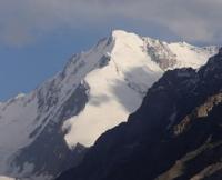
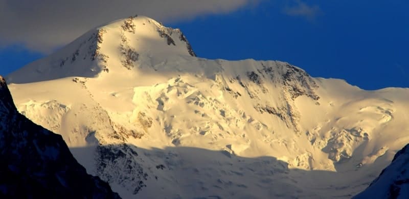
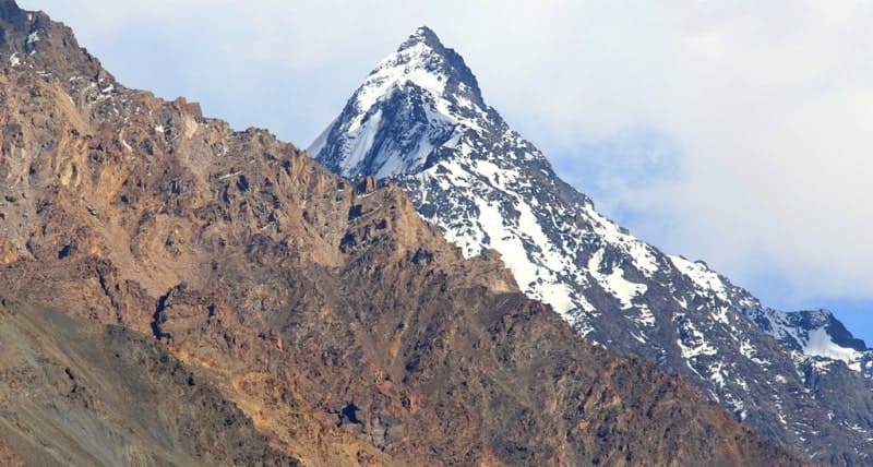
Yazgulemskiy ridge.
Horse-riding expedition in Tajikistan.
"I will not see you soon,
But I firmly believe in one thing:
You love the blue mountains
Tops covered with ice"
Yuri Vizbor. 1956.
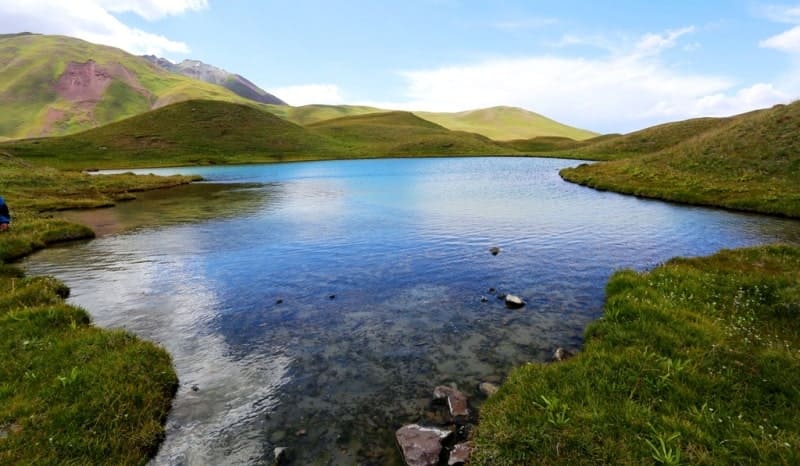
Hiking season in Pamir mountains.
Yazgulemskiy ridge is located in Western Pamirs, between valleys of Pyanj and Tanymas rivers and is located on territory of 3 districts of Gorno-Badakhshan Autonomous Region - Rushan, Vanj and Murghab. The total length of the Yazgulemsky ridge is 219 kilometers.
This ridge has a sinuous ridge line and stretches from southwest to northeast, its slopes are deeply dissected by river valleys. The southwestern border of the ridge begins from the Pyanj River valley east of the Kashokash gorge, 9.7 kilometers southwest of the village of Derushon.
The northeastern border of the ridge ends between the Grum-Grzmiilo and Cold Wall glaciers. The highest peak of the ridge is located in the northeastern part of the ridge - Revolution Peak (Independence Peak since 2006) with a height of 6940 meters above sea level.
Revolution Peak is the fourth highest peak (after the peaks of Communism, Lenin and Korzhenevskaya) in Tajikistan, located in the Pamirs. Under the northern wall of the peak there is a large firn trough, from which the greatest glacier in Eurasia, the Fedchenko glacier, originates.
At the foot of the southwestern wall the northeastern branch of the Yazgulemdara glacier begins, at the foot of the southeastern wall the Khabarvivhats glacier begins, and the second largest glacier in the Pamirs, the Grumm-Grzhimailo glacier, flows down from the northeastern slopes of the peak.
The first ascent to Revolution Peak took place during an expedition of alpinists of the All-Russian Central Council of Trade Unions under the leadership of E.A. Kazakova. 11 climbers climbed to the top under the leadership of A. Ugarov. According to the height and nature of glaciation, the Yazgulemskiy ridge is divided into two parts.
The western part, 128 kilometers long, stretches along the Yazgulem River, from the Pyanj River valley to the upper reaches of the Rakzou River, and has an average altitude of 5370 meters above sea level, the highest point being Woodor Peak at 6132 meters above sea level.
The eastern part, 91 kilometers long, borders the upper reaches of the Fedchenko and Grumm-Grzhimailo glaciers from the south. In the southwest it is limited by the valley of the Pyanj River, in the northeast - by the bend of the Tanymas River.
In the north, the Academy of Sciences ridge adjoins the ridge. The length of the ridge is about 170 kilometers. The highest point is Revolution Peak, 6974 meters above sea level. The southwestern part of the ridge, up to Lyapnazar Peak, is significantly lower in height than the northeastern part, where there are about 90 peaks above 5,000 meters above sea level and 20 peaks above 6,000 meters above sea level.
The most significant spurs extend to the south - Torvarkh (23 kilometers long), in the interfluve of Yazgulemdary and Khabarvivkhats (25 kilometers), to the west - in the interfluve of Mazardary and Rakzou (25 kilometers), to the north - Cold Wall (30 kilometers) and to the east - a spur with a turn to the south along the valley of the Tanymas River (22 kilometers).
The snow line on the northern slopes of the ridge is at an altitude of 4400 - 4850 meters above sea level, on the southern slopes of the ridge - at an altitude of 4500 - 4900 meters above sea level. The total area of glaciation is about 4380 square kilometers.
The largest glaciers and the most powerful glaciation are located in the eastern part of the ridge. Here, from the base of Revolution Peak, the largest glaciers of the Pamir - Fedchenko and Grumm-Grzhimailo - originate, in the upper reaches of the Yazgulem River there are the Yazgulemsky and Rakzou glaciers, and the complex valley glaciers Khabarvivharts, Yazgulemdara and Bashurvdara flow to the south.
In their upper reaches, almost all of these glaciers are connected to each other, forming continuous firn fields at the junction of the Academy of Sciences ridge, the Yazgulem ridge and its northern spurs. The glaciated area of the eastern part of the ridge is 497.3 square kilometers.
On the northern slope there are 133 glaciers with an area of 343.1 square kilometers. The valley bottoms and lower parts of the slopes in the southern and western parts are covered with mountain wormwood deserts, up to an altitude of 4000 meters above sea level - steppe, desert vegetation and alpine meadows, above - the nival zone.
In the ridge and its spurs there are 7 known passes above 6000 meters above sea level, about 30 - at an altitude of 5000 - 6000 meters above sea level, over 60 - at an altitude of 4000 - 5000 meters above sea level and about 15 passes at an altitude of 4000 meters above sea level (from there are 9 of them along the Bartang River).
Geographic coordinates of beginning of Yazgulemskiy ridge: Nauk: N37°53'36 E71°19'41
Geographic coordinates of average position of Yazgulemskiy ridge: N38°15'10 E72°06'09
Geographic coordinates of end of Yazgulemskiy ridge: N38°37'53 E72°32'13
Authority:
"Glaciers." L.D. Dolgushin, G.B. Osipova. Series "Nature of the world." Moscow, the publishing house "Thought". 1989.
Photos by:
Alexander Petrov.